


Rheinberg, Germany
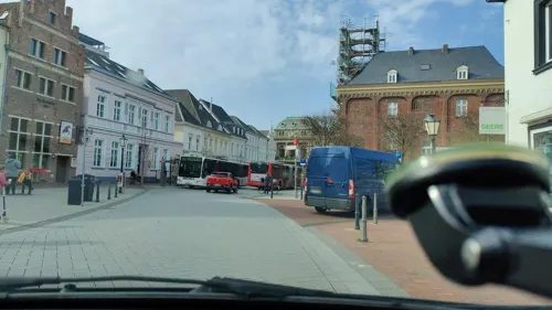
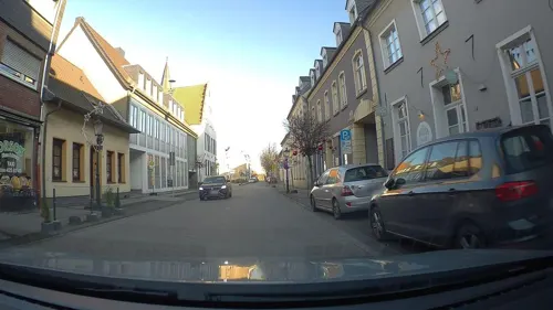
Rheinberg is a town of 32,188 people in North Rhine-Westphalia, Germany.
Why visit Rheinberg
Townapedia lists 89 museums and landmarks, 60 parks and trails, 159 places to eat, 18 places to stay and 18 attractions in and around town.
Highlights include TerraZoo Rheinberg, Tinthof, Kamp Abbey and Alte Kellnerei.
Weather in Rheinberg
Forecast from MET Norway (CC BY 4.0). Full forecast
About Rheinberg
Rheinberg (German: [ˈʁaɪnbɛʁk] ) is a town in the district of Wesel, in North Rhine-Westphalia, Germany. It is situated on the left bank of the Rhine, approx. 10 kilometres (6 miles) north of Moers and 15 km (9 miles) south of Wesel.
From the Wikipedia article Rheinberg (this version), under CC BY-SA 4.0.
Photos of Rheinberg


Things to do18

TerraZoo Rheinberg
Zoo and aquarium · 1.6 km
Mo off; Tu-Su, PH 10:00-18:00; Dec 24-25 off, Dec 31 off; Jan 01 off
Tinthof
Farm and orchard · 7.3 km
Eigene Käseherstellung, Eier, Hühner und Hähne, hochwertiges Rindfleisch
7 Weseler Straße, Voerde (Niederrhein)
We 17:00-19:00; Sa 09:00-12:00

Burgtheater Dinslaken
Cinema and theater · 9.6 km
Theatre in Dinslaken, North Rhine-Westphalia, Germany


Baumeistershof
Farm and orchard · 5.8 km
Sommerblumen, Kürbisse, Heu und Stroh
34 Mehrstraße, Voerde (Niederrhein)
"nach Vereinbarung"
Geflügelhof Göntgen
Farm and orchard · 6.2 km
Ein großes und sorgfältig ausgewähltes Sortiment, Saisonalität und Regionalität sind sehr wichtig.
51 Baggerstraße, Moers
Tu,We,Fr 15:00-18:00; Th 10:00-18:00; Sa 08:00-13:00
Hücklekemkes
Farm and orchard · 2.9 km
Eier , Gänseeier (saisonbedingt) Damwild, Geflügel
7 Winterswicker Feld, Rheinberg
"nach Vereinbarung"
Petra Kühne
Farm and orchard · 5.5 km
Obst der Saison, Gemüse der Saison, Kartoffeln, Honig, Marmelade, Eier, eigenes Rindfleisch, Nudeln aus eigenen Eiern, Eierlikör, regionales Bier
63 Xantener Straße, Kamp-Lintfort
Mo,We-Fr 09:00-12:00,15:00-18:30; Tu 15:00-18:30; Sa 09:00-14:00

Ohlmannshof
Farm and orchard · 5.5 km
Spargel
41 Hucker Straße, Alpen
Mo-Fr 08:00-20:00; Sa,Su,PH 08:00-13:00
Gärtnerhof Drießen
Farm and orchard · 5.2 km
Vielfalt aus unserem Garten und von den DeichHühnern. Frisches Gemüse und Obst nach Saison, frische Eier und vieles mehr!
7 Drießen, Rheinberg
Th-Tu 08:00-20:00
6 more on the map.
Museums and landmarks89



Landwehr
Monument and historic site · 5.5 km
6m breiter Wall, vorgelagert 3m breiter Graben;
77 more on the map.
Parks, trails and playgrounds60


Erlenbruchwald und Landwehr in der Leucht
Hiking and trails · 5.2 km


Hasenfeld und Rheinvorland zwischen Eversael und Ossenberg
Hiking and trails · 3.3 km



Solvay Hallenbad
Sports field and stadium
4 Friedrich-Stender-Weg, Rheinberg
Mo-Fr 06:00-08:00, Tu,Th 13:30-21:00, We 13:30-15:30

Bruch- und Auenwald und angrenzender Eichenwald am Ostrand der Leucht
Hiking and trails · 4.9 km
Fossa Eugeniana nördlich vom Kamperbrucher Feld
Hiking and trails · 4.1 km
Panoramabad Pappelsee
Sports field and stadium · 6.6 km
74 Bertastraße, Kamp-Lintfort
Sa,Su 10:00-14:30; Mo 14:30-15:30; Tu 06:00-07:45,16:00-21:30; We...
48 more on the map.
Restaurants and cafes159
Bäckerei Holland
Bakery · 5.7 km
Bäckerei und Cafe
398 Moerser Straße
Mo-Fr 06:00-17:00; Sa 06:00-14:00; Su 08:00-12:00
Il Grato
Restaurant · Italian · 7.0 km
81 Rheinberger Straße, Kamp-Lintfort
Mo,We-Sa 16:00-22:00; Su,PH 12:00-22:00; Tu off
Rheinwacht
Restaurant · German · 5.9 km
Aktuell (Okotober 2024) geschlossen wegen Renovierung (nur das Restaurant, gilt nicht für Hütte, Biergarten, Minigolf usw.)
46 Dammstraße, Voerde (Niederrhein)
Mo-Su off
Winha - Sushi & More
Restaurant · Asian, Sushi · 5.4 km
60 Prinzenstraße, Kamp-Lintfort
Tu-Th 10:00-20:00; Fr-Su 12:00-23:00; Mo off

Cafe Extrablatt
Cafe · Coffee Shop · 5.9 km
225 Moerser Straße, Kamp-Lintfort
Mo-Sa 08:00-24:00; Su,PH 09:30-24:00

Casa Castillo
Restaurant · Spanish · 6.4 km
21f Mühlenstraße, Duisburg
Mo-Tu off; We-Sa 17:00+; Su 12:00+; PH 12:00+
147 more on the map.
History
Rheinberg, is first documented in 1003, came into the possession of the archbishops of Cologne in the 11th century. After the town rights of Rheinberg had been granted to Archbishop Heinrich von Molenark in 1233, the construction of a city fortification began. This was initially only made of wood, but was replaced at the end of the 13th century by basalt, among other things. Almost at the same time, around 1293, the construction of the electoral palace and the customs tower called the Powder Tower, northeast of the city center, began.
Explosion of the Powder Tower in 1598, in which large parts of Rheinberg, the castle and the associated Old Waiter's Shop were destroyed
The castle was surrounded by a moat and had four towers and two drawbridges. The main bridge led to the city, the other to the outbuildings. The bailiff's manor was also built there in 1573 (Alte Kellnerei) It served as a grainstore for the income of the Amt Rheinberg and was used in the western part as a stables, but initially also as a dwelling of Salentin von Isenburg.
Read more of the history
In October 1598, during the siege of Rheinberg by the Spaniards under Francisco de Mendoza, an explosion occurred in the Powder Tower, destroying large parts of the city and castle. Only parts of the winery and a tower have been preserved. Due to further battles, the Old Winery could not be taken up until 1627. It was fundamentally rebuilt. The western section was extended to two and a half floors as the apartment of the respective Schultheiß and waiter as well as the Electorate of Cologne officials, increasingly also the fortress governors, and equipped with larger window openings. The eastern part was given two floors and was now the armoury. Both wings were separated by a massive gable wall. At that time, the winery's bleaching groundswere also located on the grounds of the winery. Military activities were also pursued on these, so there was training and temporarily soldiers' quarters were also on the square.
During the Eighty Years' War (1566–1648), Rheinberg became known as the whore of the war since it was captured and retaken so many times by competing belligerents. First taken in 1590, then 1597, 1599, 1601, 1606 and finally where Prince Rupert of the Rhine gained his first military experience fighting alongside the Protestant Frederick Henry, Prince of Orange in 1633.
A century later the Battle of Rheinberg was fought on 12 June 1758, during the Seven Years' War.
It is the location of a Commonwealth War Graves Commission cemetery, where 3,327 Commonwealth servicemen of the Second World War are buried or commemorated. The majority of those now buried in the cemetery were airmen re-interred from German cemeteries after the war. The men of the other fighting services buried there mostly lost their lives during the Battle of the Rhineland to the Elbe.
From the History section of Rheinberg on Wikipedia, under CC BY-SA 4.0.
More about Rheinberg
Economy
Rheinberg is the site of a 110,000-square-metre (1,200,000 sq ft) Amazon.com fulfilment warehouse. Rheinberg is also home to Underberg, one of the most famous liquor producers in Germany.
From the Wikipedia article Rheinberg, under CC BY-SA 4.0.
Notable people from Rheinberg
 Claudia SchifferGerman modelPhoto: Nicolas Genin - Flickr profile, CC BY-SA 2.0
 Kurt BodewigGerman politicianPhoto: Olaf Kosinsky, CC BY-SA 3.0
 Klaus ZumwinkelGerman businessmanPhoto: User:Kandschwar, CC BY-SA 2.0 de
 Barbara WoltmannGerman jurist and politicianPhoto: Harald Krichel, CC BY-SA 4.0
 Amplonius Ratinck de BerkaGerman physician, educator and book collectorPhoto: Unknown author Unknown author, Public domain
- Brigitte MohnhauptGerman terrorist, communist militant and convicted murderer
- Franz BüchelerGerman classical philologist (1837-1908)
- Heinz VersteegDutch footballer (1939-2009)
- Milly StegerGerman sculptor (1881–1948)
- Nadine HentschkeGerman hurdler
- Bettina HörstrupGerman Lawyer
- Eva-Maria HoubenGerman composer, pianist and music educator
Born in Rheinberg, according to Wikidata (CC0). Each name links to its Wikipedia article.
Where to stay18
Hotel Landhaus Steinhoff
Motel and hotel · Regional · 2.9 km
70 Bischof-Roß-Straße, Rheinberg
Casino im Park
Motel and hotel · 6.6 km
54 Friedrich-Heinrich-Allee, Kamp-Lintfort
Churches and places of worship36
Evangelische Kirche Götterswickerhamm
Church · Protestant · 5.9 km
41 Dammstraße, Voerde (Niederrhein)
Evangelische Kirche Spellen
Church · Protestant · 7.3 km
13 Friedrich-Wilhelm-Straße, Voerde (Niederrhein)
Shopping46
Gas and EV charging21
Schools, colleges and libraries38
Hochschule Rhein-Waal, Zweigbibliothek Kamp-Lintfort
Library · 6.1 km
25 Friedrich-Heinrich-Allee, Kamp-Lintfort
Rhine-Waal University of Applied Sciences, Kamp-Lintfort campus
School · 6.2 km
25 Friedrich-Heinrich-Allee, Kamp-Lintfort
Städt. Gemeinschaftsgrundschule am Rheinbogen (Teilstandort Orsoy)
School · 6.7 km
2 Nordwall, Rheinberg
Städt. Gemeinschaftsgrundschule am Rheinbogen (Teilstandort)
School · 3.4 km
5 Rheinkamper Straße, Rheinberg
Healthcare20
Map of Rheinberg
250 places. The map loads OpenStreetMap tiles when you open it.
Getting there and nearby towns
Flughafen Essen-Mülheim (ESS) is the nearest airport with scheduled flights listed in OpenStreetMap, 29 km away.
- Kamp-Lintfort 6 km southwest, about 6 min by car
- Alpen 7 km northwest, about 7 min by car
- Voerde 8 km northeast, about 8 min by car
- Dinslaken 10 km east, about 10 min by car
- Moers 11 km south, about 11 min by car
- Neukirchen-Vluyn 11 km south, about 11 min by car
- Issum 11 km west, about 11 min by car
- Hünxe 12 km northeast, about 12 min by car
- Wesel 14 km north, about 14 min by car
- Rheurdt 13 km southwest, about 13 min by car
Drive times are estimates from straight-line distance, not routes.
Towns near Rheinberg


Keep exploring
Local news
Headlines from INDB.
Reviews, tips and questions
Loading what members have shared...
Sources and licences
- GeoNames (CC BY 4.0): population, coordinates, regions and time zone
- Mapillary (see each image): photos
- OpenStreetMap contributors (ODbL 1.0): places, airports, map data
- Wikidata (CC0 1.0): elevation, founding date, time zone, website, landmarks and historic places
- Wikimedia Commons (see each image): photos
- Wikipedia (CC BY-SA 4.0): overview and history text
Photo credits
- Rheinberg, das Altes Rathaus Dm74 en Stammhaus und ehemalige Fabrikationsgebäude der Firma Underberg Dm73 foto8 2016-05-05 12.42, Michielverbeek, CC BY-SA 4.0
- Rheinberg Amplonius, A.Savin, CC BY-SA 3.0
- Rheinberg-Turm am Außenwall 82, Dat doris, CC BY-SA 4.0
- Rheinberg-Bahnhofstraße 3, Dat doris, CC BY-SA 4.0
- Rheinberg, Evangelische Pfarrkirche, 2011-12 CN-01, kaʁstn Disk / Cat, CC BY-SA 3.0 de
- Rheinberg, Evangelische Pfarrkirche, 2011-12 CN-02, kaʁstn Disk / Cat, CC BY-SA 3.0 de
- Rheinberg, Bahnhofstraße 19, 2016-03 CN-01, Steffen Schmitz, CC BY-SA 4.0
- Rheinberg-Bahnhofstraße 1, Dat doris, CC BY-SA 4.0
- SC 335575 - American tank destroyers of the 8th Armored Division of the Ninth U.S. Army line a street of Rheinberg, Germany. 6 March, 1945. (52117858202), Signal Corps Archive from United States, Public domain
- Rheinberg, Bahnhofstraße 23, 2016-03 CN-01, Steffen Schmitz, CC BY-SA 4.0
- Rheinberg, Bahnhofstraße 19–25, 2016-03 CN-01, Steffen Schmitz, CC BY-SA 4.0
- Rheinberg, Bahnhofstraße 25, 2016-03 CN-01, Steffen Schmitz, CC BY-SA 4.0
- Rheinberg, Zu den drei Fischen, 2012-04 CN-02, kaʁstn Disk / Cat, CC BY-SA 3.0 de
- Rheinberg, Wallanlagen, 2012-04 CN-01, kaʁstn Disk / Cat, CC BY-SA 3.0 de
- Rheinberg, Underbergturm, 2012-04 CN-01, kaʁstn Disk / Cat, CC BY-SA 3.0 de
- Radrevier.ruhr Knotenpunkt 8 Rheinberg Rettungspunkt, MKucharzewski, CC BY-SA 4.0
- Rheinberg, Zu den drei Fischen, 2012-04 CN-01, kaʁstn Disk / Cat, CC BY-SA 3.0 de
- Rheinberg-Xantener Straße 24-26, Dat doris, CC BY-SA 4.0
- Radrevier.ruhr Knotenpunkt 8 Rheinberg Wegweiser, MKucharzewski, CC BY-SA 4.0
- Radrevier.ruhr Knotenpunkt 8 Rheinberg Karte, MKucharzewski, CC BY-SA 4.0
- Rheinberg, Entenmarkt, 2011-12 CN-01, kaʁstn Disk / Cat, CC BY-SA 3.0 de
- Rheinberg, Bahnhofstraße 42, 2016-03 CN-01, Steffen Schmitz, CC BY-SA 4.0
- Rheinberg, Bahnhofstraße 42, 2016-03 CN-02, Steffen Schmitz, CC BY-SA 4.0
- Rheinberg, Bahnhofstraße 37, 2016-03 CN-01, kaʁstn – Steffen Schmitz, CC BY-SA 4.0
- Rheinberg, Bahnhofstraße 40, 2016-03 CN-01, Steffen Schmitz, CC BY-SA 4.0
- Rheinberg-Xantener Straße 27, Dat doris, CC BY-SA 4.0
- Rheinberg, Kamper Hof, 2011-12 CN-01, kaʁstn Disk / Cat, CC BY-SA 3.0 de
- Rheinberg, Kamper Hof, 2016-03 CN-01, Steffen Schmitz, CC BY-SA 4.0
- Rheinberg-Xantener Straße 29, Dat doris, CC BY-SA 4.0
- Rheinberg Amtsgericht, A.Savin, CC BY-SA 3.0
- Rheinberg-Xantener Straße 31, Dat doris, CC BY-SA 4.0
- Rheinberg, Bahnhofstraße 40, 2016-03 CN-02, Steffen Schmitz, CC BY-SA 4.0
- Rheinberg, Bahnhofstraße 42, 2016-03 CN-03, Steffen Schmitz, CC BY-SA 4.0
- Rheinberg, Im weißen Kreuz, 2012-04 CN-02, kaʁstn Disk / Cat, CC BY-SA 3.0 de
- Rheinberg, Bahnhof, 2016-03 CN-04, Steffen Schmitz, CC BY-SA 4.0
- Rheinberg, Im weißen Kreuz, 2012-04 CN-01, kaʁstn Disk / Cat, CC BY-SA 3.0 de
- Rheinberg, Bahnhof, 2016-03 CN-03, Steffen Schmitz, CC BY-SA 4.0
- Rheinberg, Bahnhof, 2016-03 CN-02, Steffen Schmitz, CC BY-SA 4.0
- Burghofbuehne Dinslaken, Daniel Ullrich Threedots, CC BY-SA 3.0
- Haus-Knipp-Eisenbahnbrücke, Raimond Spekking, CC BY-SA 4.0
- Kloster Kamp - Abteikirche - 2010, Avda, CC BY-SA 3.0
- Rheinberg, Alte Kellnerei, 2012-04 CN-02, kaʁstn Disk / Cat, CC BY-SA 3.0 de
- Gemeinde Alpen Mottenhügel, D. Herdemerten -- Hannibal21 13:34, 25. Mai 2007 (CEST), CC BY-SA 3.0
- St. Evermarus Borth, MayaHasenfeld, CC BY-SA 4.0
- Rheinberg, Budberg, Evangelische Kirche, 2015-12 CN-01, kaʁstn – Steffen Schmitz, CC BY-SA 4.0
- Rheinberg, Orsoy, Evangelische Kirche, 2014-09 CN-01, kaʁstn – Steffen Schmitz, CC BY-SA 4.0
- Rheinberg, Evangelische Pfarrkirche, 2012-04 CN-02, kaʁstn Disk / Cat, CC BY-SA 3.0 de
- Georg-Forster-GymnasiumSeitenansichtPausenhof, Stefan Magerstedt, CC BY-SA 4.0
- Rheinberg, Budberg, St. Marien, 2011-03 CN-02, kaʁstn Disk / Cat, CC BY-SA 3.0 de
- Rheinberg TerraZoo Gebäude, A.Savin, CC BY-SA 3.0
- Voerde, Götterswickerhamm, Evangelische Kirche, 2020-06 CN-02, Steffen Schmitz ( more photos ), CC BY-SA 4.0
- Rheinberg, Rheinvorland zwischen Eversael und Ossenberg, 2020-06 CN-08, Steffen Schmitz ( more photos ), CC BY-SA 4.0
- Rheinberg, Forschungsrevier im Orsoyer Rheinbogen, 2020-06 CN-01, Steffen Schmitz ( more photos ), CC BY-SA 4.0
- Mommniederung, Stephan Soblik, CC BY-SA 4.0
- NRW NSG Leucht Wintermaerchen 2 P1210176, Smitfotos, CC BY-SA 4.0
- Kamp-Lintfort, Christuskirche, 2024-10 CN-02, Steffen Schmitz ( more photos ), CC BY-SA 4.0
- Evangelische Kirche Spellen-001, Harald Lordick, CC BY-SA 3.0
- Kamp-Lintfort, Kreuzkirche, 2024-10 CN-05, Steffen Schmitz ( more photos ), CC BY-SA 4.0
- Stolperstein Alpen Bruckstraße 13 Amalie Levy, Gmbo 2013, CC0
- Stolperstein Alpen Lindenallee 8 Berta Meyer, Gmbo 2013, CC0
- Stolperstein Alpen Burgstraße 17 Berta Misch, Gmbo 2013, CC0
- Stolperstein Alpen Bruckstraße 20 Emma Misch, Gmbo 2013, CC0
- Stolperstein Alpen Bruckstraße 20 Erna Misch, Gmbo 2013, CC0
- Stolperstein Alpen Bruckstraße 13 Johanna Meyer, Gmbo 2013, CC0
- Rheinberg, Altrhein, 2020-06 CN-01, Steffen Schmitz ( more photos ), CC BY-SA 4.0
- NRW NSG Leucht Buchenwald am Stappweg im Mai IMG 7094, Smitfotos, CC BY-SA 4.0
- Rheinaue-2, Unknown author, CC BY-SA 3.0
- Haus Mehrum Duncker 1865, Hermann Menzler nach Heinrich Deiters (1840-1916), Alexander Duncker (1813-1897), Public domain
- Alpen, Evangelische Kirche, 2017-08 CN-02, Steffen Schmitz ( more photos ), CC BY-SA 4.0
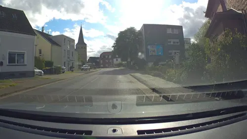
- Street-level photo, poxonline, CC BY-SA 4.0
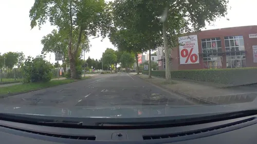
- Street-level photo, poxonline, CC BY-SA 4.0
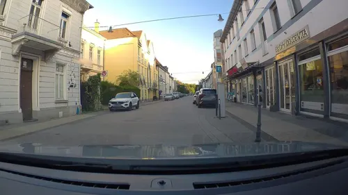
- Street-level photo, poxonline, CC BY-SA 4.0
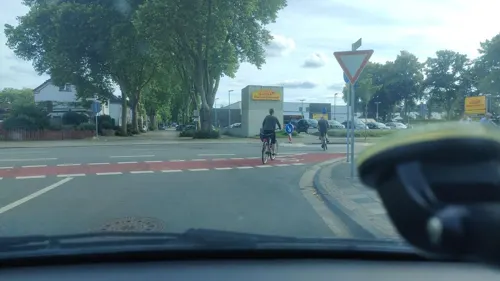
- Street-level photo, poxonline, CC BY-SA 4.0
- Street-level photo, poxonline, CC BY-SA 4.0
- Street-level photo, poxonline, CC BY-SA 4.0
- Street-level photo, poxonline, CC BY-SA 4.0
- Street-level photo, poxonline, CC BY-SA 4.0
- Street-level photo, poxonline, CC BY-SA 4.0
- Street-level photo, poxonline, CC BY-SA 4.0
- Street-level photo, poxonline, CC BY-SA 4.0
- Street-level photo, poxonline, CC BY-SA 4.0
- Street-level photo, poxonline, CC BY-SA 4.0
- Street-level photo, poxonline, CC BY-SA 4.0
- Street-level photo, poxonline, CC BY-SA 4.0
- Street-level photo, poxonline, CC BY-SA 4.0
- Street-level photo, poxonline, CC BY-SA 4.0
- Street-level photo, poxonline, CC BY-SA 4.0
- Street-level photo, poxonline, CC BY-SA 4.0
- Street-level photo, poxonline, CC BY-SA 4.0
- Street-level photo, poxonline, CC BY-SA 4.0
- Street-level photo, poxonline, CC BY-SA 4.0


Page built November 9, 2026. Spotted a mistake? Tell us or suggest a place.