


Willebadessen, Germany
Willebadessen is a town of 8,821 people in North Rhine-Westphalia, Germany.
Why visit Willebadessen
Townapedia lists 84 museums and landmarks, 24 parks and trails, 24 places to eat, 9 places to stay and 52 attractions in and around town.
Highlights include Heggehof, Bierbaums Nagel, Alte Eisenbahn and Burg Dringenberg.
Weather in Willebadessen
Forecast from MET Norway (CC BY 4.0). Full forecast
About Willebadessen
Willebadessen (German pronunciation: [ˈvɪləbaːtˌʔɛsn̩] ) is a town in Höxter district and Detmold region in North Rhine-Westphalia, Germany.
From the Wikipedia article Willebadessen (this version), under CC BY-SA 4.0.
Things to do52




40 more on the map.
Museums and landmarks84

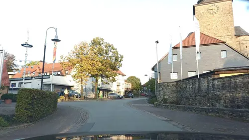
Burg Dringenberg
Monument and historic site · 5.3 km
33 Burgstraße, Bad Driburg
We 14:00-17:00; Sa 14:00-17:00; Su 10:00-12:00, 14:00-17:30
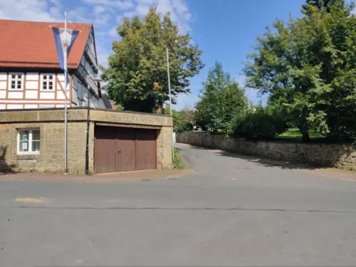
Die Vereinigten Museen
Museum · 6.2 km
2 Stiftsstraße, Bad Driburg
Apr-Oct Sa 14:00+; "nach Vereinbarung"


Rommenhöller-Ehrenmal
Monument and historic site · 9.3 km
Carl Gustav Rommenhöller (1853-1931) hat man als Begründer der Kohlensäure-Industrie ein Jahr nach seinem Tod ein 'Denkmal' in Herste...

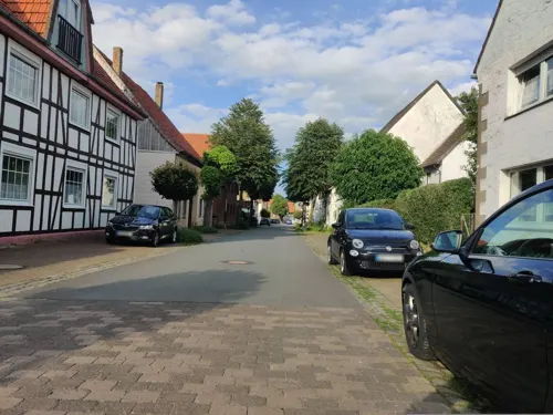

Schloss Schweckhausen
Monument and historic site · 9.1 km
2 Am Schloss, Willebadessen

Benediktinerinnenkloster St. Maria
Monument and historic site · 6.5 km

72 more on the map.
Parks, trails and playgrounds24


12 more on the map.
Restaurants and cafes24

Deutsches Haus
Restaurant · German
32 Lange Straße, Willebadessen
Tu, Fr-Sa 17:00-00:00; Su 10:30-14:00, 17:00-23:00
Landgasthaus Ikenmeyer
Restaurant · German · 6.3 km
25 Paderborner Straße, Bad Driburg
Fr-Su 17:00-22:00

Zur Niedermühle
Restaurant · German · 6.5 km
7 Niedermühlenweg, Lichtenau
Fr-Sa 17:00-22:00; Su 11:00-14:30
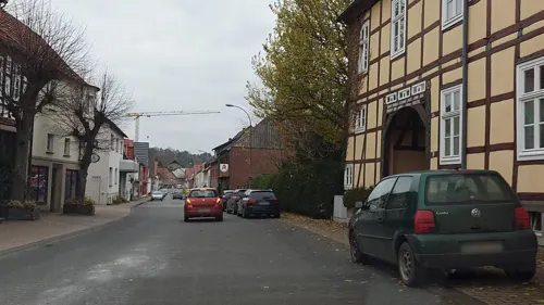
Engemann
Restaurant · 6.3 km
40 Hauptstraße, Lichtenau
Mo,We,Th,Sa 17:00+; Fr 18:00+; Su 10:00-14:00,17:00+; Tu off

Goeken backen
Bakery · 1.0 km
2 Am Sportplatz, Willebadessen
Mo-Fr 07:00-20:00; Sa 07:00-20:00; Su,PH 07:30-10:30
Goeken backen
Bakery · 7.1 km
4 Burgstraße, Willebadessen
Mo-Fr 08:00-20:00; Sa 07:30-18:00; Su,PH 07:30-10:30
Assler Deele
Restaurant · Burger, Friture, German · 7.7 km
9 Bahnhofstraße
Su-Th 16:30-20:00; Fr-Sa 16:30-21:30
Gaststätte Wienold
Restaurant · German · 7.6 km
1 St.-Johannes-Straße, Lichtenau
closed


Zum Goldenen Anker
Bar and pub · German · 5.1 km
24 Burgstraße, Bad Driburg
Tu-Su 11:00-23:00
12 more on the map.
Where to stay9
Churches and places of worship46
Wallfahrtskapelle "Mariä Heimsuchung"
Church · Roman Catholic · 6.5 km
2 Pfarrer-Leifferen-Straße, Lichtenau
Kapelle St. Josef
Church · Roman Catholic · 4.9 km
6a Kühlser Dorfstraße, Bad Driburg
Pfarrkirche Mariä Geburt
Church · Roman Catholic · 5.2 km
28 Burgstraße, Bad Driburg
Shopping10
Gas and EV charging5
Schools, colleges and libraries10
Healthcare2
Map of Willebadessen
250 places. The map loads OpenStreetMap tiles when you open it.
Getting there and nearby towns
Airport Paderborn/Lippstadt (PAD) is the nearest airport with scheduled flights listed in OpenStreetMap, 29 km away.
- Lichtenau 10 km west, about 10 min by car
- Bad Driburg 12 km north, about 12 min by car
- Brakel 14 km northeast, about 14 min by car
- Warburg 17 km southeast, about 17 min by car
- Paderborn 22 km northwest, about 22 min by car
- Marsberg 22 km southwest, about 22 min by car
- Bad Lippspringe 23 km northwest, about 23 min by car
- Beverungen 24 km east, about 24 min by car
- Volkmarsen 25 km south, about 25 min by car
- Bad Wünnenberg 26 km southwest, about 26 min by car
Drive times are estimates from straight-line distance, not routes.
Local news
Headlines from INDB.
Reviews, tips and questions
Loading what members have shared...
Sources and licences
- GeoNames (CC BY 4.0): population, coordinates, regions and time zone
- Mapillary (see each image): photos
- OpenStreetMap contributors (ODbL 1.0): places, airports, map data
- Wikidata (CC0 1.0): elevation, founding date, time zone, website
- Wikimedia Commons (see each image): photos
- Wikipedia (CC BY-SA 4.0): overview and history text
Photo credits
- Willebadessen - 2017-04-30 - Stadt von Kalktriften (03), Tsungam, CC BY-SA 4.0
- Alteeisenbahn01, Markus Schweiß, CC BY-SA 3.0
- Burg dringenberg, Linda.floren, CC BY 1.0
- Josefskapelle Kühlsen, bdk, CC BY-SA 3.0
- Wallfahrtskirche Mariä Heimsuchung, Kleinenberg, Lichtenau, Nr. 1, Tolanor, CC BY-SA 3.0
- Innenansicht der Kirche St. Kilian in Löwen, Volker.Ramsloh, CC BY-SA 4.0
- Willebadessen - 2017-09-13 - NSG Kalktriften (05), Tsungam, CC BY-SA 4.0
- Ehem. Klosteranlage, Brakel, OT Gehrden, Schloßstr. 6, Psychogerd, CC BY-SA 4.0
- Schloss Schweckhausen 109, Varus111, Public domain
- Gehrden Kath.Kirche St.Peter+Paul, Mariuswagener (Marius Wagener), Public domain
- Lichtenau - 2018-04-14 - Bülheimer Großmutter (2), Tsungam, CC BY-SA 4.0
- Bad Driburg - 2018-05-08 - NSG Gradberg (07), Tsungam, CC BY-SA 4.0
- Lichtenau - 2017-08-07 - Eselsbett (17), Tsungam, CC BY-SA 4.0
- Lichtenau - 2017-08-19 - NSG Oberer Kleinenberg (21), Tsungam, CC BY-SA 4.0
- Warburg - 2018-07-15 - HX-019 Hellberg-Scheffelberg (06), Tsungam, CC BY-SA 4.0
- Willebadessen - 2017-05-25 - NSG Königsblick (21), Tsungam, CC BY-SA 4.0
- Bad Driburg - 2017-05-15 - NSG Stollen an der Bahnlinie (14), Tsungam, CC BY-SA 4.0
- Wasserschloss Heerse 20090620 118, Varus111, Public domain
- Pfarrkirche Dringenberg, DasStofftier, CC BY-SA 3.0
- Kath. Pfarrkirche St. Agatha, Brakel, OT Siddessen, Am Kirchhof, Psychogerd, CC BY-SA 4.0
- Schmechten - St. Philippus und Jakobus - 1, Ath, CC0
- Karlsschanze bei Willebadessen, Der von einem Weg durchschnittene Hauptwall, Castritus, CC BY-SA 4.0
- Ev. Trinitatiskirche, Willebadessen, OT Peckelsheim, Psychogerd, CC BY-SA 4.0
- Bierbaums Nagel, JanA, CC BY-SA 3.0
- Bad Driburg - 2017-05-15 - NSG Stollen an der Bahnlinie (18), Tsungam, CC BY-SA 4.0
- Willebadessen - 2017-05-21 - Teutonia-Klippen (12), Tsungam, CC BY-SA 4.0
- Lichtenau - 2017-08-06 - Oberer Kleinenberg (04)-Pano, Tsungam, CC BY-SA 4.0
- Eselsbett Hakenberg (Lichtenau Westf.), Gorbulin, CC BY-SA 4.0
- Lichtenau - 2017-05-24 - NSG Glasebruch (00), Tsungam, CC BY-SA 4.0
- Bad Driburg - 2018-05-08 - NSG Gradberg (08), Tsungam, CC BY-SA 4.0
- Warburg - 2018-07-15 - HX-019 Hellberg-Scheffelberg (03), Tsungam, CC BY-SA 4.0
- Willebadessen - 2017-05-20 - Hirschstein (28), Tsungam, CC BY-SA 4.0
- Willebadessen - 2017-04-30 - NSG Kalktriften (31), Tsungam, CC BY-SA 4.0
- Warburg - 2017-08-13 - Klippen und Felsenmeer bei Hardehausen (14), Tsungam, CC BY-SA 4.0
- Willebadessen - 2017-05-25 - NSG Königsblick (01), Tsungam, CC BY-SA 4.0
- Willebadessen - 2017-04-30 - NSG Kuhkamp (1), Tsungam, CC BY-SA 4.0
- Neuenheerse Stiftskirche Turm, Thomas Berendes, Public domain
- Willebadessen - 2017-04-30 - NSG Kalktriften (10), Tsungam, CC BY-SA 4.0
- Lichtenau - 2020-02-20 - NSG Eselsbett (1), Tsungam, CC BY-SA 4.0
- Lichtenau - 2017-08-06 - Oberer Kleinenberg (20), Tsungam, CC BY-SA 4.0
- Street-level photo, steinm, CC BY-SA 4.0
- Street-level photo, amenophis, CC BY-SA 4.0
- Street-level photo, amenophis, CC BY-SA 4.0
- Street-level photo, steinm, CC BY-SA 4.0
- Street-level photo, amenophis, CC BY-SA 4.0
- Street-level photo, amenophis, CC BY-SA 4.0
- Street-level photo, amenophis, CC BY-SA 4.0
- Street-level photo, derlipper, CC BY-SA 4.0
- Street-level photo, steinm, CC BY-SA 4.0
- Street-level photo, amenophis, CC BY-SA 4.0
- Street-level photo, amenophis, CC BY-SA 4.0
- Street-level photo, amenophis, CC BY-SA 4.0
- Street-level photo, amenophis, CC BY-SA 4.0
- Street-level photo, amenophis, CC BY-SA 4.0
- Street-level photo, steinm, CC BY-SA 4.0
- Street-level photo, thetornado76, CC BY-SA 4.0
- Street-level photo, amenophis, CC BY-SA 4.0
- Street-level photo, amenophis, CC BY-SA 4.0
- Street-level photo, changchun1, CC BY-SA 4.0


Page built November 9, 2026. Spotted a mistake? Tell us or suggest a place.