


Why visit Ashford
Townapedia lists 10 museums and landmarks, 25 parks and trails, 72 places to eat, 1 place to stay and 7 attractions in and around town.
Highlights include Chertsey Bridge, Old Walton Bridge, Kempton Steam Museum and Burlington House.
Weather in Ashford
Forecast from MET Norway (CC BY 4.0). Full forecast
About Ashford
Ashford is a town in the Borough of Spelthorne in Surrey, England, which lies 14 mi (23 km) west of central London. Its name derives from a ford of the River Ash, a distributary of the River Colne. Historically part of Middlesex, the town has been part of Surrey since 1965. In 2011 it had a population of 27,382.
From the Wikipedia article Ashford, Surrey (this version), under CC BY-SA 4.0.
Photos of Ashford


Things to do7

Chertsey Bridge
Bridge · 3.2 mi
Classical bridge over the Thames in England that has stood since 1785

Old Walton Bridge
Bridge · 3.3 mi
First Walton Bridge built across the River Thames (1750-1783)

Staines Bridge
Bridge · 2.6 mi
Bridge over the Thames in Runnymede, Surrey, England, UK

Staines Railway Bridge
Bridge · 2.3 mi
Bridge over the Thames in the United Kingdom

Thorpe Park
Monument and historic site · 3.0 mi
Amusement park in Thorpe, Surrey, England

Walton Bridge
Bridge · 3.3 mi
This bridge in England, across the Thames, is in its sixth incarnation, built in 2013, one which is single-span and tied-arch above in design.

Museums and landmarks10



Bedfont Lake's Country Park rangers hut and information centre.
Monument and historic site · 0.7 mi
Parks main rangers hut with all the park information any visitor could want.
Bedfont Lakes country park visitors area.
Monument and historic site · 0.7 mi
Area for people that want park information wherever it be locals or tourist's or anyone just visiting. Nearby rangers hut has all park...
Stainash Crescent Award
Monument and historic site · 1.6 mi
As an award for the best decorated street in the Staines Ward, this plaque was presented to Stainash Crescent on the occasion of the...
Parks, trails and playgrounds25


Crane Meadows
Park · 3.4 mi
Nature reserve in London, England, United Kingdom


Crane Park Island
Park · 3.5 mi
Island in the London Borough of Richmond upon Thames, England, UK


Kempton Park Reservoirs
Park · 2.7 mi
Former reservoirs in London and Surrey, England



Cranford Park
Park · 3.6 mi
Park in London Borough of Hillingdon, United Kingdom
13 more on the map.
Restaurants and cafes72
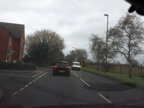
The Running Horse
Bar and pub · 1.6 mi
Groveley Road, Sunbury-on-Thames
Mo-Tu 11:30-22:00; We-Sa 11:00-23:00; Su 12:00-22:00
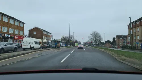
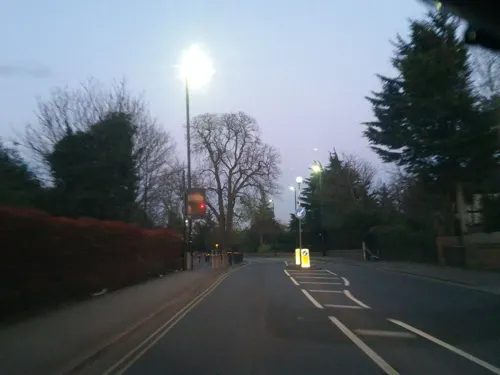

M2 Pizza Pasta
Restaurant · Pizza, Pasta · 0.4 mi
15 Church Road, Ashford
Mo-Sa 11:30-23:00; Su 11:30-22:00
Royal Grill
Restaurant · Grill · 1.2 mi
37 Edinburgh Drive, Staines-upon-Thames
We-Sa 12:00-22:30; Su 16:00-22:30


The Bell on the Green
Bar and pub · 1.6 mi
661 Staines Road, Feltham
Su-Th 11:00-23:00; Fr-Sa 11:00-00:30
60 more on the map.
History
Bronze Age artefacts have been found in Ashford (at 51.432708N, 0.485174W) giving rise to the name Bronzefield and a henge may have been present in that period. Ashford appears on the Middlesex Domesday map as Exeforde, held by Robert, Count of Mortain. Its Domesday assets were: 1 plough, meadow for 1 plough; a separate manor in 1066, it was part of the manor of Kempton in 1086. It rendered (in total) 14s 0d. Throughout the early medieval period the place was also referred to as Echelford.
A stone bridge was built over the ford in 1789 by the Hampton and Staines Turnpike Trust
Ashford Common was a large area of common land in the south and east of the town that the British Army used for military displays in the reign of George III. It was inclosed in 1809.
Ashford Manor Golf Club was established in 1902 at the property which was the Manor Farm House but the large manorial estate and manor house that were held by Solomon Abraham Hart from 1870 to 1882 had before 1902 been broken up among many small owners, and all trace of the manor house was lost. The title of Lord of the manor was acquired by Scott Freeman in 1890, and after passing to another partner of the solicitors Horne, Engall & Freeman the title passed in more recent times to Russell Grant.
Ashford's housing stock is chiefly a mixture of detached and semi-detached housing built between 1885 and 1960.
Read more of the history
The Welsh School (later St David's School) was founded in 1857. Its building north of Ashford railway station is Gothic Revival, designed by Henry Clutton. St David's School is now defunct, but in 2010 its buildings and playing fields became the premises of St James Senior Boys School.
Ashford County Grammar School was founded in 1911. It became Ashford Sixth Form College in 1975 and Spelthorne College later. In 2007 it merged with Brooklands College. A property developer, Inland Homes plc, has since acquired the former grammar school buildings in Church Road. In 2017 it started to demolish the buildings without planning permission. The developer stopped the work at the request of Spelthorne Borough Council after demolition had started, but later continued the demolition, having received planning permission to build 357 new homes on the site.
In 1894, under the Local Government Act 1894, Ashford became part of the Staines Rural District of Middlesex. In 1930 the rural district was abolished and joined Staines Urban District. In 1965, under the London Government Act 1963, Middlesex County Council was abolished and the urban district was transferred to Surrey. In 1974, under the Local Government Act 1972, Staines Urban District was abolished and its area combined with that of Sunbury-on-Thames Urban District to create the present borough of Spelthorne.
In 1931 the civil parish had a population of 16,502. On 1 April 1974 the parish was abolished.
From the History section of Ashford, Surrey on Wikipedia, under CC BY-SA 4.0.
More about Ashford
Economy
The main street, Church Road, has local businesses, including Co-op, Tesco Express, Costa Coffee, Sainsbury's, several estate agents, three funeral directors, and several places to eat. Church Road is also home to Ashford Library and a prominent World War I memorial.
Ashford, in common with most of London suburbia, has very low unemployment rates. A great deal of local employment is directly related to Heathrow Airport. BP International is another major employer. Many other residents work in London or in the Thames Valley.
The town previously had multiple high street banks including Barclays, HSBC, Lloyds and Santander, however all of these have since closed. The Barclays branch located on Church Road was the site of an attempted robbery in June 2010, when a man armed with an imitation gun and a fake bomb took multiple hostages, demanding £800,000 and a helicopter. All of the hostages were either released or escaped before the perpetrator surrendered to police.
Education
St Michael's Roman Catholic Primary School (4th best on benchmark of English and mathematics in the county)
(above in order of best combined England and Maths benchmark score 2011 primary schools)
In addition, three secondary schools were established in Sunbury-on-Thames, including the borough's religiously denominated senior schools, The Bishop Wand Church of England School and St Paul's Catholic College.
Ashford's further education college, Spelthorne College, became a Brooklands College Campus in 2007. In 2016 the Ashford Campus relocated to a new building adjacent to Thomas Knyvett College, and the former Spelthorne College site was demolished. It serves 16 to 18 year olds from a wide area of Surrey.
From the Wikipedia article Ashford, Surrey, under CC BY-SA 4.0.
Notable people from Ashford
 Ruth WilsonBritish actressPhoto: Gage Skidmore, CC BY-SA 3.0
 Roger JohnsonEnglish footballer (born 1983)Photo: Dtrc1969, CC BY-SA 3.0
 James YounghusbandPhilippine footballerPhoto: El Loko Foto, CC BY 4.0
 Ray DorsetBritish guitarist and singerPhoto: Harald Bischoff, CC BY-SA 3.0
 Robert Evans (British politician)British politician (born 1956)Photo: Rjeevans, Public domain
 Steve BeeksEnglish football player and manager (born 1971)Photo: User:Makenzis, CC BY-SA 4.0
 Toby Roland-Jonescricketer (born 1988)Photo: Dave Morton, Public domain
- Sarah WebbBritish sailor
- Sarah AytonBritish sailor
- Tony DoyleBritish cyclist (1958–2023)
- Dorothy PopenoeEnglish botanist and archaeologist (1899-1932)
- Matthew TarrantBritish rower
Born in Ashford, according to Wikidata (CC0). Each name links to its Wikipedia article.
Where to stay1
Churches and places of worship25
Church of St Mary Magdalene
Church · Anglican · 1.7 mi
Squire's Bridge Road, Shepperton
St George’s Interdenominational Chapel, Heathrow Airport
Church · 2.7 mi
Shopping13
Gas and EV charging7
Schools, colleges and libraries25
Healthcare12
Broadway Pharmacy
Clinic and pharmacy · 1.6 mi
3 The Broadway, Kingston Road, Staines-upon-Thames
Map of Ashford
197 places. The map loads OpenStreetMap tiles when you open it.
Getting there and nearby towns
Heathrow Airport (LHR) is the nearest airport with scheduled flights listed in OpenStreetMap, 2 miles away.
- Stanwell 2 mi northwest, about 3 min by car
- Sunbury-on-Thames 3 mi southeast, about 4 min by car
- Shepperton 3 mi south, about 4 min by car
- Hanworth 3 mi east, about 5 min by car
- Walton-on-Thames 4 mi southeast, about 6 min by car
- Chertsey 4 mi southwest, about 6 min by car
- Cranford 4 mi northeast, about 6 min by car
- Egham 4 mi west, about 7 min by car
- Hampton 4 mi east, about 7 min by car
- Weybridge 4 mi south, about 7 min by car
Drive times are estimates from straight-line distance, not routes.
Towns near Ashford


Keep exploring
Local news
Headlines from INDB.
Reviews, tips and questions
Loading what members have shared...
Sources and licences
- GeoNames (CC BY 4.0): population, coordinates, regions and time zone
- Mapillary (see each image): photos
- OpenStreetMap contributors (ODbL 1.0): places, airports, map data
- Wikidata (CC0 1.0): elevation, founding date, time zone, website, landmarks and historic places
- Wikimedia Commons (see each image): photos
- Wikipedia (CC BY-SA 4.0): overview and history text
Photo credits
- AshfordChurchRoad, Manfred Heyde, CC BY-SA 3.0
- Fingerpost on Church Road, Ashford (Surrey), DanielMichaelPerry, CC0
- Ashford War Memorial, Church Road, Ashford, Surrey 02, Mertbiol, CC0
- Ashford War Memorial, Church Road, Ashford, Surrey 03, Mertbiol, CC0
- Ashford War Memorial, Church Road, Ashford, Surrey 01, Mertbiol, CC0
- Ashford, UK - panoramio (4), jac, CC BY 3.0
- Chertsey Bridge, Alistair young, CC BY 2.0
- Old Walton Bridge title QS:P1476,en:"Old Walton Bridge" label QS:Len,"Old Walton Bridge", Giovanni Antonio Canal, Public domain
- StainesBridge01, Motmit, CC BY-SA 3.0
- Staines Railway Bridge Over The Thames, Jim Linwood, CC BY 2.0
- Walton Bridge - Aug 2013, Adam37, CC BY-SA 3.0
- Sir William Prescott Engine, Kempton Steam Museum, CC BY-SA 4.0
- River Crane in Crane Park 2, Dudley Miles, CC BY-SA 3.0
- Crane Park Island Nature Reserve, Twickenham, London. (3350016620), Jim Linwood from London, CC BY 2.0
- Kempton Nature Reserve, Dudley Miles, CC BY-SA 3.0
- StanwellChurch, Maxwell Hamilton from Greater London, England, UK, CC BY 2.0
- Church of St Mary Magdalen, Littleton, Surrey - April 2025 - 02, Mertbiol, CC0
- St Dunstan's Church in Feltham, Maxwell Hamilton, CC BY 2.0
- AshfordStMatthews, Manfred Heyde, CC BY-SA 3.0
- Cranebank path, Dudley Miles, CC BY-SA 3.0
- Oak Avenue Local Nature Reserve 9, Dudley Miles, CC BY-SA 3.0
- Crane Meadows, JoshuaAnthonyGill, CC BY-SA 4.0
- Ashford Hospital - panoramio, Maxwell Hamilton, CC BY-SA 3.0
- Spelthorne - Parish Church of St Matthew - 20230902123757, DanielMichaelPerry, CC BY-SA 4.0
- Spelthorne - Parish Church of St Matthew - 20230902123448, DanielMichaelPerry, CC BY-SA 4.0
- Spelthorne - Roman Catholic Church of St Michael, Including Boundary Wall and Entrance Screen - 20230902122957, DanielMichaelPerry, CC BY-SA 4.0
- Spelthorne - Ashford War Memorial - 20230902123107, DanielMichaelPerry, CC BY-SA 4.0
- Thorpe Park Resort, Smithr32, CC BY-SA 4.0
- Pylons at Chertsey Meads - panoramio, Maxwell Hamilton, CC BY-SA 3.0
- Street-level photo, southglos, CC BY-SA 4.0
- Street-level photo, ilmarinen946, CC BY-SA 4.0
- Street-level photo, alexanderar, CC BY-SA 4.0
- Street-level photo, alexanderar, CC BY-SA 4.0
- Street-level photo, ilmarinen946, CC BY-SA 4.0
- Street-level photo, ilmarinen946, CC BY-SA 4.0
- Street-level photo, ilmarinen946, CC BY-SA 4.0
- Street-level photo, rskedgell, CC BY-SA 4.0
- Street-level photo, rskedgell, CC BY-SA 4.0
- Street-level photo, ilmarinen946, CC BY-SA 4.0
- Street-level photo, themadcabbie, CC BY-SA 4.0
- Street-level photo, jjh, CC BY-SA 4.0


Page built November 10, 2026. Spotted a mistake? Tell us or suggest a place.