


Why visit Hampton
Townapedia lists 39 museums and landmarks, 65 parks and trails, 189 places to eat, 8 places to stay and 15 attractions in and around town.
Highlights include Hampton Court Bridge, Kingston Bridge, Kempton Steam Museum and Hampton Court Palace.
Weather in Hampton
Forecast from MET Norway (CC BY 4.0). Full forecast
About Hampton
Hampton is a suburb of Greater London on the north bank of the River Thames, in the London Borough of Richmond upon Thames, England, and the historic county of Middlesex. Hampton is bounded by Bushy Park to the east (and to the north of St Albans Riverside facing Tagg's Island), the suburbs of Hampton Hill and Fulwell to the north, green belt to the west, and the Thames to the south.
From the Wikipedia article Hampton, London (this version), under CC BY-SA 4.0.
Photos of Hampton


Things to do15

Hampton Court Bridge
Bridge · 1.2 mi
Bridge in London and Surrey, England

Kingston Bridge
Bridge · 2.5 mi
Road bridge at Kingston upon Thames in south west London, England, UK

Kingston Railway Bridge
Bridge · 2.5 mi
Arch bridge in Kingston upon Thames, London

Old Walton Bridge
Bridge · 3.3 mi
First Walton Bridge built across the River Thames (1750-1783)

Rose Theatre, Kingston
Cinema and theater · 2.6 mi
Theatre in Kingston-upon-Thames, London, England

Teddington Lock Footbridges
Bridge · 2.3 mi
Two footbridges on the River Thames in London

The Exchange, Twickenham
Cinema and theater · 3.0 mi
Theatre and arts venue in the London Borough of Richmond upon Thames

The Karsino
Cinema and theater · 0.7 mi
Hotel and entertainment centre on Tagg's Island, Richmond, London

Walton Bridge
Bridge · 3.3 mi
This bridge in England, across the Thames, is in its sixth incarnation, built in 2013, one which is single-span and tied-arch above in design.

Esher Theatre
Cinema and theater · 3.0 mi
Theatre in Esher, Elmbridge, Surrey, England
Normansfield Theatre
Cinema and theater · 2.3 mi
Theatre in London, England, UK
3 more on the map.
Museums and landmarks39

Kempton Steam Museum
Museum · 1.8 mi
History museum in London
Snakey Lane, Hanworth
Mar 18-Nov 19: Su 10:30-16:00
Open in Google Maps · Wikipedia · +44 1932 765328;+44 7511 730782

Hampton Court Palace
Monument and historic site · 1.4 mi
Historic royal palace in Richmond, Greater London

Garrick's Temple to Shakespeare
Monument and historic site
Folly in Hampton, London

Ham House
Museum · 3.1 mi
Historic house museum in Ham, London Borough of Richmond upon Thames, England, UK

Kilmorey Mausoleum
Monument and historic site · 3.8 mi
Mausoleum in St Margarets, London

Kingston Museum
Museum · 2.9 mi
History museum in Wheatfield Way, Kingston upon Thames, United Kingdom

Orleans House Gallery
Museum · 3.1 mi
Building and art gallery in Twickenham, London Borough of Richmond upon Thames, England, United Kingdom

Strawberry Hill House
Museum · 2.2 mi
Villa and house museum in Twickenham, London, United Kingdom

World Rugby Museum
Museum · 3.1 mi
Sports museum in Twickenham, United Kingdom

Riverside Arts Centre
Museum · 1.7 mi
Two large halls, one with a gently tiered audience space for live performances, several plays per month by different groups including...
59 Thames Street, Sunbury-on-Thames
Mo-Su

Hampton & Kempton Waterworks Railway
Monument and historic site · 1.9 mi
Mar 18-Nov 19: Su 10:30-16:00
Hampton Wick War Memorial
Monument and historic site · 2.4 mi
War memorial in London
27 more on the map.
Parks, trails and playgrounds65

Carlisle Park
Park · 0.6 mi
Park in London Borough of Richmond upon Thames, United Kingdom


Crane Park Island
Park · 2.2 mi
Island in the London Borough of Richmond upon Thames, England, UK



Sunbury Park & Orchard Meadow
Park · 1.9 mi
Dogs may not enter Orchard Meadow which is used for children to play around in, picnics and informal cricket.
Thames Street, Sunbury-on-Thames
24/7
Cigarette Island Park
Park · 1.4 mi
Park in Surrey opposite Hampton Court
Ham Lands
Park · 2.3 mi
Nature reserve in the London Borough of Richmond upon Thames, England, UK
53 more on the map.
Restaurants and cafes189
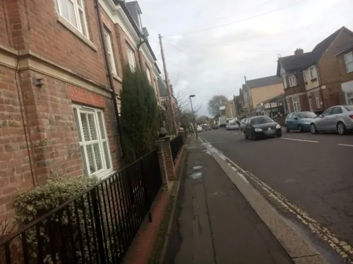

Caffè Nero
Cafe · Coffee Shop · 1.5 mi
46 Broad Street, Teddington
Mo-Fr 07:00-18:00; Sa-Su 07:30-18:00

Charm
Restaurant · Thai · 1.9 mi
86 High Street, Teddington
Tu-Sa 12:00-14:30,18:00-23:00; Su 12:00-22:00
Imperial China
Restaurant · Chinese · 1.6 mi
196-198 Stanley Road, Teddington
Mo-Th 12:00-15:00, 18:00-22:00; Fr-Sa 12:00-15:30, 18:00-23:00, Su...
PizzaExpress
Restaurant · Pizza · 1.7 mi
11 Waldegrave Road, Teddington
Su-Tu 11:30-22:30;We-Sa 11:30-23:00
Starbucks
Cafe · Coffee Shop · 1.5 mi
303 Uxbridge Road, Hampton
Mo-Fr 06:00-20:00; Sa 07:00-20:00; Su 08:30-16:30
The Pheasantry
Cafe · Pizza, Burger, Chicken · 1.2 mi
Bushy Park
Apr-Oct 09:00-18:00; Nov-Mar 09:00-17:00
Unico28
Restaurant · Italian Pizza, Italian · 0.9 mi
28 High Street, Hampton Hill
Tu-Th 12:00-15:00, 17:30-22:00; Fr-Sa 12:00-22:30; Su 12:00-22:00

177 more on the map.
History
The River Thames was displaced southwards to its present course through Berkshire and London following the Anglian glaciation c. 450,000 BCE. The local geology comprises Kempton Park Gravel above London Clay, on which the Thames deposits fertile, well-drained alluvial soils, making it an attractive area for human habitation and settlement.
There is evidence of small hunter-gatherer communities in the Thames Valley in the Palaeolithic period, who would have hunted migrating animal herds (reindeer and horse) depending on seasonal conditions. Hand-axes and a flint from that era have been recovered from sites in Hampton, indicating the presence of human activity as early as the Wolstonian Stage.
The resettlement of Britain following the Last Glacial Maximum and the start of the Holocene is evidenced in Hampton and surrounding areas by the artefacts (predominantly flintwork) of Mesolithic hunter-gatherers, who would have favoured the diversity of habitats and food resources offered by rivers and their floodplains for settlement and resource procurement. Three Mesolitihic tranchet axes were discovered during construction of the Hampton Waterworks.
Read more of the history
Evidence of Neolithic and Bronze Age settlement activity in the area is widespread, during a period when the level of the River Thames would have been significantly lower than at present. Finds on Garrick's Ait (Neolithic stone axe), Hurst Park (Neolithic pits), and Platt's Eyot (early Bronze Age axe); and the excavation in 1854 of a significant Bronze Age barrow in Bushy Park (containing the cremated remains and offerings of a local chieftain) indicate the transition to settled agriculture.
Before the Roman invasion of Britain, the Hampton area was occupied by the Catuvellauni, a Celtic tribe with its centre of government at Watamestede, near modern-day St Albans. There is little archaeological evidence of Roman activity in the Hampton area (which was concentrated around the river crossing at Kingston-upon-Thames), except for a small collection of finds at Hampton Hill, a corn drier in Hurst Park, and field boundaries laid out to Roman proportions in what would become Bushy Park.
Following the end of Roman rule the Hampton area would have been on the fringes of the Anglo-Saxon Kingdom of Mercia, in territory which came to be known as Middlesex. The settlement of Hampton first developed under the Saxons, centred on a village clustered around the intersection of the Windsor-Kingston road running east–west along the river with the road north to Twickenham, around the hillock on which St Mary's Church stands. The Anglo-Saxon parish of Hampton included the area comprising present-day Hampton, Hampton Hill, Hampton Wick, Bushy Park, parts of Teddington, and Hampton Court.
The Hampton settlement developed under the manorial system (where tenant serfs work the arable farm and grazing land of the manor on behalf of the absentee lord) as an agricultural domain primarily supporting neighbouring Kingston, which by the 9th century was a significant royal estate. Bushy Park shows extensive use of the ridge and farrow system of agriculture introduced by the Saxons. The 1086 Domesday Book records that prior to the Norman Conquest the Manor of Hampton belonged to Aelfgar, Earl of Mercia, but indicated that, as Aelfgar had not passed his lands to his son Edwin upon his death in 1062, they were instead held by King Harold at the time of the Norman Invasion.The name Hampton may come from the Anglo-Saxon words hamm meaning an enclosure in the bend of a river and ton meaning farmstead or settlement. Hamntone is recorded in the Domesday Book, the entry listing 41 villagers and 4 smallholders (accounting for households comprising ~200 individuals) occupying 35 hides, each comprising the area that could be ploughed by eight oxen in a year (~120 acres, or ~4,200 acres total). The demesne (lands belonging to the lord of the manor) comprised 18 hides tilled by only 3 ploughs, indicating it was used mostly for sheep pasture. The other 17 villanes (hides leased to serfs) each had a plough, suggesting cultivation. The entry also recorded a substantial meadow (for the provision of hay for plough animals) and a significant fishery.
The Domesday Book records the total annual value of the estate in 1086 (used to calculate how much tax the lord should be charged) as 39 pounds. The assessed 1086 value was 9 pounds less than prior to the conquest, attributed to the devastation caused by Norman forces on their circuitous route around London as they sought its subjugation.
After the Conquest the Manors of Hampton and Isleworth (comprising the hundred of Hounslow) were granted to Walter of Saint-Valéry, from whose home town in Flanders, Saint Valery-sur-Somme, William had sailed in 1066. Walter probably never resided in Middlesex, and he and his heirs were active participants in the First and Second Crusades. In 1189 the estate passed to Thomas de St Valerie, who, as a baron in the "extraordinarily difficult" position of holding large possessions on both sides of the English Channel in the time of Magna Carta and the rebellion against King John, appears to have taken the precaution of severing the two holdings—transferring the Manor of Hampton to Henry de St Albans, a London merchant, and the Manor of Isleworth to his daughter Annora's husband, Robert III of Dreux—at some point before the 1217 Battle of Lincoln (in which he was implicated and ultimately exiled). The Manor of Hampton transferred from the hundred of Hounslow to that of Spelthorne in the late 12th or early 13th century.
From the History section of Hampton, London on Wikipedia, under CC BY-SA 4.0.
Notable people from Hampton
 Brian MayBritish musician (born 1947)Photo: Gage Skidmore, CC BY-SA 4.0
 Richard DollBritish physician and epidemiologist (1912–2005)Photo: CJ DUB, CC BY-SA 2.0 ca
 Christopher FraylingBritish educationalist and writer (born 1946)Photo: University of Bath from Bath, England, CC BY 2.0
 Christopher ChessunBishop of Southwark; Bishop of WoolwichPhoto: Roger Harris, CC BY 3.0
 Leonard RosomanBritish artist (1913-2012)Photo: Ministry of Information Photo..., Public domain
 John FisherBishop of Salisbury (1748–1825)Photo: After James Northcote, Public domain
- Martin Litchfield WestBritish philologist and classical scholar (1937–2015)
- Joshua HerdmanBritish actor
- Alan SealeyEnglish footballer (1942-1996)
- Alan GlazierEnglish darts player (1939–2020)
- Robert Killick-KendrickBritish parasitologist (1929–2011)
- Ethel Sarel Barton GeppBritish botanist (1864-1922)
Born in Hampton, according to Wikidata (CC0). Each name links to its Wikipedia article.
Where to stay8
Churches and places of worship64
Shopping42
Gas and EV charging13
Schools, colleges and libraries45
St Mary's and St Peter's Church of England Primary School
School · Anglican · 1.6 mi
Somerset Road, Teddington
Healthcare15
Hampton Hill Pharmacy
Clinic and pharmacy · 1.1 mi
173B High Street, Hampton Hill
Map of Hampton
250 places. The map loads OpenStreetMap tiles when you open it.
Getting there and nearby towns
Heathrow Airport (LHR) is the nearest airport with scheduled flights listed in OpenStreetMap, 6 miles away.
- Sunbury-on-Thames 2 mi west, about 4 min by car
- Walton-on-Thames 3 mi southwest, about 4 min by car
- Shepperton 4 mi west, about 6 min by car
- Hook 4 mi southeast, about 7 min by car
- Richmond 4 mi northeast, about 7 min by car
- Isleworth 4 mi north, about 7 min by car
- Weybridge 5 mi southwest, about 8 min by car
- Stanwell 6 mi northwest, about 9 min by car
- Worcester Park 6 mi southeast, about 9 min by car
- Kew 6 mi northeast, about 9 min by car
Drive times are estimates from straight-line distance, not routes.
Towns near Hampton


Keep exploring
Local news
Headlines from INDB.
Reviews, tips and questions
Loading what members have shared...
Sources and licences
- GeoNames (CC BY 4.0): population, coordinates, regions and time zone
- Mapillary (see each image): photos
- OpenStreetMap contributors (ODbL 1.0): places, airports, map data
- Wikidata (CC0 1.0): elevation, founding date, time zone, website, landmarks and historic places
- Wikimedia Commons (see each image): photos
- Wikipedia (CC BY-SA 4.0): overview and history text
Photo credits
- Hamptonreach01, Motmit, CC BY-SA 3.0
- Hampton waterworks 1855, Unknown author Unknown author, Public domain
- Ruston building Hampton waterworks 1884, Unknown author Unknown author, Public domain
- Hampton Thames Street c1911, Unknown author Unknown author, Public domain
- Hampton Thames Street 1883, Unknown author Unknown author, Public domain
- Hampton Court Bridge 1, Unknown author, CC BY-SA 2.5
- Kingston Bridge2, Unknown author, Public domain
- Kingston Railway Bridge, Motmit at English Wikipedia ( Original text: Motmit ( talk ) ), CC BY-SA 3.0
- Old Walton Bridge title QS:P1476,en:"Old Walton Bridge" label QS:Len,"Old Walton Bridge", Giovanni Antonio Canal, Public domain
- The Rose Theatre, Kingston, London, Jim Linwood from London, CC BY 2.0
- TeddBridge, Motmit, CC BY-SA 3.0
- The Exchange, Twickenham, Robert Smith, CC BY-SA 4.0
- The Karsino, Adam37, CC BY-SA 4.0
- Walton Bridge - Aug 2013, Adam37, CC BY-SA 3.0
- Sir William Prescott Engine, Kempton Steam Museum, CC BY-SA 4.0
- Hampton Court Palace (3), Ricardalovesmonuments, CC BY-SA 4.0
- Garrick's Temple south view, Maxwell Hamilton, CC BY 2.0
- Ham House, London, Stevekeiretsu, CC BY-SA 4.0
- Entrance to The Kilmorey Mausoleum, Maxwell Hamilton, CC BY 2.0
- Exterior of Kingston Museum, Zoopraxiscope, CC BY-SA 4.0
- Orleans House Gallery, Matt Brown, CC BY 2.0
- Strawberry Hill House from garden in 2012 after restoration, Chiswick Chap, CC BY-SA 3.0
- Sport of Empire and the World Gallery, Algernon Rutter, CC BY-SA 4.0
- BushyParkAutumn, Ojw at English Wikipedia, CC BY-SA 3.0
- River Crane in Crane Park 2, Dudley Miles, CC BY-SA 3.0
- Crane Park Island Nature Reserve, Twickenham, London. (3350016620), Jim Linwood from London, CC BY 2.0
- HamptonCourtParkTrees, Ojw, CC BY-SA 3.0
- Teddington Methodist Church, Robert Smith, CC BY-SA 4.0
- St Mary's Parish Church Hampton From the River, Dnwinterburn, CC BY 3.0
- St Francis de Sales, Hampton Hill, Jonathan Cardy, CC BY-SA 3.0
- St James, Hampton Hill, Jonathan Cardy, CC BY-SA 3.0
- St Peter and St Paul, Teddington, ChristianSW, CC0
- St Paul's Church, Church Road–Palace Road, East Molesey (NHLE Code 1031856) (July 2015) (1), Hassocks5489, CC0
- Mitre Hotel and Mute Swan, Stevekeiretsu, CC BY-SA 4.0
- Kings Arms Hotel, Hampton Court 01, Jonathan Cardy, CC BY-SA 4.0
- The Park Hotel, Teddington, London (2008), Jim Linwood from London, CC BY 2.0
- Teddington Carnegie Library, Jonathan Cardy, CC BY-SA 4.0
- Hampton Methodist Church, Cameron Bools, CC BY-SA 4.0
- Stokers Moreland building 1934, Unknown author Unknown author, Public domain
- Moreland building c 1886, Unknown author Unknown author, Public domain
- Street-level photo, laye, CC BY-SA 4.0
- Street-level photo, livingwithdragons, CC BY-SA 4.0
- Street-level photo, livingwithdragons, CC BY-SA 4.0
- Street-level photo, dragma, CC BY-SA 4.0
- Street-level photo, dragma, CC BY-SA 4.0
- Street-level photo, laye, CC BY-SA 4.0
- Street-level photo, dragma, CC BY-SA 4.0


Page built November 10, 2026. Spotted a mistake? Tell us or suggest a place.