


Shepperton, United Kingdom
Shepperton is a town of 10,106 people in England, United Kingdom.
Why visit Shepperton
Townapedia lists 15 museums and landmarks, 21 parks and trails, 137 places to eat, 9 places to stay and 7 attractions in and around town.
Highlights include Chertsey Bridge, Old Walton Bridge, York Column and Brooklands Museum.
Weather in Shepperton
Forecast from MET Norway (CC BY 4.0). Full forecast
About Shepperton
Shepperton is a village in the Spelthorne district, in north Surrey, England, around 15 mi (24 km) south west of central London. The settlement is on the north bank of the River Thames, between the towns of Chertsey and Sunbury-on-Thames. The village is mentioned in a document of 959 AD and in Domesday Book.
From the Wikipedia article Shepperton (this version), under CC BY-SA 4.0.
Things to do7

Chertsey Bridge
Bridge · 1.7 mi
Classical bridge over the Thames in England that has stood since 1785

Old Walton Bridge
Bridge · 0.9 mi
First Walton Bridge built across the River Thames (1750-1783)

Staines Railway Bridge
Bridge · 3.6 mi
Bridge over the Thames in the United Kingdom

Thorpe Park
Monument and historic site · 2.8 mi
Amusement park in Thorpe, Surrey, England

Walton Bridge
Bridge · 0.9 mi
This bridge in England, across the Thames, is in its sixth incarnation, built in 2013, one which is single-span and tied-arch above in design.

Everyman Cinema
Cinema and theater · 1.6 mi
85-89 High Street, Walton-on-Thames
Mo-Su 10:00+ "half an hour before the first film of the day, if earlier"
Museums and landmarks15

York Column
Monument and historic site · 1.5 mi
Building in Elmbridge, Surrey, England, UK

Brooklands Museum
Museum · 3.0 mi
Sports museum in Weybridge, Surrey, England, United Kingdom


London Bus Museum
Museum · 3.0 mi
Transport museum located at Brooklands, Weybridge, England, United Kingdom


3 more on the map.
Parks, trails and playgrounds21


Kempton Park Reservoirs
Park · 3.1 mi
Former reservoirs in London and Surrey, England


Molesey Heath
Park · 3.2 mi
Local Nature Reserve in Molesey, Surrey, England, UK




9 more on the map.
Restaurants and cafes137

The Queens Head
Bar and pub · European, Regional, Indian · 1.8 mi
A large, old-core, pub-restaurant with a menu extending to specialty-luxury items; a long mocktails menu and three-course dining.
1 Bridge Road, Weybridge
Mo-Su
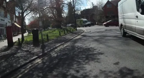
Cantina 41
Restaurant · Italian · 1.8 mi
41 Church Street, Weybridge
Mo-Th 17:00-22:00; Fr-Sa 11:30-22:30; Su 11:30-20:00
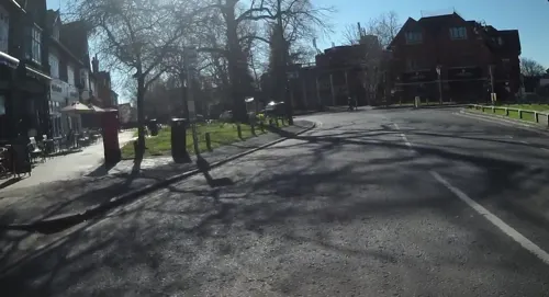
Giggling Squid
Restaurant · Thai · 1.8 mi
43-45 Church Street, Weybridge
Mo-We 12:00-22:00, Th-Sa 12:00-22:30, Su 12:00-22:00
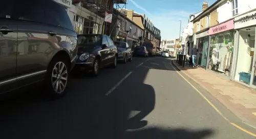
Kusina de Isobel
Cafe · Asian, Breakfast, International, Local, Steak House · 1.6 mi
34 Baker Street, Weybridge
Th-Sa 08:00-22:00; Su-We 09:00-15:30
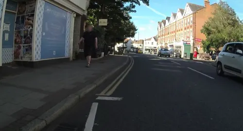
Megan's by the Wey
Restaurant · Mediterranean · 1.7 mi
17-19 Church Street, Weybridge
Mo-We 08:30-22:00; Th-Sa 08:30-23:00; Su 09:00-21:00
Pearl of China
Restaurant · Chinese · 1.7 mi
3 Balfour Road, Weybridge
Mo-Th 12:00-14:00,18:00-22:30; Fr-Sa 12:00-14:00,17:30-23:00; Su...

Buenasado Argentine Steakhouse
Restaurant · Steak House, Argentinian · 1.4 mi
New Zealand Avenue, Walton-on-Thames
Mo-Th 17:00-22:00; Fr-Sa 12:00-23:00; Su 12:00-22:00
Kinnaree Thai Restaurant
Restaurant · Thai
23 High Street, Shepperton
Mo-Th 12:00-14:30,18:00-21:00; Fr-Sa 12:00-14:30,18:00-22:30
The Goat
Restaurant · Pizza · 0.8 mi
47 Upper Halliford Road, Shepperton
Mo-Th 11:30-21:00; Fr-Sa 09:00-23:00; Su 09:00-21:00
125 more on the map.
History
The earliest evidence of human activity in the local area is from the middle Neolithic. A henge, taking the form of a penannular ring ditch, was discovered in the late 1980s, close to the River Ash, to the north of Shepperton Green. The structure was around 23 m (75 ft) in diameter and is thought to have been constructed c. 3500 BCE. The main entrance to the henge was aligned with the position of the sun at sunrise on the summer solstice and lumps of red ochre had been placed inside the ditch to mark the position of the most southerly moonrise. The ditch appeared to have been refilled and re-excavated in the late Neolithic. Two burials were discovered at the site - a torso, probably male, and an almost complete skeleton of a female. Radiocarbon dating showed that the woman had lived in the late 3rd millennium BCE and analysis of the isotope composition of her teeth suggested that she had grown up in an area where lead-zinc ore was found, possibly Derbyshire, the Mendips or the North Pennines. A reconstruction of the face of the woman from the skull was created at the University of Manchester in 2004.
Read more of the history
Finds from the Iron Age include an inhumation of a woman in her 40s, found on Chertsey Road, and iron swords, discovered at Shepperton Ranges. Pewter plates, from the latter site, are thought to date from the late Roman period. Evidence of late-Iron Age and Saxon settlements was found at Shepperton Green in the late 1960s and early 1970s.
Shepperton is recorded in Domesday Book of 1086 as Scepertone. It had a population of 25 households and was held by Westminster Abbey; (excluding any woodland, marsh and heath) it had eight hides, pasture for seven carucates and one weir (worth 6s 8d per year). In total, the annual amount rendered was £6.
The Church Lane and Church Square area, leading to and next to the river predates by several centuries the High Street as the village nucleus. When the Thames Valley Railway built in 1864 the terminus of Shepperton railway station, 1 mile (1.6 km) north, for the 12 initial years a single train and track running to and from Strawberry Hill, the village slowly expanded into its northern fields. Its coming which was largely due to contributions and permission of W. S. Lindsay the owner of Shepperton's manor.
The River Thames was important for transport from the late 13th century and carried barley, wheat, peas and root vegetables to London's markets; later timber, building materials such as bricks, sand and lime, and gunpowder, see the Wey Navigation.
While the village was wholly agricultural until the 19th century, there are originally expensive gravestones of the local minor gentry in the churchyard, two of which are dedicated to their naturalised black servants, Benjamin and Cotto Blake who both died in 1781. These bear the inscription "Davo aptio, Argo fidelior, ipso Sanchone facetior". During this long period since the conquest the wealth of the local rector and his bishop was great: William Grocyn was rector 1504–1513 and was an Oxford classical academic who corresponded regularly with Erasmus and Lewis Atterbury (1707–31) expended much of the large parish revenues on having the large tower rebuilt.
A large net income of rents and tithes of £499 per year was paid to the rectory belonging to S. H. Russell in 1848; this compares to £600 of poor relief, including for supporting its workhouse, paid out in 1829.
A change to secular council-administered rather than church-administered public services followed the establishment of poor law unions and Sanitary Districts and was completed with the founding, in 1889, of the Middlesex County Council and Staines Rural District from 1896. In 1930 on the rural district's abolition, Shepperton became part of the Sunbury-on-Thames Urban District until its dissolution into a reduced and reconfigured county of Surrey in 1965. Three districts of the historic county thus did not become part of Greater London: Staines Urban District also joined Surrey and Potters Bar Urban District joined Hertfordshire. In 1951 the civil parish had a population of 6060. On 1 April 1974 the parish was abolished.
In 2025, a new sand and gravel quarry, operated by Cemex, was opened in Shepperton.
In semi-fiction, George Eliot's Scenes of Clerical Life telling the Sad Fortunes of The Rev. Amos Barton, gives a thinly veiled picture of Chilvers Coton's church and village in the early 19th century in which she uses the name Shepperton. If anything real is to be gleaned for its use, it is perhaps a passing similarity. Shepperton Manor by John Mason Neale was contemporaneously written in 1844 fifteen years after he had spent six years living in the village. Old parts of Shepperton are said to be haunted by the ghost of a headless monk. Battlecrease Hall (formerly home to Walter Hayes, Ford Motor Company executive and a founder of the company's Formula One programme) is alleged by its owners and certain visitors to have poltergeists.
Leading to this is a short, since 1989 bypassed, winding lane from the High Street to Church Square, flanked by Shepperton Manor and the cricket ground, with some listed walls. Sir Nikolaus Pevsner described the view looking towards the south-east of the square with its now listed buildings and river opening as "one of the most perfect village pictures that the area has to offer". It offers two pub/restaurants two hotels, the Anchor Hotel and the Warren Lodge Hotel. In this little square there is also the King's Head public house.
The riverside manor, late 18th century, (its predecessor, as with the church here, predates the 12th century), features a room painted and rendered to look like a tent or draped damask. Also Grade II* listed is the c. 1500 timber framed Old Rectory refronted in the early 18th century, and including a reception hall built in 1498. Its front cladding has mathematical tiles.
From the History section of Shepperton on Wikipedia, under CC BY-SA 4.0.
More about Shepperton
Arts and culture
Shepperton Studios is home to a multi-disciplinary film production facility from on-set, through to television and various forms of animation. This also acts as a base for on-location film work for television dramas in the South East and in films, for instance for productions partly shot in the Burnham Beeches woods less than 10 miles (16 km) away. These adjoin Shepperton Green, in the now negligible village of Littleton. In the 1930s its Littleton manor's core, which covered 60 acres (24 ha) was converted into film production lots. Works produced or shot wholly or in part on its 15 stages, other lots or in its extensive animation facilities since the new millennium include:
Alexander, Harry Potter and the Prisoner of Azkaban, Troy, Wimbledon (2004)
Batman Begins, Harry Potter and the Goblet of Fire, Sahara, Star Wars: Episode III – Revenge of the Sith (2005)
Atonement, Elizabeth: The Golden Age, The Golden Compass (2007)
Lower Halliford, a completely contiguous so also integral part of Shepperton, used to be home to Halliford Film Studios, opposite the Manygate Lane conservation area, built in 1955 and one of the first film studios devoted to TV commercial production. It was an independent film studio used for commercials, small television productions and other short "promos". The studio was recently closed and demolished.
From the Wikipedia article Shepperton, under CC BY-SA 4.0.
Notable people from Shepperton
 John BoormanBritish film director, producer and screenwriterPhoto: Lionel Allorge, CC BY-SA 3.0
 Pat FryEnglish motor racing engineerPhoto: chdphd, CC BY-SA 2.0
 Liv DawsonBritish singer-songwriterPhoto: Alexpepperb, CC BY-SA 4.0
- Robert FaurissonFrench academic and Holocaust denier (1929–2018)
- Roy UrquhartBritish military officer (1901–1988)
- James WoodgateBritish archer
- Daniel JamesBritish historian
- Kate PalmerAustralian netball player and administrator
- Charles HelpsEnglish cyclist (died 1991)
Born in Shepperton, according to Wikidata (CC0). Each name links to its Wikipedia article.
Where to stay9
The Camping and Caravanning Club - Chertsey
Campground · 1.7 mi
Bridge Road, Chertsey
Churches and places of worship20
Church of St Mary Magdalene
Church · Anglican · 1.0 mi
Squire's Bridge Road, Shepperton
Shopping35
Gas and EV charging4
Schools, colleges and libraries19
Healthcare11
Map of Shepperton
250 places. The map loads OpenStreetMap tiles when you open it.
Getting there and nearby towns
Heathrow Airport (LHR) is the nearest airport with scheduled flights listed in OpenStreetMap, 5 miles away.
- Sunbury-on-Thames 1 mi northeast, about 2 min by car
- Walton-on-Thames 2 mi east, about 3 min by car
- Weybridge 2 mi south, about 3 min by car
- Stanwell 4 mi north, about 7 min by car
- Woking 7 mi southwest, about 11 min by car
- West Drayton 7 mi north, about 12 min by car
- Windsor 9 mi northwest, about 14 min by car
- Worcester Park 9 mi east, about 14 min by car
- Sunninghill 9 mi west, about 14 min by car
- Slough 10 mi northwest, about 16 min by car
Drive times are estimates from straight-line distance, not routes.
Towns near Shepperton


Keep exploring
Local news
Headlines from INDB.
Reviews, tips and questions
Loading what members have shared...
Sources and licences
- GeoNames (CC BY 4.0): population, coordinates, regions and time zone
- Mapillary (see each image): photos
- OpenStreetMap contributors (ODbL 1.0): places, airports, map data
- Wikidata (CC0 1.0): elevation, founding date, time zone, website, landmarks and historic places
- Wikimedia Commons (see each image): photos
- Wikipedia (CC BY-SA 4.0): overview and history text
Photo credits
- Pullman coach at Shepperton station, Surrey, in 2014, The Basingstoker, CC BY-SA 2.0
- A Class 458 unit at Shepperton station in 2024, Foulger Rail Photos, CC BY-SA 2.0
- 18.02.12 Shepperton 455.850 (6898797117), Phil Richards from London, UK, CC BY-SA 2.0
- Shepperton railway station in 2008, Nigel Cox, CC BY-SA 2.0
- Shepperton railway station, Station Approach, Shepperton in June 2024, Mertbiol, CC0
- Chertsey Bridge, Alistair young, CC BY 2.0
- Old Walton Bridge title QS:P1476,en:"Old Walton Bridge" label QS:Len,"Old Walton Bridge", Giovanni Antonio Canal, Public domain
- Staines Railway Bridge Over The Thames, Jim Linwood, CC BY 2.0
- Walton Bridge - Aug 2013, Adam37, CC BY-SA 3.0
- York Column, Weybridge - cropped, Mertbiol, CC0
- Sir William Prescott Engine, Kempton Steam Museum, CC BY-SA 4.0
- Kempton Nature Reserve, Dudley Miles, CC BY-SA 3.0
- Weybridge United Reformed Church, Queens Road, Weybridge (NHLE Code 1377472) (June 2015) (3), Hassocks5489, CC0
- Church of St Mary Magdalen, Littleton, Surrey - April 2025 - 02, Mertbiol, CC0
- Queen's Head pub, Bridge Road, Weybridge (NHLE Code 1377446) (June 2015), User:Hassocks5489, CC0
- Church of St John Fisher, Roman Catholic church, Shepperton, Surrey - April 2025 - 02, Mertbiol, CC0
- St Georges College UK, User:Randomskk, CC BY-SA 3.0
- Hampton Methodist Church, Cameron Bools, CC BY-SA 4.0
- Oak Avenue Local Nature Reserve 9, Dudley Miles, CC BY-SA 3.0
- Thorpe Park Resort, Smithr32, CC BY-SA 4.0
- Brooklands Museum, 22 July 2012, Colin Smith, CC BY-SA 2.0
- London Bus Museum Transportfest 2013 140 (10382998473), MANHATTAN RESEARCH INC (MANHATTAN RESEARCH INC) from S E A T T L E , S E A T T L E, CC BY 2.0
- Pylons at Chertsey Meads - panoramio, Maxwell Hamilton, CC BY-SA 3.0
- Street-level photo, jpennycook, CC BY-SA 4.0
- Street-level photo, jpennycook, CC BY-SA 4.0
- Street-level photo, jpennycook, CC BY-SA 4.0
- Street-level photo, jpennycook, CC BY-SA 4.0
- Street-level photo, jpennycook, CC BY-SA 4.0
- Street-level photo, jpennycook, CC BY-SA 4.0
- Street-level photo, jpennycook, CC BY-SA 4.0
- Street-level photo, jpennycook, CC BY-SA 4.0
- Street-level photo, jpennycook, CC BY-SA 4.0
- Street-level photo, jpennycook, CC BY-SA 4.0
- Street-level photo, jpennycook, CC BY-SA 4.0
- Street-level photo, jpennycook, CC BY-SA 4.0
- Street-level photo, jpennycook, CC BY-SA 4.0
- Street-level photo, jpennycook, CC BY-SA 4.0
- Street-level photo, jpennycook, CC BY-SA 4.0
- Street-level photo, jpennycook, CC BY-SA 4.0
- Street-level photo, jpennycook, CC BY-SA 4.0
- Street-level photo, jpennycook, CC BY-SA 4.0
- Street-level photo, jpennycook, CC BY-SA 4.0


Page built November 10, 2026. Spotted a mistake? Tell us or suggest a place.