


Weybridge, United Kingdom
Weybridge is a town of 19,463 people in England, United Kingdom.
Why visit Weybridge
Townapedia lists 46 museums and landmarks, 27 parks and trails, 210 places to eat, 11 places to stay and 8 attractions in and around town.
Highlights include Chertsey Bridge, Old Walton Bridge, Brooklands Museum and London Bus Museum.
Weather in Weybridge
Forecast from MET Norway (CC BY 4.0). Full forecast
About Weybridge
Weybridge () is a town in the Borough of Elmbridge in Surrey, England, around 17 mi (27 km) south-west of central London. The settlement is recorded as Waigebrugge and Weibrugge in the 7th century and the name derives from a crossing point of the River Wey, which flows into the River Thames to the north of the town centre. The earliest evidence of human activity is from the Bronze Age. During the Anglo-Saxon and medieval periods, Weybridge was held by Chertsey Abbey.
From the Wikipedia article Weybridge (this version), under CC BY-SA 4.0.
Travel tips from other travellers: Weybridge on Wikivoyage (CC BY-SA 4.0).
Photos of Weybridge


Things to do8

Chertsey Bridge
Bridge · 1.7 mi
Classical bridge over the Thames in England that has stood since 1785

Old Walton Bridge
Bridge · 1.6 mi
First Walton Bridge built across the River Thames (1750-1783)

Thorpe Park
Monument and historic site · 3.2 mi
Amusement park in Thorpe, Surrey, England

Walton Bridge
Bridge · 1.6 mi
This bridge in England, across the Thames, is in its sixth incarnation, built in 2013, one which is single-span and tied-arch above in design.

Everyman Cinema
Cinema and theater · 2.0 mi
85-89 High Street, Walton-on-Thames
Mo-Su 10:00+ "half an hour before the first film of the day, if earlier"

Museums and landmarks46

Brooklands Museum
Museum · 1.2 mi
Sports museum in Weybridge, Surrey, England, United Kingdom
Brooklands Drive, Weybridge
10:00-17:00

London Bus Museum
Museum · 1.1 mi
Transport museum located at Brooklands, Weybridge, England, United Kingdom
Mo 11:00-17:00; Tu-Su 10:00-17:00

York Column
Monument and historic site
Building in Elmbridge, Surrey, England, UK


The Homewood
Museum · 3.4 mi
UK modernist house in Esher, Surrey, England designed by Patrick Gwynne




34 more on the map.
Parks, trails and playgrounds27



Burhill Golf Club
Golf course · 2.2 mi
18 hole par 70 Old Course, and 18 hole par 72 New Course
Burwood Road, Walton-on-Thames

Molesey Heath
Park · 4.0 mi
Local Nature Reserve in Molesey, Surrey, England, UK

Sayes Court Open Space
Park · 1.5 mi
Benefaction of James Paine. In 1770s 'Seven Dials', St Giles a haunt of cut-throats, thieves and prostitutes. In 1773, the city...
15 more on the map.
Restaurants and cafes210

The Queens Head
Bar and pub · European, Regional, Indian
A large, old-core, pub-restaurant with a menu extending to specialty-luxury items; a long mocktails menu and three-course dining.
1 Bridge Road, Weybridge
Mo-Su
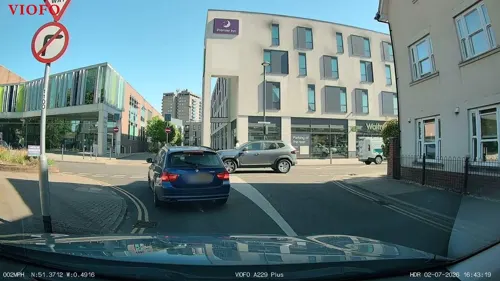
Beijing
Restaurant · Chinese · 1.4 mi
15-17 Station Road, Addlestone
Mo-Th 12:00-14:00,18:00-22:00; Fr-Sa 12:00-14:00,18:00-22:30; Su...
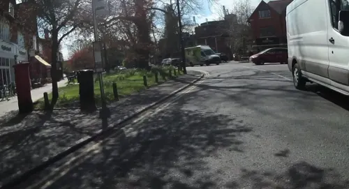
Cantina 41
Restaurant · Italian
41 Church Street, Weybridge
Mo-Th 17:00-22:00; Fr-Sa 11:30-22:30; Su 11:30-20:00
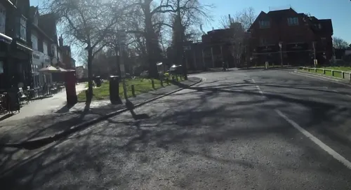
Giggling Squid
Restaurant · Thai
43-45 Church Street, Weybridge
Mo-We 12:00-22:00, Th-Sa 12:00-22:30, Su 12:00-22:00
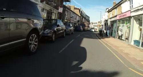
Kusina de Isobel
Cafe · Asian, Breakfast, International, Local, Steak House
34 Baker Street, Weybridge
Th-Sa 08:00-22:00; Su-We 09:00-15:30
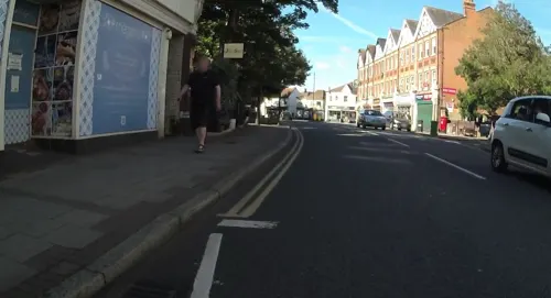
Megan's by the Wey
Restaurant · Mediterranean
17-19 Church Street, Weybridge
Mo-We 08:30-22:00; Th-Sa 08:30-23:00; Su 09:00-21:00
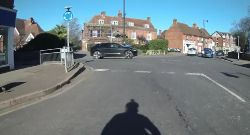
Pearl of China
Restaurant · Chinese
3 Balfour Road, Weybridge
Mo-Th 12:00-14:00,18:00-22:30; Fr-Sa 12:00-14:00,17:30-23:00; Su...
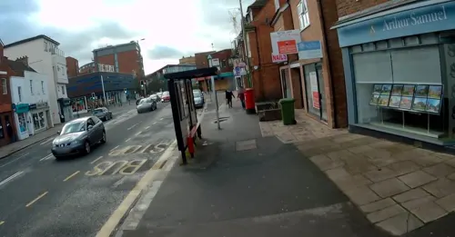


Buenasado Argentine Steakhouse
Restaurant · Steak House, Argentinian · 1.9 mi
New Zealand Avenue, Walton-on-Thames
Mo-Th 17:00-22:00; Fr-Sa 12:00-23:00; Su 12:00-22:00
Kinnaree Thai Restaurant
Restaurant · Thai · 1.7 mi
23 High Street, Shepperton
Mo-Th 12:00-14:30,18:00-21:00; Fr-Sa 12:00-14:30,18:00-22:30
198 more on the map.
History
The earliest evidence of human occupation in Weybridge is from the Bronze Age. A number of weapons, including socketed axe heads, a rapier, and a palstave, were retrieved from the River Wey close to the Wey Bridge in 1912. At least fifty cinerary urns dating from the same period were found in the area in the 19th and early 20th centuries. Three of the urns were recovered from a barrow during building work on the Silvermere estate (south of St George's Hill) and were found to contain bones and charcoal.
A copper-alloy bucket, now held by the British Museum, was discovered during the construction of the Brooklands racetrack in 1907. It is thought to have originated in northern Italy in the late Bronze or early Iron Age and similar vessels have been found in Austria, Belgium and Germany. During the Iron Age, there was a fort on St George's Hill. It covered an area of around 14 acres (5.7 ha) and was protected by a rampart and ditch. Most traces of the fort were destroyed by housebuilding in the first half of the 20th century. Remains of a roundhouse and archaeological evidence of iron workings were discovered in the triangle of land between the railway lines in 1981.
Read more of the history
There is not thought to have been a significant Roman presence in Weybridge, but 68 bronze coins of the late 3rd and early 4th centuries were found at Brooklands in 1907. Much of the hoard, which included nummi from the reigns of Diocletian (284–305 CE), Maximian (286–305), Constantius I (305–306) and Galerius (305–311), was donated to the British Museum.
There are three separate entries for Weybridge in Domesday Book. The first area of land described was held by Bishop Odo of Bayeux as tenant-in-chief and Herfrid of Throwley as lesser tenant. It included 16 acres (6.5 ha) of meadow and woodland for five swine with a value of £5 per annum. The other two entries list areas belonging to Chertsey Abbey, totalling a further 16 acres of meadow, land for four swine and ploughland for 1½ plough teams. None of the entries records a church or a mill in the settlement.
There are only sporadic surviving references to Weybridge in the following centuries. A chapel is mentioned in a papal bull issued by Pope Alexander III in 1176 and a later document shows that Chertsey Abbey had sold the advowson to Newark Priory by 1200. By 1262, the Priory had obtained a license that confirmed its rights to appoint a priest, to hold church property and to collect tithes from the local residents. In 1284 the village was held by Geoffrey de Lucy as a lesser tenant of Chertsey Abbey.
Following the dissolution of the monasteries, Weybridge was held by the Rede family for three years, before passing to the Crown in 1537. In June of the same year, Henry VIII began to construct Oatlands Palace by expanding an existing late-medieval manor house located to the north of the town centre. Some of the stone used in the construction of the foundations was taken from the demolition of Chertsey Abbey. Henry had intended that the palace would become the residence of his fourth wife, Anne of Cleves, but the marriage was annulled after six months. The king married his fifth wife, Catherine Howard, at Oatlands, but rarely visited thereafter. Following Henry's death the palace remained a possession of the Crown until the Commonwealth, when the contents were sold and the buildings demolished. Only a side entrance gate and adjoining sections of walls, which date from c. 1545, remain.
Reforms during the Tudor period reduced the importance of manorial courts and the day-to-day administration of towns such as Weybridge became the responsibility of the vestry of the parish church. The Weybridge vestry oversaw the distribution of poor relief and the maintenance of local roads. In the 1840s, responsibility for poor relief was transferred to the Chertsey Board of Guardians of the Poor. Local drainage and highways boards were established in the 1860s and in the 1870s a burial board was created to purchase land for new cemeteries.
The Local Government Act 1888 transferred many administrative responsibilities to the newly formed Surrey County Council and was followed by an 1894 Act that created the Weybridge Urban District Council (UDC). Initially the council met at the National school, but moved to Aberdeen House at the junction of High Street and Baker Street in 1908. As a result of the Local Government Act 1929, the UDCs of Weybridge and Walton were combined in 1932. In 1951 the civil parish of Weybridge had a population of 8083. On 1 April 1974 the parish was abolished. The unified council was merged with the Esher UDC to form Elmbridge Borough Council in 1974.
The name "Weybridge" suggests that there has been a bridge over the River Wey in the area since Anglo-Saxon times. During the Elizabethan period, the bridge was a wooden structure, 240 ft (73 m) long and 5.25 ft (1.60 m) wide and was maintained by Elizabeth I in her capacity as lord of the manor. The structure was rebuilt in 1808 on 13 wooden arches. The present bridge dates from 1865 and is constructed from brick, iron and stone. A second bridge, downstream of the first, was completed in 1945 and now carries the A317.
Both the Thames and the Wey have been used for transport since ancient times. By the 14th century, there was a wharf at Weybridge used for shipment of timber and, in 1463, Thomas Warner was given permission to build a dock on his land, which became known as the "Crown Wharf". In 1537, materials for the construction of Oatlands Palace were transported to Weybridge by river. The River Wey Navigation was authorised by Act of Parliament in 1651. Twelve locks (including two flood locks) and 9 mi (14 km) of new cuts were constructed between the Thames and Guildford. Thames Lock was rebuilt in concrete in the 1930s, but like all the locks on the Wey, it was originally turf sided.
From the History section of Weybridge on Wikipedia, under CC BY-SA 4.0.
More about Weybridge
Geography
Weybridge is in northwest Surrey, around 17 mi (27 km) south-west of central London. The town centre is close to the confluence of the River Wey and the River Thames, but the settlement also includes St George's Hill and Brooklands, to the south. The highest point in Weybridge is 78 m (256 ft) above ordnance datum, but the low-lying areas close to the rivers are only 10–20 m (33–66 ft) above sea level.
Neighbouring settlements include Shepperton to the north, Walton-on-Thames to the east, Wisley to the south and Addlestone to the west.
The rock strata on which Weybridge sits were deposited in the Cenozoic. The Bagshot Sands are the main outcrop to the south of the town and at Brooklands. From the centre of Weybridge northwards towards the Thames, the surface geology is dominated by river gravels.
Overlying the Bagshot Sands at St George's Hill is a cap of Bracklesham Clay, which was used for brickmaking in the 19th century. Ironstone, containing 33-48% iron(III) oxide, is also found on the Hill, along with a capping of chert gravels, thought to have been deposited by a former course of the River Wey.
Arts and culture
The Thames at Weybridge painted by J. M. W. Turner in 1805–6 is held by the Tate. The Elmbridge Museum collection includes works by Charles Claude Houssard (1884–1958), Edwin Lock (active 1929–1961), and Nancy Wallis. Guildford House Gallery holds two riverside views of Weybridge by Winifred Schofield (d. 2000). Brooklands Museum holds a number of artworks that reference the area's motor racing and aviation heritage.
Several authors have lived in Weybridge. The writer George Meredith moved to the town with his first wife in 1849. Whilst living at Weybridge he wrote The Shaving of Shagpat: An Arabian Entertainment, his first work of fiction, which was published in 1856. He moved to Box Hill in 1868. Following the Dreyfus affair, the French novelist Émile Zola (1840–1902) was exiled to England from July 1898 to June 1899, during which time he lived at the Oatlands Park Hotel. The novelist E. M. Forster (1879–1970) lived at 19 Monument Green from 1904 until 1912, during which he wrote all six of his novels. A plaque recording his residence in Weybridge was installed on the outside wall of his former home in the 1980s. The novelist Warwick Deeping lived on Brooklands Lane from 1918 until his death in 1950.
Education
The first recorded school in Weybridge was a Dame School for 12 children, founded c. 1650 in Baker Street. A charity school for poor children was founded in Weybridge in 1732 by Elizabeth Hopton and was incorporated into a new Parochial School in 1813. A second small parochial school was founded on the Oatlands estate in 1862 and was enlarged in 1874 to accommodate 201 children.
There are several Primary Schools in Weybridge. St Charles Borromeo Catholic Primary School was founded in Heath Road in 1881. It educates around 210 pupils aged from 4 to 11. Cleves School, in Oatlands Avenue, became an academy in November 2010. St James Church of England Primary School is in Grotto Road.
Heathside School, in Brooklands Lane, is a co-educational secondary school for students aged 11 to 18. It opened in 1966.
St George's College Junior School is a coeducational Catholic school for pupils aged 3 to 11. It moved from the main school campus in Addlestone to Thames Street in 2000. The site, to the north of Weybridge town centre, had previously been occupied by a school for girls, founded in 1898 by the nuns of Les Dames de St Maur.
From the Wikipedia article Weybridge, under CC BY-SA 4.0.
Notable people from Weybridge
 Jacqueline BissetEnglish actressPhoto: Kevin Paul, CC BY 4.0
 Colin DavisBritish conductor (1927–2013)Photo: Ron Kroon for Anefo, CC BY-SA 3.0
 Will HughesEnglish association football playerPhoto: Matlock-Photo from Derbyshire, England, CC BY 2.0
 James SomervilleBritish Royal Navy officer (1882-1949)Photo: Oswald Hornby Joseph Birley, Public domain
 Josh FranceschiEnglish singer-songwriterPhoto: Mr. Rossi, CC BY-SA 4.0
 Agnes Freda ForresBritish sculptorPhoto: Bain News Service, publisher, Public domain
 Nick Schleepainter (born 1931)Photo: Ronnie Temple, CC BY-SA 4.0
- Richard HughesBritish writer (1900–1976)
- Antony DarnboroughBritish film director and film producer (1913–2000)
- John LeechBritish mathematician (1926–1992)
- Stephen B. Grimesproduction designer, art director (1927-1988)
- R. C. TrevelyanEnglish poet and translator (1872–1951)
Born in Weybridge, according to Wikidata (CC0). Each name links to its Wikipedia article.
Where to stay11
The Camping and Caravanning Club - Chertsey
Campground · 1.8 mi
Bridge Road, Chertsey
Churches and places of worship35
Shopping56
Gas and EV charging10
Schools, colleges and libraries33
St Nicholas Church of England Primary School
School · Anglican · 1.6 mi
Manor Farm Avenue, Shepperton
Healthcare20
Map of Weybridge
250 places. The map loads OpenStreetMap tiles when you open it.
Getting there and nearby towns
Heathrow Airport (LHR) is the nearest airport with scheduled flights listed in OpenStreetMap, 7 miles away.
- Woking 6 mi southwest, about 9 min by car
- Worcester Park 9 mi east, about 15 min by car
- Windsor 10 mi northwest, about 16 min by car
- Slough 11 mi northwest, about 18 min by car
- Sutton 11 mi east, about 18 min by car
- Harrow 15 mi north, about 25 min by car
- Croydon 16 mi east, about 25 min by car
- City of Westminster 16 mi northeast, about 26 min by car
- London 17 mi northeast, about 28 min by car
- Islington 19 mi northeast, about 31 min by car
Drive times are estimates from straight-line distance, not routes.
Towns near Weybridge


Keep exploring
Local news
Headlines from INDB.
Reviews, tips and questions
Loading what members have shared...
Sources and licences
- GeoNames (CC BY 4.0): population, coordinates, regions and time zone
- Mapillary (see each image): photos
- OpenStreetMap contributors (ODbL 1.0): places, airports, map data
- Wikidata (CC0 1.0): elevation, founding date, time zone, website, landmarks and historic places
- Wikimedia Commons (see each image): photos
- Wikipedia (CC BY-SA 4.0): overview and history text
Photo credits
- Hamptons International Lettings Weybridge, Hamptonsinternational, CC BY-SA 4.0
- Hamptons International Sales Weybridge, Hamptonsinternational, CC BY-SA 4.0
- Chertsey Bridge, Alistair young, CC BY 2.0
- Old Walton Bridge title QS:P1476,en:"Old Walton Bridge" label QS:Len,"Old Walton Bridge", Giovanni Antonio Canal, Public domain
- Walton Bridge - Aug 2013, Adam37, CC BY-SA 3.0
- York Column, Weybridge - cropped, Mertbiol, CC0
- The Homewood and garden, Tjandspallan at English Wikipedia, Public domain
- Manor Farm, Surrey (8), Dudley Miles, CC BY-SA 4.0
- Christ Church, Guildford Road, Ottershaw (NHLE Code 1260037) (June 2015) (2), User:Hassocks5489, CC0
- Esher02, Motmit at en.wikipedia, CC BY-SA 3.0
- Weybridge United Reformed Church, Queens Road, Weybridge (NHLE Code 1377472) (June 2015) (3), Hassocks5489, CC0
- Mercedes-Benz World, Weybridge, Surrey - Flickr - Supermac1961 (1), Supermac1961 from CHAFFORD HUNDRED, England, CC BY 2.0
- Rally car on Members' Banking, John Chapman ( Pyrope ), CC BY-SA 3.0
- Watkin Concorde (475530514), allen watkin from London, UK, CC BY-SA 2.0
- Queen's Head pub, Bridge Road, Weybridge (NHLE Code 1377446) (June 2015), User:Hassocks5489, CC0
- Church of St John Fisher, Roman Catholic church, Shepperton, Surrey - April 2025 - 02, Mertbiol, CC0
- WeybridgeHeathScrubClearance, Etienne Cherdlu, CC BY-SA 2.5
- St Georges College UK, User:Randomskk, CC BY-SA 3.0
- 4265 GN64DXF (49673291032), Chris Errett from Guildford, Surrey, CC BY-SA 2.0
- 4214 KX61FHM (50076374386), Chris Errett from Guildford, Surrey, CC BY-SA 2.0
- 4214 KX61FHM (49898809821), Chris Errett from Guildford, Surrey, CC BY-SA 2.0
- Thorpe Park Resort, Smithr32, CC BY-SA 4.0
- Bellman Hangar, Brooklands Museum, MartynDavies, CC BY-SA 3.0
- Fuel filler of Guy Special country bus GS34 (MXX 334) with an AEC Q bus (CGJ 188) in the background, London Bus Museum, Surrey, UK julesvernex2, Jules Verne Times Two, CC BY-SA 4.0
- Byfleet Manor House, Colin Smith, CC BY-SA 2.0
- Pylons at Chertsey Meads - panoramio, Maxwell Hamilton, CC BY-SA 3.0
- Brooklands Community Park car park, 15 April 2013, Alan Hunt, CC BY-SA 2.0
- Street-level photo, jpennycook, CC BY-SA 4.0
- Street-level photo, jpennycook, CC BY-SA 4.0
- Street-level photo, jpennycook, CC BY-SA 4.0
- Street-level photo, jpennycook, CC BY-SA 4.0
- Street-level photo, jpennycook, CC BY-SA 4.0
- Street-level photo, jpennycook, CC BY-SA 4.0
- Street-level photo, jpennycook, CC BY-SA 4.0
- Street-level photo, jpennycook, CC BY-SA 4.0
- Street-level photo, jpennycook, CC BY-SA 4.0
- Street-level photo, jpennycook, CC BY-SA 4.0
- Street-level photo, RyanBush, CC BY-SA 4.0
- Street-level photo, RyanBush, CC BY-SA 4.0
- Street-level photo, jpennycook, CC BY-SA 4.0
- Street-level photo, jpennycook, CC BY-SA 4.0
- Street-level photo, jpennycook, CC BY-SA 4.0
- Street-level photo, jpennycook, CC BY-SA 4.0
- Street-level photo, jpennycook, CC BY-SA 4.0
- Street-level photo, jpennycook, CC BY-SA 4.0
- Street-level photo, jpennycook, CC BY-SA 4.0


Page built November 10, 2026. Spotted a mistake? Tell us or suggest a place.