


Why visit Baildon
Townapedia lists 28 museums and landmarks, 29 parks and trails, 127 places to eat, 7 places to stay and 7 attractions in and around town.
Highlights include Ireland Bridge, Salts Mill, The Peace Museum and Northcliffe Park.
Weather in Baildon
Forecast from MET Norway (CC BY 4.0). Full forecast
About Baildon
Baildon is a town and civil parish in the Bradford Metropolitan Borough in West Yorkshire, England and within the historic boundaries of the West Riding of Yorkshire.
From the Wikipedia article Baildon (this version), under CC BY-SA 4.0.
Photos of Baildon

Things to do7

Ireland Bridge
Bridge · 2.2 mi
Bridge in Bingley, West Yorkshire, England,UK

Acrehowe Hill
Scenic view · 1.0 mi
Former site of Acrehowe Cross aka Rerehow Cross (OS sheet CCI.NE, publ 1894). Possibly a plague location to saely leave supplies
Museums and landmarks28


Cartwright Hall Art Gallery
Museum · 2.5 mi
Art museum in Bradford, West Yorkshire, England, UK




Eldwick Beck Mill
Monument and historic site · 1.3 mi
Woolen (worsted) spinning mill extant in C1th with mill pond to NNE
16 more on the map.
Parks, trails and playgrounds29


Lister Park
Park · 2.4 mi
Public park in Bradford, West Yorkshire, England, UK

Peel Park, Bradford
Park · 3.2 mi
Park in Bolton and Undercliffe, United Kingdom

Bingley St Ives
Park · 2.9 mi
Country park in West Yorkshire, England
Prince of Wales Park
Park · 1.6 mi
Park in Bingley, West Yorkshire, England


17 more on the map.
Restaurants and cafes127

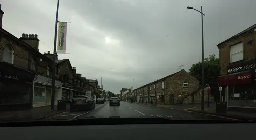
The Quaffery
Cafe · 0.9 mi
58-60 Bingley Road, Shipley
Mo-Fr 08:30-16:00; Sa 08:30-17:00; Su 10:00-16:00


Copper & Moss
Restaurant · 0.7 mi
Salts Mill Road, Shipley
Tu 09:00-14:00; We 09:00-15:00; Th 09:00-21:00; Fr 09:00-23:00; Sa...

The Fishermans Inn
Bar and pub · 1.4 mi
Wagon Lane, Bingley
Mo,Tu 16:00-21:00; We,Th 14:00-21:00; Fr,Sa 12:00-23:00; Su 12:00-21:00

The Quays
Cafe · Bistro · 0.8 mi
16 Ashley Lane, Shipley
Mo-Fr 08:00-15:00, Sa-Su 10:00-15:00

Cakes To Please
Bakery · 1.0 mi
13 Kirkgate, Shipley
Mo, Tu, Th-Sa 09:30-17:00; We 09:30-15:00
Cap and Collar
Bar and pub · 0.9 mi
4 Queen's Road, Shipley
Tu-Th 17:00-22:00; Fr 16:00-23:00; Sa 13:00-23:00; Su 13:00-18:00
115 more on the map.
History
Cup-and-ring stones on Baildon Moor have shown evidence of Bronze Age inhabitation.
Baildon Moor has a number of gritstone outcrops with numerous prehistoric cup and ring marks. A denuded and mutilated bank represents the remains of an Iron Age settlement known as Soldier's Trench, sometimes mistaken for a Bronze Age stone circle.
The name Baildon derives from the Old English bēgeldūn meaning 'bend hill' or 'circle hill'.
Baildon is recorded as Beldone and Beldune in the Domesday Book. In 1066 it belonged to a Gospatric, son of Arnketil, and had passed to Erneis of Buron by 1086.
Baildon had two manor houses: one on Hall Cliffe, the other in lower Baildon.
During the Industrial Revolution, Baildon developed a woollen industry; Westgate House was built in 1814 by the Ambler family who were prominent in the wool trade and the warehouse part of the building was Feathers Bakery now Nine Café adjacent to the mill which is now the Westgate Bar.
Read more of the history
During the 19th and early 20th centuries, conditions in Bradford deteriorated and poverty and ill health became widespread; Baildon began developing as a commuter town along with neighbouring Shipley. In the 1960s, the Hall Cliffe manor house was demolished and replaced with the Ian Clough Hall, named after a local mountaineer. In the latter years of the 20th century, the West Riding suffered from economic decline through the gradual closure of its textile and engineering industries. Bradford was particularly affected by this; however, Leeds grew as a major administrative and financial centre and Baildon with its railway links to Leeds has become a strategic commuter town.
Baildon was an important location for the British Gypsy community. A report of 1929 stated that annual Gypsy Parties had started two to three hundred years before – records were said to go back to 1770 when it was reported to be an ancient custom. In 1881, up to 5,000 people are said to have paid for admission. Gradually the event was taken over by local residents, who dressed up as Gypsies and formed 'tribes'. Proceeds went to the local horticultural society.
After 1897 the tradition died out, apparently because the 'real Gypsies' had disappeared. However, in 1929 it was revived to raise funds for Baildon Hospital.
A local resident, John Keen, then contacted the so-called King of the Gypsies, Xavier Petulengro, and they re-established large Gypsy gatherings at Baildon, recorded on Pathe News films and shown nationally in cinemas.
The Gypsy Parties ended with the start of the Second World War, and were never revived.
In northern Shipley off Prod Lane there was a small fairground with dodgem cars, booths and a historic "Aerial Glide" suspended roller coaster that for a short period had listed building status.
In earlier years the fairground attractions at Shipley Glen were much more extensive.
The fairground closed and is now dismantled and newly built (2015/6) private housing now covers the site.
The only working remnant of the Pleasure Grounds is the Shipley Glen Cable Tramway, a funicular railway carrying passengers from just north of Roberts Park, Saltaire up the hill side through Walker Wood to the location of the Pleasure Grounds at the top of Prod Lane.
From the History section of Baildon on Wikipedia, under CC BY-SA 4.0.
More about Baildon
Geography
Baildon lies to the north east of Bradford, and is linked to Bradford and Shipley by the B6151. To the north of Baildon lies Baildon Moor, a part of Rombalds Moor, with several quarries and underlying strata of coal. There are the remains of old bell pits for mining the coal.
Across Baildon Moor is the village of Menston, the town of Ilkley and Ilkley Moor. Baildon is situated on a hill to the north of the River Aire and the Leeds and Liverpool Canal.
Baildon is 9 miles (14 km) from Leeds city centre and 3 miles (5 km) from Bradford city centre.
Economy
Baildon has a modest town centre with most everyday amenities including independent traders, estate agents and family law solicitors.
There is a Co-op supermarket and a small Tesco on the outskirts.
The centre is home to many independent shops including Westgate General Stores, Seasons Home, Finesse Gifts and Baildon Interiors.
There are also several independently owned hair dressers and beauty salons and a variety of restaurants and take-aways.
Charlestown in south east Baildon is the area of Baildon with the highest concentration of industry.
The area is in the valley bottom between Otley Road and the River Aire, and includes the Acorn Park Industrial Estate and the Butterfield Industrial Estate. Notable companies established in Charlestown include Manor Coating Systems and Denso Marston Radiators.
Further north east in Charlestown there are plans for a 'Baildon Business Park' and hotel on a green field site near Buck Lane, at a cost of £25 million but there is opposition to the move.
Another industrial area is the Tong Park Industrial Estate off Otley Road in eastern Baildon.
Arts and culture
For nearly a quarter of a century the August bank holiday weekend saw over 500 Harley-Davidson riders arrive in Baildon as part of the annual UK rally of the Harley-Davidson Riders Club of Great Britain fundraising rally.
The HDRCGB ran the rally up to 2001 when it moved to Berkshire.
In 2003, Harley-Davidson's Centenary Year, the HDRCGB hosted the event for the last time in Baildon.
The rally is now organised by the Shipley Harley-Davidson Club.
In 2008 430 riders were given a police escort down Browgate towards Hollins Hill, from where most riders travelled to Harewood House.
Billy Liar (1963) – Locations: Midland Road; Hinchliffe Avenue (Number 37 is the Fisher household)
Monty Python's The Meaning of Life (1983) – Locations: Baildon Moor
Damon & Debbie (1987) – Locations: St Anne's Terrace; Threshfield
Rita, Sue & Bob Too (1987) – Locations: Bramham Drive (Number 5 is Bob's House); Baildon Moor; Baildon Village.
Where The Heart Is (1997) – Locations: Ferniehurst First School, Cliffe Lane West & Baildon Green
Baildon Orchestra is an amateur orchestra which was formed in the mid-1940s and still meets on a weekly basis throughout the year. website baildonorchestra.weebly.com
Education
There were a large number of First and Middle schools in the area, including Ferniehurst First School, Tong Park First School, Belmont Middle School and Ladderbanks Middle School, before the 1998 Bradford Education reform which returned the area to a two-tier school system. Currently, there are four local primary schools: Sandal Primary School to the North on West Lane, Baildon Church of England School to the east off Langley Lane, Hoyle Court Primary school in Charlestown and Baildon Glen Primary School to the south on Thompson Lane.
The nearest secondary school for the area is Titus Salt School on Higher Coach Road, overlooking Roberts Park, Saltaire. There is dispute as to which town the school actually is in, some classing it as Baildon and some as Saltaire.
From the Wikipedia article Baildon, under CC BY-SA 4.0.
Notable people from Baildon
 Aidy BoothroydEnglish association football player, coach and manager (born 1971)Photo: Sven Mandel, CC BY-SA 4.0
 Austin MitchellBritish politician (1934–2021)Photo: Matthew Kay, Public domain
- Arthur MitchellEnglish cricketer (1902-1976)
- Cliff GodfreyEnglish footballer (born 1909)
- Bert HoyleEnglish footballer (1920-2003)
- Joseph Hermon CawthraBritish artist
- Sam ThorntonBritish diver
- Bertie SnowballEnglish professional golfer
- Fred LeachEnglish golfer
- William Wadsworth(1823-1891)
Born in Baildon, according to Wikidata (CC0). Each name links to its Wikipedia article.
Where to stay7
Churches and places of worship27
Shopping23
Gas and EV charging4
Schools, colleges and libraries15
St Walburga's Catholic Primary School, A Voluntary Academy
School · Roman Catholic · 1.0 mi
Victoria Park, Shipley
Healthcare4
Map of Baildon
250 places. The map loads OpenStreetMap tiles when you open it.
Getting there and nearby towns
Leeds Bradford Airport (LBA) is the nearest airport with scheduled flights listed in OpenStreetMap, 6 miles away.
- Shipley 1 mi southeast, about 2 min by car
- Bingley 2 mi west, about 3 min by car
- Bradford 4 mi south, about 6 min by car
- Guiseley 4 mi northeast, about 6 min by car
- Ilkley 6 mi north, about 9 min by car
- Otley 6 mi northeast, about 9 min by car
- Horsforth 6 mi east, about 10 min by car
- Pudsey 6 mi southeast, about 10 min by car
- Cleckheaton 9 mi south, about 15 min by car
- Leeds 10 mi east, about 17 min by car
Drive times are estimates from straight-line distance, not routes.
Towns near Baildon


Keep exploring
Local news
Headlines from INDB.
Reviews, tips and questions
Loading what members have shared...
Sources and licences
- GeoNames (CC BY 4.0): population, coordinates, regions and time zone
- Mapillary (see each image): photos
- OpenStreetMap contributors (ODbL 1.0): places, airports, map data
- Wikidata (CC0 1.0): elevation, founding date, time zone, website, landmarks and historic places
- Wikimedia Commons (see each image): photos
- Wikipedia (CC BY-SA 4.0): overview and history text
Photo credits
- Bingley Ireland Bridge 1, Unknown author, CC BY-SA 2.0
- Entrance to The Peace Museum, Salts Mill, Saltaire, The wub, CC BY-SA 4.0
- Cartwright Hall and fountain, Bradford (22nd October 2010), Flickr user:Tim Green aka atouch, CC BY 2.0
- The woods in Northcliffe Park Shipley, The joy of all things, CC BY-SA 4.0
- Roberts Park, Saltaire (25th September 2010), Flickr user:Tim Green aka atouch, CC BY 2.0
- Cartwright Hall from southeast, Green Giant, CC BY 4.0
- Saltaire - United Reformed Church - 1, Benjamin Smith, CC BY-SA 4.0
- Bingley All Saints Parish Church1, Unknown author, CC BY-SA 2.0
- Holy Trinity Church, Idle, Rude Health, CC BY-SA 2.0
- Holy Trinity Church Bingley, The joy of all things, CC BY-SA 4.0
- Brackenhall 017, Linda Spashett Storye book, CC BY 3.0
- Saltaire - Salts Mill - 1, Benjamin Smith, CC BY-SA 4.0
- Shipley Glen Tramway (25th September 2010), Flickr user:Tim Green aka atouch, CC BY 2.0
- Moravian Church, Baildon (2642361201), Tim Green from Bradford, CC BY 2.0
- St John, Baildon (6307131486), Tim Green from Bradford, CC BY 2.0
- The Malt Shovel Tavern, Baildon, Mtaylor848, CC BY-SA 3.0
- Saltaire Primary School, Simon Cobb, CC0
- The Salt Cellar, Tim Green, CC BY 2.0
- Shipley Glen Tramway cf 2024 04, Secretlondon, CC BY-SA 4.0
- Peel Park, Bradford (2302697594), Tim Green from Bradford, CC BY 2.0
- Street-level photo, gmc, CC BY-SA 4.0
- Street-level photo, tallguy, CC BY-SA 4.0
- Street-level photo, gmc, CC BY-SA 4.0
- Street-level photo, tallguy, CC BY-SA 4.0
- Street-level photo, tallguy, CC BY-SA 4.0
- Street-level photo, arturcz, CC BY-SA 4.0
- Street-level photo, arturcz, CC BY-SA 4.0
- Street-level photo, lvl5, CC BY-SA 4.0
- Street-level photo, lvl5, CC BY-SA 4.0
- Street-level photo, gmc, CC BY-SA 4.0
- Street-level photo, gmc, CC BY-SA 4.0


Page built November 10, 2026. Spotted a mistake? Tell us or suggest a place.