
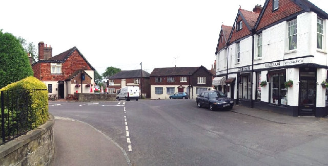


Why visit Balcombe
Townapedia lists 13 museums and landmarks, 16 parks and trails, 14 places to eat, 1 place to stay and 4 attractions in and around town.
Highlights include Ouse Valley Viaduct, Hawth Theatre, Priest House and Wings Museum.
Weather in Balcombe
Forecast from MET Norway (CC BY 4.0). Full forecast
About Balcombe
Balcombe is a village and civil parish in the Mid Sussex District of West Sussex, England. It lies 31 miles (50 km) south of London, 16 miles (26 km) north of Brighton, and 32 miles (51 km) east-northeast of the county town of Chichester. Nearby towns include Crawley to the northwest and Haywards Heath to the south-southeast.
From the Wikipedia article Balcombe (this version), under CC BY-SA 4.0.
Photos of Balcombe


Things to do4

Ouse Valley Viaduct
Bridge · 1.8 mi
Viaduct carrying the London-Brighton Railway Line over the River Ouse in Sussex, England, UK



Museums and landmarks13

Priest House
Museum · 3.6 mi
Historical house and museum in Sussex, England, United Kingdom

Largest Growing Christmas Tree in England
Monument and historic site · 2.1 mi



Ardingly Showground
Monument and historic site · 2.0 mi
Selsfield Road, Haywards Heath
Ditton Place
Monument and historic site · 1.5 mi
1 to 12 Brantridge Lane, Haywards Heath
Wakehurst Mansion
Monument and historic site · 2.1 mi
Selsfield Road, Haywards Heath
1 more on the map.
Parks, trails and playgrounds16
Wakehurst
Park · 1.8 mi
House and botanic gardens in Ardingly, West Sussex, England, UK
Selsfield Road, Haywards Heath

Blunts Wood and Paiges Meadow
Park · 3.7 mi
Nature reserve in West Sussex

Eastern Road Nature Reserve
Park · 4.2 mi
Local Nature Reserve in England


Tilgate Park
Park · 3.2 mi
Recreational park in Crawley, West Sussex, England

Bermondsey Huts Camp Site
Park · 1.9 mi
Camp site for groups, not individuals
24/7

Quiet Garden
Park · 2.4 mi
Open to the public as part of the Quiet Garden Movement, a national initiative welcoming people into beautiful gardens where they can...
4 more on the map.
Restaurants and cafes14

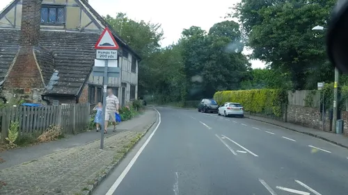


The Gardeners Arms
Bar and pub · 2.1 mi
Selsfield Road, Haywards Heath
Mo-Th 11:30-22:00; Fr,Sa 11:30-23:00; Su 11:30-21:00

2 more on the map.
History
The name Balcombe may mean "Mining Place Camp". Bal is a Cornish word meaning a mining place as in Bal Maidens, and the same word may have existed in Ancient British Celtic. Although Coombe or Combe can mean a valley, it can also come from the Roman "camp". So possibly from its name Balcombe could have once been a Romano-British mining settlement.
South of Balcombe on the London to Brighton railway line is the Ouse Valley Viaduct. Designed and engineered by John Urpeth Rastrick (1780–1856) in consultation with the talented architect David Mocatta, it was completed in 1842. It is 100 feet (30 m) high and 500 yards long. It has 37 arches and was built with 11 million imported Dutch bricks.
The village has a series of murals about World War I in its Victory Hall. Lady Gertrude Denman commissioned artist Neville Lytton to paint the thirty-four feet (10 m) long by ten feet (3.0 m) high frescoes.
Balcombe was the birthplace of Colour Sergeant (later Lieutenant Colonel) Frank Bourne DCM, who fought at the battle of Rorke's Drift in the Zulu War. He was the last British survivor of that battle when he died in Dorking in 1945. Famous residents included actor Paul Scofield who is buried with his wife Joy in St. Mary's churchyard.
The River Ouse was once navigable from the south coast to Balcombe, for the delivery of Dutch bricks to the viaduct.
From the History section of Balcombe on Wikipedia, under CC BY-SA 4.0.
Notable people from Balcombe
- David HorneBritish actor (1898-1970)
- Frank BourneBritish Army officer
Born in Balcombe, according to Wikidata (CC0). Each name links to its Wikipedia article.
Where to stay1
Churches and places of worship17
Shopping1
Schools, colleges and libraries7
Map of Balcombe
73 places. The map loads OpenStreetMap tiles when you open it.
Getting there and nearby towns
London Gatwick Airport (LGW) is the nearest airport with scheduled flights listed in OpenStreetMap, 7 miles away.
- Handcross 3 mi west, about 5 min by car
- Crawley 4 mi northwest, about 7 min by car
- Haywards Heath 4 mi south, about 7 min by car
- Broadfield 4 mi northwest, about 7 min by car
- Horsted Keynes 5 mi east, about 8 min by car
- Burgess Hill 7 mi south, about 11 min by car
- East Grinstead 7 mi northeast, about 12 min by car
- Horsham 8 mi west, about 14 min by car
- Horley 8 mi north, about 13 min by car
- Hurstpierpoint 9 mi south, about 14 min by car
Drive times are estimates from straight-line distance, not routes.
Towns near Balcombe


Keep exploring
Local news
Headlines from INDB.
Reviews, tips and questions
Loading what members have shared...
Sources and licences
- GeoNames (CC BY 4.0): population, coordinates, regions and time zone
- Mapillary (see each image): photos
- OpenStreetMap contributors (ODbL 1.0): places, airports, map data
- Wikidata (CC0 1.0): elevation, founding date, time zone, website, landmarks and historic places
- Wikimedia Commons (see each image): photos
- Wikipedia (CC BY-SA 4.0): overview and history text
Photo credits
- CentreBalcombe, Nigel Freeman, CC BY-SA 2.0
- Balcombe railway station 1, Ravenseft, CC BY-SA 3.0
- Ouse Valley viaduct - 42183534692, Dmitry Djouce, CC BY 2.0
- The Priest House & Garden, West Hoathly, Meagainreally, CC BY-SA 4.0
- Blunts Wood and Paiges Meadow (4), Dudley Miles, CC BY-SA 4.0
- Eastern Road Nature Reserve (2), Dudley Miles, CC BY-SA 4.0
- Scrase Valley (3), Dudley Miles, CC BY-SA 4.0
- Target Hill Park (1), Dudley Miles, CC BY-SA 4.0
- All Saints Church, Highbrook (IoE Code 302817), The Voice of Hassocks, Public domain
- All Saints Church Lindfield, Hjamesberglen, CC BY-SA 4.0
- Ardingly College (public school) Chapel, CreiterAdam45z, CC BY-SA 4.0
- Friary Church of St Francis and St Anthony, Crawley, The Voice of Hassocks, Public domain
- Holy Trinity Church, Cuckfield (IoE Code 302923), The Voice of Hassocks, Public domain
- St John the Baptist's Church, Crawley (October 2011), The Voice of Hassocks, CC0
- St Margaret's Church, West Hoathly (IoE Code 302844), The Voice of Hassocks, Public domain
- WorthAbbey, JohnArmagh, CC BY-SA 3.0
- Nymans Garden 03, Colin Smith, CC BY-SA 2.0
- Ardingly Church 2, Charlesdrakew, Public domain
- Balcombe Church, Charlesdrakew, Public domain
- Cadillac, BS 8388, London to Brighton Veteran Car Run 2008, Model A 1903, Christine Matthews, CC BY-SA 2.0
- Wakehurst Place Mansion 1, West Sussex - Aug 2009, Diliff, CC BY-SA 3.0
- Worth School and Abbey, Nigel Freeman, CC BY-SA 2.0
- Hawth theatre, Geograph user Alan Simkins, CC BY-SA 2.0
- St. Peter's, Ardingly, Antiquary, CC BY 4.0
- Nymans Garden 01, Rictor Norton & David Allen from London, United Kingdom, CC BY 2.0
- Nymans house and gallery entrance 2026-07-31, Andy Li, CC0
- Stewartia sinensis at Tilgate Park, Shubimperatrix, CC BY-SA 3.0
- Street-level photo, richardc, CC BY-SA 4.0


Page built November 10, 2026. Spotted a mistake? Tell us or suggest a place.