


Haywards Heath, United Kingdom
Haywards Heath is a town of 33,845 people in England, United Kingdom.
Why visit Haywards Heath
Townapedia lists 8 museums and landmarks, 26 parks and trails, 75 places to eat, 4 places to stay and 2 attractions in and around town.
Highlights include Ouse Valley Viaduct, The Priory, Cuckfield Museum and Ashenground and Bolnore Woods.
Weather in Haywards Heath
Forecast from MET Norway (CC BY 4.0). Full forecast
About Haywards Heath
Haywards Heath is a town in West Sussex, England, 36 miles (58 km) south of London, 14 miles (23 km) north of Brighton, 13 miles (21 km) south of Gatwick Airport and 31 miles (50 km) northeast of the county town, Chichester. Nearby towns include Burgess Hill to the southwest, Horsham to the northwest, Crawley northwest and East Grinstead northeast. With a decently small number of jobs available in the immediate vicinity, mostly in the agricultural or service sector, residents work remotely or commute daily via road or rail to London, Brighton, Crawley or Gatwick Airport.
From the Wikipedia article Haywards Heath (this version), under CC BY-SA 4.0.
Travel tips from other travellers: Haywards Heath on Wikivoyage (CC BY-SA 4.0).
Photos of Haywards Heath


Things to do2

Ouse Valley Viaduct
Bridge · 2.6 mi
Viaduct carrying the London-Brighton Railway Line over the River Ouse in Sussex, England, UK

Museums and landmarks8

The Priory
Monument and historic site
In 2019 building converted into apartments. Previously it comprised The Minstrels Gallery Restaurant, The Priory Club and Squash Courts...
Syresham Gardens, Haywards Heath




Parks, trails and playgrounds26


Blunts Wood and Paiges Meadow
Park · 1.0 mi
Nature reserve in West Sussex

Eastern Road Nature Reserve
Park · 1.6 mi
Local Nature Reserve in England





14 more on the map.
Restaurants and cafes75
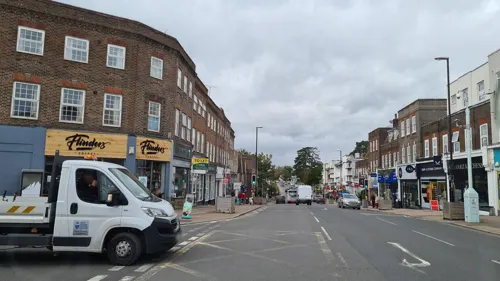
Francisco Lounge
Restaurant · British
90-92 South Road, Haywards Heath
Su-Th 09:00-22:00; Fr,Sa 09:00-23:00
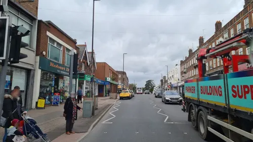


Cuckfish
Restaurant · Fish And Chips · 1.8 mi
High Street, Cuckfield
Mo-Th 16:00-20:00; Fr-Sa 12:00-14:00,16:00-21:00

The Talbot
Bar and pub · 1.8 mi
High Street, Haywards Heath
Mo-Th 11:00-23:00; Fr 11:00-24:00; Sa 09:30-24:00; Su 09:30-21:00

Banana Tree
Restaurant
33 The Broadway, Haywards Heath
Mo-Th 12:00-22:00; Fr-Sa 12:00-22:30; Su 12:00-22:00
63 more on the map.
History
Haywards Heath's Muster Green was the site of the Battle of Muster Green, a minor battle that took place in early December 1642 during the First English Civil War between a Royalist army under Edward Ford, High Sheriff of Sussex, and a smaller (but more disciplined) Parliamentarian army under Herbert Morley. Due to the fact that neither side possessed field guns, hand-to-hand combat ensued and after roughly an hour of fighting and 200 Royalists killed or wounded, the Parliamentarians emerged victorious and routed the Royalist army.
Haywards Heath is located in the east of the ancient parish of Cuckfield. A separate civil parish and urban district of Haywards Heath was created in 1894. From 1934 to 1974 Cuckfield, Haywards Heath and Lindfield were combined to form Cuckfield Urban District, but since 1974 the three settlements have had separate councils again.
Read more of the history
Haywards Heath as a settlement is a relatively modern development. Following the arrival of the London & Brighton Railway in 1841, its size increased considerably. Haywards Heath railway station opened on 12 July 1841 and served as the southern terminus of the line until the completion of Brighton station on 21 September. The position of Haywards Heath, and its place on both this railway and near the main road (A23) between London and Brighton, enables it to function as a commuter town, with many residents working in London, Brighton, Crawley and Gatwick Airport.
The opening of the Sussex County Lunatic Asylum (later called St Francis Hospital) in 1859. The superintendent here was, for many years, Dr Lockhart Robertson, later Lord Chancellor's Visitor.
The opening of Bannister's Cattle Market, the 12th largest in the UK at one point, in 1859. This was closed to make way for a Sainsbury's supermarket in 1989.
The opening of Victorian and Edwardian villas built as early commuter settlements in 1894
The opening of the Eliot Cottage Hospital, later King Edward VII Eliot Memorial Hospital, in 1906, named after benefactor, Alice Annie Eliot (1864–1904)
Schemes in the 1920s helped families on low incomes to become self-sufficient, resulting in the building of Franklands Village in the 1930s.
In the 1960s and 1970s, two light industrial estates were built. Office development has lately resulted in the town being a regional or national centre for a number of national companies and government agencies.
The population has risen from 200 in the early 1850s to 22,800 (2001 census), making it one of the larger towns in West Sussex. The area of the civil parish is 974.99 hectares (2,409.3 acres).
The parish church, dedicated to St Wilfrid, and the Roman Catholic church of St Paul are among the churches and chapels in Haywards Heath. Other places of worship include the Methodist church in Perrymount Road and two Baptist churches, St Richards (C of E), the Church of the Presentation (C of E) and the Ascension Church (C of E).
The Priory of Our Lady of Good Counsel on Franklynn Road was built in 1886 and is Grade II listed.
Haywards Heath was in East Sussex, but a change to the county boundary in 1974 brought it under the jurisdiction of West Sussex. Haywards Heath Town Hall was completed in 1990.
On May 9, 1946, delegates from thirteen countries, including representatives of the British and Foreign Bible Society, met in Haywards Heath to establish the United Bible Societies. Headquartered in Swindon, this society numbered in 2025 more than 150 chapter (national) societies and worked in more than 200 countries, translating and publishing Bibles.
In March 2017, Haywards Heath Waitrose opened on the site of the former bus station. TV presenter Richard Osman has previously stated that the supermarket may hold the title of the "first ever escalator in Haywards Heath."
From the History section of Haywards Heath on Wikipedia, under CC BY-SA 4.0.
More about Haywards Heath
Education
Oathall Community College is a secondary school for the town and surrounding area. Facilities include a school farm. Additionally, in the nearby village of Cuckfield, Warden Park Secondary Academy (part of the Sussex Learning Trust) provides education to c. 1500 students from the surrounding areas, including the village where it's situated - Cuckfield - as well as Haywards Heath, Ansty, Bolnore, Balcombe and other towns and villages.
Haywards Heath is also home to a number of local primary schools, one of which is St Joseph's Catholic Primary School, located on Hazelgrove Road near the centre of the town. Additionally, other nearby schools include St Wilfrid's, Harlands Primary School, Warden Park Primary Academy, Lindfield Primary Academy and Bolnore Village Primary School.
In September 2020, a new Chichester College campus opened, called Haywards Heath College. The college uses the old Central Sussex College Haywards Heath campus on Harlands Road which closed in Summer 2017.
From the Wikipedia article Haywards Heath, under CC BY-SA 4.0.
Notable people from Haywards Heath
 Kaya ScodelarioBritish actressPhoto: Desmond Herzfelder, CC BY 4.0
 Natasha BedingfieldEnglish and New Zealand singer-songwriter (born 1981)Photo: Sven Mandel, CC BY-SA 4.0
 Tamzin MerchantBritish actressPhoto: Kate Merchant, GFDL
 Robert KazinskyBritish actor and modelPhoto: Gage Skidmore from Peoria, AZ,..., CC BY-SA 2.0
 Mark RavenhillBritish actor and writerPhoto: Andymiah, CC BY 3.0
 Harvey ValeIrish association football player (born 2003)Photo: Timmy96, CC0
 Kieran SadlierIrish association football playerPhoto: Sads123blue, CC BY-SA 4.0
 Fynn Hudson-Prenticecricketer (born 1996)Photo: Dave Morton, Public domain
 Tom ClarkEnglish cricketerPhoto: Dave Morton, Public domain
- Dean CoxEnglish footballer (born 1987)
- Fred Klaassencricketer
- Katie GeorgeEnglish cricketer (born 1999)
Born in Haywards Heath, according to Wikidata (CC0). Each name links to its Wikipedia article.
Where to stay4
Chownesmead Hotel - Under Construction
Motel and hotel · 1.0 mi
Chownes Mead Lane, Haywards Heath
Churches and places of worship32
Holy Trinity Church
Church · Anglican · 1.8 mi
Church Street, Haywards Heath
Church of the Ascension
Church · Anglican · 0.6 mi
Southdown Close, Haywards Heath
Church of the Presentation
Church · Anglican · 0.5 mi
New England Road, Haywards Heath
Shopping22
Gas and EV charging3
Schools, colleges and libraries14
Holy Trinity Church of England Primary School, Cuckfield
School · Anglican · 1.6 mi
Glebe Road, Haywards Heath
Haywards Heath Library, Information Centre & Registration Office
Library · 0.4 mi
Boltro Road, Haywards Heath
Healthcare12
The Vale Surgery Vale Primary Care Centre
Clinic and pharmacy · 0.7 mi
Bolding Way, Haywards Heath
Map of Haywards Heath
198 places. The map loads OpenStreetMap tiles when you open it.
Getting there and nearby towns
London Gatwick Airport (LGW) is the nearest airport with scheduled flights listed in OpenStreetMap, 11 miles away.
- Burgess Hill 3 mi southwest, about 5 min by car
- Hurstpierpoint 6 mi southwest, about 9 min by car
- Broadfield 8 mi northwest, about 13 min by car
- Crawley 9 mi northwest, about 14 min by car
- Uckfield 9 mi east, about 14 min by car
- East Grinstead 10 mi northeast, about 16 min by car
- Lewes 10 mi southeast, about 16 min by car
- Horsham 11 mi northwest, about 17 min by car
- Brighton 12 mi south, about 19 min by car
- Hove 12 mi south, about 19 min by car
Drive times are estimates from straight-line distance, not routes.
Towns near Haywards Heath


Keep exploring
Local news
Headlines from INDB.
Reviews, tips and questions
Loading what members have shared...
Sources and licences
- GeoNames (CC BY 4.0): population, coordinates, regions and time zone
- Mapillary (see each image): photos
- OpenStreetMap contributors (ODbL 1.0): places, airports, map data
- Wikidata (CC0 1.0): elevation, founding date, time zone, website, landmarks and historic places
- Wikimedia Commons (see each image): photos
- Wikipedia (CC BY-SA 4.0): overview and history text
Photo credits
- SouthRoadHaywardsHeath, Nigel Freeman, CC BY-SA 2.0
- Haywards Heath United Reformed Church, The Voice of Hassocks, Public domain
- Ouse Valley viaduct - 42183534692, Dmitry Djouce, CC BY 2.0
- Bolnore Wood (1), Dudley Miles, CC BY-SA 4.0
- Blunts Wood and Paiges Meadow (4), Dudley Miles, CC BY-SA 4.0
- Eastern Road Nature Reserve (2), Dudley Miles, CC BY-SA 4.0
- Scrase Valley (3), Dudley Miles, CC BY-SA 4.0
- All Saints URC Church, Burgess Hill, The Voice of Hassocks, Public domain
- Ardingly College (public school) Chapel, CreiterAdam45z, CC BY-SA 4.0
- Wivelsfield Strict Baptist Chapel, Charlesdrakew, Public domain
- Jireh Strict Baptist Chapel, Haywards Heath, The Voice of Hassocks, Public domain
- Ote Hall Chapel, Ditchling Road, Wivelsfield (NHLE Code 1223103) (September 2021) (10), Hassocks5489, CC0
- Former Providence Chapel, Burgess Hill, The Voice of Hassocks, Public domain
- All Saints Church Lindfield, Hjamesberglen, CC BY-SA 4.0
- Holy Trinity Church, Cuckfield (IoE Code 302923), The Voice of Hassocks, Public domain
- Princess Royal Hospital, Nigel Freeman, CC BY-SA 2.0
- Carters Domestic Appliances, grassrootsgroundswell, CC BY 2.0
- JoJo Maman Bebe, grassrootsgroundswell, CC BY 2.0
- Raymondionymus marqueti (Aubé) (13347596353), Udo Schmidt from Deutschland, CC BY-SA 2.0
- Former Priory of Our Lady of Good Counsel, Haywards Heath, The Voice of Hassocks, Public domain
- Anna Sewell (4656409694), Simon Harriyott from Uckfield, England, CC BY 2.0
- Norris Brothers plaque, Charlotte John, CC BY-SA 4.0
- Street-level photo, andreste96, CC BY-SA 4.0
- Street-level photo, andreste96, CC BY-SA 4.0
- Street-level photo, andreste96, CC BY-SA 4.0
- Street-level photo, andreste96, CC BY-SA 4.0


Page built November 10, 2026. Spotted a mistake? Tell us or suggest a place.