


Handcross, United Kingdom
Handcross is a town of 1,027 people in England, United Kingdom.
Why visit Handcross
Townapedia lists 5 museums and landmarks, 7 parks and trails and 8 places to eat in and around town.
Highlights include Wings Museum, Old Slaugham Place, NT Nymans Gardens and Target Hill Park.
Weather in Handcross
Forecast from MET Norway (CC BY 4.0). Full forecast
About Handcross
Handcross is a village in the Mid Sussex District of West Sussex, England. It lies on the A23 road 4.2 miles (6.8 kilometres) south of Crawley. At the 2011 Census the population fell within the civil parish of Slaugham.
From the Wikipedia article Handcross (this version), under CC BY-SA 4.0.
Photos of Handcross


Museums and landmarks5



Ditton Place
Monument and historic site · 1.4 mi
1 to 12 Brantridge Lane, Haywards Heath
Parks, trails and playgrounds7


Tilgate Park
Park · 3.0 mi
Recreational park in Crawley, West Sussex, England


Restaurants and cafes8
JO.CO
Cafe · Portuguese
High Street, Handcross
Mo-We 07:30-16:30; Th-Sa 07:30-16:30,18:00-21:30; Su 10:00-16:00




Churches and places of worship5

St Mary's Church
Church · Anglican · 1.1 mi
Staplefield Road, Haywards Heath

St Mary's Church, Slaugham
Church · 1.1 mi
Church in Mid Sussex, England, UK
Shopping3
Gas and EV charging4
Schools, colleges and libraries4
Map of Handcross
36 places. The map loads OpenStreetMap tiles when you open it.
Getting there and nearby towns
London Gatwick Airport (LGW) is the nearest airport with scheduled flights listed in OpenStreetMap, 7 miles away.
- Broadfield 3 mi north, about 5 min by car
- Crawley 4 mi north, about 7 min by car
- Horsham 6 mi west, about 9 min by car
- Haywards Heath 6 mi southeast, about 9 min by car
- Burgess Hill 7 mi southeast, about 12 min by car
- Hurstpierpoint 8 mi south, about 13 min by car
- Horley 9 mi north, about 14 min by car
- East Grinstead 10 mi northeast, about 16 min by car
- Redhill 13 mi north, about 21 min by car
- Reigate 13 mi north, about 20 min by car
Drive times are estimates from straight-line distance, not routes.
Towns near Handcross


Keep exploring
Local news
Headlines from INDB.
Reviews, tips and questions
Loading what members have shared...
Sources and licences
- GeoNames (CC BY 4.0): population, coordinates, regions and time zone
- Mapillary (see each image): photos
- OpenStreetMap contributors (ODbL 1.0): places, airports, map data
- Wikidata (CC0 1.0): elevation, founding date, time zone, website, landmarks and historic places
- Wikimedia Commons (see each image): photos
- Wikipedia (CC BY-SA 4.0): overview and history text
Photo credits
- Food for sale on the counter of JO.CO, Handcross 2026-07-31, Andy Li, CC0
- Breakfast at JO.CO, Handcross 2026-07-31, Andy Li, CC0
- Zoar Strict Baptist Chapel, Handcross, The Voice of Hassocks, Public domain
- Red Lion Handcross Metrobus Bus stop (Brighton direction), Andy Li, CC0
- Target Hill Park (1), Dudley Miles, CC BY-SA 4.0
- Nymans Garden 03, Colin Smith, CC BY-SA 2.0
- Cadillac, BS 8388, London to Brighton Veteran Car Run 2008, Model A 1903, Christine Matthews, CC BY-SA 2.0
- St Mary's Church, Slaugham (IoE Code 302746), The Voice of Hassocks, Public domain
- Nymans Garden 01, Rictor Norton & David Allen from London, United Kingdom, CC BY 2.0
- Flower (7166194130), Berit from Redhill/Surrey, UK, CC BY 2.0
- Public footpath to Nymans car park, Andy Li, CC0
- Nymans house and gallery entrance 2026-07-31, Andy Li, CC0
- Stewartia sinensis at Tilgate Park, Shubimperatrix, CC BY-SA 3.0
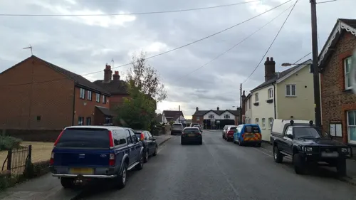
- Street-level photo, andreste96, CC BY-SA 4.0
- Street-level photo, tallguy, CC BY-SA 4.0
- Street-level photo, richardc, CC BY-SA 4.0
- Street-level photo, richardc, CC BY-SA 4.0
- Street-level photo, richardc, CC BY-SA 4.0
- Street-level photo, tallguy, CC BY-SA 4.0
- Street-level photo, richardc, CC BY-SA 4.0
- Street-level photo, richardc, CC BY-SA 4.0
Page built November 10, 2026. Spotted a mistake? Tell us or suggest a place.