

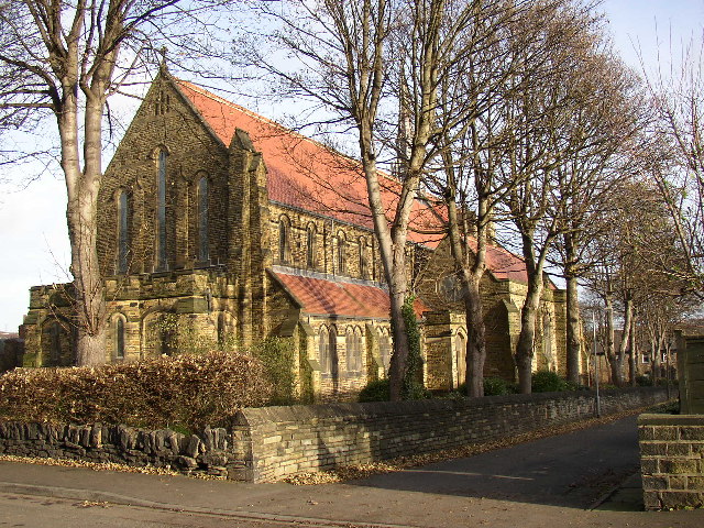


Barkisland, United Kingdom
Barkisland is a town of 1,004 people in England, United Kingdom.
Why visit Barkisland
Townapedia lists 4 museums and landmarks, 3 parks and trails, 18 places to eat, 4 places to stay and 6 attractions in and around town.
Highlights include Scammonden Bridge, Slack Roman fort and Savile Park.
Weather in Barkisland
Forecast from MET Norway (CC BY 4.0). Full forecast
About Barkisland
Barkisland () is a village in civil parish of Ripponden, in the Calderdale district, in West Yorkshire, England. Historically part of the West Riding of Yorkshire, it is one mile (1.5 kilometres) east of Ripponden, two miles (three kilometres) south of Sowerby Bridge and four miles (six kilometres) southwest of Halifax town centre.
From the Wikipedia article Barkisland (this version), under CC BY-SA 4.0.
Things to do6

Museums and landmarks4

Slack Roman fort
Monument and historic site · 2.4 mi
Archaeological site in Kirklees, West Yorkshire, England, UK
Parks, trails and playgrounds3

Savile Park
Park · 3.0 mi
Open space in Halifax, West Yorkshire, England, UK


Restaurants and cafes18


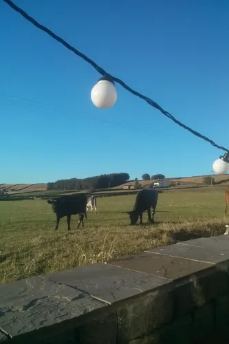

Outhouse Norland
Cafe · Coffee Shop · 1.2 mi
Moor Bottom Lane, Sowerby Bridge
Th-Tu 07:00-15:00


Spring Rock Inn
Bar and pub · 1.1 mi
Norland Road, Halifax
Mo-Th 12:00-21:30; Fr-Sa 12:00-22:00; Su 12:00-21:00
6 more on the map.
History
A ten-thousand-year-old axe was discovered near Ringstone Reservoir, providing evidence of human activity in the area now known as Barkisland dating back to the Stone Age. The origin of the name is in dispute. In a book of place names printed in 1944 it was stated that Barkisland derived from it being a settlement ('land') of a chieftain called 'Barkis'. While much earlier, in 1789, the Rev. John Watson, vicar of Ripponden church between 1754 and 1769, theorised that "Barsey or Barkesey are Anglo-Saxon words meaning low-lying enclosures where birches grow. It also is the Anglo-Saxon for a district where there are wolves."
Bowers Mill was built in the 18th century as a water-powered fulling mill. It has also been used as a corn mill, a worsted mill and a woollen mill. Textiles manufacturer J. & S. Taylor Ltd occupied the mill from 1882 to 1991 before moving production to Sowerby Bridge. The mill has now been converted for smaller businesses.
Barkisland Mill, a six-storey building, was used for textile production in the 19th and 20th centuries. At the start of the 21st century it was converted into residential flats. Bottomley's Mill, a cotton mill, was recorded when a fire broke out there on 13 January 1871.
From the History section of Barkisland on Wikipedia, under CC BY-SA 4.0.
More about Barkisland
Geography
Barkisland is situated on a hilltop that gently rises from Greetland in the north-east and declines westwards to Ripponden and eastwards to Stainland. The hill continues to climb southwards towards Scammonden.
Education
Barkisland Junior and Infant school serves the village. Barkisland School Association (BSA) is a parent-teacher organisation supporting the school by organising events and fundraising.
From the Wikipedia article Barkisland, under CC BY-SA 4.0.
Where to stay4
Churches and places of worship5
St Bartholomew's Parish Church
Church · Anglican · 0.9 mi
Old Bank, Sowerby Bridge
Shopping1
Schools, colleges and libraries6
Barkisland Church of England (Voluntary Aided) Primary School
School · Anglican
Scammonden Road, Halifax
Map of Barkisland
47 places. The map loads OpenStreetMap tiles when you open it.
Getting there and nearby towns
Leeds Bradford Airport (LBA) is the nearest airport with scheduled flights listed in OpenStreetMap, 17 miles away.
- Elland 3 mi east, about 5 min by car
- Halifax 4 mi northeast, about 6 min by car
- Rastrick 5 mi east, about 9 min by car
- Huddersfield 6 mi east, about 9 min by car
- Brighouse 6 mi east, about 9 min by car
- Littleborough 8 mi west, about 12 min by car
- Todmorden 8 mi west, about 13 min by car
- Cleckheaton 9 mi east, about 15 min by car
- Mirfield 9 mi east, about 15 min by car
- Bradford 11 mi northeast, about 17 min by car
Drive times are estimates from straight-line distance, not routes.
Towns near Barkisland


Keep exploring
Local news
Headlines from INDB.
Reviews, tips and questions
Loading what members have shared...
Sources and licences
- GeoNames (CC BY 4.0): population, coordinates, regions and time zone
- Mapillary (see each image): photos
- OpenStreetMap contributors (ODbL 1.0): places, airports, map data
- Wikidata (CC0 1.0): elevation, founding date, time zone, website, landmarks and historic places
- Wikimedia Commons (see each image): photos
- Wikipedia (CC BY-SA 4.0): overview and history text
Photo credits
- Christ Church, Barkisland (3206795709), Tim Green from Bradford, CC BY 2.0
- All Saints Church Elland SE1020, Humphrey Bolton, CC BY-SA 2.0
- St. Bartholomew, Ripponden, Tim Green, CC BY 2.0
- Old Bridge Inn, Ripponden (5591816217), Tim Green from Bradford, CC BY 2.0
- Butcher's Arms, Ripponden (3727751776), Tim Green from Bradford, CC BY 2.0
- Savile Park and St Jude (44757646135), Tim Green from Bradford, UK, CC BY 2.0
- The Griffin, Barkisland (5591815159), Tim Green from Bradford, UK, CC BY 2.0
- Street-level photo, mappo2, CC BY-SA 4.0
- Street-level photo, aidan573, CC BY-SA 4.0
- Street-level photo, mappo2, CC BY-SA 4.0
- Street-level photo, mappo2, CC BY-SA 4.0
- Street-level photo, mapz4lolz, CC BY-SA 4.0
- Street-level photo, mappo2, CC BY-SA 4.0
- Street-level photo, mappo2, CC BY-SA 4.0
Page built November 10, 2026. Spotted a mistake? Tell us or suggest a place.