


Why visit Halifax
Townapedia lists 24 museums and landmarks, 42 parks and trails, 283 places to eat, 12 places to stay and 11 attractions in and around town.
Highlights include Vue Halifax, Brighouse Bridge, Bankfield Museum and Shibden Hall.
Weather in Halifax
Forecast from MET Norway (CC BY 4.0). Full forecast
About Halifax
Halifax is a town in the Metropolitan Borough of Calderdale, in West Yorkshire, England. It is in the eastern foothills of the Pennines. In the 15th century, the town became an economic hub of the old West Riding of Yorkshire, primarily in woollen manufacture with the large Piece Hall square later built for trading wool in the town centre. The town was a thriving mill town during the Industrial Revolution with the Dean Clough Mill buildings a surviving landmark.
From the Wikipedia article Halifax, West Yorkshire (this version), under CC BY-SA 4.0.
Travel tips from other travellers: Halifax on Wikivoyage (CC BY-SA 4.0).
Photos of Halifax


Things to do11
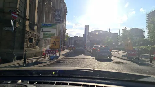


North Bridge, Halifax
Bridge · 0.8 mi
Bridge in West Yorkshire, England


Victoria Theatre
Cinema and theater · 0.6 mi
Theatre in Halifax, England



Museums and landmarks24

Bankfield Museum
Museum · 1.2 mi
Textiles gallery, historic house museum, regimental museum. in West Yorkshire, England, United Kingdom
Tu-Sa 10:00-16:00; BH 10:00-16:00

Shibden Hall
Museum · 0.9 mi
Historic house museum. in West Yorkshire, England, United Kingdom
Lister's Road, Halifax
Mo-Fr 10:00-17:00; Sa-Su 11:00-17:00

Calderdale Industrial Museum
Museum · 0.5 mi
Museum in Halifax, West Yorkshire, England, United Kingdom




Slack Roman fort
Monument and historic site · 4.5 mi
Archaeological site in Kirklees, West Yorkshire, England, UK
12 more on the map.
Parks, trails and playgrounds42

People's Park
Park · 1.0 mi
Park in Halifax, West Yorkshire, England, UK


Savile Park
Park · 1.0 mi
Open space in Halifax, West Yorkshire, England, UK


Harold Park
Park · 4.1 mi
Park in Bradford, West Yorkshire, England, UK
30 more on the map.
Restaurants and cafes283
Kaya's Grill
Restaurant · Turkish · 0.7 mi
Huddersfield Road, Halifax
Tu-We 17:00-21:00; Th-Sa 17:00-22:20; Su 17:00-21:00
Kipling's
Restaurant · Curry, Indian · 2.6 mi
28 Town Hall Street, Sowerby Bridge
Mo 14:40-21:00; Tu 15:50-22:30; We-Th 16:00-22:30; Fr 15:00-22:29;...
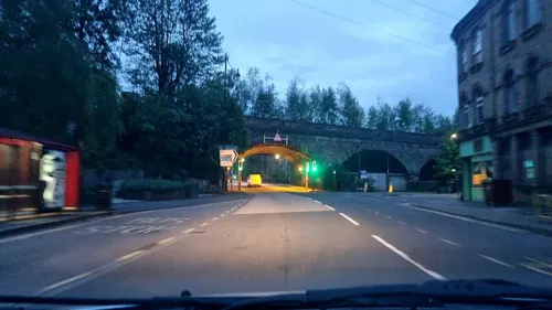
Artichoke
Cafe · 2.6 mi
11 Ryburn Buildings
Fr-Sa 10:00-17:00; We 13:00-17:00; Th 10:00-18:30; Su 12:00-16:00
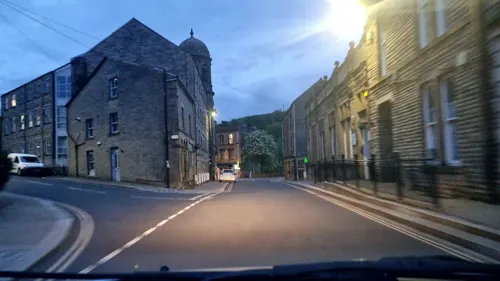
Hollins Mill
Bar and pub · 2.6 mi
12 Hollins Mill Lane, Sowerby Bridge
Mo,Tu 14:00-09:00; We 14:00-09:00; Th 14:00-11:00; Fr,Sa...

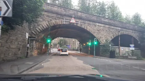

Jubilee Refreshment Rooms
Cafe · Coffee Shop, Sandwich · 2.4 mi
Station Road, Sowerby Bridge
Mo-Fr 09:30-15:30; Sa 09:00-12:00; Su off
Mamil Cafe Bar Halifax
Cafe · Brunch, Coffee Shop, Sandwich, Cake · 0.6 mi
24-26 Commercial Street, Halifax
Su-Th 10:00-20:00; Fr-Sa 10:00-23:00

Caffè Nero
Cafe · Coffee Shop · 0.6 mi
12-16 Southgate, Halifax
Mo-Fr 07:00-18:30; Sa 07:30-18:30; Su 08:00-17:30
271 more on the map.
History
Halifax is not mentioned in the Domesday Book, and evidence of the early settlement is unclear. By the 12th century the township had become the religious centre of the vast parish of Halifax, which extended from Brighouse in the east to Heptonstall in the west. Halifax Minster, parts of which date from the 12th century is dedicated to St John the Baptist. The minster's first organist, in 1766, was William Herschel, who discovered the planet Uranus. The coat of arms of Halifax include the chequers from the original coat of arms of the Earls Warenne, who held the town during Norman times.
Halifax was notorious for its gibbet, an early form of guillotine used to execute criminals by decapitation, that was last used in 1650. A replica has been erected on the original site in Gibbet Street. Its original blade is on display at Bankfield Museum. Punishment in Halifax was notoriously harsh, as remembered in the Beggar's Litany by poet John Taylor (1580–1654), a prayer whose text included "From Hull, from Halifax, from Hell, 'tis thus, From all these three, Good Lord deliver us.".
The town's 19th-century wealth came from the cotton, wool and carpet industries and like most other Yorkshire towns, it had a large number of weaving mills many of which have been lost or converted to alternative use.
Read more of the history
In November 1938, in an incident of mass hysteria, many residents believed a serial killer, the Halifax Slasher, was on the loose. Scotland Yard concluded there were no attacks after several locals admitted they had inflicted wounds on themselves.
Halifax plc started as a building society, the Halifax Permanent Benefit Building and Investment Society, in the town in 1853. Today the bank operates as a trading name of HBOS, part of the Lloyds Banking Group. Yorkshire Bank, based in Leeds and known as the West Riding Penny Savings Bank, was established on 1 May 1859 by Colonel Edward Akroyd of Halifax. Halifax is twinned with Aachen in Germany. The A58 has a stretch called Aachen Way.
From the History section of Halifax, West Yorkshire on Wikipedia, under CC BY-SA 4.0.
More about Halifax
Geography
Topographically, Halifax is located in the south-eastern foothills of the moorland region called the South Pennines. Halifax is situated about 4 miles (6 km) from the M62 motorway, close to Bradford and Huddersfield. The A641 road links the town with Brighouse, Bradford and Huddersfield. The Hebble Brook joins the River Calder at Salterhebble.
Economy
From New Year's Day 1779, manufacturers and mercers dealt internationally in such articles through its grandiose square, the Piece Hall. Halifax is known for Mackintosh's chocolate and toffee products, including Rolo and Quality Street. The Halifax bank was founded and has large offices in the town. Dean Clough, north of the town centre, was once one of the largest textile factories in the world at more than 1⁄2 mile (800 m) long; today the building has been converted for office and retail use including a gym, theatre, Travelodge and radio station.
As well as the significance of the bank Halifax plc which, since 2008, is part of the Lloyds Banking Group, the town has strong associations with confectionery.
John Mackintosh and his wife, Violet, opened a toffee shop in King Cross Lane in 1890. Violet formulated the toffee's recipe. John became known as "The Toffee King". A factory was opened on Queens Road in 1898. A new factory at Albion Mill, at the current site near the railway station, opened in 1909. John died in 1920, and his son Harold continued the business, expanding it to its present size and range of confectionery. Their famous brands, including Rolo, Toffee Crisp and Quality Street of chocolate and confectionery have global popularity.
Arts and culture
The Duke of Wellington's Regiment (West Riding) Regimental Association, previously based at Wellesley Park, on the junction of Gibbet Street and Spring Hall Road, in the former Wellesley Barracks is located within the Bankfield Museum on Boothtown Road. The former barracks, having served as the headquarters of the schools' music service in the last few decades of the 20th century, became a school in 2005.
Former regimental colours of the 'Duke's' are laid up in the Halifax Minster. These include the stand used by the 33rd Regiment between 1761 and 1771, which is one of the oldest in existence in England, plus those carried by the regiment during the Battle of Waterloo and the Crimea. The 1981 stand of colours, was taken out of service in 2002. They were marched through the town from the town hall to the minster, which at that time was still a parish church, accompanied by two escorts of 40 troops, the Regimental Drums and the Heavy Cavalry and Cambrai Band on Sunday 31 March 2007. The troops were then inspected by the Lord Lieutenant of West Yorkshire, Dame Ingrid Roscoe DCVO DStJ FSA and the Mayor of Halifax Cllr Colin Stout making a total of eight stands of colours within the Regimental Chapel. The regiment was presented with the "Freedom of Halifax" on 18 June 1945.
Education
The Halifax area is home to two selective and non fee-paying grammar schools, which are the Crossley Heath School in Savile Park and North Halifax Grammar School in Illingworth. Both schools achieve excellent GCSE and A level results with both schools achieving a large proportion of A*to C grades at GCSE level. In 2005, the Crossley Heath School was the highest ranking co-educational school in the North of England.
Calderdale College is a further education college located on Francis Street, just off King Cross Road, in the west of the town. The Maltings College opened in 2013 and offers a range of vocational sixth form courses.
In December 2006 it was announced that Calderdale College, in partnership with Leeds Beckett University, opened a new higher education institution in January 2007 called 'University Centre Calderdale'.
In 2019, Trinity Sixth Form opened in Halifax town centre, which provides 'outstanding' further education for pupils aged between 16 and 18. The school formed as a result of the closure of sixth forms within schools in the Trinity MAT. This allowed for a more 16-18 friendly education to be sought by pupils from the Trinity schools. This school, as with the above school, boasts excellent A-level results, with a consistently >98% pass rate since opening in 2019, as well as almost 200% growth in student numbers in that time.
From the Wikipedia article Halifax, West Yorkshire, under CC BY-SA 4.0.
Notable people from Halifax
 John E. WalkerBritish biochemist (born 1941)Photo: Mogens Engelund, CC BY-SA 3.0
 Oliver SmithiesBiochemistry, genetics, Nobel Prize in Physiology or Medicine 2007Photo: Douglas A. Lockard, CC BY-SA 3.0
 David HartleyBritish philosopherPhoto: Unknown author, CC BY 4.0
 Anne ListerEnglish landowner and lesbian diarist (1791–1840)Photo: Joshua Horner, Public domain
 Nick HolmesBritish singerPhoto: Dario De Marco, Public domain
 Jacob BrownEnglish association football player (born 1998)Photo: Timmy96, CC0
 John LawtonBritish singer (1946–2021)Photo: Stefan Scheer, CC BY-SA 3.0
 John Alan RobinsonBritish-American mathematician (1930-2016)Photo: David Monniaux, CC BY-SA 3.0
 Eric PortmanBritish actor (1901-1969)Photo: Julia cabré, CC BY-SA 4.0
 Barrie InghamEnglish actor (1932-2015)Photo: Ssaco, CC BY-SA 3.0
 hbomberguyBritish YouTuber (born 1992)Photo: Novara Media, CC BY 3.0
- Henry BriggsBritish mathematician
Born in Halifax, according to Wikidata (CC0). Each name links to its Wikipedia article.
Where to stay12
Churches and places of worship71
Our Lady Of Lourdes & St Malachy
Church · Roman Catholic · 2.2 mi
Nursery Lane, Halifax
Shopping50
Gas and EV charging9
Schools, colleges and libraries66
Christ Church Sowerby Bridge CofE (VA) Primary School
School · Anglican · 2.2 mi
Park Road, Sowerby Bridge
Elland Church of England (Voluntary Aided) Junior, Infant and Nursery School
School · Anglican · 2.2 mi
Westgate, Elland
St Malachy's Catholic Primary School, A Voluntary Academy
School · Roman Catholic · 2.5 mi
Furness Place, Halifax
Healthcare15
Map of Halifax
250 places. The map loads OpenStreetMap tiles when you open it.
Getting there and nearby towns
Leeds Bradford Airport (LBA) is the nearest airport with scheduled flights listed in OpenStreetMap, 13 miles away.
- Elland 2 mi south, about 4 min by car
- Rastrick 3 mi southeast, about 5 min by car
- Huddersfield 5 mi southeast, about 9 min by car
- Cleckheaton 6 mi east, about 9 min by car
- Liversedge 6 mi east, about 10 min by car
- Bradford 7 mi northeast, about 11 min by car
- Mirfield 7 mi southeast, about 11 min by car
- Heckmondwike 7 mi east, about 11 min by car
- Shipley 9 mi northeast, about 14 min by car
- Bingley 9 mi north, about 15 min by car
Drive times are estimates from straight-line distance, not routes.
Towns near Halifax


Keep exploring
Local news
Headlines from INDB.
Reviews, tips and questions
Loading what members have shared...
Sources and licences
- GeoNames (CC BY 4.0): population, coordinates, regions and time zone
- Mapillary (see each image): photos
- OpenStreetMap contributors (ODbL 1.0): places, airports, map data
- Wikidata (CC0 1.0): elevation, founding date, time zone, website, landmarks and historic places
- Wikimedia Commons (see each image): photos
- Wikipedia (CC BY-SA 4.0): overview and history text
Photo credits
- Halifax view from Beacon Hill, Mr Barndoor ( talk ), CC BY 3.0
- Halifax Flickr 24 September 2023, Tim Green, CC BY 2.0
- Halifax from Trooper Lane (30019872247), Tim Green from Bradford, UK, CC BY 2.0
- Mills, from Trooper Lane, Halifax (2577837625), Tim Green from Bradford, CC BY 2.0
- Brighouse Bridge by Richard Kay, Richard Kay, CC BY-SA 2.0
- North bridges, Halifax, Charlesdrakew, Public domain
- Brighouse bridge 019, Linda Spashett Storye book, CC BY 3.0
- Bankfield Museum 099, Linda Spashett Storye_book, CC BY 3.0
- Halifax Parish Church, Jwholdsworth, CC BY-SA 3.0
- All Souls church, Halifax, Plucas58, Public domain
- All Saints Church Elland SE1020, Humphrey Bolton, CC BY-SA 2.0
- Halifax Victoria Theatre, Charlesdrakew, Public domain
- Halifax Borough Market, Charlesdrakew, Public domain
- Eureka! exterior, Sospot, CC BY-SA 3.0
- Church of St. John the Baptist, Coley (2224154320), Tim Green from Bradford, CC BY 2.0
- Old Cock, new management (6473393357), Tim Green from Bradford, CC BY 2.0
- Christ Church, Pellon, Halifax (2640218262), Tim Green from Bradford, CC BY 2.0
- All Saints, Dudwell Lane, Halifax (16660196286), Tim Green from Bradford, CC BY 2.0
- Duke of Wellington's Regimental Memorial, Tim Green, CC BY 2.0
- Exterior of Eureka! The National Children's Museum, Sospot, CC BY-SA 4.0
- Borough Market, Halifax (2305922796), Tim Green from Bradford, CC BY 2.0
- Savile Park and St Jude (44757646135), Tim Green from Bradford, UK, CC BY 2.0
- Trooper Lane (2578717688), Tim Green from Bradford, CC BY 2.0
- Trooper Lane (29934199997), Tim Green from Bradford, UK, CC BY 2.0
- View from Trooper Lane (2578711876), Tim Green from Bradford, CC BY 2.0
- Ruined buildings at Bare Head Quarry 3 (2833575595), Tim Green from Bradford, CC BY 2.0
- Shibden Hall (6448838033), Tim Green from Bradford, CC BY 2.0
- Piece Hall (40159874632), Tim Green from Bradford, UK, CC BY 2.0
- Halifax Cenotaph, Tim Green, CC BY 2.0
- Hercules, People's Park, Halifax, Tim Green, CC BY 2.0
- Shroggs Park 2 (4815677431), Tim Green from Bradford, CC BY 2.0
- Street-level photo, mappo2, CC BY-SA 4.0
- Street-level photo, mappo2, CC BY-SA 4.0
- Street-level photo, mappo2, CC BY-SA 4.0
- Street-level photo, mappo2, CC BY-SA 4.0
- Street-level photo, mappo2, CC BY-SA 4.0
- Street-level photo, mappo2, CC BY-SA 4.0
- Street-level photo, mappo2, CC BY-SA 4.0
- Street-level photo, humez, CC BY-SA 4.0
- Street-level photo, mappo2, CC BY-SA 4.0
- Street-level photo, mappo2, CC BY-SA 4.0
- Street-level photo, mappo2, CC BY-SA 4.0
- Street-level photo, mappo2, CC BY-SA 4.0
- Street-level photo, mappo2, CC BY-SA 4.0
- Street-level photo, humez, CC BY-SA 4.0


Page built November 10, 2026. Spotted a mistake? Tell us or suggest a place.