


Barnoldswick, United Kingdom
Barnoldswick is a town of 10,435 people in England, United Kingdom.
Why visit Barnoldswick
Townapedia lists 8 museums and landmarks, 11 parks and trails, 42 places to eat, 2 places to stay and 11 attractions in and around town.
Highlights include Little Cut, Bancroft Shed and Ghyll Golf Club.
Weather in Barnoldswick
Forecast from MET Norway (CC BY 4.0). Full forecast
About Barnoldswick
Barnoldswick (pronounced ) is a market town and civil parish in the Borough of Pendle, Lancashire, England. It lies within the boundaries of the historic West Riding of Yorkshire. It is situated 30 miles (48 km) from Leeds and 40 miles (64 km) from Lancaster; nearby towns include Skipton to the east, Clitheroe to the west, Burnley to the south and Keighley to the east-south-east. The civil parish has a population of 10,752.
From the Wikipedia article Barnoldswick (this version), under CC BY-SA 4.0.
Things to do11

Museums and landmarks8


Bancroft Shed
Museum · 0.5 mi
Mill museum in Barnoldswick, Pendle, Lancashire, England, UK

Parks, trails and playgrounds11




Restaurants and cafes42
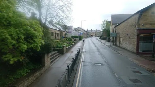
Simply Wicked
Cafe · Coffee Shop, Bistro
43 Albert Road, Barnoldswick
Mo-Sa 09:00-17:00, Su 10:30-15:30




30 more on the map.
History
Barnoldswick dates back to Anglo Saxon times. It was listed in the Domesday Book as Bernulfesuuic, meaning "Bernulf's Town" (–uuic being an archaic spelling of –wick, meaning "settlement", in particular, a "dairy farm"). The town is known locally as Barlick.
A Cistercian monastery was founded here in 1147, by monks from Fountains Abbey. However, they left after six years, before construction was complete, driven out by crop failures and locals unhappy at their interference in the affairs of the local church. They went on to build Kirkstall Abbey. They returned after another ten years to build the isolated Church of St Mary-le-Ghyll close to the road between Barnoldswick and Thornton in Craven.
At the same time, William de Percy II, feudal baron of Topcliffe, granted Crooks House in the northern part of the Bracewell area to the monks who founded Sawley Abbey.
For hundreds of years, Barnoldswick remained a small village. However, the arrival of the Leeds and Liverpool Canal, and later the (now closed) railway, spurred the development of the existing woollen industry, and helped it to become a major cotton town. The engine of the last mill to be built in Barnoldswick, Bancroft Mill, has been preserved and is now open as a tourist attraction – a 600hp steam engine, which is still operational.
From the History section of Barnoldswick on Wikipedia, under CC BY-SA 4.0.
More about Barnoldswick
Geography
On the lower slopes of Weets Hill in the Pennines, astride the natural watershed between the Ribble and Aire valleys, Barnoldswick is the highest town on the Leeds and Liverpool Canal, lying on the summit level of the canal between Barrowford Locks to the south west and Greenberfield Locks just north east of the town.
Barnoldswick lies very near the Yorkshire Dales National Park and the Forest of Bowland Area of Outstanding Natural Beauty. Stock Beck, a tributary of the River Ribble, runs through the town.
Economy
Since 1854, Barnoldswick has been the home of Esse stoves, one of the country's oldest standing stove manufacturers. The company have manufactured in the town since 1854 and clients have included Florence Nightingale, Shackleton and Scott, Alan Hinkes and River Cottage. Esse have their head office at the Ouzledale Factory in the town and distribute all their stoves through a close link of specialist stove retailers.
Barnoldswick is also home to Silentnight Beds, the United Kingdom's largest manufacturer of beds and mattresses. Silentnight, part of the Silentnight Group, has its head office and manufacturing premises in the town. Silentnight is noteworthy in trade union history (in this case Furniture, Timber and Allied Trades Union) as having the longest ever strike, from 1985 to 1987.
Rolls-Royce plc is a large employer based in the town. It was originally Bankfield Shed, a cotton weaving mill that Rover used to produce the production version of Whittle's gas turbine and was purchased by Rolls-Royce in 1943. The model number of many Rolls-Royce jet engines start with the initials RB (e.g. RB199) which stands for Rolls Barnoldswick, as Rolls-Royce aero's design centre was situated in Barnoldswick. The company once employed over 3,000 people in the town, a figure which has been reduced to around 350 today, and it remains the largest single employer.
Education
Barnoldswick is served by four primary schools; Gisburn Road, Church School and Coates Lane, whilst St. Joseph's caters to the town's Catholic population. Most secondary age students attend West Craven High School, a Secondary school situated in Barnoldswick itself, though a significant minority of students attend Ss John Fisher and Thomas More Roman Catholic High School and Park High School in Colne, and the Skipton Grammar Schools, Ermysted's and Skipton Girls' High School.
From the Wikipedia article Barnoldswick, under CC BY-SA 4.0.
Notable people from Barnoldswick
- Harry Crabtreecricketer (1906-1982)
- Michael HoltEnglish footballer (born 1977)
Born in Barnoldswick, according to Wikidata (CC0). Each name links to its Wikipedia article.
Where to stay2
Churches and places of worship15
Shopping6
Gas and EV charging2
Schools, colleges and libraries7
Healthcare4
Map of Barnoldswick
108 places. The map loads OpenStreetMap tiles when you open it.
Getting there and nearby towns
Leeds Bradford Airport (LBA) is the nearest airport with scheduled flights listed in OpenStreetMap, 22 miles away.
- Colne 4 mi south, about 7 min by car
- Nelson 6 mi south, about 9 min by car
- Brierfield 7 mi south, about 11 min by car
- Burnley 8 mi south, about 13 min by car
- Skipton 8 mi northeast, about 12 min by car
- Clitheroe 9 mi west, about 15 min by car
- Padiham 10 mi southwest, about 15 min by car
- Great Harwood 13 mi southwest, about 21 min by car
- Todmorden 14 mi south, about 23 min by car
- Blackburn 17 mi southwest, about 27 min by car
Drive times are estimates from straight-line distance, not routes.
Towns near Barnoldswick


Keep exploring
Local news
Headlines from INDB.
Reviews, tips and questions
Loading what members have shared...
Sources and licences
- GeoNames (CC BY 4.0): population, coordinates, regions and time zone
- Mapillary (see each image): photos
- OpenStreetMap contributors (ODbL 1.0): places, airports, map data
- Wikidata (CC0 1.0): elevation, founding date, time zone, website, landmarks and historic places
- Wikimedia Commons (see each image): photos
- Wikipedia (CC BY-SA 4.0): overview and history text
Photo credits
- Barnoldswick, Lancashire, Dr Neil Clifton, CC BY-SA 2.0
- St Mary, Thornton in Craven, Tim Green, CC BY 2.0
- St Peter's church - Marton in Craven, Tomw37, CC BY-SA 4.0
- Anchor Inn, Salterforth (5878560820), Tim Green from Bradford, CC BY 2.0
- Barnsay Tunnel, Little Cut, Barnoldswick, Trappedinburnley, CC BY-SA 4.0
- Street-level photo, skifans, CC BY-SA 4.0
- Street-level photo, skifans, CC BY-SA 4.0
- Street-level photo, skifans, CC BY-SA 4.0
- Street-level photo, skifans, CC BY-SA 4.0
- Street-level photo, skifans, CC BY-SA 4.0
Page built November 10, 2026. Spotted a mistake? Tell us or suggest a place.