


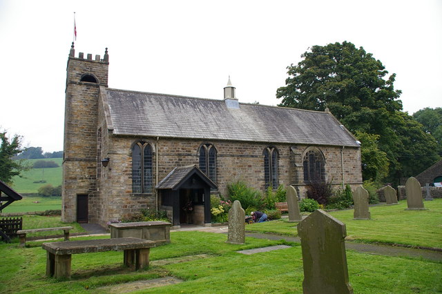

Clitheroe, United Kingdom
Clitheroe is a town of 14,765 people in England, United Kingdom.
Why visit Clitheroe
Townapedia lists 8 museums and landmarks, 8 parks and trails, 80 places to eat, 5 places to stay and 3 attractions in and around town.
Highlights include Edisford Bridge, The Grand, Clitheroe Castle and Clitheroe Castle Museum.
Weather in Clitheroe
Forecast from MET Norway (CC BY 4.0). Full forecast
About Clitheroe
Clitheroe () is a town and civil parish in the Borough of Ribble Valley, Lancashire, England; it is located 34 miles (55 km) north-west of Manchester. It is near the Forest of Bowland and is often used as a base for tourists visiting the area. In 2021, the Clitheroe parish had a population of 17,138.
From the Wikipedia article Clitheroe (this version), under CC BY-SA 4.0.
Travel tips from other travellers: Clitheroe on Wikivoyage (CC BY-SA 4.0).
Things to do3


Museums and landmarks8


Stock Well
Monument and historic site
“The smallest of the three borough wells used until water was supplied in 1856. It is first recorded in 1645. The well was sealed in...


Heald Well
Monument and historic site · 0.6 mi
This well was one of the three public wells which formed the water supply of the borough until the establishment of the waterworks on...
St Mary’s Well
Monument and historic site · 0.7 mi
The name ‘St Mary’s suggests this was a Holy Well, and it possibly dates from medieval times. It is at the top of Well Terrace. There...
The Pinnacle
Monument and historic site
The Pinnacle was once part of the Houses of Parliament and was gifted to the town in 1937
Parks, trails and playgrounds8




Restaurants and cafes80




68 more on the map.
History
The name Clitheroe is thought to come from the Anglo-Saxon for "Rocky Hill", and was also spelled Clyderhow and Cletherwoode, amongst others. The town was the administrative centre for the lands of the Honour of Clitheroe. The Battle of Clitheroe was fought in 1138 during the Anarchy. These lands were held by Roger the Poitevin, who passed them to the de Lacy family, from whom they passed by marriage in 1310 or 1311 to Thomas, Earl of Lancaster. It subsequently became part of the Duchy of Lancaster until Charles II at the Restoration bestowed it, on George Monck, 1st Duke of Albemarle, from whose family it descended through the house of Montague to that of Buccleuch.
At one point, the town of Clitheroe was given to Richard, 1st Duke of Gloucester. Up until 1835, the Lord of the Honor was also by right Lord of Bowland, the so-called Lord of the Fells. The town's earliest existing charter is from 1283, granted by Henry de Lacy, Earl of Lincoln, confirming rights granted by one of his forebears between 1147 and 1177.
According to local legend, stepping stones across the River Ribble near the town are the abode of an evil spirit, who drowns one traveller every seven years.
Read more of the history
During World War II, the jet engine was developed by the Rover Company. Rover and Rolls-Royce met engineers from the different companies at Clitheroe's Swan & Royal Hotel. The residential area 'Whittle Close' in the town is named after Frank Whittle, being built over the site of the former jet engine test beds.
The town has three Scheduled Ancient Monuments, Bellmanpark Lime kiln and embankment, Edisford Bridge and Clitheroe Castle.
From the History section of Clitheroe on Wikipedia, under CC BY-SA 4.0.
More about Clitheroe
Economy
ICI founded a chemical plant in 1941, which was sold for a reported £260 million in September 2002, to Johnson Matthey. Conservatory manufacturer Ultraframe was started in Clitheroe, by John Lancaster in 1983. In March 1997, it floated on the stock exchange, being valued at £345 million in 2003. In June 2006, however, a downturn led to a takeover by Brian Kennedy's Latium Holdings.
Heidelberg Materials, formerly Hanson Cement, and known locally as Castle Cement is one of the town's largest employers. The Ribblesdale plant will celebrate its 90th year anniversary in 2026.
Another local firm, the family-owned animal feed producer Dugdale Nutrition can trace its history back to John Dugdale who was trading at Waddington Post Office in 1850.
Historically, Dawsons green grocers was a significant player in the town retail fabric, circa late sixties and early seventies. Batemans Boys Wear fulfilled a retail need from approximately 1968 to 1980.
There are numerous banks and building societies, including Skipton Building Society & HSBC. Clitheroe has three jewellers, with Nettletons Jewellers being on the high street.
Arts and culture
Clitheroe is twinned with Rivesaltes, a small town in France.
In 2018, the short documentary Alfie the Odd-Job Boy of Clitheroe featured on BBC Three. The film follows the ups and downs of 18-year-old Alfie Cookson, who set up his own business on a tandem pushbike and trailer after struggling to work for other people.
Clitheroe has hosted the Ribble Valley Jazz and Blues Fest since making a return in 2010 after more than 40 years. It is held annually, usually during Early May Bank Holiday weekend.
The annual Clitheroe Food Festival takes place in early August. Eighty or more Lancashire food and drink producers are selected to participate by the festival organisers. Lancashire's top professional chefs, the town's retailers, groups and volunteer organisations also take part.
Education
The two main secondary schools in the town are Clitheroe Royal Grammar School and Ribblesdale High School. There are several primary schools in the town. These are St James's Church of England Primary School, St. Michael and John's Roman Catholic Primary School, Pendle Primary School, Edisford Primary School, Brookside Primary School and newly built (2024) Ribblesdale Primary School.
From the Wikipedia article Clitheroe, under CC BY-SA 4.0.
Notable people from Clitheroe
 Bill SlaterEnglish footballer (1927-2018)Photo: Eskil Malmberg, Public domain
 Benjamin DeanAmerican politician in Massachusetts (1824-1897)Photo: Mathew Benjamin Brady / Levin Corbin Handy, Public domain
- Norman MyersBritish environmentalist (1934–2019)
- Jim FurnellEnglish footballer (born 1937)
- Frederic T. GreenhalgeAmerican politician (1842-1896)
- Ian SharpBritish television director (born 1946)
- James Kingofficer of the Royal Navy; served under James Cook (1750-1784)
- George AkersEnglish football player
- Jeff NuttallBritish writer (1933-2004)
- Peter HargreavesBritish businessman
- Sam GalbraithBritish politician (1945-2014)
- Derek SpencerBritish politician (born 1936)
Born in Clitheroe, according to Wikidata (CC0). Each name links to its Wikipedia article.
Where to stay5
Churches and places of worship15
Shopping19
Gas and EV charging2
Schools, colleges and libraries11
St Michael and St John's Roman Catholic Primary School
School · Roman Catholic · 0.4 mi
Lowergate, Clitheroe
Healthcare6
Clitheroe Health Centre
Clinic and pharmacy · 0.6 mi
Railway View Avenue, Clitheroe
Map of Clitheroe
157 places. The map loads OpenStreetMap tiles when you open it.
Getting there and nearby towns
Warton Aerodrome (WRT) is the nearest airport with scheduled flights listed in OpenStreetMap, 22 miles away.
- Great Harwood 6 mi south, about 9 min by car
- Padiham 6 mi southeast, about 9 min by car
- Burnley 8 mi southeast, about 13 min by car
- Nelson 8 mi east, about 14 min by car
- Blackburn 9 mi southwest, about 14 min by car
- Colne 9 mi east, about 15 min by car
- Haslingden 12 mi south, about 19 min by car
- Rawtenstall 12 mi south, about 20 min by car
- Preston 14 mi southwest, about 23 min by car
- Ramsbottom 15 mi south, about 25 min by car
Drive times are estimates from straight-line distance, not routes.
Towns near Clitheroe


Keep exploring
Local news
Headlines from INDB.
Reviews, tips and questions
Loading what members have shared...
Sources and licences
- GeoNames (CC BY 4.0): population, coordinates, regions and time zone
- Mapillary (see each image): photos
- OpenStreetMap contributors (ODbL 1.0): places, airports, map data
- Wikidata (CC0 1.0): elevation, founding date, time zone, website, landmarks and historic places
- Wikimedia Commons (see each image): photos
- Wikipedia (CC BY-SA 4.0): overview and history text
Photo credits
- Clitheroe Castle Grounds Eshton St Entrance 8483, Photograph by Clem Rutter, Rochester, Kent. ( www.clemrutter.net )., CC BY-SA 3.0
- Clitheroe Castle Grounds Eshton St Entrance 8477, Photograph by Clem Rutter, Rochester, Kent. ( www.clemrutter.net )., CC BY-SA 3.0
- Clitheroe Castle, Lux01 at English Wikipedia, Public domain
- Clitheroe Castle Museum, Gpwitteveen, CC BY-SA 3.0
- St Ambrose's Church, Grindleton, Alexander P Kapp, CC BY-SA 2.0
- St Michael and St John Church, Clitheroe 06, Immanuel Giel, CC BY-SA 4.0
- Clitheroe Library 02, Immanuel Giel, CC BY-SA 4.0
- St James' Church of England Primary School, Clitheroe, Gpwitteveen, CC BY-SA 3.0
- Stock Well plaque, Clitheroe, DIaNyf8q, CC0
- Clitheroe war memorial, Nev1, CC BY-SA 3.0
- Street-level photo, endszbrxns, CC BY-SA 4.0


Page built November 10, 2026. Spotted a mistake? Tell us or suggest a place.