




Barrow in Furness, United Kingdom
Barrow in Furness is a town of 55,489 people in England, United Kingdom.
Why visit Barrow in Furness
Townapedia lists 24 museums and landmarks, 18 parks and trails, 130 places to eat, 31 places to stay and 13 attractions in and around town.
Highlights include Rampside Lighthouse, Bow Bridge, The Dock Museum and Furness Abbey.
Weather in Barrow in Furness
Forecast from MET Norway (CC BY 4.0). Full forecast
About Barrow in Furness
Barrow-in-Furness, commonly known as Barrow, is an industrial port town and civil parish in the Westmorland and Furness local government area of Cumbria, England. Historically in Lancashire, Barrow is at the tip of the Furness peninsula, 24 miles (39 km) south-west of Kendal and 18 miles (29 km) west of Lancaster. It is bordered by Morecambe Bay to the east, the Duddon Estuary to the west, and the Irish Sea to the south. In 2021, Barrow's population was 55,489, making it the second-largest urban area in Cumbria after Carlisle and the largest in Westmorland and Furness.
From the Wikipedia article Barrow-in-Furness (this version), under CC BY-SA 4.0.
Travel tips from other travellers: Barrow in Furness on Wikivoyage (CC BY-SA 4.0).
Photos of Barrow in Furness


Things to do13

Rampside Lighthouse
Lighthouse · 3.2 mi
Grade II listed lighthouse in Barrow-in-Furness, Cumbria, England, UK

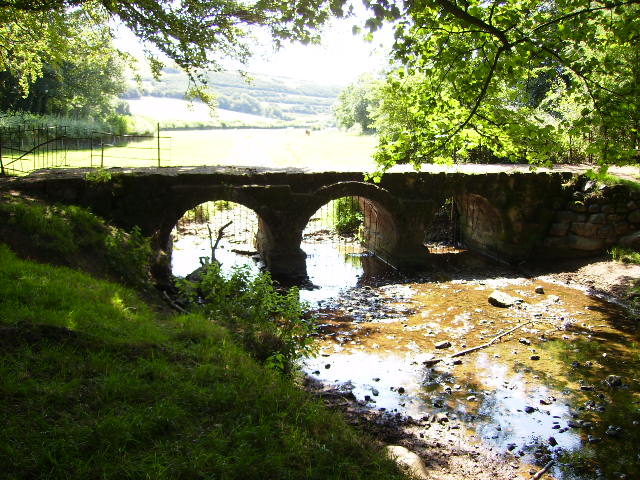
Bow Bridge
Bridge · 2.2 mi
Bridge in Barrow, Westmorland and Furness, Cumbria, England, UK

Hodbarrow Beacon
Lighthouse · 5.9 mi
Lighthouse in Cumbria, England, UK


The Forum
Cinema and theater
Theatre, media and arts centre in Barrow-in-Furness, Cumbria, England
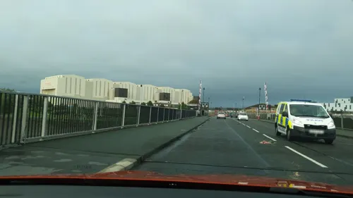

Walney Lighthouse
Lighthouse · 4.8 mi
Lighthouse in Cumbria, England, UK

Hodbarrow Point Lighthouse
Lighthouse · 5.7 mi
Lighthouse in Millom, England


1 more on the map.
Museums and landmarks24


Gleaston Castle
Monument and historic site · 4.2 mi
14th-century enclosure castle in England


Barrow Park Cenotaph
Monument and historic site · 0.5 mi
War memorial in Barrow-in-Furness, Cumbria, England, UK
Dock Museum
Museum · 0.5 mi
Museum in Barrow-in-Furness, Westmorland and Furness, Cumbria, England, United Kingdom

(Public Right of Way across Walney Channel is dangerous. Seek local Guidance.. See Note)
Monument and historic site · 1.0 mi
Bridges are stone footbridges covered by the tide

Dalton Castle
Monument and historic site · 3.5 mi
Market Place, Dalton-in-Furness
Cocken Lane (Public Rights of Way across Walney Channel are dangerous. Seek local Guidance.. See Note)
Monument and historic site · 1.3 mi
12 more on the map.
Parks, trails and playgrounds18

Barrow Park
Park · 0.6 mi
Public park in Barrow-in-Furness, Cumbria, England, UK

Hodbarrow Nature Reserve
Park · 6.3 mi
Nature reserve on former mining site



North Walney
Park · 2.4 mi
Nature reserve in Barrow-in-Furness, Cumbria, England

6 more on the map.
Restaurants and cafes130

Duke of Edinburgh Hotel
Restaurant · Regional · 0.4 mi
Abbey Road, Barrow-in-Furness
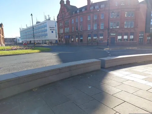
Francescas Pizzaria
Restaurant · Pizza
Duke Street, Barrow-in-Furness
Mo-Th 12:00-14:30, 17:00-23:00; Fr-Su 12:00-23:00

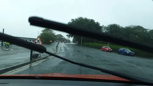

Asda Café
Cafe · Coffee Shop · 0.8 mi
Walney Road, Barrow-in-Furness
Mo-Sa 08:30-18:00; Su 10:00-16:00

Abbey mill coffee shop
Cafe · 2.1 mi
Abbey Approach, Barrow-in-Furness
We-Su 10:00-16:00
118 more on the map.
History
Barrow and the surrounding area have been settled non-continuously for several millennia, with evidence of Neolithic inhabitants on Walney Island. Despite a rich history of Roman settlement across Cumbria and the discovery of related artefacts in the Barrow area, no buildings or structures have been found to support the idea of a functioning Roman community on the Furness peninsula. The Furness Hoard discovery of Viking silver coins and other artefacts in 2011 provided significant archaeological evidence of Norse settlement in the early 9th century. Several areas of Barrow, including Yarlside and Ormsgill, as well as "Barrow" and "Furness", have names of Old Norse origin. The Domesday Book of 1086 recorded the settlements of Hietun, Rosse, and Hougenai, which are now the districts of Hawcoat, Roose, and Walney respectively.
Read more of the history
In the Middle Ages, the Furness peninsula was controlled by the Cistercian monks of the Abbey of St Mary of Furness, known as Furness Abbey. This was in the "Vale of Nightshade", now on the outskirts of the town. Founded for the Savigniac order, it was built on the orders of King Stephen in 1123. Soon after the abbey's foundation, the monks discovered iron ore deposits, which later provided the basis for the Furness economy. These thin strata, close to the surface, were extracted through open-cut workings, which were then smelted by the monks. The proceeds from mining, along with agriculture and fisheries, meant that by the 15th century the abbey had become the second richest and most powerful Cistercian abbey in England, after Fountains Abbey in Yorkshire. The monks of Furness Abbey constructed a wooden tower on nearby Piel Island in 1212 which acted as their main trading point; it was twice invaded by the Scots, in 1316 and 1322. In 1327, King Edward III gave Furness Abbey a licence to crenellate the tower, and a motte-and-bailey castle was built. However, Barrow itself was just a hamlet in the parish of Dalton-in-Furness, reliant on the land and sea for survival. Small quantities of iron and ore were exported from jetties on the channel separating the village from Walney Island. Aside from Furness Abbey and Piel Castle, the oldest surviving buildings in Barrow are cottages and farmhouses in Newbarns and Ormsgill, which date back to the early 17th century; as well as Rampside Hall, a Grade I listed building and the best-preserved in the Barrow area from the 1600s. Even as late as 1843, there were still only 32 dwellings, including two pubs.
In 1839, Henry Schneider arrived as a young speculator and dealer in iron, and he discovered large deposits of haematite in 1850. He and other investors founded the Furness Railway, the first section of which opened in 1846, to transport the ore from the slate quarries at Kirkby-in-Furness and haematite mines at Lindal-in-Furness and Askam and Ireleth to a deep-water harbour near Roa Island. The crucial and difficult link across Morecambe Bay between Ulverston and Carnforth on the main line was promoted, as the Ulverston and Lancaster Railway, by a group led by John Brogden and opened in 1857. It was promptly purchased by the Furness Railway.
The docks built between 1863 and 1881 in the more sheltered channel between the mainland and Barrow Island replaced the port at Roa Island. The first dock to open was Devonshire Dock in 1867, and Prime Minister William Ewart Gladstone stated his belief that "Barrow would become another Liverpool". The increasing quantities of iron ore mined in Furness were then brought into the centre of Barrow to be transported by sea.
The investors in the burgeoning mining and railway industries decided that greater profits could be made by smelting the iron ore and converting the resultant pig iron into steel, and then exporting the finished product. Schneider and James Ramsden, the railway's general manager, erected blast furnaces at Barrow that by 1876 formed the largest steelworks in the world. Its success was a result of the availability of local iron ore and coal from the Cumberland mines and easy rail and sea transport. The Furness Railway, which counted local aristocrats the 7th Duke of Devonshire and the Duke of Buccleuch as investors, kick-started the Industrial Revolution on the peninsula. The railway brought mined ore to the town, where the steelworks produced large quantities of steel. It was used for shipbuilding, and derived products such as rails were also exported from the newly built docks.
Barrow's population grew rapidly. Population figures for the town itself were not collected until 1871, though sources suggest that Barrow's population was still as low as 700 in 1851. During the first half of the 19th century, Barrow formed part of the parish of Dalton-in-Furness, the population of which shows some of Barrow's early growth from the 1850s:
In 1871, Barrow's population was recorded at 18,584 and in 1881 at 47,259, less than forty years after the railway was built. The majority of migrants originated from elsewhere in Lancashire, although significant numbers settled in Barrow from Ireland and Scotland, which represented 11% and 7% of the local population in the 1890s. By the turn of the 20th century, the Scottish-born population had increased to form the highest portion anywhere in England. Other notable immigrant groups included Cornish people who represented 80% of the district of Roose's population at the time of the 1881 census. In an attempt to diversify Barrow's economy James Ramsden founded the Barrow and Calcutta Jute Company in 1870 and the Barrow Jute Works was soon constructed alongside the Furness Railway line in Hindpool. The mill employed 2,000 women at its peak and was awarded a gold medal for its produce at the 1878 Paris Exposition Universelle.
From the History section of Barrow-in-Furness on Wikipedia, under CC BY-SA 4.0.
More about Barrow in Furness
Geography
Barrow is situated at the tip of the Furness peninsula on the north-western edge of Morecambe Bay, south of the Duddon Estuary and east of the Irish Sea. Walney Island, surrounds the peninsula's Irish Sea coast and is separated from Barrow by the narrow Walney Channel. Both Morecambe Bay and the Duddon Estuary are characterised by large areas of quicksand and fast-moving tidal bores. Areas of sand dunes exist on coasts surrounding Barrow, particularly at Roanhead and North Walney. The town centre and major industrial areas sit on a fairly flat coastal shelf, with hillier ground rising to the east of the town, peaking at 94 metres (310 ft) at Yarlside. Barrow sits on soils deposited during the end of the Ice Age, eroded from the mountains of the Lake District National Park, 10 miles (15 km) to the north-east. Barrow's soils are composed of glacial lake clay and glacial till, while Walney is almost entirely made up of reworked glacial morraine. Beneath these soils is a sandstone bedrock, from which many of the town's older buildings are constructed.
Economy
Historically Barrow's economy was dominated by the manufacturing sector, with the Barrow Hematite Steel Company and Vickers Shipbuilding and Engineering being amongst the most important global companies in their respective fields during the 20th century. In the present day, manufacturing remains the largest employment sector in the town. BAE Systems is the single largest employer with around 14,500 employees as at 2025, anticipated to increase further. However, like most of the UK, employment trends have greatly diversified since the 20th century and there are no other predominant employment sectors in Barrow.
Barrow has played a vital role in global ship and submarine construction for around 150 years. Ottoman submarine Abdül Hamid was built in the town in 1886 and became the first submarine in the world to fire a live torpedo underwater, while oil tanker British Admiral became the first British vessel to exceed 100,000 tonnes when launched in 1965. The vast majority of all current and former Royal Navy submarines were constructed in Barrow as well as numerous Royal Navy Fleet Flagships.
Arts and culture
Barrow contains a wealth of natural and built heritage assets, which includes 274 Listed Buildings and four SSSIs. The 2016 Heritage Index formed by the Royal Society of Arts and the Heritage Lottery Fund placed the borough as sixth highest of 325 English districts for 'assets' with especially high scores relating to nationally important landscape and natural heritage assets and industrial heritage assets.
Education
Education in the state-funded sector includes fifteen primary schools, five infant schools, five junior schools and many nurseries. The three secondary schools in the town are: Furness Academy, St. Bernard's Catholic High School and Walney School. Chetwynde School is an all-through school for children aged 4 to 18. Formerly a private school, Chetwynde became a state-funded free school in 2014.
In the further education sector there is one college, Furness College. Furness College merged with Barrow Sixth Form College in 2016 forming the largest college in Cumbria. Technical and professional qualifications are delivered at the Channelside campus, with A levels delivered at the Rating Lane campus, the home of the former sixth form college. Although there are currently no higher education institutions based in Barrow, Furness College offers several higher apprenticeships, foundation degrees, Bachelor's and Master's programmes accredited by the University of Cumbria, University of Lancaster and the University of Central Lancashire. In March 2023 plans were approved for a 1,400-capacity campus of the University of Cumbria on Barrow Island which is expected to be open for September 2025. The university campus is situated adjacent to BAE's Submarine Academy and forms a new 'Learning Quarter' for the town.
From the Wikipedia article Barrow-in-Furness, under CC BY-SA 4.0.
Notable people from Barrow in Furness
 Emlyn HughesEnglish association football player (1947–2004)Photo: Comet Photo AG (Zürich), CC BY-SA 4.0
 Georgia StanwayEnglish association football playerPhoto: Raph_PH, CC BY 4.0
 Ben DaviesEnglish association football player (born 1995)Photo: Preston North End F.C., CC0
 Chris ThompsonBritish long-distance runnerPhoto: Paul W, CC BY-SA 4.0
 Cat SmithBritish politician (born 1985)Photo: ©House of Commons, CC BY 3.0
 Kathryn WarnerEnglish historianPhoto: Julie Frusher, CC BY-SA 4.0
- Gary StevensEnglish footballer (born 1963)
- Emma WalmsleyBritish businesswoman, CEO of GlaxoSmithKline
- Derek ClaytonAustralian long distance runner
- David TattersallEnglish cinematographer
- Nigel KnealeBritish screenwriter (1922–2006)
- Caroline AlexanderScottish cyclist
Born in Barrow in Furness, according to Wikidata (CC0). Each name links to its Wikipedia article.
Where to stay31
Churches and places of worship35
Shopping31
Gas and EV charging2
Schools, colleges and libraries44
Sacred Heart Catholic Primary School
School · Roman Catholic · 0.5 mi
Lumley Street, Barrow-in-Furness
Healthcare10
Alfred Barrow Health Centre
Clinic and pharmacy
Duke Street, Barrow-in-Furness
Lloyds Pharmacy
Clinic and pharmacy · 3.7 mi
75-77 Market Street, Dalton-in-Furness
Map of Barrow in Furness
250 places. The map loads OpenStreetMap tiles when you open it.
Getting there and nearby towns
Walney Aerodrome (BWF) is the nearest airport with scheduled flights listed in OpenStreetMap, 2 miles away.
- Ulverston 8 mi northeast, about 13 min by car
- Heysham 14 mi east, about 23 min by car
- Morecambe 15 mi east, about 24 min by car
- Fleetwood 16 mi southeast, about 25 min by car
- Lancaster 18 mi east, about 29 min by car
- Thornton-Cleveleys 18 mi southeast, about 30 min by car
- Cleveleys 18 mi southeast, about 29 min by car
- Blackpool 22 mi south, about 35 min by car
- Poulton-le-Fylde 22 mi southeast, about 35 min by car
- Fylde 23 mi southeast, about 37 min by car
Drive times are estimates from straight-line distance, not routes.
Towns near Barrow in Furness


Keep exploring
Local news
Headlines from INDB.
Reviews, tips and questions
Loading what members have shared...
Sources and licences
- GeoNames (CC BY 4.0): population, coordinates, regions and time zone
- Mapillary (see each image): photos
- OpenStreetMap contributors (ODbL 1.0): places, airports, map data
- Wikidata (CC0 1.0): elevation, founding date, time zone, website, landmarks and historic places
- Wikimedia Commons (see each image): photos
- Wikipedia (CC BY-SA 4.0): overview and history text
Photo credits
- Barrow montage2, DannyFromBarrow, CC BY-SA 3.0
- Rampside lighthouse, Yohan euan o4, CC BY-SA 3.0
- Bow Bridge, Barrow, Phil Catterall, CC BY-SA 2.0
- Old lighthouse, Hodbarrow, Millom (3), The wub, CC BY-SA 3.0
- Michaelson Rd Bridge, Stevvvv4444, CC BY-SA 3.0
- North-Tower-from-NW, Chas Hollwey, CC BY-SA 4.0
- Piel Castle, Arnold Price, CC BY-SA 2.0
- Barrow Park Entrance, Stevvvv4444, CC BY-SA 4.0
- Millom - view over Hodbarrow nature reserve, The wub, CC BY-SA 3.0
- St John's Church, Barrow Island, SpikePix, CC BY-SA 2.0
- St Mary's Church, Vickerstown, Alexander P Kapp, CC BY-SA 2.0
- St Mary's Church, Dalton-in-Furness, Alexander P Kapp, CC BY-SA 2.0
- Presbyterian Church, Barrow, Alexander P Kapp, CC BY-SA 2.0
- Cenotaph, Barrow Park, Stephen Middlemiss, CC BY-SA 2.0
- Furness Abbey 01, Francis Bijl from Groningen, Netherlands, CC BY 2.0
- Abbey House Hotel front elevation, Stevvvv4444, CC BY-SA 4.0
- DUKE OF EDINBURGH BARROW IN FURNESS CUMBRIA SEP 2013 (9997097555), calflier001, CC BY-SA 2.0
- Barrow-in-Furness - The Ship Inn - 20281224014839, Geni, CC BY-SA 4.0
- Barrow-in-Furness - Victoria Park Hotel - 20240924143414, Pjwtrad67, CC BY-SA 4.0
- BSFC Main Building, Pipkin2.0, CC BY-SA 4.0
- Image of Chetwynde School, Pipkin2.0, CC BY-SA 4.0
- The Forum, Barrow-in-Furness, southlakes-uk.co.uk, CC BY-SA 3.0
- Craven House, office block - panoramio (1), SteveMi, CC BY 3.0
- Townhall Barrow, Lee Coward, CC BY-SA 2.0
- Barrow Town Hall, Cumbria, NWE, Ian Petticrew, CC BY-SA 2.0
- Arms of Cavendish and Montagu-Douglas-Scott on Town Hall, flipflopnick from Cumbria, UK, CC BY 2.0
- Duke Street Surgery, Stevvvv4444, CC BY-SA 4.0
- Mylad's Barrow - Flickr - Ian Livesey, Ian Livesey from England, UK, CC BY 2.0
- Barrow - panoramio (5), Tanya Dedyukhina, CC BY 3.0
- Walney Lighthouse (43981406965), Reading Tom from Reading, UK, CC BY 2.0
- Dock Museum Graving Dock, Vicki Deritis, CC BY-SA 2.0
- Street-level photo, a-sav, CC BY-SA 4.0
- Street-level photo, 767vbfxczicayv, CC BY-SA 4.0
- Street-level photo, 767vbfxczicayv, CC BY-SA 4.0
- Street-level photo, a-sav, CC BY-SA 4.0
- Street-level photo, a-sav, CC BY-SA 4.0
- Street-level photo, 767vbfxczicayv, CC BY-SA 4.0
- Street-level photo, 767vbfxczicayv, CC BY-SA 4.0


Page built November 10, 2026. Spotted a mistake? Tell us or suggest a place.