


Fleetwood, United Kingdom
Fleetwood is a town of 26,232 people in England, United Kingdom.
Why visit Fleetwood
Townapedia lists 3 museums and landmarks, 6 parks and trails, 87 places to eat, 6 places to stay and 5 attractions in and around town.
Highlights include Beach Lighthouse, Pharos Lighthouse, Fleetwood Museum and Hackensall Hall.
Weather in Fleetwood
Forecast from MET Norway (CC BY 4.0). Full forecast
About Fleetwood
Fleetwood is a coastal town in the Borough of Wyre in Lancashire, England, at the northwest corner of the Fylde. It had a population of 26,232 at the 2021 census.
From the Wikipedia article Fleetwood (this version), under CC BY-SA 4.0.
Travel tips from other travellers: Fleetwood on Wikivoyage (CC BY-SA 4.0).
Things to do5
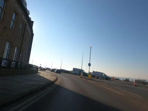

Pharos Lighthouse
Lighthouse
Lighthouse in Fleetwood, England
Pharos Street, Fleetwood
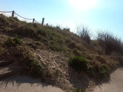
Rossall Point Observation Tower
Monument and historic site · 1.4 mi
Observation tower in Fleetwood, England

Wyre Light
Lighthouse · 2.0 mi
Lighthouse at Fleetwood, Lancashire, England, UK

Museums and landmarks3

Fleetwood Museum
Museum
Museum in Fleetwood, Lancashire, England, United Kingdom
6-7 Queen's Terrace, Fleetwood

Hackensall Hall
Monument and historic site · 0.8 mi
Hackensall Road, Poulton-le-Fylde
Parks, trails and playgrounds6


Wyre Estuary Country Park
Park · 3.4 mi
Wyre Estuary Country Park is located in Thornton-Cleveleys, Lancashire, England


Restaurants and cafes87
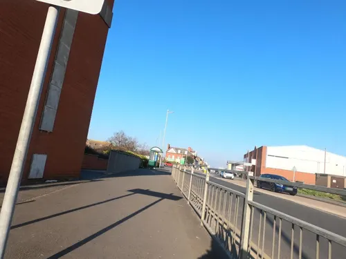
Asda Café
Cafe · Coffee Shop · 0.4 mi
190 - 244 Dock Street, Fleetwood
Mo-Sa 08:30-18:00; Su 10:00-16:00
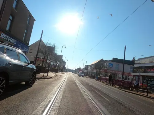




The Coffee House at Fleetwood Museum
Cafe · Coffee Shop
6 - 7 Queens Terrace, Fleetwood
75 more on the map.
History
The area around Fleetwood has been populated since ancient times, and an Iron Age settlement was discovered at Bourne Hill (just south of present-day Fleetwood) in 2007. By the time of the Roman conquest of Britain, the area was home to a tribe known as the Setantii and the coast around Fleetwood has often been suggested as a location for the lost Setantiorum Portus ('the port of the Setantii') named by Ptolemy in his 2nd century AD work, Geographia. Ptolemy lists the port as being just south of the Moricambe Aestuarium (Morecambe Bay) and North of the Belisama Aestuarium (possibly the Ribble Estuary). The Roman road from Ribchester also appears to make a sharp northwesterly turn towards Fleetwood after Kirkham (12 miles (19 km) to the southeast).
There is evidence that both banks of the River Wyre were occupied during the Danish invasions of the 9th and 10th centuries. Place names such as Skippool and Rossall to the west, where present-day Fleetwood stands, and Hackinsall on the east, can be traced to Viking settlers there. By the time of the Domesday Book in 1086, the land on which Fleetwood now stands was part of the Hundred of Amounderness.
Read more of the history
A manor house at present-day Rossall, in the southwest of the town, was in the possession of the Allen family by the time of Henry VIII. The Allens were prominent Roman Catholics, and Henry VIII repossessed the land. Cardinal William Allen was born at the manor house in 1532. It was ultimately sold to Thomas Fleetwood, comptroller of the Royal Mint, whose son Edmund, expanded the house into Rossall Hall. The land remained in the Fleetwood family for 300 years.
By the 1830s, the house and estate was in the ownership of Edmund's descendant Peter Hesketh, High Sheriff of Lancashire and MP for Preston. A man of somewhat liberal views for his time, Hesketh believed that the sheltered harbour and views over Morecambe Bay gave the area the makings of a busy seaport and popular resort for the less-affluent. With no rail link between London and Scotland, he envisaged Fleetwood as the transfer point between the railway and the steamers to Scotland, and set about encouraging a railway link from Preston. With a new career in parliament to prepare for, he engaged Frederick Kemp as his agent. He originally considered naming the new town Wyreton or New Liverpool, but after changing his name to Peter Hesketh-Fleetwood in 1831, he settled on the name Fleetwood. After some delays, he recruited the prominent architect Decimus Burton, whose work in St Leonard's-on-Sea he had admired, to lay out what would be the first planned town of the Victorian era. The plans were complete by 1835, and construction of the first buildings and the railway line began in 1836.
Burton's plan was to use the largest of the sand-dunes on the north-facing shore as the focus of a half-wheel street layout. This was landscaped, and became known as the Mount. It served as the hub of Burton's half-wheel design, the main residential streets acted as the spokes, and the main commerce area of Dock Street was the rim of the wheel. The oldest surviving building in the town, once the custom house, later the town hall and latterly Fleetwood Museum, dates from 1836 and housing from as early as 1838 still exists in the town. The crown jewel was the North Euston Hotel, built in 1841, a fine semi-circular building overlooking the bay and the river's estuary. The hotel was built to serve overnight guests making the railway journey from Euston, and was close to the point of departure for the steamers to Scotland. This journey was made by Queen Victoria in 1847, but by the mid-1850s the completion of the western railway link between London and Scotland over Shap Fell rendered Fleetwood's role as a transport terminus obsolete.
Burton designed two lighthouses for the town: The Upper Lighthouse, usually referred to as the Pharos (after the Pharos of Alexandria in Egypt, one of the Seven Wonders of the Ancient World), can be seen for 13 miles (21 km) and Beach Lighthouse is visible for 9 miles (14 km). Both opened in 1840. A third lighthouse, Wyre Light, built in 1839–40 by blind engineer Alexander Mitchell, offshore on the northeast corner of North Wharf, was the first screw pile lighthouse to be built in Great Britain. Fleetwood is the only town in the United Kingdom to possess three lighthouses and the two within the town itself remain fully operational. Wyre Light has now fallen into a state of disrepair.
Fleetwood Market, still a prominent permanent market, was established in 1840.
By 1838, Hesketh-Fleetwood had run into serious financial difficulties, with costs for the railway in particular ultimately exceeding £300,000. He had numerous financial arguments with Frederick Kemp, who borrowed against the estate revenues to finance the expansion of the town, and was suspected of taking financial advantage of Sir Peter. Hesketh-Fleetwood became short of cash and was forced to mortgage his properties. Depressed, he gradually withdrew from the project, and by 1844 he had been obliged to sell much of his estate. He leased Rossall Hall itself to the Church of England, which intended to set up a boarding school as a North of England equivalent of Marlborough School. Under the auspices of Rev. St. Vincent Beechey, the vicar of Fleetwood, it was to become Rossall School. Virtually bankrupt, Hesketh-Fleetwood retired to Brighton, giving up his parliamentary obligations in 1847. Meanwhile, Kemp's influence expanded. He had set up the Fleetwood Estates Company to manage the land, and the North Lancashire Steam Navigation Company in 1843 to manage the expanding steamer trade. However, by the late 1850s, the combination of the new western railway route and the rise of neighbouring Blackpool as a prominent seaside resort signalled a decline in the town's fortunes.
From the History section of Fleetwood on Wikipedia, under CC BY-SA 4.0.
More about Fleetwood
Geography
Fleetwood is in the northwest corner of the Fylde coastal plain, 8 miles (13 km) north of Blackpool, on the western side of the mouth of the River Wyre. The town is on a peninsula, almost 2 miles (3 km) wide, bounded to the west by the Irish Sea, to the north by Morecambe Bay and to the east by the River Wyre estuary. Access to Fleetwood is thus restricted, and for many years there were only two roads into and out of the town (three since 1979). A large sandbank, the North Wharf, extends some 2+1⁄4 miles (3.6 km) north into Morecambe Bay, and is exposed at low tide. The river channel forms the eastern boundary of the bank. Together with the larger Bernard Wharf on the other side of the river, this makes navigation of the river difficult. Conversely, the port is highly sheltered from the prevailing westerly winds.
Economy
Fleetwood's economy still revolves around the traditional areas of fishing, tourism, port activity and light industry, but since the early 1970s the town has continued to struggle economically. A government report in 2006 stated that three of the town's five wards fall into the 5% to 10% most deprived wards in England.
The same government report noted that the demise of the fishing industry cost Fleetwood some 8,000 jobs, employment in fishing-related industries falling from 9,000 to less than 1,000, mostly in the fish-processing sector. The closure of the ICI Hillhouse works cost the region a further 4,500 jobs. Industrial and commercial development has been at a standstill for fifteen years and only a single commercial employer based in the town has more than 200 employees. The stock of both commercial and residential property is in decline.
While Wyre Borough in general has a lower unemployment rate than the rest of the United Kingdom, Fleetwood's is considerably higher. Using figures indicating benefit claimants as a percentage of total population (usually considered to be about half the 'actual' unemployment rate) the figures for August 2007 are:
The town's largest and most prominent single employer is Lofthouse's of Fleetwood Ltd., manufacturers of Fisherman's Friend—a menthol lozenge popular worldwide and especially in Japan.
Arts and culture
The town's most prominent feature is the Mount, a 7-acre (2.8 ha) park facing the sea-front, laid out by Decimus Burton, and built on a large sand dune originally known as Tup's Hill. It is surmounted by a pavilion built in 1904 incorporating a clock added in 1919.
The 13 hectares of Fleetwood Memorial Park was developed out of the earlier Warrenhurst Park, itself an early-C20 park designed by Thomas Lumb of Blackpool. In 1917 the park was renamed "Memorial Park" in memory of those who died in the First World War. The memorial statue was added a few years later and memorial trees planted by the children who lost relatives.
In the early 1900s the park was home to a boating lake and the current facilities include three crown green bowling greens, a children's play area and picnic area, cenotaph memorial, duck pond, football pitches (on the site of the old boating lake) and tennis courts.
Education
Rossall School is a co-educational, independent, day and boarding school for ages 5 to 18. It was founded in 1844 on the site of Rossall Hall in the south west of the town. There are two public-sector secondary schools in the town. Fleetwood High School on Broadway was founded in 1977 as a comprehensive non-denominational secondary school, a successor to Fleetwood Grammar School (1921–77) and Bailey School. It was 're-branded' as Fleetwood Sports College in 2005 when the school was given specialist school status in sport, but reverted to its original name in September 2010. Cardinal Allen Catholic High School is a Roman Catholic high school, founded in 1963 as a secondary modern school.
The only tertiary educational institution in Fleetwood is the Nautical Campus of Blackpool and The Fylde College, located at Broadwater.
From the Wikipedia article Fleetwood, under CC BY-SA 4.0.
Notable people from Fleetwood
 John RobbBritish musician and journalistPhoto: Phil King, CC BY 2.0
 Lorraine BeaversBritish politicianPhoto: ©House of Commons / Laurie Noble, CC BY 3.0
- Charles Kay OgdenEnglish linguist, philosopher, writer (1889–1957)
- John AdsheadEnglish footballer (born 1942)
- Stuart ChatwoodCanadian musician
- Kevin BarnesEnglish footballer (born 1975)
- George Mulocknaval officer and Antarctic surveyor (1882-1963)
- Belle ChrystallBritish actress (1910-2003)
- Stephen HibbertAmerican actor and comedy writer
- Billy PorterEnglish footballer (1905-1946)
- Maria Bitner-GlindziczBritish physician and professor of human and molecular genetics
- Jack CuttingEnglish footballer (1924-1985)
Born in Fleetwood, according to Wikidata (CC0). Each name links to its Wikipedia article.
Where to stay6
Churches and places of worship19
St Oswald
Church · Anglican · 1.4 mi
Lancaster Road, Poulton-le-Fylde
Agnew Road Congreagational Church
Church · Methodist · 0.6 mi
47 Agnew Road, Fleetwood
Shopping22
Gas and EV charging2
Schools, colleges and libraries10
St Wulstan's and St Edmund's Catholic Academy
School · Roman Catholic · 1.0 mi
Poulton Road, Fleetwood
Healthcare7
Map of Fleetwood
167 places. The map loads OpenStreetMap tiles when you open it.
Getting there and nearby towns
Blackpool Airport (BLK) is the nearest airport with scheduled flights listed in OpenStreetMap, 11 miles away.
- Poulton-le-Fylde 6 mi south, about 10 min by car
- Blackpool 8 mi south, about 12 min by car
- Heysham 9 mi northeast, about 15 min by car
- Preston 17 mi southeast, about 27 min by car
- Ulverston 19 mi north, about 31 min by car
- Blackburn 25 mi southeast, about 40 min by car
- Ormskirk 25 mi south, about 41 min by car
- Formby 25 mi south, about 41 min by car
- Great Harwood 26 mi east, about 42 min by car
- Wigan 31 mi southeast, about 49 min by car
Drive times are estimates from straight-line distance, not routes.
Towns near Fleetwood


Keep exploring
Local news
Headlines from INDB.
Reviews, tips and questions
Loading what members have shared...
Sources and licences
- GeoNames (CC BY 4.0): population, coordinates, regions and time zone
- Mapillary (see each image): photos
- OpenStreetMap contributors (ODbL 1.0): places, airports, map data
- Wikidata (CC0 1.0): elevation, founding date, time zone, website, landmarks and historic places
- Wikimedia Commons (see each image): photos
- Wikipedia (CC BY-SA 4.0): overview and history text
Photo credits
- Fleetwood - Mar 2008 - Marine Hall and Gardens from the Mount, Stevew2022, CC BY-SA 3.0
- Fleetwood fountain, Roger Harrisson, CC BY-SA 4.0
- Fleetwood (37768761784), grassrootsgroundswell, CC BY 2.0
- St Peter's Church, Fleetwood, james denham, CC BY-SA 2.0
- Fleetwood Maritime Museum, Belovedfreak, CC BY-SA 3.0
- Fleetwood - Mar 2008 - St May's RC Church, Lord St, Stevew2022, CC BY-SA 3.0
- Fleetwood - Mar 2008 - St Nicholas Church, Broadway, Stevew2022, CC BY-SA 3.0
- Fleetwood - Mar 2008 - St Peter's Parish Church, Stevew2022, CC BY-SA 3.0
- FTFC01, Tangerines at English Wikipedia, Public domain
- Former Museum and Public Library, Fleetwood 2, Belovedfreak, CC BY-SA 3.0
- St Oswald's Church, Knott End, David Medcalf, CC BY-SA 2.0
- Pharos Lighthouse, Fleetwood - panoramio, jolmartyn, CC BY-SA 3.0
- Street-level photo, tonys999, CC BY-SA 4.0
- Street-level photo, tonys999, CC BY-SA 4.0
- Street-level photo, tonys999, CC BY-SA 4.0
- Street-level photo, tonys999, CC BY-SA 4.0
- Street-level photo, tonys999, CC BY-SA 4.0
- Street-level photo, tonys999, CC BY-SA 4.0
- Street-level photo, tonys999, CC BY-SA 4.0
- Street-level photo, tonys999, CC BY-SA 4.0
- Street-level photo, tonys999, CC BY-SA 4.0
- Street-level photo, tonys999, CC BY-SA 4.0
- Street-level photo, tonys999, CC BY-SA 4.0
- Street-level photo, mfk, CC BY-SA 4.0


Page built November 10, 2026. Spotted a mistake? Tell us or suggest a place.