


Thornton-Cleveleys, United Kingdom
Thornton-Cleveleys is a town of 31,157 people in England, United Kingdom.
Why visit Thornton-Cleveleys
Townapedia lists 5 museums and landmarks, 13 parks and trails, 119 places to eat, 8 places to stay and 4 attractions in and around town.
Highlights include Vue, Children's Corner, Fylde Memorial Arboretum and Community Woodland and Thornton-Cleveleys War Memorial.
Weather in Thornton-Cleveleys
Forecast from MET Norway (CC BY 4.0). Full forecast
About Thornton-Cleveleys
Thornton-Cleveleys is a conurbation consisting of the village of Thornton and the town of Cleveleys. The two settlements formed a joint urban district from 1927 until 1974, before becoming part of Wyre, Lancashire.
From the Wikipedia article Thornton-Cleveleys (this version), under CC BY-SA 4.0.
Things to do4
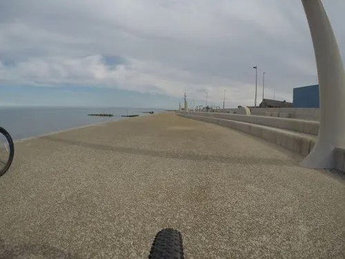
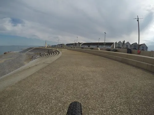
Children's Corner
Monument and historic site · 1.1 mi
Amusement park in Cleveleys, Lancashire, England


Thornton Little Theatre
Cinema and theater · 0.5 mi
Victoria Road East, Thornton-Cleveleys
Museums and landmarks5

Fylde Memorial Arboretum and Community Woodland
Monument and historic site · 1.8 mi
War memorial in the UK

Thornton-Cleveleys War Memorial
Monument and historic site · 0.5 mi
War memorial in Wyre, Lancashire, England, UK


Poulton-le-Fylde War Memorial
Monument and historic site · 2.2 mi
War memorial in Poulton-le-Fylde, Lancashire, England, UK
Parks, trails and playgrounds13

Devonshire Road Rock Gardens
Park · 1.8 mi
Park in Bispham, United Kingdom


Jean Stansfield Memorial Park
Park · 2.3 mi
Public park in Poulton-le-Fylde, Lancashire, England

Tee Time Golf Centre
Golf course · 1.0 mi
Driving range & 9 hole Pitch & Putt
Fleetwood Road, Thornton-Cleveleys
Wyre Estuary Country Park
Park · 1.8 mi
Wyre Estuary Country Park is located in Thornton-Cleveleys, Lancashire, England

Bambinos Play Centre
Playground · 0.7 mi
17 St George's Avenue, Thornton Cleveleys
1 more on the map.
Restaurants and cafes119


China House
Restaurant · Chinese · 0.6 mi
160 Victoria Road West, Thornton-Cleveleys
Dragon Express
Restaurant · Chinese · 0.7 mi
120 Victoria Road West, Thornton-Cleveleys
Meherin
Restaurant · Indian · 0.8 mi
7 Anchorsholme Lane East, Thornton-Cleveleys
Oriental Kitchen
Restaurant · Chinese · 0.5 mi
62 Fleetwood Road North, Thornton-Cleveleys

Pizzeria Larco
Cafe · Pizza · 0.6 mi
123-125 Victoria Road West, Thornton-Cleveleys
107 more on the map.
Notable people from Thornton-Cleveleys
 Hannah GodfreyScottish footballer (born 1997)Photo: James Boyes, CC BY 2.0
- Andy JamesonBritish swimmer, Olympic bronze medallist
- Alan TaylorEnglish footballer, born 1943
- William LaveryFootballer (1887-?)
- Clifford BowmanBritish flying ace
Born in Thornton-Cleveleys, according to Wikidata (CC0). Each name links to its Wikipedia article.
Where to stay8
Britannia Norbreck Castle Hotel
Motel and hotel · 1.5 mi
Queen's Promenade, Blackpool
Churches and places of worship27
Church of Saint Martin & Saint Hilda
Church · Anglican, Catholic · 1.5 mi
Fleetwood Road, Poulton-le-Fylde
Shopping14
Smiths Equipment Hire
Hardware store · 0.8 mi
245 Fleetwood Road, Thornton-Cleveleys
Gas and EV charging2
Schools, colleges and libraries23
Carleton St Hilda's Church of England Primary School
School · Anglican · 1.5 mi
Bispham Road, Poulton-le-Fylde
Sacred Heart Catholic Primary School
School · Roman Catholic · 0.7 mi
Heys Street, Thornton-Cleveleys
St Teresa's Catholic Primary School
School · Roman Catholic · 0.6 mi
St George's Avenue, Thornton-Cleveleys
Healthcare7
Alliance Pharmacy
Clinic and pharmacy · 0.4 mi
108 Fleetwood Road North, Thornton-Cleveleys
Cleveleys Health Centre Pharmacy Ltd.
Clinic and pharmacy · 0.8 mi
Kelso Avenue, Thornton-Cleveleys
Cleveleys Pharmacy
Clinic and pharmacy · 0.8 mi
42 Kelso Avenue, Thornton-Cleveleys
Map of Thornton-Cleveleys
222 places. The map loads OpenStreetMap tiles when you open it.
Getting there and nearby towns
Blackpool Airport (BLK) is the nearest airport with scheduled flights listed in OpenStreetMap, 7 miles away.
- Cleveleys 1 mi west, about 1 min by car
- Poulton-le-Fylde 3 mi southeast, about 5 min by car
- Fleetwood 4 mi north, about 6 min by car
- Blackpool 4 mi south, about 7 min by car
- Heysham 13 mi northeast, about 21 min by car
- Preston 15 mi southeast, about 24 min by car
- Clayton-le-Woods 19 mi southeast, about 30 min by car
- Formby 22 mi south, about 35 min by car
- Ormskirk 22 mi south, about 35 min by car
- Blackburn 24 mi east, about 38 min by car
Drive times are estimates from straight-line distance, not routes.
Towns near Thornton-Cleveleys


Keep exploring
Local news
Headlines from INDB.
Reviews, tips and questions
Loading what members have shared...
Sources and licences
- GeoNames (CC BY 4.0): population, coordinates, regions and time zone
- Mapillary (see each image): photos
- OpenStreetMap contributors (ODbL 1.0): places, airports, map data
- Wikidata (CC0 1.0): elevation, founding date, time zone, website, landmarks and historic places
- Wikimedia Commons (see each image): photos
- Wikipedia (CC BY-SA 4.0): overview and history text
Photo credits
- Fylde Memorial Arboretum 298, RHaworth, CC BY-SA 3.0
- War Memorial, Thornton-Cleveleys, Gerald England, CC BY-SA 2.0
- Bispham Rock Gardens01, Tangerines at English Wikipedia, Public domain
- St John's Church, Poulton-le-Fylde, Belovedfreak, CC BY-SA 3.0
- St Chad's Church, Poulton-le-Fylde from south, Belovedfreak, CC BY-SA 3.0
- Fleetwood - Mar 2008 - St May's RC Church, Lord St, Stevew2022, CC BY-SA 3.0
- BisphamParishChurch01, Tangerines at English Wikipedia, Public domain
- NCH With Tram, Norbreckcastle, CC BY-SA 3.0
- Kingscote Park, No machine-readable author provided. Fethroesforia assumed (based on copyright claims)., CC BY-SA 2.5
- Marsh Mill 2023, Seasider53, CC BY-SA 4.0
- Street-level photo, mfk, CC BY-SA 4.0
- Street-level photo, emr, CC BY-SA 4.0
- Street-level photo, mfk, CC BY-SA 4.0
- Street-level photo, emr, CC BY-SA 4.0


Page built November 10, 2026. Spotted a mistake? Tell us or suggest a place.