


Cleveleys, United Kingdom
Cleveleys is a town of 15,000 people in England, United Kingdom.
Why visit Cleveleys
Townapedia lists 5 museums and landmarks, 11 parks and trails, 108 places to eat, 4 places to stay and 5 attractions in and around town.
Highlights include Vue, Children's Corner, Fylde Memorial Arboretum and Community Woodland and Thornton-Cleveleys War Memorial.
Weather in Cleveleys
Forecast from MET Norway (CC BY 4.0). Full forecast
About Cleveleys
Cleveleys is a town on the coast of the Fylde peninsula of Lancashire, England, about 4 miles (6 km) north of Blackpool and 2 miles (3 km) south of Fleetwood. It is part of the Borough of Wyre. With its neighbouring settlement of Thornton, Cleveleys was part of the former urban district of Thornton-Cleveleys and is part of the Blackpool Urban Area. In 2011 the Cleveleys Built-up area sub division had a population of 10,754.
From the Wikipedia article Cleveleys (this version), under CC BY-SA 4.0.
Travel tips from other travellers: Cleveleys on Wikivoyage (CC BY-SA 4.0).
Photos of Cleveleys


Things to do5
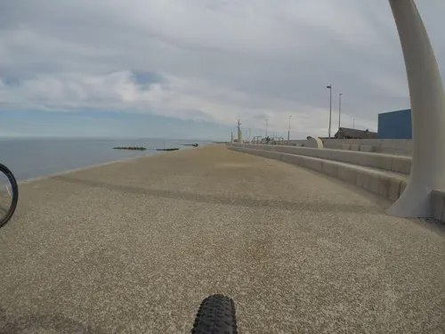
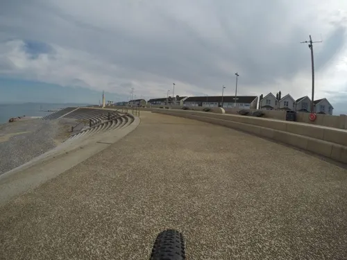
Children's Corner
Monument and historic site
Amusement park in Cleveleys, Lancashire, England
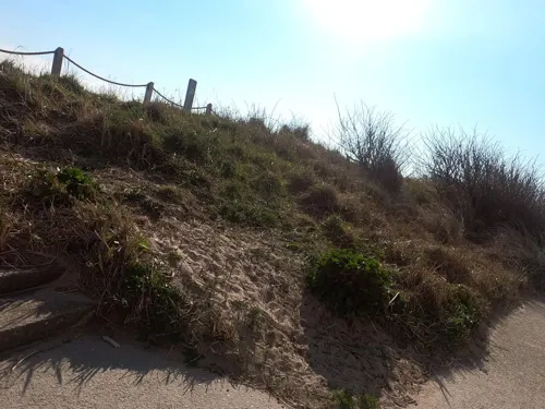
Rossall Point Observation Tower
Monument and historic site · 3.1 mi
Observation tower in Fleetwood, England


Thornton Little Theatre
Cinema and theater · 1.2 mi
Victoria Road East, Thornton-Cleveleys
Museums and landmarks5

Fylde Memorial Arboretum and Community Woodland
Monument and historic site · 2.1 mi
War memorial in the UK

Thornton-Cleveleys War Memorial
Monument and historic site · 1.3 mi
War memorial in Wyre, Lancashire, England, UK


Poulton-le-Fylde War Memorial
Monument and historic site · 2.9 mi
War memorial in Poulton-le-Fylde, Lancashire, England, UK
Parks, trails and playgrounds11

Devonshire Road Rock Gardens
Park · 1.9 mi
Park in Bispham, United Kingdom

Jean Stansfield Memorial Park
Park · 3.0 mi
Public park in Poulton-le-Fylde, Lancashire, England

Tee Time Golf Centre
Golf course · 1.1 mi
Driving range & 9 hole Pitch & Putt
Fleetwood Road, Thornton-Cleveleys
Wyre Estuary Country Park
Park · 2.5 mi
Wyre Estuary Country Park is located in Thornton-Cleveleys, Lancashire, England

Restaurants and cafes108


Meherin
Restaurant · Indian · 0.4 mi
7 Anchorsholme Lane East, Thornton-Cleveleys
Oriental Kitchen
Restaurant · Chinese · 1.2 mi
62 Fleetwood Road North, Thornton-Cleveleys


96 more on the map.
History
At the start of the Second World War, several departments of the Ministry of Pensions, the Ministry of Education and the Board of Trade were moved to the Cleveleys area. Some were housed in the Rossall School briefly. An extensive site was developed for the Ministry of Pensions in the Norcross section of Carleton and all the government departments moved out in 1940.
On 1 February 2008, the MS Riverdance ferry, while undertaking a regular sailing from Northern Ireland to Heysham under severe stormy conditions, ran aground on Anchorsholme beach, close to the boundary with Cleveleys
From the History section of Cleveleys on Wikipedia, under CC BY-SA 4.0.
Notable people from Cleveleys
 Chris PattenBritish politician and colonial administrator (born 1944)Photo: Roger Harris, CC BY 3.0
 Lucy FallonBritish actressPhoto: Phil Clayton, CC BY 2.0
- David DemaineFootballer (born 1942)
Born in Cleveleys, according to Wikidata (CC0). Each name links to its Wikipedia article.
Where to stay4
Britannia Norbreck Castle Hotel
Motel and hotel · 1.4 mi
Queen's Promenade, Blackpool
Churches and places of worship25
Shopping13
Smiths Equipment Hire
Hardware store · 0.8 mi
245 Fleetwood Road, Thornton-Cleveleys
Gas and EV charging2
Schools, colleges and libraries16
Sacred Heart Catholic Primary School
School · Roman Catholic · 1.3 mi
Heys Street, Thornton-Cleveleys
Healthcare6
Alliance Pharmacy
Clinic and pharmacy · 1.1 mi
108 Fleetwood Road North, Thornton-Cleveleys
Cleveleys Health Centre Pharmacy Ltd.
Clinic and pharmacy
Kelso Avenue, Thornton-Cleveleys
Map of Cleveleys
195 places. The map loads OpenStreetMap tiles when you open it.
Getting there and nearby towns
Blackpool Airport (BLK) is the nearest airport with scheduled flights listed in OpenStreetMap, 7 miles away.
- Fleetwood 4 mi north, about 6 min by car
- Blackpool 4 mi south, about 7 min by car
- Poulton-le-Fylde 4 mi southeast, about 6 min by car
- Heysham 13 mi northeast, about 21 min by car
- Preston 16 mi southeast, about 25 min by car
- Formby 22 mi south, about 36 min by car
- Ormskirk 22 mi south, about 36 min by car
- Ulverston 22 mi north, about 36 min by car
- Blackburn 24 mi east, about 39 min by car
- Maghull 25 mi south, about 41 min by car
Drive times are estimates from straight-line distance, not routes.
Towns near Cleveleys


Keep exploring
Local news
Headlines from INDB.
Reviews, tips and questions
Loading what members have shared...
Sources and licences
- GeoNames (CC BY 4.0): population, coordinates, regions and time zone
- Mapillary (see each image): photos
- OpenStreetMap contributors (ODbL 1.0): places, airports, map data
- Wikidata (CC0 1.0): elevation, founding date, time zone, website, landmarks and historic places
- Wikimedia Commons (see each image): photos
- Wikipedia (CC BY-SA 4.0): overview and history text
Photo credits
- Victoria Road West, Cleveleys - DSC06528, Rept0n1x, CC BY-SA 3.0
- Fylde Memorial Arboretum 298, RHaworth, CC BY-SA 3.0
- War Memorial, Thornton-Cleveleys, Gerald England, CC BY-SA 2.0
- Bispham Rock Gardens01, Tangerines at English Wikipedia, Public domain
- St John's Church, Poulton-le-Fylde, Belovedfreak, CC BY-SA 3.0
- St Chad's Church, Poulton-le-Fylde from south, Belovedfreak, CC BY-SA 3.0
- Fleetwood - Mar 2008 - St May's RC Church, Lord St, Stevew2022, CC BY-SA 3.0
- Fleetwood - Mar 2008 - St Nicholas Church, Broadway, Stevew2022, CC BY-SA 3.0
- BisphamParishChurch01, Tangerines at English Wikipedia, Public domain
- NCH With Tram, Norbreckcastle, CC BY-SA 3.0
- Marsh Mill 2023, Seasider53, CC BY-SA 4.0
- Vehicles in the United Kingdom 121, Steven's Transport Photos, CC BY 2.0
- Vehicles in the United Kingdom 119, Steven's Transport Photos, CC BY 2.0
- Street-level photo, mfk, CC BY-SA 4.0
- Street-level photo, emr, CC BY-SA 4.0
- Street-level photo, mfk, CC BY-SA 4.0
- Street-level photo, tonys999, CC BY-SA 4.0
- Street-level photo, emr, CC BY-SA 4.0


Page built November 10, 2026. Spotted a mistake? Tell us or suggest a place.