


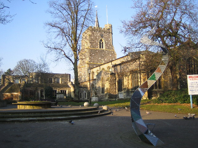
Croxley Green, United Kingdom
Croxley Green is a town of 13,500 people in England, United Kingdom.
Why visit Croxley Green
Townapedia lists 9 museums and landmarks, 20 parks and trails, 56 places to eat, 1 place to stay and 2 attractions in and around town.
Highlights include Watford Palace Theatre, Woodward Chartered Surveyors, Museum of Watford and Moor Park Golf Club.
Weather in Croxley Green
Forecast from MET Norway (CC BY 4.0). Full forecast
About Croxley Green
Croxley Green is both a village and a suburb of Rickmansworth in Hertfordshire, England. It is also a civil parish. Located on the A412 between Watford to the northeast and Rickmansworth to the southwest, it is approximately 20 miles (32 km) northwest of central London. It purportedly has the longest village green in England with a length of 1,207.5 metres.
From the Wikipedia article Croxley Green (this version), under CC BY-SA 4.0.
Things to do2
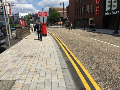
Watford Palace Theatre
Cinema and theater · 2.8 mi
Theatre and cinema in Watford, Hertfordshire, England, UK

Museums and landmarks9

Woodward Chartered Surveyors
Monument and historic site · 0.7 mi
Listed building next to Batchworth Lock
99 Church Street, Rickmansworth
Mo-Fr 09:00-18:00

Museum of Watford
Museum · 2.7 mi
Local museum in Hertfordshire, United Kingdom

Watford Peace Memorial
Monument and historic site · 2.7 mi
Memorial in Watford, Hertfordshire, England, UK


Parks, trails and playgrounds20

Moor Park Golf Club
Golf course · 0.4 mi
18 hole Par 72 High course & 18 hole Par 69 West Course (WD3 1QL for SATNAV)
Open in Google Maps · Wikipedia · +44 1923 774 113;+44 1923 721 650;+44 1923 773 146

Cassiobury Park
Park · 2.3 mi
Park in Watford, Hertfordshire, England, UK


Prestwick Road Meadows
Park · 2.9 mi
Local Nature Reserve in South Oxhey, Hertfordshire, England, UK

Rickmansworth Aquadrome
Park · 1.2 mi
Park and nature reserve in Hertfordshire, England, UK



Chorleywood Common
Park · 3.0 mi
Nature reserve in Hertfordshire, England
8 more on the map.
Restaurants and cafes56

The Feathers Pub
Bar and pub · 0.8 mi
34 Church Street, Rickmansworth
Mo-We 12:00 - 23:00; Th-Sa 12:00-24:00; Su 12:00-22:30

The Pennsylvanian
Bar and pub · 0.9 mi
115-117 High Street, Rickmansworth
Mo,Tu,We,Th 08:00-24:00; Fr,Sa 08:00-25:00; Su 08:00-22:30

Amicis Cafe
Cafe · Coffee Shop, Italian, Sandwich · 1.5 mi
53 Baldwins Lane, Rickmansworth
Mo-Fr 08:00-17:00
Crazy Goat Coffee & Deli
Cafe · Coffee Shop · 1.0 mi
141 New Road, Rickmansworth
Mo-Fr 08:00-15:30; Sa 09:00-15:30; Su 09:00-14:30

Tukka Thai
Restaurant · Thai · 1.5 mi
15 Moneyhill Parade, Rickmansworth
Mo off; Tu,We,Fr,Sa 16:00-22:30; Th 16:00-22:00; Su 14:00-22:00
Woks Cookin
Restaurant · Chinese · 1.5 mi
157 Uxbridge Road, Rickmansworth
Mo off; Tu-Th,Su 17:00-22:30, Fr,Sa 12:00-14:00,17:00-23:00
Anchor Tap & Bottle
Bar and pub · 1.0 mi
142 Watford Road, Rickmansworth
Mo-Th 15:00-23:00; Fr 14:00-23:30; Sa 12:00-23:30; Su 12:00-22:30
Caffè Nero
Cafe · Coffee Shop · 1.0 mi
80 High Street, Rickmansworth
Mo-Sa 07:00-19:00; Su 09:00-17:00
44 more on the map.
History
In 1830, John Dickinson built Croxley Mill adjacent to the Grand Junction Canal, since 1929 part of the Grand Union Canal. John Dickinson Stationery produced Croxley Script. Dickinson Square and Dickinson Avenue are named after the paper mill owner and contain houses built by the company for their workers at the end of the 19th century. The mill closed in 1980.
Croxley Green was historically part of the parish of Rickmansworth, which was included in the Watford Poor Law Union from 1835. When sanitary districts were created in 1872, the parish of Rickmansworth, including Croxley Green, therefore became part of the Watford Rural Sanitary District, which in turn became Watford Rural District in 1894.
Croxley Green became part of Rickmansworth Urban District on its creation on 15 April 1898. On 1 April 1974, the urban district was abolished and the village became part of the Three Rivers District. The civil parish of Croxley Green was created on 1 April 1986, covering the eastern part of the former Rickmansworth Urban District and an adjoining area transferred from the parish of Sarratt.
From the History section of Croxley Green on Wikipedia, under CC BY-SA 4.0.
Notable people from Croxley Green
- Micky BenningAssociation football player and manager, and later a businessman (1938-2019)
Born in Croxley Green, according to Wikidata (CC0). Each name links to its Wikipedia article.
Where to stay1
Churches and places of worship13
Shopping10
Gas and EV charging3
Schools, colleges and libraries17
St Mary's Rickmansworth Church of England Primary School
School · Anglican · 1.1 mi
Stockers Farm Road, Rickmansworth
Healthcare7
Map of Croxley Green
138 places. The map loads OpenStreetMap tiles when you open it.
Getting there and nearby towns
RAF Northolt (NHT) is the nearest airport with scheduled flights listed in OpenStreetMap, 6 miles away.
- Rickmansworth 1 mi west, about 2 min by car
- Northwood 2 mi southeast, about 3 min by car
- Watford 3 mi northeast, about 4 min by car
- Pinner 4 mi southeast, about 6 min by car
- Ruislip 4 mi south, about 7 min by car
- Ickenham 5 mi south, about 8 min by car
- Harrow Weald 5 mi east, about 8 min by car
- Harrow 6 mi southeast, about 10 min by car
- Northolt 7 mi southeast, about 11 min by car
- Harrow on the Hill 7 mi southeast, about 11 min by car
Drive times are estimates from straight-line distance, not routes.
Towns near Croxley Green


Keep exploring
Local news
Headlines from INDB.
Reviews, tips and questions
Loading what members have shared...
Sources and licences
- GeoNames (CC BY 4.0): population, coordinates, regions and time zone
- Mapillary (see each image): photos
- OpenStreetMap contributors (ODbL 1.0): places, airports, map data
- Wikidata (CC0 1.0): elevation, founding date, time zone, website, landmarks and historic places
- Wikimedia Commons (see each image): photos
- Wikipedia (CC BY-SA 4.0): overview and history text
Photo credits
- Watford Town Hall (19716814084), Matt Brown from London, England, CC BY 2.0
- Watford Peace Memorial, Matt Brown from London, England, CC BY 2.0
- Cassiobury Park 012, Panhard, CC BY 2.5
- Oxhey Woods 3, Dudley Miles, CC BY-SA 3.0
- Prestwick Road Meadows 4, Dudley Miles, CC BY-SA 4.0
- St Mary's Church, Watford, Nigel Cox, CC BY-SA 2.0
- All Saints, Croxley Green, Hertfordshire, Hogweard, Public domain
- At Rickmansworth Aquadrome 2024 003, Photograph by Mike Peel ( www.mikepeel.net )., CC BY-SA 4.0
- Moor Park Mansion, Nigel Cox, CC BY-SA 2.0
- At London 2025 763, Photograph by Mike Peel ( www.mikepeel.net )., CC BY-SA 4.0
- St Joan of Arc School (The Elms), Rickmansworth, Hertfordshire, Elly3802, CC BY-SA 3.0
- 99 Church Street 1100875 (1), No Swan So Fine, CC BY-SA 4.0
- The Feathers Public House, Rickmansworth (1), No Swan So Fine, CC BY-SA 4.0
- St Mary's Church of England Primary School, Rickmansworth, Landsil, CC BY-SA 3.0
- Merchant Taylors' School - Superb Surroundings, Merchant Taylors' School, CC BY-SA 3.0
- Moor Park Golf Course (4336170620), Jay from UK, CC BY 2.0
- The Withey Beds 5, Dudley Miles, CC BY-SA 4.0
- GOC Chorleywood & Chess Valley 032 Chorleywood House Estate (21672031176), Peter O'Connor aka anemoneprojectors, CC BY-SA 2.0
- Street-level photo, tallguy, CC BY-SA 4.0
- Street-level photo, themadcabbie, CC BY-SA 4.0
- Street-level photo, smsm1, CC BY-SA 4.0
- Street-level photo, 4004, CC BY-SA 4.0
- Street-level photo, grkaluza, CC BY-SA 4.0


Page built November 10, 2026. Spotted a mistake? Tell us or suggest a place.