


Bellshill, United Kingdom
Bellshill is a town of 19,700 people in Scotland, United Kingdom.
Why visit Bellshill
Townapedia lists 21 museums and landmarks, 10 parks and trails, 40 places to eat, 5 places to stay and 4 attractions in and around town.
Highlights include Clyde Bridge, M&D's, Bothwell Castle and David Livingstone Centre.
Weather in Bellshill
Forecast from MET Norway (CC BY 4.0). Full forecast
About Bellshill
Bellshill (pronounced "Bells hill") is a town in North Lanarkshire in Scotland, ten miles (sixteen kilometres) southeast of Glasgow city centre and 37 mi (60 km) west of Edinburgh. Other nearby localities are Motherwell 2 mi (3 km) to the south, Hamilton 3 mi (5 km) to the southwest, Viewpark 1+1⁄2 mi (2.5 km) to the west, Holytown 2 mi (3 km) to the east and Coatbridge 3 mi (5 km) to the north.
From the Wikipedia article Bellshill (this version), under CC BY-SA 4.0.
Photos of Bellshill


Things to do4
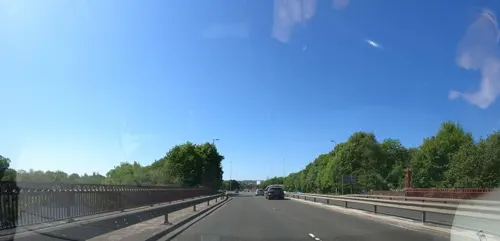
Clyde Bridge
Bridge · 2.3 mi
Bridge between North and South Lanarkshire, Scotland, UK, carries the A723 road across River Clyde

M&D's
Monument and historic site · 1.5 mi
Theme park in Motherwell, Scotland, UK

Museums and landmarks21

Bothwell Castle
Monument and historic site · 3.1 mi
Castle in South Lanarkshire, Scotland, UK

David Livingstone Centre
Museum · 2.8 mi
Category A listed building in South Lanarkshire, Scotland, UK

Hamilton Mausoleum
Monument and historic site · 2.4 mi
Mausoleum in South Lanarkshire, Scotland, UK

Low Parks Museum
Museum · 2.7 mi
Museum in Hamilton, Scotland, United Kingdom
Bothwellhaugh Roman Fort
Monument and historic site · 1.6 mi
Architectural structure in North Lanarkshire, Scotland, UK
Memorial to the Spanish Civil War
Monument and historic site · 2.3 mi
Memorial in Motherwell, Scotland, UK

North Lanarkshire Heritage Centre
Museum · 2.0 mi
Scottish museum and heritage centre, United Kingdom
Summerlee Iron Works
Monument and historic site · 3.4 mi
Demolished 19th century iron works
Pillars
Monument and historic site · 1.2 mi
Pillars from Orbiston House Entrance (c.1800)
9 more on the map.
Parks, trails and playgrounds10

Strathclyde Country Park
Park · 1.3 mi
Country park in Lanarkshire, Scotland





Restaurants and cafes40

Carter's Cafe
Cafe · Burger, Coffee Shop, Regional, Juice, Salad, Dessert, Cake, Chips · 0.8 mi
Unit 40 Evans Business Centre, Belgrave Street, Bellshill


28 more on the map.
History
The earliest record of Bellshill's name is handwritten on a map by Timothy Pont dated 1596; the letters are difficult to distinguish. It's possible that it reads Belſsill with the first s being an old-fashioned long s. The site is recorded as being east of "Vdinſtoun" and north of "Bothwel-hauch" (which confusingly is above "Orbeſton" on Pont's map). The name can also been seen on a map, which was derived from Pont's work, made by the Dutch cartographer Joan Blaeu; he calls the place "Belmil". The village consisted of a row of quarry workers' houses owned by a Mr. Bell, who owned a stone quarry to the south of Belmill. Charles Ross's map of 1773 has "Belsihill" marked north of Crosgates and Orbiston.
About 1810, this new settlement took on the name Bellshill and continued to grow. It absorbed nearby villages such as Nesnas, Black Moss and Sykehead. Bellshill was on the road which linked Glasgow and Edinburgh.
Read more of the history
According to the first Statistical Account, in the late 1700s the parish of Bothwell, which encompasses modern Bellshill, was a centre of hand-loom weaving with 113 weavers recorded. Some 50 colliers were listed. A hundred or so years later, these occupations had changed places in degree of importance to the area economy. With the introduction of new machinery in the mid-19th century, many cottage weavers lost their livelihood. Demand for coal to feed British industry resulted in expansion that by the 1870s, produced 20 deep pits operating in the area.
The first mine to open (and the last to close in 1953) was the Thankerton mine. Others followed swiftly and rapidly increased the size of the town, attracting a steady stream of immigrant workers from abroad, particularly from Ireland and Lithuania. The town is sometimes referred to as 'Little Lithuania' because of these immigrants. (Historically it was called 'Little Poland', as contemporary evidence shows locals did not work to distinguish incomers' backgrounds). Factors adversely affecting integration for the first generation of these 'new Scots' included a language barrier, minority religion (most were Catholic), and hostility based on suspicion that they were taking jobs, by accepting lower wages and being used to break strikes. – Lithuanians in Bellshill and elsewhere tended to identify more closely with the Irish communities of each town, who had similar issues.
The rise in the migrant population (though severely lessened by the political changes following the First World War and subsequent Russian Revolution, which adversely affected the status of Lithuanians both in their homeland and in Britain) resulted in their opening The Scottish Lithuanian Recreation and Social Club on Calder Road in the Mossend area. Gradually Lithuanian culture has faded over the decades, as families have assimilated into Scottish life. Younger generations sometimes are unaware of their family's history, also because of intermarriage, name changes and anglicisation of distinctive surnames (either voluntarily or by obligation).
Among the most famous of the descendants of this community was footballer Billy McNeill of Celtic and Scotland. Other mid-20th century players of Lithuanian heritage included Andy Swallow, Alex Millar, Matt Balunas, and John Jack.
Iron and steel production were also central to the development of the town through the 19th century. J. B. Neilson, developer of the revolutionary 'hot blast' process, opened the first iron works in the area (Mossend Iron Works) in 1839.
During the industrial boom there were a number of railway stations, including Mossend, Fallside and Bell Cross. The settlement is now served solely by Bellshill railway station.
Maternity services were provided at Bellshill Maternity Hospital until the hospital was closed in 2001. According to a report by the Halifax Building Society, in the first quarter of 2005 Bellshill was the UK's property hot spot with a 46% rise in house prices. This took the average property price to £105,698 (according to reports published April 2005). Reflecting an increase in new Muslim immigrant populations from east Asia, in 2006, a new mosque was opened in the Mossend area of Bellshill. It has become one of the largest mosques in Scotland.
The streetscape project, a plan to regenerate and modernise the town centre, commenced in April 2007 and was completed nearly three years later. The project, created a one-way system on the main street and provided more space for pedestrians.
From the History section of Bellshill on Wikipedia, under CC BY-SA 4.0.
More about Bellshill
Arts and culture
The Bellshill Cultural Centre has a free library. Various singers, such as Sheena Easton, and sportsmen such as Sir Matt Busby and Billy McNeill hailed from the town (a statue of McNeill at Bellshill Cross was unveiled in 2022).
Bellshill is also known for its music, especially since the mid-1980s. Bands such as the Soup Dragons, BMX Bandits, and Teenage Fanclub put Bellshill on the map as an indie rock hot-spot in Scotland. The scene – known as the Bellshill Sound or the Bellshill Beat – was celebrated by influential DJ John Peel in the Channel 4 television series Sounds Of The Suburbs. Members of the rock bands Mogwai and De Rosa are from Bellshill. Sheena Easton was also from the town, and attended Bellshill Academy.
The town has a football team, Bellshill Athletic, that plays in the West of Scotland Football League. The club won promotion to the Second Division in 2024 after finishing 3rd behind Lanark United and Lesmahagow. They play their home games at Rockburn Park. They had moved from Tollcross, Glasgow, after New Brandon Park was closed to reduce costs.
Education
Bellshill once had six primary schools, including Belvidere Primary School. This was closed in early June 2010 and has now been demolished.
Holy Family Primary School was founded in 1868. It moved to new buildings in 1907 to accommodate the influx of Lithuanian, Polish and Irish Catholics seeking work in the area. Other primary schools include Sacred Heart Primary, Mossend Primary, Noble Primary, St. Gerard's Primary, and Lawmuir Primary.
There are two fairly large secondary schools, Bellshill Academy and Cardinal Newman High School, a Catholic school.
From the Wikipedia article Bellshill, under CC BY-SA 4.0.
Notable people from Bellshill
 Robin CookBritish Labour Party politician (1946-2005)Photo: Foreign & Commonwealth Office, Attribution
 John Reid, Baron Reid of CardowanBritish politician (born 1947)Photo: ©House of Lords / photography by Roger Harris, CC BY 3.0
 Paul McGuiganScottish directorPhoto: Gage Skidmore from Peoria, AZ,..., CC BY-SA 2.0
 Lee McCullochScottish association football manager (born 1978)Photo: Alasdair Middleton, CC BY 2.0
 Aminatta FornaScottish and Sierra Leonean writerPhoto: Jürgen Matern, CC BY-SA 3.0
- David MacMillanBritish chemist (1968-)
- Matt BusbyScottish football player and manager (1909–1994)
- Ally McCoistScottish association football player and manager (born 1962)
- Sheena EastonScottish singer (born 1959)
- Phil O'DonnellScottish association football player (1972-2007)
- Billy McNeillScottish footballer and manager (1940-2019)
- Stephen O'DonnellScottish association football player
Born in Bellshill, according to Wikidata (CC0). Each name links to its Wikipedia article.
Where to stay5
Churches and places of worship10
Shopping6
Gas and EV charging5
Schools, colleges and libraries14
Healthcare4
New Stevenston Pharmacy
Clinic and pharmacy · 1.5 mi
Clydesdale Street, New Stevenston
Map of Bellshill
119 places. The map loads OpenStreetMap tiles when you open it.
Getting there and nearby towns
Glasgow Airport (GLA) is the nearest airport with scheduled flights listed in OpenStreetMap, 17 miles away.
- Mossend 1 mi east, about 1 min by car
- Motherwell 2 mi southeast, about 3 min by car
- Coatbridge 3 mi north, about 5 min by car
- Hamilton 4 mi south, about 6 min by car
- Meikle Earnock 5 mi south, about 7 min by car
- Wishaw 5 mi southeast, about 8 min by car
- Cambuslang 6 mi west, about 9 min by car
- Larkhall 6 mi south, about 10 min by car
- East Kilbride 7 mi southwest, about 12 min by car
- Rutherglen 8 mi west, about 12 min by car
Drive times are estimates from straight-line distance, not routes.
Towns near Bellshill


Keep exploring
Local news
Headlines from INDB.
Reviews, tips and questions
Loading what members have shared...
Sources and licences
- GeoNames (CC BY 4.0): population, coordinates, regions and time zone
- Mapillary (see each image): photos
- OpenStreetMap contributors (ODbL 1.0): places, airports, map data
- Wikidata (CC0 1.0): elevation, founding date, time zone, website, landmarks and historic places
- Wikimedia Commons (see each image): photos
- Wikipedia (CC BY-SA 4.0): overview and history text
Photo credits
- St Andrew s Church, Iain Thompson, CC BY-SA 2.0
- 05906 Central Church of Scotland, Bellshill 005, WeeHolly, CC BY-SA 4.0
- 05906 Central Church of Scotland, Bellshill 006, WeeHolly, CC BY-SA 4.0
- 05906 Central Church of Scotland, Bellshill 001, WeeHolly, CC BY-SA 4.0
- 05906 Central Church of Scotland, Bellshill 008, WeeHolly, CC BY-SA 4.0
- 05906 Central Church of Scotland, Bellshill 004, WeeHolly, CC BY-SA 4.0
- 05906 Central Church of Scotland, Bellshill 002, WeeHolly, CC BY-SA 4.0
- 05906 Central Church of Scotland, Bellshill 003, WeeHolly, CC BY-SA 4.0
- 05906 Central Church of Scotland, Bellshill 009, WeeHolly, CC BY-SA 4.0
- 05906 Central Church of Scotland, Bellshill 007, WeeHolly, CC BY-SA 4.0
- Bothwell Castle 20080505 - south-east tower, Otter, CC BY-SA 3.0
- David Livingstone Centre, Blantyre, Kim Traynor, CC BY-SA 4.0
- Hamilton Mausoleum Interior, Supergolden, CC BY-SA 3.0
- LowParksMuseum, Supergolden, CC BY-SA 3.0
- Strathclyde Park, No machine-readable author provided. Supergolden assumed (based on copyright claims)., CC BY-SA 3.0
- Old Parish Church Hamilton, Unknown author, CC BY-SA 2.5
- Hamilton Bandstand 1912, Graemedick, CC BY-SA 4.0
- File 24-06-2016, 19 43 37, Alanmathew78, CC BY-SA 4.0
- Gothic Arch Corbel, Alanmathew78, CC BY-SA 4.0
- Gothic Pillar Capital, Alanmathew78, CC BY-SA 4.0
- Street-level photo, hobgoblin, CC BY-SA 4.0
- Street-level photo, recklessxpy, CC BY-SA 4.0
- Street-level photo, marscot, CC BY-SA 4.0
- Street-level photo, recklessxpy, CC BY-SA 4.0


Page built November 10, 2026. Spotted a mistake? Tell us or suggest a place.