


Rutherglen, United Kingdom
Rutherglen is a town of 30,950 people in Scotland, United Kingdom.
Why visit Rutherglen
Townapedia lists 37 museums and landmarks, 32 parks and trails, 80 places to eat, 2 places to stay and 27 attractions in and around town.
Highlights include Albert Bridge, Alhambra Theatre Glasgow, Scottish Football Museum and Centre for Contemporary Arts.
Weather in Rutherglen
Forecast from MET Norway (CC BY 4.0). Full forecast
About Rutherglen
Rutherglen (; Scots: Ruglen, Scottish Gaelic: An Ruadh-Ghleann) is a town in South Lanarkshire, Scotland, immediately south-east of Glasgow, three miles (five kilometres) from the city. The town is directly south of the River Clyde. Having previously existed as a separate Lanarkshire burgh, in 1975 Rutherglen lost its own local council and administratively became a component of the City of Glasgow District within the Strathclyde region (along with neighbouring Cambuslang). In 1996 the towns were reallocated to the South Lanarkshire council area.
From the Wikipedia article Rutherglen (this version), under CC BY-SA 4.0.
Travel tips from other travellers: Rutherglen on Wikivoyage (CC BY-SA 4.0).
Photos of Rutherglen


Things to do27


Alhambra Theatre Glasgow
Cinema and theater · 2.8 mi
Former theatre in Glasgow, Scotland, UK

Britannia Music Hall
Cinema and theater · 2.3 mi
Theatre in Glasgow, Scotland

Caledonian Railway Bridge
Bridge · 2.6 mi
Bridge in Glasgow, Scotland, UK, carries all rail lines serving Glasgow Central Stations, across River Clyde

Citizens Theatre
Cinema and theater · 2.1 mi
Theatre in Glasgow, Scotland, UK

City Union Bridge
Bridge · 2.2 mi
Railway bridge in Glasgow City, Scotland, UK, carries the City Union Line across River Clyde

Clyde Arc
Bridge · 3.3 mi
Bridge in Glasgow, Scotland, UK, carries a minor road across River Clyde

George V Bridge
Bridge · 2.6 mi
Bridge in Glasgow, Scotland, UK, carries the A77 road across River Clyde

Glasgow Bridge
Bridge · 2.5 mi
Bridge in Glasgow, Scotland, UK, carries the A77 road across the River Clyde

Glasgow Empire Theatre
Cinema and theater · 2.9 mi
Former theatre in Glasgow, Scotland, UK
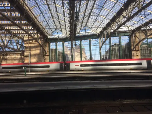
Hielanman's Umbrella
Bridge · 2.7 mi
Glass-walled railway bridge carrying platforms of Glasgow Central station across Argyle Street, Scotland, UK

Glasgow Gaiety Theatre
Cinema and theater · 2.7 mi
Former cine-theatre in Anderston Cross, Glasgow, Scotland, UK
15 more on the map.
Museums and landmarks37


Centre for Contemporary Arts
Museum · 3.2 mi
Arts centre in Glasgow, Scotland, UK

Gallery of Modern Art
Museum · 2.6 mi
Art museum in Glasgow, Scotland, United Kingdom

Glasgow Cenotaph
Monument and historic site · 2.6 mi
War memorial in Glasgow, Scotland, UK

Glasgow Women's Library
Museum · 2.3 mi
Library in Glasgow, Scotland, United Kingdom

National Piping Centre
Museum · 3.1 mi
Museum in Glasgow City, Scotland, UK

Nelson Monument
Monument and historic site · 1.9 mi
Monument in Glasgow City, Scotland, UK

People's Palace
Museum · 1.8 mi
Museum and glasshouse in Glasgow Green, Glasgow, Scotland, United Kingdom

Provand's Lordship
Museum · 2.5 mi
Historic house museum in Glasgow, Scotland, United Kingdom

Scotland Street School Museum
Museum · 2.7 mi
Museum in Glasgow, Scotland, United Kingdom

Glasgow Print Studio
Museum · 2.3 mi
Not-for-profit arts organization in Glasgow City, Scotland, UK
Heatherbank Museum of Social Work
Museum · 3.0 mi
Former stand alone museum now part of Glasgow Caledonian University
25 more on the map.
Parks, trails and playgrounds32


Alexandra Park, Glasgow
Park · 2.6 mi
Urban park in Glasgow, Scotland, UK


Sir Chris Hoy Velodrome
Sports field and stadium · 1.3 mi
1000 London Road, Glasgow




Holmhills Community Park
Park · 2.0 mi
Park in Cambuslang, South Lanarkshire, Scotland, UK
20 more on the map.
Restaurants and cafes80
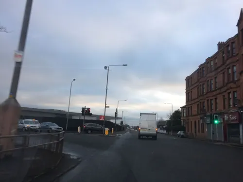
The Real McCoy
Bar and pub · 1.4 mi
1281 London Road, Glasgow
Su-Mo 11:00-23:00; Fr-Sa 11:00-23:59


Hamptons
Cafe · Brunch · 0.9 mi
9 Kingsheath Avenue, Glasgow
Tu-Sa 09:00-16:00;Su 09:00-15:00

Dino's Sweets and Treats
Cafe · Ice Cream, Dessert · 1.5 mi
7 Buchanan Drive, Cambuslang
68 more on the map.
History
By tradition, Rutherglen is said to have received its Royal Burgh status in 1126 by a Royal Charter from King David I of Scotland, who reigned from 1124 to 1153.
Read more of the history
However, a factual analysis of the state of knowledge, would conclude that there is no evidence that David I granted Royal Burgh status, nor granted it by a charter. That David I did probably grant Rutherglen some trading or even burghal status, is evidence by a William I charter granted sometime during the period 1179-1189. Thus, the only tenable conclusion is that sometime during David I's reign (1124-1153) he granted some form of privileges to Rutherglen, but not necessarily in 1126. Indeed, had such a royal burgh charter been granted for Rutherglen by David I, then the William I renewal of Rutherglen's status should proceed in standardised terms of ratifying any earlier charter, but instead it was worded to grant it anew, in greater solemnity with burghal status, and not only to embody it in a charter but also to identify its jurisdictional marches, which would be an unnecessary step if the charter had been intended to represent a ratification or renewal of any previous charter of erection. Important in this regard is the phrasing evidenced in the William I charter - et hac carta mea confirmasse. Thus, the William I charter implicitly represents the granting of a new status and it even contains a description of the trading boundary to flesh out the nature of this status. It has been well demonstrated that as none of Scotland’s Royal Burghs have documented evidence of charters from the period of David I, then they were all erected purely by word-of-mouth, without any charter. Generally, it has been believed that charters for such burghs were avoided because they all shared a sort of common constitution enshrined in Leges Burgorum, and so the only step the king had to take for new burghs, was simply to declare that locality was part of a longer list.
The sole origin of the relatively modern claim that Rutherglen was founded as a royal burgh in 1126, is traceable to a Scottish Parliamentary Roll entry dated 30 May 1661. This proceeds upon a supplication to the Parliament, made by a burghal clerk on behalf of the Provost, Baillies and Council of Rutherglen, claiming that the town was erected a ‘frie burgh by King David in the yeer 1126’. This supplication involved the Burgh’s plea for permission to increase their number of fairs in order to compete with the greater competition of the adjacent Royal Burgh of Glasgow. Their ‘antient Royall burgh’ of Rutherglen, they contended, was falling into decay and ruin as a consequence of Glasgow’s attraction. The clerk, in stating the alleged foundation year of 1126, lent no support to the supplication. In this context it appears like an overstatement to try and achieve a goal. Of course, the concept of a ‘free burgh’ undermines the authority further still because such a grant classification did not exist until 1200, and even then only in England. Problems like these can be deliberate or accidental, but in the latter exists the possibility that the year of founding was misdated, as was quite common at that time. Indeed, in two confirmation charters for Lanark’s Royal Burgh in the 1500s and 1600s make reference to the wrong king in terms of the period in which the charter was granted. As such, the claim of 1126 as the burgh's foundation date, is not only very late attested, but is also expressed in a context of agendas and commonplace historiographical mistakes. As such, there is no evidence that Rutherglen received Royal Burgh status in 1126, just that it received some form of trading rights sometime during David I's reign, and probably not by means of a charter. 1126 remains possible, but there is no evidence to encourage its likelihood.
Rutherglen Royal Burgh gradually diminished in importance as neighbouring Glasgow grew in power and size, although the establishment of other Royal Burghs at Ayr, Dumbarton, and indeed Lanark, may have contributed to this decline. By tradition, the masons who built Glasgow Cathedral are said to have lodged in Rutherglen, although this same tradition calls them Picts and suggests they travelled to the Cathedral site by a subterranean passage, which raises great credibility concerns.
In the 14th century Walter Stewart, father of King Robert II, was granted Farme Castle. This was located close to Farme Cross in the north of Rutherglen, and stood until the 1960s.
Rutherglen Castle, located to the north of the town's Main Street today, was occupied by an English garrison during the struggle between John Balliol and Robert Bruce for the Scottish crown. It was besieged by Robert the Bruce in 1309 and eventually came into Scottish possession in 1313. It was destroyed by Regent Murray after the Battle of Langside with the stones used for other buildings, and no trace remaining.
Rutherglen was a centre of heavy industry, having a long coal mining tradition which died out by 1950. In the 18th century, barges carried coal from Rutherglen to Greenock almost every day. A small shipyard, T.B. Seath & Co., was in operation on the Clyde at the northern edge of the town for several decades. The Clydebridge Steelworks, situated between Rutherglen and Cambuslang, began operating in the 1880s and employed thousands by the mid-20th century, but the workforce dwindled to a few dozen by the 20th century and now only refines steel produced elsewhere. J & J White Chemicals (later ACC Chrome & Chemicals) in Shawfield, which was in existence from 1820 to 1967, produced more than 70 per cent of the UK's chromate products including chromic acid, chromic oxide pigment, sodium and potassium chromate and dichromate. Today there is a significant legacy of soluble chromium (VI) waste in the area.
From the History section of Rutherglen on Wikipedia, under CC BY-SA 4.0.
More about Rutherglen
Geography
Since being granted Royal Burgh status by King David I in the 12th century, Rutherglen has grown considerably from its origins as little more than a single street, and although growth has been hampered to some extent by the proximity of the river Clyde to the north, the encroaching Glasgow urban sprawl to the west and the boundary with neighbouring Cambuslang to the east, it now covers a much larger area than its ancient parish boundaries. Historic areas near the Main Street such as Bankhead, Burnhill and Gallowflat have changed greatly over the decades, with the Farme Cross and Shawfield areas mostly occupied by industry of various types; the expansion of the village of Burnside (which falls under the Rutherglen boundary but has its own Community Council) to share a single suburban settlement with its larger neighbour, and the construction after World War II of peripheral housing schemes on land surrounding Burnside which had been either farms or rural estates (Blairbeth, Cathkin, Eastfield, Fernhill, Spittal and Springhall) have given the town a frequently changing character.
Education
Loch Primary and Cathkin Primary are feeder schools for Cathkin High School (built in 1970, rebuilt in 2008), which is located at Whitlawburn just outside the Rutherglen boundaries and is primarily the secondary school for Cambuslang. Conversely, two schools located in Cambuslang (James Aiton and Park View) are feeders for Stonelaw High in Rutherglen, along with Bankhead, Burgh, Burnside, Calderwood and Spittal Primaries within the burgh.
Trinity High (to which St Anthony's, St Mark's and St Columbkille's Primaries are affiliated) is the only Catholic secondary school for both towns, as is the case for Rutherglen High School, the local Additional Support Needs facility which shares a campus with Cathkin High.
All council-run schools in the South Lanarkshire area were rebuilt between the late 1990s and 2010s.
Bankhead Primary School, Bankhead Road, Rutherglen, G73 2BQ (310)
Burgh Primary School, 41 King Street, Rutherglen, G73 1JY (180)
Burnside Primary School, Glenlui Avenue, Burnside, Rutherglen, G73 4JE (378)
Calderwood Primary School, Buchanan Drive, Rutherglen G73 3PQ (435)
Cathkin Primary School, Burnside Road, Rutherglen, G73 4AA (194)
Loch Primary School, Lochaber Drive, Springhall, Rutherglen, G73 5HX (203)
Spittal Primary School, Lochlea Road, Spittal, Rutherglen G73 4QJ (151)
Stonelaw High School, 140 Calderwood Road, Rutherglen, G73 3BP (1248)
From the Wikipedia article Rutherglen, under CC BY-SA 4.0.
Notable people from Rutherglen
 Kenny McLeanScottish association football player (born 1992)Photo: Bryan Berlin, CC BY-SA 4.0
 Richard RankinScottish actorPhoto: Gage Skidmore, CC BY-SA 3.0
 Bobby MurdochScottish football player (1944–2001)Photo: Archivo Histórico, Public domain
 Lee Gibsonassociation football player (born 1991)Photo: Steffen Prößdorf, CC BY-SA 4.0
 Craig BrysonScottish footballer (born 1986)Photo: Alasdair Middleton from Rothesay,..., CC BY 2.0
 Duncan WeirScottish rugby union playerPhoto: Reuben Gray from Ireland, CC BY 2.0
 Archie JacksonAustralian cricketer (1909-1933)Photo: Fairfax Corporation, Public domain
 Brian McLeanScottish footballer (born 1985)Photo: Alasdair Middleton from Rothesay, Scotland, CC BY 2.0
- Robbie ColtraneScottish actor (1950–2022)
- Aiden McGeadyIrish association football player (born 1986)
- William Gemmell CochranBritish / American statistician (1909–1980)
- Declan GallagherScottish association football player
Born in Rutherglen, according to Wikidata (CC0). Each name links to its Wikipedia article.
Where to stay2
Churches and places of worship44
Caledonia Road United Presbyterian Church, 1 Caledonia Road, Glasgow
Church · 2.0 mi
Camphill Queen's Park Church, 20 Balvicar Drive, Glasgow
Church · 2.3 mi
Collegiate Church of the Blessed Virgin Mary and St Anne, Glasgow
Church · 2.3 mi
Adelaide Place Baptist Church, 188 Pitt Street, Glasgow
Church · 3.2 mi
Cathcart Old Parish Church and Hall, Carmunnock Road, Glasgow
Church · 1.7 mi
Cathcart South Church, 90-92 Clarkston Road, Glasgow
Church · 2.2 mi
Shopping9
Gas and EV charging11
Schools, colleges and libraries30
Healthcare6
Map of Rutherglen
250 places. The map loads OpenStreetMap tiles when you open it.
Getting there and nearby towns
Glasgow Airport (GLA) is the nearest airport with scheduled flights listed in OpenStreetMap, 9 miles away.
- Cambuslang 2 mi southeast, about 4 min by car
- Glasgow 3 mi northwest, about 5 min by car
- Carmunnock 3 mi south, about 4 min by car
- Wishaw 12 mi east, about 20 min by car
- Whitburn 21 mi east, about 33 min by car
- Stirling 23 mi northeast, about 37 min by car
- Saltcoats 26 mi southwest, about 42 min by car
- Troon 26 mi southwest, about 42 min by car
- Edinburgh 40 mi east, about 1 h by car
- Tranent 49 mi east, about 1 h 15 min by car
Drive times are estimates from straight-line distance, not routes.
Towns near Rutherglen


Keep exploring
Local news
Headlines from INDB.
Reviews, tips and questions
Loading what members have shared...
Sources and licences
- GeoNames (CC BY 4.0): population, coordinates, regions and time zone
- Mapillary (see each image): photos
- OpenStreetMap contributors (ODbL 1.0): places, airports, map data
- Wikidata (CC0 1.0): elevation, founding date, time zone, website, landmarks and historic places
- Wikimedia Commons (see each image): photos
- Wikipedia (CC BY-SA 4.0): overview and history text
Photo credits
- Rutherglen Town Hall 2016-02-28 view from west, User:BrainiacBlink, CC BY-SA 4.0
- Mercat Cross, Rutherglen 2016-02-28, User:BrainiacBlink, CC BY-SA 4.0
- Rutherglen Town Hall dance 1, John Seb Barber, CC BY 2.0
- Rutherglen Town Hall dance 2, John Seb Barber, CC BY 2.0
- 141-147 Main St, Rutherglen 2016-03-05, User:BrainiacBlink, CC BY-SA 4.0
- Rutherglen Library 2016-02-28, User:BrainiacBlink, CC BY-SA 4.0
- Rutherglen Town Hall 2016-02-28 three-quarter view from east, User:BrainiacBlink, CC BY-SA 4.0
- SLC Q&A Rutherglen - 2016-02-28, User:BrainiacBlink, CC BY-SA 4.0
- 05928 St Columbkille's Roman Catholic Church, Rutherglen 006, WeeHolly, CC BY-SA 4.0
- 05928 St Columbkille's Roman Catholic Church, Rutherglen 001, WeeHolly, CC BY-SA 4.0
- 05928 St Columbkille's Roman Catholic Church, Rutherglen 010, WeeHolly, CC BY-SA 4.0
- 05928 St Columbkille's Roman Catholic Church, Rutherglen 023, WeeHolly, CC BY-SA 4.0
- 05928 St Columbkille's Roman Catholic Church, Rutherglen 004, WeeHolly, CC BY-SA 4.0
- 05928 St Columbkille's Roman Catholic Church, Rutherglen 005, WeeHolly, CC BY-SA 4.0
- 05928 St Columbkille's Roman Catholic Church, Rutherglen 007, WeeHolly, CC BY-SA 4.0
- 05928 St Columbkille's Roman Catholic Church, Rutherglen 011, WeeHolly, CC BY-SA 4.0
- 05928 St Columbkille's Roman Catholic Church, Rutherglen 016, WeeHolly, CC BY-SA 4.0
- 05928 St Columbkille's Roman Catholic Church, Rutherglen 022, WeeHolly, CC BY-SA 4.0
- 05928 St Columbkille's Roman Catholic Church, Rutherglen 012, WeeHolly, CC BY-SA 4.0
- 05928 St Columbkille's Roman Catholic Church, Rutherglen 017, WeeHolly, CC BY-SA 4.0
- 05928 St Columbkille's Roman Catholic Church, Rutherglen 018, WeeHolly, CC BY-SA 4.0
- 05928 St Columbkille's Roman Catholic Church, Rutherglen 008, WeeHolly, CC BY-SA 4.0
- 05928 St Columbkille's Roman Catholic Church, Rutherglen 013, WeeHolly, CC BY-SA 4.0
- 05928 St Columbkille's Roman Catholic Church, Rutherglen 020, WeeHolly, CC BY-SA 4.0
- The Britannia Music Hall, Keith Edkins, CC BY-SA 2.0
- Caledonian Railway Bridge, Glasgow, Scotland 08, Michal Klajban, CC BY-SA 4.0
- 119 Gorbals Street, Citizen's Theatre 01, Stinglehammer, CC BY-SA 4.0
- City Union Bridge, Glasgow, 2018-06-30 panorama, BrainiacBlink, CC BY-SA 4.0
- Squinty Bridge (Clyde Arc), Clydiee, CC BY-SA 4.0
- George V Bridge, Glasgow, Sonictiller, CC BY-SA 4.0
- Glasgow Bridge, Glasgow, Scotland, Michal Klajban, CC BY-SA 4.0
- Glasgow Empire Theatre Sauchiehall Street about 1930, Hwyndham, CC BY-SA 4.0
- Centre for Contemporary Arts, Glasgow (34986043461), Sam Saunders from Bristol, CC BY-SA 2.0
- Gallery of Modern Art, Glasgow, front view, 2018-06-27, BrainiacBlink, CC BY-SA 4.0
- Glasgow Cenotaph, MrsEllacott, CC BY-SA 4.0
- Glasgow Green, Nelson Monument, dave souza, CC BY-SA 4.0
- People's Palace and Winter Gardens in Glasgow Green, Emmi Hakka, CC BY-SA 4.0
- Provand's Lordship 2026, TSP, CC BY 4.0
- Scotland Street School infants entrance DSCN8975, AlasdairW, CC BY-SA 4.0
- Cathkinpark, Celticfcuk ( talk ), Public domain
- Linnpark fromcastle, Zeddy ( talk ), Public domain
- Queen'sParkSnow, Raymond McCrae, CC BY 2.0
- BaronyHallPhoto, Cs104g13, CC BY-SA 4.0
- Caledonia Road Church, Glasgow, Scotland, Michal Klajban, CC BY-SA 4.0
- 20 Balvicar Drive, Camphill Queen's Park Church 01, Stinglehammer, CC BY-SA 4.0
- 71 Trongate, Tron Steeple 02, Stinglehammer, CC BY-SA 4.0
- 2018 07 19 Schottland (33), Bewahrerderwerte, CC BY-SA 4.0
- 11023 Pollokshields Church of Scotland, Pollokshields 001, WeeHolly, CC BY-SA 4.0
- GCU Campus View, Knwwsss, CC BY-SA 3.0
- Glasgow School of Art - September 2017, Stinglehammer, CC BY-SA 4.0
- Glasgow Women's Library exterior, Lirazelf, CC BY-SA 4.0
- Hampden Park (Glasgow) aerial view cropped, Dan Kearney, cropped by Blackcat, CC BY-SA 3.0
- Celtic park 2, Zhi Yong Lee from Glasgow, UK, CC BY 2.0
- Emirates Arena 05, Nicola, CC BY-SA 3.0
- Trinity High School Rutherglen, Crowsus, CC BY-SA 4.0
- Holyrood Secondary School, Glasgow, Scotland, Michal Klajban, CC BY-SA 4.0
- South Lanarkshire - Rutherglen Library - 20240729095105, Crowsus, CC BY-SA 4.0
- Bridgeton Library at Olympia, User:Laura Dolan, CC BY-SA 3.0
- Glasgow City - Walled Garden, Aikenhead House, Kings Park, 325 Carmunnock Road, Glasgow - 20140724120316, Crowsus, CC BY-SA 4.0
- AlexandraPark2024 05, Horep, CC0
- Hampden Park, Roger May, CC BY-SA 2.0
- 0 C0 01 ALHAMBRA Theatre Glasgow, Unknown author Unknown author, CC BY-SA 4.0
- Overtoun Park Bandstand, Rutherglen 2016-02-28, User:BrainiacBlink, CC BY-SA 4.0
- Albert Bridge, Glasgow, northern part viewed from the south-east, 2018-06-27, BrainiacBlink, CC BY-SA 4.0
- The National Piping Centre DSCN1883, AlasdairW, CC BY-SA 4.0
- Street-level photo, hobgoblin, CC BY-SA 4.0
- Street-level photo, zuzak, CC BY-SA 4.0
- Street-level photo, gmc, CC BY-SA 4.0
- Street-level photo, gmc, CC BY-SA 4.0
- Street-level photo, gmc, CC BY-SA 4.0
- Street-level photo, gmc, CC BY-SA 4.0
- Street-level photo, gmc, CC BY-SA 4.0
- Street-level photo, gmc, CC BY-SA 4.0
- Street-level photo, zuzak, CC BY-SA 4.0
- Street-level photo, gmc, CC BY-SA 4.0
- Street-level photo, gmc, CC BY-SA 4.0
- Street-level photo, gmc, CC BY-SA 4.0
- Street-level photo, gmc, CC BY-SA 4.0
- Street-level photo, gmc, CC BY-SA 4.0
- Street-level photo, gmc, CC BY-SA 4.0
- Street-level photo, gmc, CC BY-SA 4.0
- Street-level photo, gmc, CC BY-SA 4.0
- Street-level photo, gmc, CC BY-SA 4.0
- Street-level photo, gmc, CC BY-SA 4.0


Page built November 10, 2026. Spotted a mistake? Tell us or suggest a place.