


Cambuslang, United Kingdom
Cambuslang is a town of 30,790 people in Scotland, United Kingdom.
Why visit Cambuslang
Townapedia lists 14 museums and landmarks, 16 parks and trails, 40 places to eat, 1 place to stay and 3 attractions in and around town.
Highlights include Rutherglen Bridge, Bothwell Castle, David Livingstone Centre and Cambuslang Park.
Weather in Cambuslang
Forecast from MET Norway (CC BY 4.0). Full forecast
About Cambuslang
Cambuslang (Scots: Cammuslang, from Scottish Gaelic: Camas Lang) is a town on the south-eastern outskirts of Greater Glasgow, Scotland. With approximately 30,000 residents, it is the 27th-largest town in Scotland by population, although, never having had a town hall, it may also be considered the largest village in Scotland. It is within the local authority area of South Lanarkshire and directly borders the town of Rutherglen to the west. Historically, it was a large civil parish incorporating the nearby hamlets of Newton, Flemington, Westburn and Halfway.
From the Wikipedia article Cambuslang (this version), under CC BY-SA 4.0.
Photos of Cambuslang


Things to do3

Rutherglen Bridge
Bridge · 3.4 mi
Bridge in Glasgow, Scotland, UK, carries the A728 road across River Clyde

Museums and landmarks14

Bothwell Castle
Monument and historic site · 2.6 mi
Castle in South Lanarkshire, Scotland, UK

David Livingstone Centre
Museum · 3.1 mi
Category A listed building in South Lanarkshire, Scotland, UK
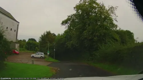
National Museum of Rural Life
Museum · 3.3 mi
National museum in South Lanarkshire, Scotland, UK



Hunter House Museum
Museum · 2.3 mi
Former museum in South Lanarkshire, Scotland, UK
Cambuslang Miners Memorial
Monument and historic site · 0.6 mi
52 Hamilton Road, Cambuslang
2 more on the map.
Parks, trails and playgrounds16


Overtoun Park
Park · 2.2 mi
Park in Rutherglen, near Glasgow, Scotland

Holmhills Community Park
Park · 0.5 mi
Park in Cambuslang, South Lanarkshire, Scotland, UK


4 more on the map.
Restaurants and cafes40



Dino's Sweets and Treats
Cafe · Ice Cream, Dessert · 1.0 mi
7 Buchanan Drive, Cambuslang
28 more on the map.
History
The local geography of Cambuslang explains a great deal of its history. It has been very prosperous over time, depending first upon its agricultural land (supplying food, then wool, then linen), then the mineral resources under its soil (limestone and coal and to some extent, iron). These were guarded by the medieval Church, and later by the local aristocracy, particularly the Duke of Hamilton (previously Barons of Cadzow and Earls of Arran).
Because of its relative prosperity, Cambuslang has been intimately concerned in the politics of the country (through the Hamilton connection) and of the local Church. Bishop John Cameron of Glasgow, and Cardinal Beaton, were both Rectors of Cambuslang. This importance continued following the Protestant Reformation. From then until the Glorious Revolution a stream of Ministers of Cambuslang came, were expelled, or were re-instated, according to whether supporters of the King, Covenanters, or Oliver Cromwell were in power. The religious movements of the 18th century, including the Cambuslang Wark, were directly linked to similar movements in North America. The Scottish Enlightenment was well represented in the person of Rev Dr James Meek, the Minister. His troubles with his parishioners foreshadowed the split in the Church of Scotland during the 19th century.
Read more of the history
The manufacturing industries that developed from the agricultural and mineral resources attracted immigrants from all over Scotland and Ireland and other European countries. Cambuslang has always benefited from its closeness to the burgeoning city of Glasgow, brought closer in the 18th century by a turnpike road then, in the 19th century, by a railway. In the 21st century, it continues to derive benefit from its proximity to Glasgow and to wider communication networks, particularly via the M74 motorway system. Its increasing (and increasingly diverse) population posed problems, over the centuries, of employment and housing as well as of schooling and health, not all of which have been solved; in this regard, it is fairly typical of most Scottish towns.
In sport, Cambuslang F.C. were founder members of the Scottish Football League whose most notable achievement was being the runners-up in the 1887–88 Scottish Cup. They folded by the early 20th century, as did Scottish Junior Cup winners Cambuslang Hibernian, but a new team Cambuslang Rangers F.C. was established and continues to this day – they enjoyed great success in the 1970s.
From the History section of Cambuslang on Wikipedia, under CC BY-SA 4.0.
More about Cambuslang
Geography
Cambuslang is located on a lengthy bend on the River Clyde, south-east of Glasgow. The town is accessible from the nearby M74; the nearby A724 links to Glasgow city centre and Hamilton; the town is also accessible by car from East Kilbride by the A725, A749 and then the B759. The town's railway station, Cambuslang, lies on the Argyle Line between central Glasgow and Lanark.
The Reverend Dr John Robertson, Minister of Cambuslang Kirk, described the Parish in the Second Statistical Account of Scotland 1845. "It is bounded by the Clyde on the north, which separates it from the Parish of Old Monkland; by the Calder on the east, which separates it from Blantyre; by part of Blantyre and Kilbryde, on the south; and by Carmunnock and Rutherglen on the west." The highest points in this low-lying Parish are Dechmont Hill (602 ft) and Turnlaw (or Turnlea) Hill (553 ft.) There are remains of an Iron Age fort on Dechmont.
Education
There is a range of schools in Cambuslang, and a history of further education colleges, although there are no longer any in the town.
Some parts of Cambuslang are within the catchment area of Stonelaw High School, which is situated in Rutherglen, the adjoining town. Uddingston Grammar School, one train stop from Cambuslang on the Motherwell via Bellshill line, includes Newton Farm Primary in its catchment.
Cambuslang College of the Building Trades was a specialist college established in the mid-twentieth century but it gradually expanded to teach other trades and academic subjects. It became Cambuslang College of Further Education in the 1960s, and went on to open a campus in East Kilbride, as well as facilities in Hamilton and Wishaw. A substantial annexe remained in Cambuslang on Hamilton Road, by now located in the former Gateside School. Reflecting its wider geographical coverage, it became South Lanarkshire College in 2000. In 2008, the Cambuslang campus closed and all South Lanarkshire College facilities were moved to a new, custom-built campus in East Kilbride.
South Lanarkshire College has links with University of the West of Scotland, Hamilton Campus, a degree-awarding higher education institution, 3 miles (5 km) away in Hamilton, so that local students can progress through to degrees.
From the Wikipedia article Cambuslang, under CC BY-SA 4.0.
Notable people from Cambuslang
 Midge UreBritish guitarist, singer, keyboard player, and songwriterPhoto: Stefan Brending ( 2eight ), CC BY-SA 3.0 de
 Mike Watson, Baron Watson of InvergowrieBritish politician (born 1949)Photo: ©House of Lords / photography by Roger Harris, CC BY 3.0
- John Claudius LoudonScottish botanist (1782-1843)
- Claudius BuchananBritish theologian
- Jimmy JacksonBritish footballer (1875–?)
- Ken CampbellScottish footballer (1892-1971)
- Archie GrayScottish footballer (1878-1950)
- John ByrneScottish footballer, born 1939
- Joseph SullivanBritish politician (1866-1935)
- James George WeirBritish aviation pioneer (1887-1973)
- Edward DonaghyAmerican soccer referee
- Billy BoydScottish footballer (1905-1967)
Born in Cambuslang, according to Wikidata (CC0). Each name links to its Wikipedia article.
Where to stay1
Churches and places of worship11
Flemington Hallside Parish Church
Church · Church Of Scotland · 0.9 mi
Hutchinson Place, Glasgow
Shopping6
Schools, colleges and libraries13
St Cadoc's Primary School
School · Roman Catholic · 0.4 mi
Ivybank Avenue, Cambuslang
Healthcare7
Map of Cambuslang
111 places. The map loads OpenStreetMap tiles when you open it.
Getting there and nearby towns
Glasgow Airport (GLA) is the nearest airport with scheduled flights listed in OpenStreetMap, 11 miles away.
- Rutherglen 2 mi northwest, about 4 min by car
- East Kilbride 3 mi south, about 5 min by car
- Glasgow 5 mi northwest, about 9 min by car
- Giffnock 5 mi west, about 8 min by car
- Hamilton 6 mi southeast, about 9 min by car
- Meikle Earnock 6 mi southeast, about 10 min by car
- Coatbridge 6 mi northeast, about 10 min by car
- Mossend 6 mi east, about 10 min by car
- Motherwell 7 mi east, about 11 min by car
- Newton Mearns 7 mi west, about 12 min by car
Drive times are estimates from straight-line distance, not routes.
Towns near Cambuslang


Keep exploring
Local news
Headlines from INDB.
Reviews, tips and questions
Loading what members have shared...
Sources and licences
- GeoNames (CC BY 4.0): population, coordinates, regions and time zone
- Mapillary (see each image): photos
- OpenStreetMap contributors (ODbL 1.0): places, airports, map data
- Wikidata (CC0 1.0): elevation, founding date, time zone, website, landmarks and historic places
- Wikimedia Commons (see each image): photos
- Wikipedia (CC BY-SA 4.0): overview and history text
Photo credits
- Cambuslang Old Parish Church graveyard (K5IM0786 v1-1), Iroberts696, CC BY-SA 4.0
- Cambuslang Old Parish Church (K5IM0776 v1-1), Iroberts696, CC BY-SA 4.0
- Cambuslang Old Parish Church (K5IM0784 v1-1), Iroberts696, CC BY-SA 4.0
- Cambuslang Old Parish Church (K5IM0789 v1-1), Iroberts696, CC BY-SA 4.0
- Cambuslang Old Parish Church (K5IM0780 v1-1), Iroberts696, CC BY-SA 4.0
- Cambuslang Old Parish Church (K5IM0791 v1-1), Iroberts696, CC BY-SA 4.0
- 05623 St Cuthbert's Episcopal Church, Cambuslang 002, WeeHolly, CC BY-SA 4.0
- 05623 St Cuthbert's Episcopal Church, Cambuslang 001, WeeHolly, CC BY-SA 4.0
- 05623 St Cuthbert's Episcopal Church, Cambuslang 005, WeeHolly, CC BY-SA 4.0
- 05623 St Cuthbert's Episcopal Church, Cambuslang 003, WeeHolly, CC BY-SA 4.0
- 05623 St Cuthbert's Episcopal Church, Cambuslang 004, WeeHolly, CC BY-SA 4.0
- 08093 Romanian Pentecostal Church, Kirkhill, Cambuslang 003, WeeHolly, CC BY-SA 4.0
- 08093 Romanian Pentecostal Church, Kirkhill, Cambuslang 009, WeeHolly, CC BY-SA 4.0
- Bothwell Castle 20080505 - south-east tower, Otter, CC BY-SA 3.0
- David Livingstone Centre, Blantyre, Kim Traynor, CC BY-SA 4.0
- Cambuslang Park in 2024 (3), Sahaib, CC BY 4.0
- GilbertfieldNE, Taken by User:Supergolden, CC BY-SA 3.0
- Trinity High School Rutherglen, Crowsus, CC BY-SA 4.0
- Carmyle Church (K5IM1046 v1-1), Iroberts696, CC BY-SA 4.0
- West Coats Primary School showing original building and new building, Helen Bradshaw, Public domain
- Overtoun Park Bandstand, Rutherglen 2016-02-28, User:BrainiacBlink, CC BY-SA 4.0
- Kirkhill railway station in 1979, Peter Whatley, CC BY-SA 2.0
- Rutherglen Bridge from Richmond Park, billys.uk, CC BY 2.0
- Street-level photo, gmc, CC BY-SA 4.0
- Street-level photo, xdTAGCLAN, CC BY-SA 4.0
- Street-level photo, pidginperfect, CC BY-SA 4.0
- Street-level photo, clairemckay, CC BY-SA 4.0
- Street-level photo, gmc, CC BY-SA 4.0


Page built November 10, 2026. Spotted a mistake? Tell us or suggest a place.