


East Kilbride, United Kingdom
East Kilbride is a town of 75,310 people in Scotland, United Kingdom.
Why visit East Kilbride
Townapedia lists 51 museums and landmarks, 47 parks and trails, 52 places to eat, 5 places to stay and 23 attractions in and around town.
Highlights include Odeon, Village Theatre, National Museum of Rural Life and Site of Kilbride Castle (Laigh Mains Motte).
Weather in East Kilbride
Forecast from MET Norway (CC BY 4.0). Full forecast
About East Kilbride
East Kilbride (; Scottish Gaelic: Cille Bhrìghde an Ear [ˈkʲʰiʎə ˈvɾʲiːtʲə əɲ ˈɛɾ]), often referred to as EK, is the largest town in South Lanarkshire in Scotland, and the country's sixth-largest locality by population, with 76,607 inhabitants in 2022. Historically a small village, it was designated Scotland's first "new town" on 6 May 1947, and thereafter widely expanded. The area lies on a raised plateau to the south of the Cathkin Braes, about eight miles (thirteen kilometres) southeast of Glasgow and close to the boundary with East Renfrewshire.
From the Wikipedia article East Kilbride (this version), under CC BY-SA 4.0.
Travel tips from other travellers: East Kilbride on Wikivoyage (CC BY-SA 4.0).
Photos of East Kilbride


Things to do23




11 more on the map.
Museums and landmarks51
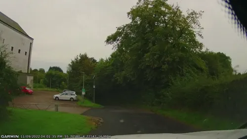
National Museum of Rural Life
Museum · 1.9 mi
National museum in South Lanarkshire, Scotland, UK

Site of Kilbride Castle (Laigh Mains Motte)
Monument and historic site · 1.2 mi

Hunter House Museum
Museum · 1.3 mi
Former museum in South Lanarkshire, Scotland, UK

Bogles Brig
Monument and historic site
This bridge - identifiable as being the "bridge at Rosemound" - is mentioned as being called "Bogle's Brig" in Allison Galbraith's...
East Kilbride Arts Centre (Bosfield House)
Museum · 0.6 mi
51-53 Old Coach Road, East Kilbride
Torrance Dyke and Promontory
Monument and historic site · 1.4 mi
A likely large medieval boundary dyke is in an effaced buried state and may end in an early fortified structure overlooking to old ford...
39 more on the map.
Parks, trails and playgrounds47


Brancumhall Golf Development Centre
Golf course · 1.5 mi
9 hole Pitch & Putt
St Leonards Road, East Kilbride

Calderglen Country Park
Park · 1.6 mi
Country park in South Lanarkshire, Scotland, UK
Holmhills Community Park
Park · 3.3 mi
Park in Cambuslang, South Lanarkshire, Scotland, UK
Peel Park
Park · 1.9 mi
Business park in East Kilbride, South Lanarkshire, Scotland, UK
Kittoch Valley Woodlands (College Wood)
Park · 1.2 mi
An area of mixed woodland and open meadows along the Kittoch Water between the areas of Stewartfield and College Milton North. The name...
24/7

35 more on the map.
Restaurants and cafes52
Yakitori House
Restaurant · Japanese
5 St Bryde Street, Glasgow
Mo-Th 12:00-22:00; Fr-Sa 12:00-23:00; Su 15:00-22:00



40 more on the map.
History
The earliest-known evidence of occupation in the area dates as far back as the late Neolithic and Early Bronze Age, as archaeological investigation has demonstrated that burial cairns in the district began as ceremonial or ritual sites of burial during the Neolithic, with the use of cup-marked, and other inscribed stones at key elevated sites, only to be later built upon with earth and re-used for burial into the Bronze Age.
These findings have found further support through ongoing research indicating that many East Kilbride Cairns first noticed by the Reverend David Ure in his History of Rutherglen and East Kilbride (1793), are embedded, alongside other monuments, into a ritual landscape related to ancestor cults and relationships with key topographical features and annual solar events. A flint arrow head was discovered by Allan Forrest, a then child resident whilst groundworks were taking place in his family's garden at Glen Bervie, St Leonards in 1970 which later was identified as dating to 1500 BC (Bronze Age).
Prehistoric – possibly Roman – graves have also been found near the Kype Water close to the town of Strathaven, some distance from East Kilbride but suggesting a Roman context for the wider area. Roman coins, footwear, and a Romano-British oil lamp have also been found in the area.
Read more of the history
East Kilbride traditionally takes its name from an Irish saint named St Bride (or Brigit), who may have founded a monastery for nuns and monks in Kildare in Leinster, Ireland, in the 6th century. Dál Riatan monks afterwards introduced her order to parts of Scotland, although the origins of the East Kilbride example - situated in the West of Scotland, is less certain due to a lack of early historical or linguistic involvement with Dalriada.
The Scots anglicisation kil takes its root from the Gaelic cille, borrowed from the Latin for cell or chapel, of St Brigit. The use of cille to mark a probable dedication to an Irish saint in this part of Scotland is problematic due to linguistic dating issues, but some analysis suggests that churches with cille place-names in the south west represent an early and short-lived influx of Irish church influence in or before the eighth century, which may or may not have involved the Céilí Dé who were monastics. However, it has been suggested by Prof. T. O. Clancy and others that cille place-names in the region, including the East Kilbride example, may instead relate to the main period of Gaelic cultural influx in the period post 900 AD.
The original parish church was located on what may have been a site of a pre-Christian significance, and tentatively the origin of the association with St Brigit, since the site may be dedicated to the Celtic goddess Brigid, whose traditions have been continued through the reverence of St Brigit brought on by the Celtic Church. However, this view is unpopular amongst academic audiences due to a complete lack of evidence supporting such earlier origins, thus making it an unfalsifiable concept.
Alternatively, the later dedication may commemorate the Scottish St Bryde, who is alleged to have been born in 451 AD and died at Abernethy 74 years later. However, this is also the same year Brigit is supposed to have been born, and the same year of her death.
Culdee-type Christian settlements were essential to the spread of the Celtic church in Scotland, with small pagan sites being converted and chapels or cells forming little more than crude shelters, or timber and turf buildings with crude circular enclosures. Additionally, the number of place-name dedications to St. Brigit in Scotland is further evidence of the possibility of Culdee activity in the southwest, if extrapolations are allowed from known areas of culdee activity. How this possibility relates to the relatively late dating-periods in the British kingdom of Strathclyde has not been explored owing to a lack of surviving written sources to provide insights for this geographical area.
In the early 18th century, the word 'East' was added to the name of East Kilbride, and 'West' to West Kilbride to distinguish the towns from each other.
East Kilbride grew from a small village of around 900 inhabitants in 1930 to become a large burgh in 1967. The rapid industrialisation of the 20th century underpins this growth and left much of the working population throughout Scotland's Central Belt, from Glasgow to Edinburgh, living in the housing stock built at the end of the previous century. The Great War postponed any housing improvements, as did the Treaty of Versailles and the period of post-war settlement it created. In turn, this was followed by the Great Depression. After the Second World War, Glasgow, already suffering from chronic housing shortages, incurred bomb damage from the war. In 1946, the Clyde Valley Regional Plan allocated sites where overspill satellite "new towns" could be constructed to help alleviate the housing shortage. Glasgow would also undertake the development of its peripheral housing estates. East Kilbride was the first of six new towns in Scotland to be designated, in 1947, followed by Glenrothes (1948), Cumbernauld (1956), Livingston (1962), Irvine (1964) and Stonehouse (1972), although Stonehouse new town was never built.
The planned town has been subdivided into residential precincts, each with its own local shops, primary schools and community facilities. The housing precincts surround the shopping centre, which is bound by a ring road. Industrial estates were concentrated on the outskirts of the town in northern, western and south-eastern directions (Nerston, College Milton and Kelvin respectively).
From the History section of East Kilbride on Wikipedia, under CC BY-SA 4.0.
More about East Kilbride
Geography
Hamilton, the administrative headquarters for South Lanarkshire Council, is about five miles (eight kilometres) east of East Kilbride. The A725 road linking the towns also passes Blantyre and one of the University of the West of Scotland campuses, with links to Bothwell, Motherwell and ultimately to the M74 and M8 motorways.
The nearest Glasgow district of Castlemilk is about three miles (five kilometres) northwest, with the Cathkin Braes, farmland and the village of Carmunnock in between; a bypass (the B766) was built in 1988 to remove Glasgow traffic from Carmunnock. Rutherglen and Cambuslang lie about the same distance to the north-east and are linked to East Kilbride via the dual carriageway A749 road which continues into Glasgow.
Clarkston and Busby are also about three miles (five kilometres) northwest via the A727 road, with Thorntonhall much closer. Eaglesham lies about three miles (five kilometres) west of East Kilbride centre; the Glasgow Southern Orbital, another modern bypass which is part of the A726 road, keeps East Kilbride traffic heading for the M77 motorway away from Eaglesham and Newton Mearns.
Economy
The town centre is occupied by a large shopping centre comprising six linked malls (The Plaza (development started in 1972), Princes Mall (1984), Southgate (1989), Princes Square (1997), Centre West (2003) and The Hub (2016)).
A £400m redevelopment of part of East Kilbride shopping centre was approved in 2006 by South Lanarkshire Council. The plan proposed demolishing some existing buildings to create a new civic centre, health centre, library and shopping facilities. The shopping centre's owners went into administration in 2022. There are plans to demolish a large part of the Centre West segment and turn this into housing with the overall retail space to be reduced and new civic amenities to be built.
A branch of the government's Department for International Development, now the Foreign, Commonwealth and Development Office, is located in the western Hairmyres area of East Kilbride.
From the Wikipedia article East Kilbride, under CC BY-SA 4.0.
Notable people from East Kilbride
 John HannahScottish actorPhoto: Gage Skidmore, CC BY-SA 3.0
 John HunterScottish surgeon (1728-1793)Photo: anonymous, Public domain
 Liam FoxBritish politician (born 1961)Photo: Chris McAndrew, CC BY 3.0
 William HunterBritish anatomist and physician (1718-1783)Photo: Allan Ramsay, Public domain
 Denise MinaBritish crime writer and playwrightPhoto: D Benny 23, CC0
 Kate DickieScottish actressPhoto: Amy Martin Photography, CC BY-SA 4.0
 Frazer WrightScottish footballer (born 1979)Photo: Alasdair Middleton from Rothesay,..., CC BY 2.0
 Aileen McLeodScottish politician (born 1971)Photo: Scottish Government, CC BY 4.0
- Bobby MaddenScottish football referee
- Jordan McGheeScottish association football player (born 1996)
- Alan McGeeScottish music industry executive
- JockBritish comics artist
Born in East Kilbride, according to Wikidata (CC0). Each name links to its Wikipedia article.
Where to stay5
Churches and places of worship18
Westwoodhill Evangelical Church
Church · Brethren · 0.9 mi
1 Blenheim Avenue, East Kilbride
Shopping22
Gas and EV charging6
Schools, colleges and libraries24
Duncanrig Secondary School
School · 1.1 mi
Winnipeg Drive, East Kilbride
Healthcare3
Map of East Kilbride
250 places. The map loads OpenStreetMap tiles when you open it.
Getting there and nearby towns
Glasgow Airport (GLA) is the nearest airport with scheduled flights listed in OpenStreetMap, 12 miles away.
- Rutherglen 5 mi north, about 8 min by car
- Giffnock 5 mi northwest, about 9 min by car
- Hamilton 6 mi east, about 9 min by car
- Meikle Earnock 6 mi east, about 9 min by car
- Newton Mearns 6 mi west, about 10 min by car
- Motherwell 7 mi east, about 12 min by car
- Glasgow 8 mi northwest, about 12 min by car
- Mossend 8 mi northeast, about 12 min by car
- Larkhall 8 mi east, about 14 min by car
- Wishaw 10 mi east, about 16 min by car
Drive times are estimates from straight-line distance, not routes.
Towns near East Kilbride


Keep exploring
Local news
Headlines from INDB.
Reviews, tips and questions
Loading what members have shared...
Sources and licences
- GeoNames (CC BY 4.0): population, coordinates, regions and time zone
- Mapillary (see each image): photos
- OpenStreetMap contributors (ODbL 1.0): places, airports, map data
- Wikidata (CC0 1.0): elevation, founding date, time zone, website, landmarks and historic places
- Wikimedia Commons (see each image): photos
- Wikipedia (CC BY-SA 4.0): overview and history text
Photo credits
- Parish Church, East Kilbride, John McLeish, CC BY-SA 2.0
- Montgomerie Arms, East Kilbride, Delphine Dallison, CC BY-SA 4.0
- West Kirk, East Kilbride, Delphine Dallison, CC BY-SA 4.0
- 07638 East Kilbride Old Church of Scotland, East Kilbride 006, WeeHolly, CC BY-SA 4.0
- 07638 East Kilbride Old Church of Scotland, East Kilbride 008, WeeHolly, CC BY-SA 4.0
- 07638 East Kilbride Old Church of Scotland, East Kilbride 005, WeeHolly, CC BY-SA 4.0
- 07638 East Kilbride Old Church of Scotland, East Kilbride 009, WeeHolly, CC BY-SA 4.0
- 07638 East Kilbride Old Church of Scotland, East Kilbride 004, WeeHolly, CC BY-SA 4.0
- 07638 East Kilbride Old Church of Scotland, East Kilbride 001, WeeHolly, CC BY-SA 4.0
- 07638 East Kilbride Old Church of Scotland, East Kilbride 010, WeeHolly, CC BY-SA 4.0
- 07638 East Kilbride Old Church of Scotland, East Kilbride 011, WeeHolly, CC BY-SA 4.0
- 07638 East Kilbride Old Church of Scotland, East Kilbride 003, WeeHolly, CC BY-SA 4.0
- 07638 East Kilbride Old Church of Scotland, East Kilbride 007, WeeHolly, CC BY-SA 4.0
- 07638 East Kilbride Old Church of Scotland, East Kilbride 002, WeeHolly, CC BY-SA 4.0
- 9 Montgomery St, East Kilbride, Delphine Dallison, CC BY-SA 4.0
- East Kilbride village JMcLeish, John McLeish, CC BY-SA 2.0
- 01702 East Kilbride West Church of Scotland, East Kilbride 008, WeeHolly, CC BY-SA 4.0
- 01702 East Kilbride West Church of Scotland, East Kilbride 010, WeeHolly, CC BY-SA 4.0
- 01702 East Kilbride West Church of Scotland, East Kilbride 001, WeeHolly, CC BY-SA 4.0
- 01702 East Kilbride West Church of Scotland, East Kilbride 004, WeeHolly, CC BY-SA 4.0
- Cambuslang Park in 2024 (3), Sahaib, CC BY 4.0
- Duncanrig Secondary School, East Kilbride, G Laird, CC BY-SA 2.0
- St Brides EK05, Jonathan Oldenbuck, CC BY-SA 4.0
- 161020 1437 Laigh Mains Motte from High Mains farm, Dave souza, CC BY-SA 4.0
- Trifle specific - panoramio, wanderer2, CC BY 3.0
- Street-level photo, gmc, CC BY-SA 4.0
- Street-level photo, gmc, CC BY-SA 4.0
- Street-level photo, gmc, CC BY-SA 4.0
- Street-level photo, gmc, CC BY-SA 4.0
- Street-level photo, ccbb7766, CC BY-SA 4.0
- Street-level photo, hobgoblin, CC BY-SA 4.0
- Street-level photo, gmc, CC BY-SA 4.0
- Street-level photo, hobgoblin, CC BY-SA 4.0
- Street-level photo, ccbb7766, CC BY-SA 4.0
- Street-level photo, ccbb7766, CC BY-SA 4.0
- Street-level photo, gmc, CC BY-SA 4.0
- Street-level photo, gmc, CC BY-SA 4.0


Page built November 10, 2026. Spotted a mistake? Tell us or suggest a place.