


Blantyre, United Kingdom
Blantyre is a town of 17,090 people in Scotland, United Kingdom.
Why visit Blantyre
Townapedia lists 33 museums and landmarks, 24 parks and trails, 34 places to eat, 1 place to stay and 3 attractions in and around town.
Highlights include Clyde Bridge, M&D's, Bothwell Castle and David Livingstone Centre.
Weather in Blantyre
Forecast from MET Norway (CC BY 4.0). Full forecast
About Blantyre
Blantyre ( or ; Scottish Gaelic: Blantaidhr) is a town and civil parish in South Lanarkshire, Scotland, with a population of 16,900. It is bounded by the River Clyde to the north, the Rotten Calder to the west, the Park Burn to the east (denoting the boundary with the larger adjoining town of Hamilton) and the Rotten Burn to the south.
From the Wikipedia article Blantyre, South Lanarkshire (this version), under CC BY-SA 4.0.
Photos of Blantyre


Things to do3
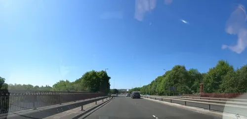
Clyde Bridge
Bridge · 3.2 mi
Bridge between North and South Lanarkshire, Scotland, UK, carries the A723 road across River Clyde

M&D's
Monument and historic site · 2.2 mi
Theme park in Motherwell, Scotland, UK

Museums and landmarks33

Bothwell Castle
Monument and historic site · 0.9 mi
Castle in South Lanarkshire, Scotland, UK

David Livingstone Centre
Museum · 0.6 mi
Category A listed building in South Lanarkshire, Scotland, UK

Hamilton Mausoleum
Monument and historic site · 2.6 mi
Mausoleum in South Lanarkshire, Scotland, UK

Low Parks Museum
Museum · 2.6 mi
Museum in Hamilton, Scotland, United Kingdom

Bothwellhaugh Roman Fort
Monument and historic site · 2.7 mi
Architectural structure in North Lanarkshire, Scotland, UK

Hunter House Museum
Museum · 2.5 mi
Former museum in South Lanarkshire, Scotland, UK
21 more on the map.
Parks, trails and playgrounds24


Strathclyde Country Park
Park · 2.8 mi
Country park in Lanarkshire, Scotland


Holmhills Community Park
Park · 3.3 mi
Park in Cambuslang, South Lanarkshire, Scotland, UK
McAnulty Park
Park
McAnulty Park officially opened on 2nd March 2007 by Councillor Jim Handibore. Named in honour of Andrew (Andrea) McAnulty for his...
12 more on the map.
Restaurants and cafes34
Red Burn Farm - Farmhouse inns
Bar and pub · 1.1 mi
East Avenue, Glasgow
Mo-Su 08:00-23:00


Chillies Take Away
Restaurant · Indian · 1.1 mi
87 Main Street, Bothwell
Shanghai Teahouse
Restaurant · 1.2 mi
34, 32 Main Street, Glasgow
22 more on the map.
History
The name has a number of probable origins: originally Cumbric blaen tir "top of the land" which has been Gaelicised; an association with Saint Blane, whose associates have a number of local place-names named after them, such as Dalmarnock, and further afield, and personally, Dunblane.
The town consists of a number of small hamlets which have largely become connected into a single urban area, with housing in a variety of styles and ages reflecting the changing use and availability of land over the decades.
Read more of the history
High Blantyre is the area to the east and south of Burnbrae Road which continues to High Blantyre Cross at the north. It is thought to be the area of earliest settlement, with a Bronze Age village near Auchintibber 2 miles (3 km) south of Blantyre Parish Church (High Blantyre). Also in this area is Greenhall Park, where the Calder (Cawther) flows north through a valley to eventually join the Clyde near Newton. A new residential development, Greenhall Village, was built at the western side of High Blantyre in the 2010s. There was previously a large mining community in this area clustered around several pits including Auchinraith and Larkfield which still exist as distinct communities within the town; weaving was another local occupation. A railway station (on the Hamilton and Strathaven Railway) was in use from the 1860s to the 1950s, located to the west of the church. High Blantyre Primary School was established in 1875, continuing through various reconstructions to its current buildings dating from 2005.
At the western end of the main thoroughfare, Glasgow Road (A724) which runs east–west, is the Priory Bridge neighbourhood (named after the original bridge over the Calder towards Cambuslang, which itself was named after the now-ruined Blantyre Priory to the north of the town which was home to monks from around 1235). It borders the older and larger Coatshill housing estate which has its own schools and community facilities. On the other side of the main road from Coatshill is the similar neighbourhood of Wheatlands (parts of which were built by the Scottish Special Housing Association), while further east is the modern centre of the town, built up from the 19th-century mining communities at Stonefield and Low Blantyre featuring the local secondary school Calderside Academy, Stonefield public park, Blantyre Leisure Centre, several churches and the Clydeview Shopping Centre (which has featured a large Asda supermarket since its opening in 1980). Glasgow Road continues south-east via the A725 elevated bypass, the Springwells neighbourhood and the town boundary, leading on to Burnbank (specifically the area once known as Greenfield).
Further north of the town centre is The Village, the oldest industrially developed part of Blantyre which was previously a mill settlement on the River Clyde. Near to the town's train station, it is the only part which is north of the railway lines. Next to the David Livingstone Centre, at the end of Station Road, is an iron suspension footbridge which crosses the Clyde giving pedestrian access to Bothwell.
From the History section of Blantyre, South Lanarkshire on Wikipedia, under CC BY-SA 4.0.
More about Blantyre
Education
University of the West of Scotland (Lanarkshire Campus); relocated from Bell College to Hamilton International Technology Park (within Blantyre) in 2018
From the Wikipedia article Blantyre, South Lanarkshire, under CC BY-SA 4.0.
Notable people from Blantyre
 David LivingstoneScottish missionary and explorer (1813-1873)Photo: Thomas Annan / Adam Cuerden, Public domain
 William Bauchop WilsonScottish-American politician in Pennsylvania (1862-1934)Photo: Bain News Service, publisher, Public domain
 John FallonScottish footballer (1940-2025)Photo: Unknown author Unknown author, Public domain
 John GowansGeneral of the Salvation Army (1934–2012)Photo: Salvationistdan, CC BY-SA 4.0
 Philip MurrayAmerican labor leader (1886-1952)Photo: Harris & Ewing, photographer, Public domain
 Ian StewartLabour politician (born 1950)Photo: University of Salford Press Office, CC BY 2.0
 Robert CormackScottish academicPhoto: Corriemilne, CC BY-SA 4.0
- Jimmy BinningScottish footballer (born 1927)
- James PatersonScottish landscape and portrait painter (1854-1932)
- Robbie BuchananScottish association football player (born 1996)
- Willie SteelScottish footballer and manager (1908-1990)
- Jimmy AdamScottish football player born 13 May 1931
Born in Blantyre, according to Wikidata (CC0). Each name links to its Wikipedia article.
Where to stay1
Churches and places of worship7
Bellshill and Bothwell Parish Church
Church · Church Of Scotland · 1.1 mi
Main Street, Glasgow
Shopping8
Gas and EV charging1
Schools, colleges and libraries20
Healthcare6
Map of Blantyre
137 places. The map loads OpenStreetMap tiles when you open it.
Getting there and nearby towns
Glasgow Airport (GLA) is the nearest airport with scheduled flights listed in OpenStreetMap, 14 miles away.
- Cambuslang 3 mi west, about 4 min by car
- Hamilton 3 mi southeast, about 5 min by car
- Bellshill 3 mi northeast, about 5 min by car
- East Kilbride 4 mi southwest, about 6 min by car
- Meikle Earnock 4 mi southeast, about 6 min by car
- Motherwell 4 mi east, about 6 min by car
- Mossend 4 mi east, about 6 min by car
- Rutherglen 5 mi northwest, about 8 min by car
- Coatbridge 5 mi northeast, about 9 min by car
- Airdrie 7 mi northeast, about 11 min by car
Drive times are estimates from straight-line distance, not routes.
Towns near Blantyre


Keep exploring
Local news
Headlines from INDB.
Reviews, tips and questions
Loading what members have shared...
Sources and licences
- GeoNames (CC BY 4.0): population, coordinates, regions and time zone
- Mapillary (see each image): photos
- OpenStreetMap contributors (ODbL 1.0): places, airports, map data
- Wikidata (CC0 1.0): elevation, founding date, time zone, website, landmarks and historic places
- Wikimedia Commons (see each image): photos
- Wikipedia (CC BY-SA 4.0): overview and history text
Photo credits
- 05634 Livingstone Memorial Church of Scotland, Blantyre 008, WeeHolly, CC BY-SA 4.0
- 05634 Livingstone Memorial Church of Scotland, Blantyre 003, WeeHolly, CC BY-SA 4.0
- 05634 Livingstone Memorial Church of Scotland, Blantyre 009, WeeHolly, CC BY-SA 4.0
- 05634 Livingstone Memorial Church of Scotland, Blantyre 010, WeeHolly, CC BY-SA 4.0
- 05634 Livingstone Memorial Church of Scotland, Blantyre 001, WeeHolly, CC BY-SA 4.0
- 05634 Livingstone Memorial Church of Scotland, Blantyre 005, WeeHolly, CC BY-SA 4.0
- 05634 Livingstone Memorial Church of Scotland, Blantyre 013, WeeHolly, CC BY-SA 4.0
- 05634 Livingstone Memorial Church of Scotland, Blantyre 002, WeeHolly, CC BY-SA 4.0
- 05634 Livingstone Memorial Church of Scotland, Blantyre 006, WeeHolly, CC BY-SA 4.0
- 05634 Livingstone Memorial Church of Scotland, Blantyre 007, WeeHolly, CC BY-SA 4.0
- 05634 Livingstone Memorial Church of Scotland, Blantyre 012, WeeHolly, CC BY-SA 4.0
- 05634 Livingstone Memorial Church of Scotland, Blantyre 011, WeeHolly, CC BY-SA 4.0
- 05634 Livingstone Memorial Church of Scotland, Blantyre 004, WeeHolly, CC BY-SA 4.0
- South Lanarkshire - Livingstone Memorial Church, Glasgow Road, Blantyre - 20240919235523, Crowsus, CC BY-SA 4.0
- South Lanarkshire - Livingstone Memorial Church, Glasgow Road, Blantyre - 20240919235652, Crowsus, CC BY-SA 4.0
- 05635 St Joseph's Roman Catholic Church, Blantyre 019, WeeHolly, CC BY-SA 4.0
- 05635 St Joseph's Roman Catholic Church, Blantyre 018, WeeHolly, CC BY-SA 4.0
- 05635 St Joseph's Roman Catholic Church, Blantyre 015, WeeHolly, CC BY-SA 4.0
- 05635 St Joseph's Roman Catholic Church, Blantyre 010, WeeHolly, CC BY-SA 4.0
- 05635 St Joseph's Roman Catholic Church, Blantyre 011, WeeHolly, CC BY-SA 4.0
- 05635 St Joseph's Roman Catholic Church, Blantyre 017, WeeHolly, CC BY-SA 4.0
- 05635 St Joseph's Roman Catholic Church, Blantyre 008, WeeHolly, CC BY-SA 4.0
- 05635 St Joseph's Roman Catholic Church, Blantyre 003, WeeHolly, CC BY-SA 4.0
- 05635 St Joseph's Roman Catholic Church, Blantyre 002, WeeHolly, CC BY-SA 4.0
- 05635 St Joseph's Roman Catholic Church, Blantyre 007, WeeHolly, CC BY-SA 4.0
- 05635 St Joseph's Roman Catholic Church, Blantyre 001, WeeHolly, CC BY-SA 4.0
- 05635 St Joseph's Roman Catholic Church, Blantyre 004, WeeHolly, CC BY-SA 4.0
- 05635 St Joseph's Roman Catholic Church, Blantyre 009, WeeHolly, CC BY-SA 4.0
- 05635 St Joseph's Roman Catholic Church, Blantyre 013, WeeHolly, CC BY-SA 4.0
- 05635 St Joseph's Roman Catholic Church, Blantyre 006, WeeHolly, CC BY-SA 4.0
- 05635 St Joseph's Roman Catholic Church, Blantyre 012, WeeHolly, CC BY-SA 4.0
- 05635 St Joseph's Roman Catholic Church, Blantyre 005, WeeHolly, CC BY-SA 4.0
- 05635 St Joseph's Roman Catholic Church, Blantyre 016, WeeHolly, CC BY-SA 4.0
- 05635 St Joseph's Roman Catholic Church, Blantyre 014, WeeHolly, CC BY-SA 4.0
- South Lanarkshire - Livingstone Memorial Church, Glasgow Road, Blantyre - 20240919235434, Crowsus, CC BY-SA 4.0
- Bothwell Castle 20080505 - south-east tower, Otter, CC BY-SA 3.0
- Hamilton Mausoleum Interior, Supergolden, CC BY-SA 3.0
- LowParksMuseum, Supergolden, CC BY-SA 3.0
- Cambuslang Park in 2024 (3), Sahaib, CC BY 4.0
- Strathclyde Park, No machine-readable author provided. Supergolden assumed (based on copyright claims)., CC BY-SA 3.0
- Old Parish Church Hamilton, Unknown author, CC BY-SA 2.5
- David Livingstone Centre, Blantyre, Kim Traynor, CC BY-SA 4.0
- Battle-of-bothwell-bridge-1679, Unknown author Unknown author, Public domain
- Hamilton Bandstand 1912, Graemedick, CC BY-SA 4.0
- Street-level photo, hobgoblin, CC BY-SA 4.0
- Street-level photo, gmc, CC BY-SA 4.0
- Street-level photo, fozy81, CC BY-SA 4.0
- Street-level photo, trishfarrell26, CC BY-SA 4.0
- Street-level photo, fozy81, CC BY-SA 4.0
- Street-level photo, gmc, CC BY-SA 4.0


Page built November 10, 2026. Spotted a mistake? Tell us or suggest a place.