


Bletchley, United Kingdom
Bletchley is a town of 50,193 people in England, United Kingdom.
Why visit Bletchley
Townapedia lists 28 museums and landmarks, 17 parks and trails, 114 places to eat, 4 places to stay and 5 attractions in and around town.
Highlights include Bletchley Flyover, Denbigh Hall Railway Bridge, Bletchley Park and The National Museum of Computing.
Weather in Bletchley
Forecast from MET Norway (CC BY 4.0). Full forecast
About Bletchley
Bletchley is a constituent town of Milton Keynes, a city in Buckinghamshire, England. It gives its name to a larger census "built-up area" that occupies the south-west of the city and which is divided by the West Coast Main Line railway between the civil parishes of Bletchley & Fenny Stratford and West Bletchley, together with a fragment of Stoke Hammond CP. At the 2021 census, the population of this wider area was 45,010.
From the Wikipedia article Bletchley (this version), under CC BY-SA 4.0.
Photos of Bletchley


Things to do5


Denbigh Hall Railway Bridge
Bridge · 1.2 mi
Railway bridge in West Bletchley, Milton Keynes, Buckinghamshire, England, UK

National Bowl
Cinema and theater · 2.1 mi
Concert stage in Milton Keynes, UK


Museums and landmarks28

Bletchley Park
Monument and historic site
Museum based in the former WW2 HQ of Britain's cryptography operation, know as Station X where Alun Turing, Tommy Flowers and Bill Tutte...
Sherwood Drive, Milton Keynes

Bletchley Park Museum
Museum · 0.4 mi
Museum celebrating British WWII code-breaking

Statue of Alan Turing
Monument and historic site · 0.4 mi
2007 artwork by Stephen Kettle

Hut 3
Museum · 0.4 mi
Analysis of German Army and Air Force message decrypts



Bow Brickhill War Memorial
Monument and historic site · 2.4 mi
Grade II listed monument in Buckinghamshire, England, UK

National Radio Centre (RSGB)
Museum · 0.4 mi
Mo-Su 09:30-17:00; Nov-Feb Mo-Su 09:30-16:00; Jan 1 off; Dec 24...
16 more on the map.
Parks, trails and playgrounds17
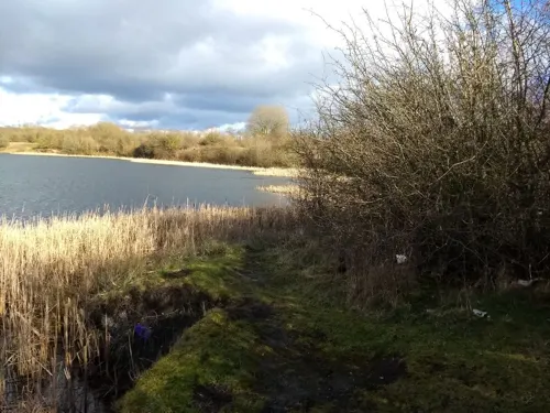
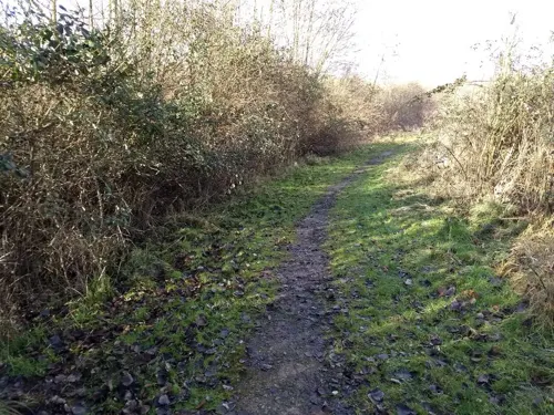
Blue Lagoon Park
Park · 0.6 mi
Local nature reserve in Buckinghamshire, England

Stadium MK
Sports field and stadium · 1.1 mi
Stadium Way West, Bletchley


5 more on the map.
Restaurants and cafes114
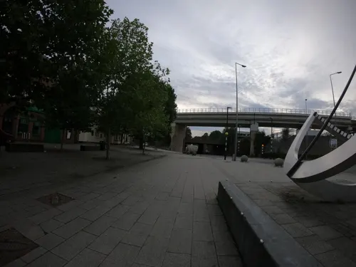
Romanelli
Restaurant · Italian, Pizza, Pasta
3A Chandos Place, Milton Keynes
Mo-Sa 11:00-14:00,17:00-21:00
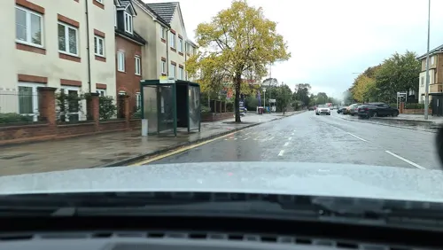


The Maltsters Arms Public House
Bar and pub · 0.8 mi
45 Aylesbury Street, Milton Keynes

Bella Italia
Restaurant · Italian · 1.2 mi
14 Stadium Way West, Bletchley
Mo-Th 11:30-22:00; Fr-Sa 11:00-23:00; Su 11:00-22:00
Treat Street
Restaurant · Waffle, Pancake · 1.2 mi
Denbigh North, Milton Keynes
Mo-Th 12:00-22:00; Fr,Sa 12:00-23:00; Su 12:00-22:00
102 more on the map.
History
The town name is Anglo-Saxon and means Blæcca's clearing. It was first recorded in manorial rolls in the 12th century as Bicchelai, then later as Blechelegh (13th century) and Blecheley (14th–16th centuries). Just to the south of Fenny Stratford, there was Romano-British town, MAGIOVINIUM on either side of Watling Street, a Roman road.
Bletchley was originally a minor village on the outskirts of Fenny Stratford, of lesser importance than Water Eaton. Fenny Stratford fell into decline from the English Civil War (17c) onwards. Bletchley railway station was built to serve the London and Birmingham Railway from 1838 (now part of the West Coast Main Line). The subsequent branch lines to Bedford (1846) and Buckingham (1850) together grew subsequently to become the Varsity Line between Oxford and Cambridge, making it a significant junction station. The town grew to eclipse both its antecedent settlements.
Almost forty years after the construction of the station, the 1884/5 Ordnance Survey map showed the settlement as still just a small village around the Church of England parish church at Old Bletchley. There was a separate hamlet near to the Methodist chapel and Shoulder of Mutton public house, at the junction of Shenley Road/Newton Road with Buckingham Road. These districts are known today as Old Bletchley and Far Bletchley. The major settlement of the time is nearby Fenny Stratford.
Read more of the history
The Bletchley area is rich in Oxford Clay, which has long been used for bricks. Brick-making has taken place on the Newton Leys site and the surrounding area from the late 19th century, circa 1897. Bletchley Brickworks closed in September 1990.
In the urban growth of the Victorian period brought by the railway, the town merged with Fenny Stratford. The latter had been constituted an urban district, with Simpson, in 1895 and Bletchley was added in 1898. By 1911, the population of the combined parishes was 5,166, but the balance between them had changed; in that year, the name of the local council (Urban District) changed from Fenny Stratford UD to Bletchley UD. The 1926 Ordnance Survey map shows the settlements beginning to merge, with large private houses along the Bletchley Road between them. In 1933, the newly-founded Bletchley Gazette began a campaign for a "Bigger, Better, Brighter, Bletchley".
As the nation emerged from World War II, Bletchley Council renewed its desire to expand from its 1951 population of 10,919. By mid-1952, the council was able to agree terms with five London boroughs to accept people and businesses from bombed-out sites in the capital. This trend continued through the 1950s and 1960s, culminating in the Greater London Council–funded Lakes Estate in Water Eaton parish, even as Milton Keynes was being founded.
Industrial development kept pace, with former London businesses relocating to new industrial estates in Mount Farm and Denbigh; Marshall Amplification was the most notable. With compulsory purchase, Bletchley Road (now renamed to Queensway after a royal visit in 1966) became the new high street with wide pavements where front gardens once lay. Houses near the railway end were replaced by shops, but those nearer Fenny Stratford became banks and professional premises. At the 1971 Census, the population of the Bletchley Urban District was 30,642.
Proposals for a new city in North Buckinghamshire had been floated from the early 1960s. Bletchley had fought to be the centre of the proposed new city, but when the Milton Keynes designation order was made in 1967, Bletchley was at its southern end rather than its centre. The 1971 Plan for Milton Keynes placed Central Milton Keynes on a completely new hill-top site 4 miles (6.4 km) further north, halfway to Wolverton. Bletchley was relegated to the status of suburb.
Bletchley thrived in the early years of the growth of Milton Keynes, since it was the main shopping area. Bletchley centre was altered considerably when the Brunel Shopping Centre was built in the early 1970s, creating a new end to Queensway. Previously, Queensway – formerly known as Bletchley Road – was a continuous run from Fenny Stratford to Old Bletchley. The town's boom came to an end when the new Central Milton Keynes Shopping Centre was built and commercial Bletchley has declined as a retail destination since then.
The town's importance as a major hub within Milton Keynes and the wider region was recognised in March 2021, following a successful bid by the Bletchley and Fenny Stratford Town Deal Board. MK City Council was successful in securing an award of £22.7 million as part of the UK Government's New Towns Deal, with the city council focusing most of that money on Bletchley and Fenny Stratford. This led to the publishing of their Town Investment Plan (TIP), which aimed to boost jobs, skills and connectivity in the area, and further invest in Bletchley town centre).
From the History section of Bletchley on Wikipedia, under CC BY-SA 4.0.
Notable people from Bletchley
 Derek RedmondBritish athletePhoto: Parliament Speakers Limited, CC BY-SA 3.0
- Mark LathwellEngland Test cricketer (born 1971)
- Kenneth V. JonesBritish composer
- Adam FicekEnglish musician
- Elton HayesEnglish actor and musician (1915-2001)
- Christopher HerrickBritish organist
- Tim BurtEnglish cricketer (born 1972)
- Tim SousterBritish composer (1943–1994)
- Derrick Christieassociation football player
- Jackie JarvisWestern Australian politician
- Mark OsbornEnglish footballer (born 1981)
- James JessopBritish contemporary artist
Born in Bletchley, according to Wikidata (CC0). Each name links to its Wikipedia article.
Where to stay4
Churches and places of worship20
St Thomas Aquinas
Church · Roman Catholic · 0.7 mi
Sycamore Avenue, Milton Keynes
Shopping23
Gas and EV charging6
Schools, colleges and libraries22
St Thomas Aquinas Catholic Primary School
School · Roman Catholic · 0.9 mi
St Marys Avenue, Milton Keynes
Healthcare13
Map of Bletchley
250 places. The map loads OpenStreetMap tiles when you open it.
Getting there and nearby towns
London Luton Airport (LTN) is the nearest airport with scheduled flights listed in OpenStreetMap, 17 miles away.
- Milton Keynes 3 mi north, about 6 min by car
- Leighton Buzzard 6 mi southeast, about 10 min by car
- Newport Pagnell 7 mi north, about 10 min by car
- Ampthill 10 mi east, about 17 min by car
- Flitwick 10 mi east, about 16 min by car
- Buckingham 11 mi west, about 17 min by car
- Dunstable 12 mi southeast, about 19 min by car
- Kempston Hardwick 12 mi northeast, about 19 min by car
- Kempston 13 mi northeast, about 21 min by car
- Bedford 15 mi northeast, about 24 min by car
Drive times are estimates from straight-line distance, not routes.
Towns near Bletchley


Keep exploring
Local news
Headlines from INDB.
Reviews, tips and questions
Loading what members have shared...
Sources and licences
- GeoNames (CC BY 4.0): population, coordinates, regions and time zone
- Mapillary (see each image): photos
- OpenStreetMap contributors (ODbL 1.0): places, airports, map data
- Wikidata (CC0 1.0): elevation, founding date, time zone, website, landmarks and historic places
- Wikimedia Commons (see each image): photos
- Wikipedia (CC BY-SA 4.0): overview and history text
Photo credits
- Bletchley Queensway, Tom walker, CC BY 3.0
- 2020-07-30 Bletchley Flyover Replacement (01), WT79, CC0
- 2020-07-30 Bletchley Flyover Replacement (03), WT79, CC0
- 2020-07-30 Bletchley Flyover Replacement (02), WT79, CC0
- 66090 Maritime Intermodal Six 4M60 1104 Didcot T.C. to Northampton Gateway Dbc Bletchley station 160625, kitmasterbloke, CC BY 2.0
- 2020-07-24 Bletchley Flyover Replacement (03), WT79, CC0
- 2020-07-24 Bletchley Flyover Replacement (10), WT79, CC0
- 2020-07-24 Bletchley Flyover Replacement (16), WT79, CC0
- 2020-07-24 Bletchley Flyover Replacement (15), WT79, CC0
- 2020-07-24 Bletchley Flyover Replacement (09), WT79, CC0
- 2020-07-24 Bletchley Flyover Replacement (12), WT79, CC0
- 2020-07-24 Bletchley Flyover Replacement (13), WT79, CC0
- 2020-07-24 Bletchley Flyover Replacement (01), WT79, CC0
- 2020-07-24 Bletchley Flyover Replacement (14), WT79, CC0
- 2020-07-24 Bletchley Flyover Replacement (05), WT79, CC0
- 2020-07-24 Bletchley Flyover Replacement (08), WT79, CC0
- 2020-07-24 Bletchley Flyover Replacement (02), WT79, CC0
- 2020-07-26 Bletchley Flyover Replacement (1), WT79, CC0
- 2020-07-24 Bletchley Flyover Replacement (06), WT79, CC0
- 2020-07-24 Bletchley Flyover Replacement (11), WT79, CC0
- 2020-07-24 Bletchley Flyover Replacement (04), WT79, CC0
- 2020-07-24 Bletchley Flyover Replacement (07), WT79, CC0
- 2020-07-26 Bletchley Flyover Replacement (2), WT79, CC0
- Denbigh Hall Bridge - then and now, George Haydock Dodgson; Voice of Clam, Public domain
- MK Bowl Stage, Original uploader was Cheesy mike at en.wikipedia, CC BY-SA 2.0
- Alan Turing by Stephen Kettle 2007, DeFacto, CC BY-SA 4.0
- All Saints Church, Ninetyone, CC BY 3.0
- Bow Brickhill Church, Photo: Viki Male, Attribution
- Church of the Servant King, Furzton, Ninetyone, CC BY 3.0
- StGilesChurchTattenhoe1, Guydrury, Public domain
- MK FennyStratford StMartinschurch01, Chris Nyborg, CC BY-SA 3.0
- StadiumMKEnglandU21, Jamie Smith, CC BY-SA 3.0
- Hut 8, Bletchley Park, Bibeyjj, CC BY-SA 4.0
- West Bletchley - Hut 3 at Bletchley Park - 20240823144944, Violetlizabet, CC BY-SA 4.0
- Bletchley Park House home of the World War Two Codebreakers,, Outwivcamera, CC BY-SA 4.0
- 1125424 - Fenny Stratford, Maltsters Pub, Barrymyles, CC BY-SA 4.0
- 1125440 - Fenny Stratford Red Lion, Barrymyles, CC BY-SA 4.0
- Bletchley Park Mansion, DeFacto, CC BY-SA 4.0
- Hut6, Unknown author, Public domain
- Stadium MK, Beechey604, CC BY-SA 4.0
- 2020-07-25 Bletchley Flyover Replacement (2), WT79, CC0
- ICL System 25 at the National Museum of Computing at Bletchley Park, Hubcapp, CC BY 4.0
- Street-level photo, richlv, CC BY-SA 4.0
- Street-level photo, richlv, CC BY-SA 4.0
- Street-level photo, alexanderar, CC BY-SA 4.0
- Street-level photo, alexanderar, CC BY-SA 4.0
- Street-level photo, southglos, CC BY-SA 4.0
- Street-level photo, alexanderar, CC BY-SA 4.0
- Street-level photo, richlv, CC BY-SA 4.0
- Street-level photo, photomaps, CC BY-SA 4.0
- Street-level photo, alexanderar, CC BY-SA 4.0
- Street-level photo, alexanderar, CC BY-SA 4.0
- Street-level photo, alexanderar, CC BY-SA 4.0
- Street-level photo, southglos, CC BY-SA 4.0
- Street-level photo, southglos, CC BY-SA 4.0
- Street-level photo, tallguy, CC BY-SA 4.0
- Street-level photo, southglos, CC BY-SA 4.0
- Street-level photo, cyclestreets, CC BY-SA 4.0
- Street-level photo, photomaps, CC BY-SA 4.0
- Street-level photo, southglos, CC BY-SA 4.0
- Street-level photo, richlv, CC BY-SA 4.0
- Street-level photo, editid, CC BY-SA 4.0
- Street-level photo, editid, CC BY-SA 4.0
- Street-level photo, richlv, CC BY-SA 4.0


Page built November 10, 2026. Spotted a mistake? Tell us or suggest a place.