


Dunstable, United Kingdom
Dunstable is a town of 51,973 people in England, United Kingdom.
Why visit Dunstable
Townapedia lists 6 museums and landmarks, 19 parks and trails, 129 places to eat, 4 places to stay and 3 attractions in and around town.
Highlights include Totternhoe Roman villa, Waulud's Bank, Dunstable Downs and Lancot Meadow.
Weather in Dunstable
Forecast from MET Norway (CC BY 4.0). Full forecast
About Dunstable
Dunstable is a market town and civil parish in Bedfordshire, England, east of the Chiltern Hills, 30 miles (50 kilometres) north of London. There are several steep chalk escarpments, most noticeable when approaching Dunstable from the north. Dunstable is the fourth largest town in Bedfordshire and along with Houghton Regis forms the westernmost part of the Luton/Dunstable urban area.
From the Wikipedia article Dunstable (this version), under CC BY-SA 4.0.
Travel tips from other travellers: Dunstable on Wikivoyage (CC BY-SA 4.0).
Photos of Dunstable

Things to do3

Museums and landmarks6

Totternhoe Roman villa
Monument and historic site · 1.9 mi
Roman villa in Bedfordshire, England

Waulud's Bank
Monument and historic site · 3.2 mi
Archaeological site in Luton, Bedfordshire, England, UK

Whipsnade Tree Cathedral
Monument and historic site · 2.4 mi
Garden in Bedfordshire, England, UK

Parks, trails and playgrounds19


Totternhoe Knolls
Park · 2.4 mi
Site of Special Scientific Interest in Bedfordshire, England, UK

Totternhoe nature reserve
Park · 2.3 mi
Nature reserve in the United Kingdom

Whipsnade Zoo
Park · 2.6 mi
Zoo near Dunstable in Bedfordshire, England



7 more on the map.
Restaurants and cafes129
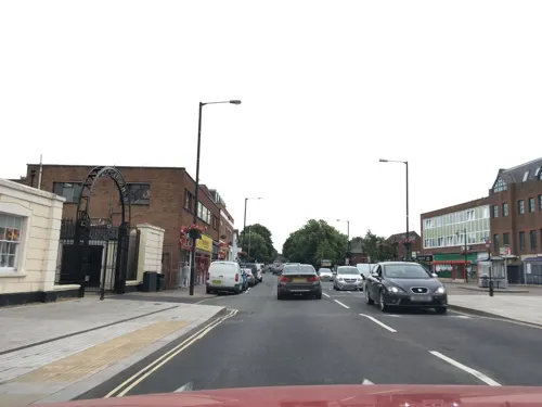
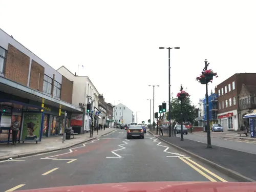

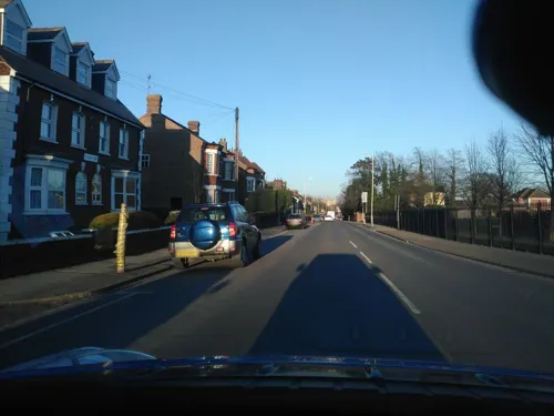
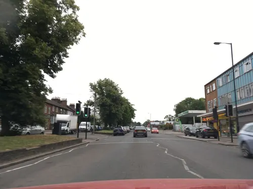


117 more on the map.
History
Relics of Palæolithic humans, including such relics as flint implements and the bones of contemporary wild animals, suggest the settlement is prehistoric. Traces of Neolithic activity are not in doubt but much of their mystery may be lost under the surrounding Chiltern Hills. At Maiden Bower in the parish of Houghton Regis to the north, there is an Iron Age hill fort, which is clearly marked on the Ordnance survey maps. Maiden Bower has some of the ramparts showing through the edge of an old chalk quarry at Sewell where remains of an older Bronze Age fort exist. There are many prehistoric sites in the area and Dunstable is on the route of the Icknield Way, claimed to be 'the oldest road in Britain'.
A settlement was established by the AD 40s and 50s, when the Romans arrived and paved the road now known as Watling Street and its crossroad, the Icknield Way. The Romans built a posting station and probably named the settlement Durocobrivis (as noted in the Etymology section above). The area was occupied by Saxons around AD 571.
Read more of the history
Dunstable's modern structure dates back to Anglo-Saxon times, as do many of the nearby towns/villages. The etymology of Dunstable, akin to Luton, Houghton Regis, Totternhoe, Kensworth, Caddington, Toddington, Leighton Buzzard, etc. is Anglo-Saxon in origin, and believed to mean "Dun's market", "Downs' market" (i.e. market near the downs or hills), or "Dun's post/pole". There is no firm date as to the founding of Dunstable. However, it's possible that once the early Anglo-Saxon settled in the area, and had subdued local Romano-Britons, Dunstable along with its adjacent communities was founded between the 6th-8th centuries. During the Heptarchy period, what was to become Bedfordshire was part of the Kingdom of Mercia. This area of southern Bedfordshire was near the Danelaw boundary (the river Lea running through Luton), though within the territory ruled by King Alfred the Great in his treaty with the Norse Lord Guthrum.
There were raids by Norsemen, who had settled in Bedford and further north in Northampton and up to the Leicester/Rutland regions, for cattle, crops, slaves, and other items, which were often repelled by local Anglo-Saxon forces. One such raid occurred in 912, where Norse jarls from the East Midlands arranged raids of what is now southern Bedfordshire, including the Luton and Dunstable areas. However, Norse activity in the area was subdued after the Anglo-Saxon victory at the Battle of Tempsford, believed to have been fought further north in the county. Bedfordshire and by extension the Dunstable area was affected by later Norse raids, under Kings Sweyn Forkbeard and Cnut of Denmark, in response to the St. Bride's Massacre executed by King Athelred the Unready of England. From 1002, (the date of the Massacre) to 1016 (the accession of Cnut as King of England), the Anglo-Saxon Chronicle states that Bedfordshire was heavily affected by Norse harrying.
At the time of the Norman Conquest in 1066, this area of the county is known to have been uncultivated tract covered by woodlands. In 1109, Henry I started a period of activity by responding to this danger to travellers. He instructed areas to be cleared and encouraged settlers with offers of royal favour. In 1123, a royal residence was built at what is now called the Royal Palace Lodge Hotel on Church Street. The king used the residence as a base to hunt on nearby lands.
Dunstable Priory was founded in 1131 by Henry I who transferred land from the Parish of Houghton Regis, and it was here that the annulment of Henry VIII's and Catherine of Aragon's marriage would be confirmed years later, which led to the establishment of the Church of England in opposition to the Roman Catholic Church. The same year the town granted a town charter to the power of the priors.
In 1290, Dunstable was one of twelve sites to erect an Eleanor cross recognising Eleanor of Castile, wife of Edward I, whose coffin was laid close to the crossroads for the local people to mourn the dead Queen. The coffin was then guarded inside the priory by the canons overnight before continuing on to St. Albans. The original wooden cross has long since perished but a modern memorial remains.
During the Invasion of England of 1326, Queen Isabella of France and her army, having landed in Suffolk, captured Dunstable on 7 October without a fight.
Bedfordshire was one of the counties that largely supported the Roundheads during the English Civil War. Nearby St Albans in Hertfordshire was the headquarters of the Roundheads, and troops were occasionally stationed at Dunstable. The town was plundered by King Charles I's soldiers when passing through in June 1644, and Essex's men destroyed the Eleanor cross.
The town's prosperity, and the large number of inns or public houses in the town, is partly because it is only one or two days' ride by horse from London (32 miles (51 km)), and therefore a place to rest overnight. There are two pubs which still have coaching gates to the side: the Sugar Loaf in High Street North, and the Saracen's Head in High Street South. The Saracen's Head is a name often given to pubs frequented by knights of the crusades. It is positioned considerably lower than the road to its front, witness to the fact that the road has been resurfaced a number of times during the lifetime of the pub.
Dunstable's first railway opened in 1848, originally in Houghton Regis. It was a branch joining the West Coast Main Line at Leighton Buzzard. A second line linking Dunstable with Hatfield via Luton opened in 1858. Passenger services to Dunstable were withdrawn in 1965, but the line between Dunstable and Luton remained open for freight traffic for many years.
Dunstable was a significant market town, but its importance diminished as the neighbouring town of Luton grew.
From the History section of Dunstable on Wikipedia, under CC BY-SA 4.0.
More about Dunstable
Geography
The oldest part of the town is along the Icknield Way and Watling Street where they cross. These roads split the rest of the town into four quadrants which have each been developed in stages.
The northwest quadrant started to be developed in the 19th century when the British Land Company laid out the roads around Victoria Street. The development of the Beecroft area began with the houses around Worthington Road; after the Second World War the borough council extended the estate up to Westfield Road with its shops, and then up to Aldbanks. The war-time site of the Meteorological Office, was then in Houghton Regis, where Cookfield Close and Weatherby stand. The site was redeveloped by George Wimpey Homes and others. At the north of the town there is an estate originally marketed as French's Gate Estate, and at the west of the town there is an area of houses on Lancot Hill.
Education
All Saints Academy, Dunstable, formerly Northfields Technology College
The Priory Academy is a combined Middle and Upper School serving children from the ages of 9 to 16.
The former Dunstable Grammar School (later Ashton Middle School) closed in 2016, and its historic buildings have been converted to private residences.
All secondary schools apart from the Priory Academy the town have attached sixth forms.
The Chiltern School and Weatherfield Academy are coeducational special schools in Dunstable. These schools educate pupils from the wider Central Bedfordshire area.
Central Bedfordshire College is a further education site which serves students from Dunstable and the surrounding rural area.
From the Wikipedia article Dunstable, under CC BY-SA 4.0.
Notable people from Dunstable
 Badly Drawn BoyBritish singer-songwriterPhoto: Claude-Étienne Armingaud - Claudé, CC BY-SA 2.5
 Nikki IlesBritish musicianPhoto: Richard Kaby, CC BY 2.0
 Rob Keoghcricketer (born 1991)Photo: Kyle Andrews, CC BY-SA 4.0
 Moses GloverBritish artistPhoto: en:Moses Glover , 1601 - ca. 1640, Public domain
- Elkanah SettleEnglish poet and playwright
- Michael KilbyBritish politician (1924-2008)
- Jon GreenEnglish cricketer (born 1980)
- Paul ClaytonEnglish footballer (born 1965)
- Antony MouldsFootballer (born 1988)
- Lisa LomasBritish table tennis player
- John Abraham FisherBritish musician
- Ben KudjodjiEnglish footballer (born 1989)
Born in Dunstable, according to Wikidata (CC0). Each name links to its Wikipedia article.
Where to stay4
Churches and places of worship30
Shopping29
Gas and EV charging9
Schools, colleges and libraries25
Ashton St Peter's (Voluntary Aided) Church Of England School
School · Anglican
Leighton Court, Dunstable
Healthcare9
Acorn Dispensing Chemists
Clinic and pharmacy · 1.2 mi
57 Katherine Drive, Dunstable
Map of Dunstable
250 places. The map loads OpenStreetMap tiles when you open it.
Getting there and nearby towns
London Luton Airport (LTN) is the nearest airport with scheduled flights listed in OpenStreetMap, 7 miles away.
- Luton 5 mi east, about 7 min by car
- Leighton Buzzard 6 mi west, about 10 min by car
- Flitwick 8 mi north, about 13 min by car
- Harpenden 9 mi southeast, about 14 min by car
- Berkhamsted 9 mi south, about 14 min by car
- Tring 9 mi southwest, about 14 min by car
- Hemel Hempstead 10 mi south, about 16 min by car
- Ampthill 10 mi north, about 16 min by car
- Hitchin 11 mi northeast, about 18 min by car
- St Albans 12 mi southeast, about 20 min by car
Drive times are estimates from straight-line distance, not routes.
Towns near Dunstable


Keep exploring
Local news
Headlines from INDB.
Reviews, tips and questions
Loading what members have shared...
Sources and licences
- GeoNames (CC BY 4.0): population, coordinates, regions and time zone
- Mapillary (see each image): photos
- OpenStreetMap contributors (ODbL 1.0): places, airports, map data
- Wikidata (CC0 1.0): elevation, founding date, time zone, website, landmarks and historic places
- Wikimedia Commons (see each image): photos
- Wikipedia (CC BY-SA 4.0): overview and history text
Photo credits
- GOC Leagrave to Harpenden 010 Waulud's Bank (8548556990), Peter O'Connor aka anemoneprojectors from Stevenage, United Kingdom, CC BY-SA 2.0
- Lancot Meadow 8, Dudley Miles, CC BY-SA 4.0
- Landpark Wood 1, Dudley Miles, CC BY-SA 4.0
- Sallowsprings 2, Dudley Miles, CC BY-SA 4.0
- Sewell Cutting 4, Dudley Miles, CC BY-SA 4.0
- Totternhoe Knolls 5, Dudley Miles, CC BY-SA 4.0
- Totternhoe Chalk Quarry 5, Dudley Miles, CC BY-SA 4.0
- Church of St Mary, Kensworth, AnemoneProjectors ( talk ) ( Flickr ), CC BY-SA 2.0
- Dunstable Priory - 2, Mike Stuchbery Mikestuchbery, CC BY-SA 3.0
- The Sugar Loaf coaching inn or public house, Dunstable, 2011, Rodolph, CC BY-SA 3.0
- St Fremund C of E Church, Dunstable, Alex, CC BY-SA 4.0
- DunstablePriory, JohnArmagh, Public domain
- Church - Spring 2016 066a, Frdiego, CC BY-SA 4.0
- Site of Totternhoe Roman Villa, Dudley Miles, CC BY-SA 4.0
- GOC Markyate 098 Whipsnade Tree Cathedral (9369909674), Peter O'Connor aka anemoneprojectors, CC BY-SA 2.0
- GOC Dunstable Downs 037 Dunstable Downs (24782557136), Peter O'Connor aka anemoneprojectors, CC BY-SA 2.0
- Ara militaris -Whipsnade Zoo, Bedfordshire, England-8a, William Warby from London, England, CC BY 2.0
- Street-level photo, zymurgic, CC BY-SA 4.0
- Street-level photo, southglos, CC BY-SA 4.0
- Street-level photo, southglos, CC BY-SA 4.0
- Street-level photo, endszbrxns, CC BY-SA 4.0
- Street-level photo, endszbrxns, CC BY-SA 4.0
- Street-level photo, adam2, CC BY-SA 4.0
- Street-level photo, southglos, CC BY-SA 4.0
- Street-level photo, southglos, CC BY-SA 4.0
- Street-level photo, endszbrxns, CC BY-SA 4.0
- Street-level photo, southglos, CC BY-SA 4.0
- Street-level photo, southglos, CC BY-SA 4.0
- Street-level photo, zymurgic, CC BY-SA 4.0
- Street-level photo, southglos, CC BY-SA 4.0
- Street-level photo, zymurgic, CC BY-SA 4.0
- Street-level photo, endszbrxns, CC BY-SA 4.0
- Street-level photo, southglos, CC BY-SA 4.0
- Street-level photo, endszbrxns, CC BY-SA 4.0


Page built November 10, 2026. Spotted a mistake? Tell us or suggest a place.