


Bowthorpe, United Kingdom
Bowthorpe is a town of 20,000 people in England, United Kingdom.
Why visit Bowthorpe
Townapedia lists 11 museums and landmarks, 36 parks and trails, 55 places to eat, 6 places to stay and 8 attractions in and around town.
Highlights include Blackfriar's Bridge, Fye Bridge, The Sainsbury Centre and Norwich Castle.
Weather in Bowthorpe
Forecast from MET Norway (CC BY 4.0). Full forecast
About Bowthorpe
Bowthorpe is a suburban village to the west of Norwich, in the county of Norfolk, England.
From the Wikipedia article Bowthorpe (this version), under CC BY-SA 4.0.
Things to do8

Blackfriar's Bridge
Bridge · 3.2 mi
Bridge in Norwich, Norfolk, England, UK


Maddermarket Theatre
Cinema and theater · 3.1 mi
Theatre in Norwich, England

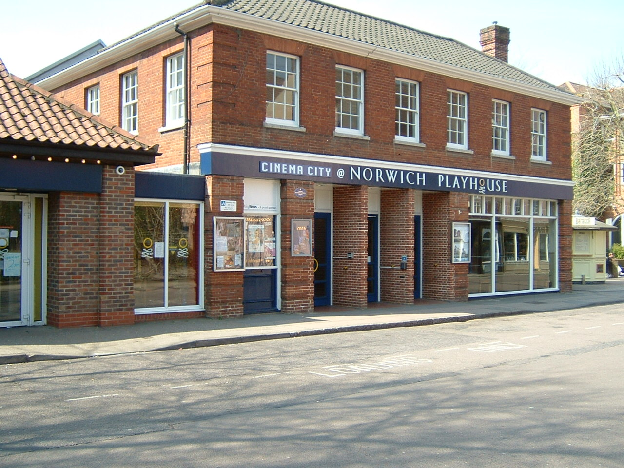
Norwich Playhouse
Cinema and theater · 3.2 mi
Theatre in Norwich, Norfolk, England

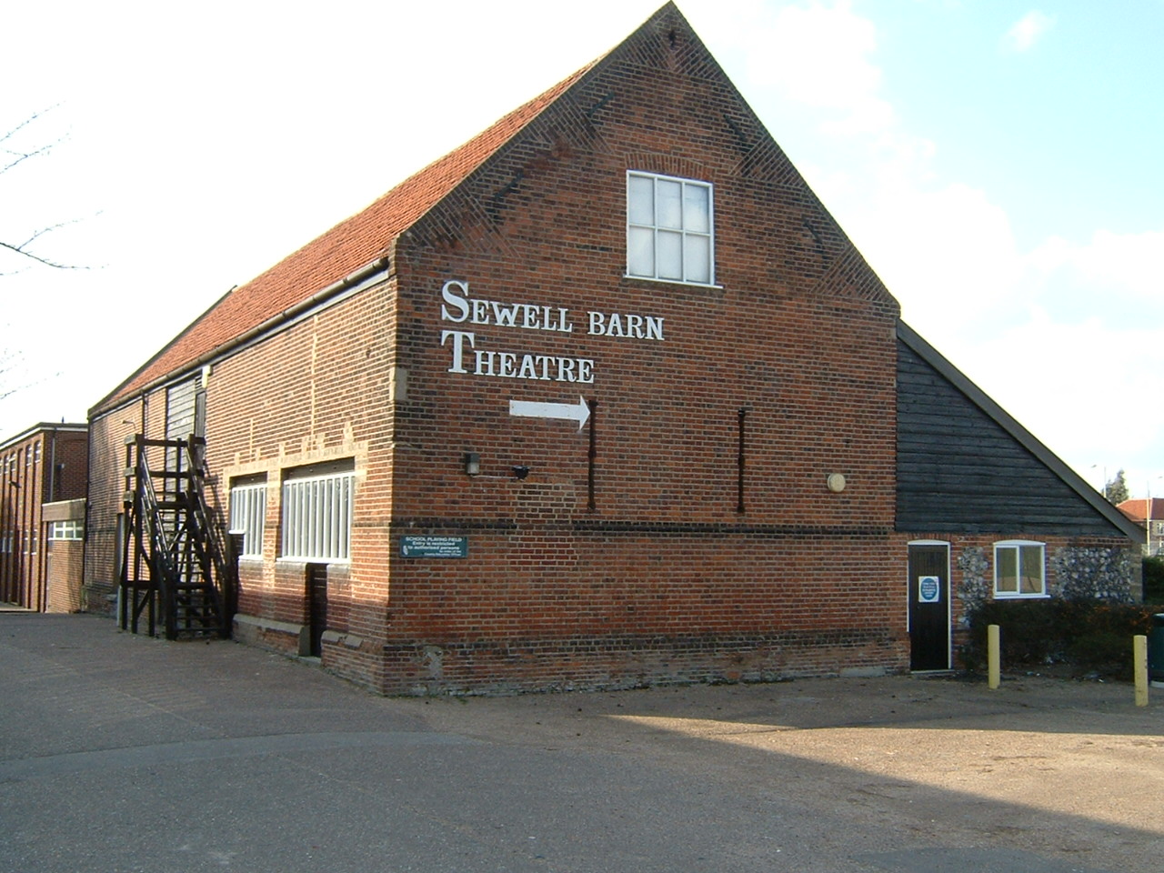
Sewell Barn Theatre
Cinema and theater · 3.4 mi
Theatre in Norwich, England

St Crispin's Bridge
Bridge · 2.9 mi
Bridge in Norwich, Norfolk, England, UK

Theatre Royal, Norwich
Cinema and theater · 3.1 mi
Theatre in Norwich, England

St Miles Bridge
Bridge · 3.1 mi
Bridge in Norwich, Norfolk, England, UK
Museums and landmarks11

The Sainsbury Centre
Museum · 1.4 mi
Norfolk Road, Norwich
Mo off; Tu-Fr 09:00-18:00; Sa-Su 10:00-17:00

Norwich Castle
Monument and historic site · 3.4 mi
Historic castle and museum in Norwich, England
Sainsbury Centre
Museum · 1.4 mi
Art gallery and museum at the University of East Anglia, Norwich, England, United Kingdom

Strangers' Hall
Museum · 3.1 mi
Grade I listed building in Norwich, England

Bridewell Museum
Museum · 3.3 mi
Grade I listed building in Norwich, Norfolk, England, UK

Norwich War Memorial
Monument and historic site · 3.2 mi
War memorial in Norwich, England
Parks, trails and playgrounds36


Earlham Park Woods
Park · 1.2 mi
Nature reserve in Norwich, Norfolk, England, UK




24 more on the map.
Restaurants and cafes55
The Fiveways
Bar and pub · 1.4 mi
Gipsy Lane, Norwich
Mo-Sa 12:00-23:00; Su 12:00-22:30



43 more on the map.
History
Bowthorpe's name is of Norse origin and refers to 'Bui's' farm or settlement.
In the Domesday Book, Bowthorpe is recorded as being made up of 19 households and being owned principally by William the Conqueror.
In 1549, Robert Kett briefly camped at Bowthorpe at the beginning of the rebellion that was to bear his name. On 10 July 1549, the Sheriff of Norfolk, Sir Edward Wyndham, was nearly pulled from his house by the rebels in the village as he tried to persuade them to disband. This helped to inspire further people from Norwich to join Kett at his camp in the village. Kett quickly decided that Bowthorpe was too exposed for a rebel camp, and moved on to Mousehold Heath.
In 1931 the civil parish had a population of 44. On 1 April 1935 the parish was abolished and merged with Costessey.
From the History section of Bowthorpe on Wikipedia, under CC BY-SA 4.0.
More about Bowthorpe
Geography
Bowthorpe is primarily a residential area, but includes a large industrial estate (Bowthorpe Industrial Estate; occupied by mix-use commercial business, including the technology sector) and one small out-of-town shopping centre, containing a supermarket and various smaller retail outlets. A community hall is situated close to Bowthorpe village centre. A police station was located near the centre until it closed in 2018. Most of present-day Bowthorpe has been developed from the 1970s onward.
The largest of these areas is Clover Hill, a mix of council development and private housing, making up almost two-thirds of Bowthorpe. Clover Hill, situated to the east of the other three areas was developed in the 1970s and 1980s. Further development of the mainly private housing estates, Chapel Break and Three Score took place in the 1990s and early 2000s.
Bowthorpe differs from the nearby estates of Earlham and Costessey; by having a high variability of housing stock, and a centrally planned network of bus and bicycle-only lanes. Large open spaces and parks border the periphery of the Bowthorpe housing estate, with Bowthorpe Park between the north of the estate and Dereham Road, and the Yare Marshland and Bowthorpe Southern Park bordering the south and west of the estate.
Education
Bowthorpe is home to three schools; made up of two infant schools and one junior school. One infant school is located in Clover Hill, the other schools are located in Chapel Break.
There was originally a Bowthorpe High School, which was actually located in nearby Earlham. Bowthorpe High School has since been demolished and replaced with a fire station and private housing. The nearest high schools to Bowthorpe are Ormiston Victory Academy (previously Costessey High School), and the City Academy Norwich (previously Earlham High School).
From the Wikipedia article Bowthorpe, under CC BY-SA 4.0.
Where to stay6
Churches and places of worship47
Holy Apostles St. Peter & St. Paul Catholic Church
Church · Catholic · 1.1 mi
Scarnell Road, Norwich
Shopping8
Gas and EV charging5
Schools, colleges and libraries20
Healthcare12
Norfolk & Norwich Kidney Centre
Clinic and pharmacy · 0.4 mi
Francis Way, Norwich
Map of Bowthorpe
208 places. The map loads OpenStreetMap tiles when you open it.
Getting there and nearby towns
Norwich Airport (NWI) is the nearest airport with scheduled flights listed in OpenStreetMap, 4 miles away.
- Norwich 3 mi east, about 6 min by car
- East Dereham 12 mi west, about 20 min by car
- Attleborough 12 mi southwest, about 19 min by car
- North Walsham 14 mi northeast, about 23 min by car
- Diss 19 mi south, about 30 min by car
- Beccles 19 mi southeast, about 31 min by car
- Thetford 25 mi southwest, about 40 min by car
- Stowmarket 32 mi south, about 52 min by car
- Downham Market 35 mi west, about 56 min by car
- Ipswich 40 mi south, about 1 h by car
Drive times are estimates from straight-line distance, not routes.
Towns near Bowthorpe


Keep exploring
Local news
Headlines from INDB.
Reviews, tips and questions
Loading what members have shared...
Sources and licences
- GeoNames (CC BY 4.0): population, coordinates, regions and time zone
- Mapillary (see each image): photos
- OpenStreetMap contributors (ODbL 1.0): places, airports, map data
- Wikidata (CC0 1.0): elevation, founding date, time zone, website, landmarks and historic places
- Wikimedia Commons (see each image): photos
- Wikipedia (CC BY-SA 4.0): overview and history text
Photo credits
- Striking postmen at the Royal Mail Bowthorpe depot in 2009, Roger Blackwell from Norwich, UK, CC BY 2.0
- Blackfriars Bridge Norwich, Northmetpit, CC BY-SA 3.0
- Norwich - Fye Bridge - 20220911135036, Barrymyles, CC BY-SA 4.0
- Maddermarket, Cameron Self, aka C1self at en.wikipedia, CC BY 2.5
- NorwichPlayhouse, Cameron Self, CC BY 2.5
- SewellBarn, Cameron Self, CC BY 2.5
- -2018-07-14 City Station (St Crispin's) Bridge, Norwich, Norfolk (1), Evelyn Simak, CC BY-SA 2.0
- Norwich Theatre Royal, Northmetpit, Public domain
- Norwich castle, The original uploader was Bluemoose at English Wikipedia ., CC BY-SA 3.0
- Strangers' Hall - Charing Cross, Norwich - museum windows, Elliott Brown, CC BY 2.0
- Brundall Church Fen 3, Dudley Miles, CC BY-SA 4.0
- Danby Wood 4, Dudley Miles, CC BY-SA 4.0
- Earlham Park Woods 1, Dudley Miles, CC BY-SA 4.0
- Eaton Common 1, Dudley Miles, CC BY-SA 4.0
- Heigham Park Norwich 2, Northmetpit, CC BY-SA 4.0
- Marston Marshes 2, Dudley Miles, CC BY-SA 4.0
- Waterloo Park Norwich Bandstand & Pavilion, Northmetpit, CC0
- Church of St John the Baptist , Timberhill, Elliott Brown, CC BY 2.0
- Sainsbury Centre for Visual Arts, Oxyman, CC BY 2.5
- NHS NNUH entrance, Unknown author, CC BY-SA 3.0
- Colney-g2, Original uploader was Pommes104 at en.wikipedia (Original text : Bernd Jatzwauk Pommes104 ), CC BY-SA 3.0
- -2011-03-24 Bandstand, Chapelfield gardens, Norwich, Norfolk, Tanya Dedyukhina, CC BY 3.0
- Street-level photo, mrssmsm1, CC BY-SA 4.0
- Street-level photo, mrssmsm1, CC BY-SA 4.0
- Street-level photo, miguel_andrade, CC BY-SA 4.0
- Street-level photo, mrssmsm1, CC BY-SA 4.0
- Street-level photo, miguel_andrade, CC BY-SA 4.0
- Street-level photo, miguel_andrade, CC BY-SA 4.0
- Street-level photo, mrssmsm1, CC BY-SA 4.0
- Street-level photo, miguel_andrade, CC BY-SA 4.0
- Street-level photo, miguel_andrade, CC BY-SA 4.0


Page built November 10, 2026. Spotted a mistake? Tell us or suggest a place.