


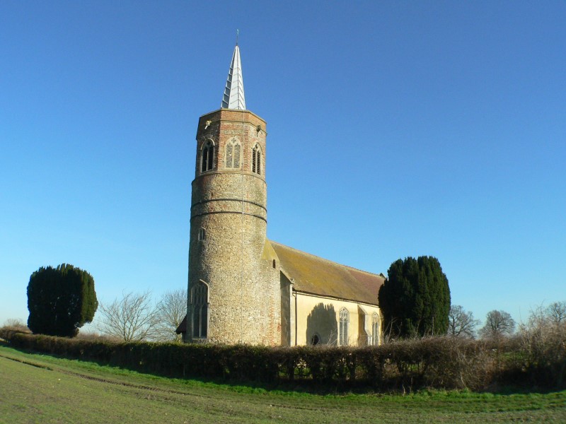

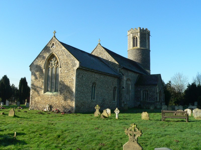

Why visit Diss
Townapedia lists 5 museums and landmarks, 8 parks and trails, 49 places to eat, 2 places to stay and 2 attractions in and around town.
Highlights include The Corn Hall, Diss Museum, Bressingham Steam and Gardens and Roydon Fen.
Weather in Diss
Forecast from MET Norway (CC BY 4.0). Full forecast
About Diss
Diss is a market town and civil parish in the district of South Norfolk in Norfolk, England. It is near to the boundary with Suffolk. It had a population of 7,572 in 2011. It lies in the valley of the river Waveney, around a mere covering 6 acres (2.4 ha) and up to 18 feet (5.5 m) deep, although there is another 51 feet (16 m) of mud.
From the Wikipedia article Diss, Norfolk (this version), under CC BY-SA 4.0.
Travel tips from other travellers: Diss on Wikivoyage (CC BY-SA 4.0).
Things to do2


Museums and landmarks5

Bressingham Steam and Gardens
Museum · 2.3 mi
Museum/various trains and visitor gardens in Norfolk

Parks, trails and playgrounds8





Restaurants and cafes49



Singtong
Restaurant · Thai
Norfolk House Yard, Diss
We-Sa 18:00-22:00

37 more on the map.
History
Diss has several historic buildings, including an early 14th-century parish church and an 1850s Corn Hall, which is still in use. Under Edward the Confessor, Diss was part of the Hartismere hundred of Suffolk, It was recorded as such in the Domesday Book of 1086. It is recorded as being in the King's possession as demesne (direct ownership) of the Crown; at that time, there was a church and a glebe of 4 acres (1.6 ha).
This was thought to be worth £15 per annum, which had doubled by the time of William the Conqueror to £30, with the benefit of the whole hundred and half belonging to it. It was then found to be a league long, around 3 miles (4.8 km) and half that distance wide, and paid 4d. in Danegeld. From this it appears that it was still relatively small, but it soon grew, when it subsumed Watlingsete Manor, a neighbouring area as large as Diss, and seemingly more populated according to the geld or tax that it paid. The town includes part of Heywode, as appears from its joining to Burston, into which the manor extended.
Diss was granted by King Henry I to Richard de Lucy, some time before 1135. The Testa de Neville finds it not known whether Diss was rendered to Richard de Lucy as an inheritance or for his service, but adds it was doubtless for the latter. Richard de Lucy became Chief Justiciar to King Stephen and Henry II.
Read more of the history
In 1152, Richard de Lucy received the right to hold a market in Diss and, before 1161, he gave a third of a hundred of Diss (Heywood or Hewode) together with the market in frank marriage with his daughter Dionisia to Sir Robert de Mountenay. After Richard de Lucy's death in 1179, the inheritance of the other two parts of Diss hundred passed to his daughter Maud, who married Walter FitzRobert.
The whole estate later fell to the Lordship of the FitzWalters, who were raised to Baron FitzWalter in 1295. In 1299, the then Lord FitzWalter obtained a charter of confirmation for a fair every year at his manor of Diss, to be held around the feast day of Saint Simon and Jude (28 October) and several days after. A grant made in 1298 to William Partekyn of Prilleston (now Billingford) presented for homage and half a mark of silver two homesteads in Diss, with liberty of washing his wool and cloths in Diss Meer. This came on the express condition that the gross dye be washed off first. It seems that Diss church was built by the same Lord, as his arms appear in the stone of the south porch of the church several times.
Soon after the Battle of Agincourt in 1415, Edward Plantagenet, Duke of York and Earl of Rutland, came to hold Diss manor, hundred and market, together with Hemenhale, and the title of Lord FitzWalter became attached to the estate.
Hemenhale and Diss manors, with the hundred of Diss in Norfolk
The manors of Wodeham-Walter (now Woodham Walter), Henham, Leiden (now part of Leaden Roding), Vitring, Dunmow Parva (now Little Dunmow), Burnham, Winbush and Shering (now Sheering) in Essex.
Shortly afterwards, the estate was acquired by the Ratcliffe family, which inherited the title of Baron FitzWalter. The family owned the land until at least 1732, styling themselves Viscounts FitzWalter.
John Skelton, tutor and court poet to Henry VIII, was appointed rector at St. Mary's Church in Diss in about 1503. He retained the benefice until his death. Events there formed the subject of some of his poems, such as the humorous invective "Ware the Hauke", in which another priest goes falconing in St Mary's, barring the doors against him and causing chaos in the church.
Opposite the 14th-century parish Church of St Mary the Virgin stands a 16th-century building known as the Dolphin House. This was one of the town's major buildings, as its impressive dressed-oak beams denote. It may have been a wool merchant's house. Formerly a pub, the Dolphin, from the 1800s to the 1960s, the building now houses some small businesses.
Next to Dolphin House is the town's market place, the town's geographical and social centre. The market is held every Friday (except Good Friday and other holidays, when it is rescheduled to Thursday): a variety of local traders sell fresh fruit and vegetables, meat, fish and cheeses. It was first granted a charter by Richard the Lionheart. The town's post office and main shopping street, Mere Street, are also near the marketplace, and Diss Town Hall is located nearby on Market Hill.
Early in 1871, alterations at a house in Mount Street about 100 yards (100 m) north of the parish church led workmen to remove the brick flooring of a ground-floor room and insert the joists of a boarded floor. They found in the centre, some 18 inches (50 cm) from the surface, a hoard of over 300 coins, all silver but for two gold nobles.
From 1927 until 1982, Cambridge businessman Jack Baldry and his son Derek operated a factory in the town that produced soda water, lemonade and cola for the pubs of East Anglia. Baldry also owned soft drinks factories in Cambridge and Sawston The old brewery in Diss that Jack converted into a soda factory is still known locally as Baldry's Yard.
The Diss Museum has been located in a building called the Shambles since 1993.
The 100th Bomb Group Memorial Museum is located 4.5 mi (7.2 km) east of Diss at the former RAF Thorpe Abbotts airfield.
In March 2006, Diss became the third UK town to join Cittaslow, an international body promoting a concept of "Slow Towns". However, it has since withdrawn.
From the History section of Diss, Norfolk on Wikipedia, under CC BY-SA 4.0.
Notable people from Diss
 Declan RuddEnglish association football playerPhoto: Preston_North_End_v_Liverpool_FC_-_Ju..., CC BY 2.0
 James Bickerton FisherNew Zealand politician (1843–1910)Photo: Unknown author Unknown author, Public domain
 Ethel Le NeveMistress of Dr CrippenPhoto: Unknown author, CC BY 4.0
 Trevor HedgeEnglish speedway riderPhoto: Lawson Speedway, CC BY-SA 3.0
- John WilbyeEnglish composer
- Mary Wilson, Baroness Wilson of RievaulxEnglish peeress and poet (1916–2018)
- Mervyn CawstonEnglish footballer (born 1952)
- John Goldworth AlgerEnglish journalist and historian
- William Richard BashamBritish doctor
- Mary AlgerBritish headmistress
- Alec ThurlowFootballer (1922-1956)
Born in Diss, according to Wikidata (CC0). Each name links to its Wikipedia article.
Where to stay2
Churches and places of worship16
Shopping21
Gas and EV charging3
Schools, colleges and libraries6
Healthcare3
Map of Diss
115 places. The map loads OpenStreetMap tiles when you open it.
Getting there and nearby towns
RAF Honington (BEQ) is the nearest airport with scheduled flights listed in OpenStreetMap, 14 miles away.
- Stowmarket 14 mi south, about 22 min by car
- Thetford 15 mi west, about 25 min by car
- Norwich 19 mi northeast, about 31 min by car
- Ipswich 22 mi south, about 35 min by car
- Woodbridge 22 mi southeast, about 35 min by car
- East Dereham 22 mi north, about 36 min by car
- Mildenhall 25 mi west, about 41 min by car
- Sudbury 28 mi southwest, about 46 min by car
- Felixstowe 30 mi south, about 49 min by car
- Harwich 31 mi south, about 50 min by car
Drive times are estimates from straight-line distance, not routes.
Towns near Diss


Keep exploring
Local news
Headlines from INDB.
Reviews, tips and questions
Loading what members have shared...
Sources and licences
- GeoNames (CC BY 4.0): population, coordinates, regions and time zone
- Mapillary (see each image): photos
- OpenStreetMap contributors (ODbL 1.0): places, airports, map data
- Wikidata (CC0 1.0): elevation, founding date, time zone, website, landmarks and historic places
- Wikimedia Commons (see each image): photos
- Wikipedia (CC BY-SA 4.0): overview and history text
Photo credits
- Diss Crown Post Office, kitmasterbloke, CC BY 2.0
- Wortham - Church of St Mary, Keith Evans, CC BY-SA 2.0
- Shimpling-g6, Bernd Jatzwauk Pommes104, CC BY-SA 3.0
- Roydon Fen 1, Dudley Miles, CC BY-SA 4.0
- Roydon-g2, Pommes104 at English Wikipedia, CC BY-SA 3.0
- -2016-07-01 Market Hill, Diss, Norfolk, Ant Basterfield, CC BY-SA 2.0
- Street-level photo, AR_Mapper, CC BY-SA 4.0
- Street-level photo, IpswichEdits, CC BY-SA 4.0
- Street-level photo, smsm1, CC BY-SA 4.0
- Street-level photo, IpswichEdits, CC BY-SA 4.0
- Street-level photo, IpswichEdits, CC BY-SA 4.0
- Street-level photo, tallguy, CC BY-SA 4.0
- Street-level photo, IpswichEdits, CC BY-SA 4.0
- Street-level photo, smsm1, CC BY-SA 4.0
- Street-level photo, IpswichEdits, CC BY-SA 4.0
- Street-level photo, IpswichEdits, CC BY-SA 4.0
- Street-level photo, tallguy, CC BY-SA 4.0
- Street-level photo, AR_Mapper, CC BY-SA 4.0
- Street-level photo, tallguy, CC BY-SA 4.0
Page built November 10, 2026. Spotted a mistake? Tell us or suggest a place.