


Thetford, United Kingdom
Thetford is a town of 24,833 people in England, United Kingdom.
Why visit Thetford
Townapedia lists 51 museums and landmarks, 30 parks and trails, 69 places to eat, 7 places to stay and 2 attractions in and around town.
Highlights include The Light, Charles Burrell Museum, Dad's Army Museum and East Wretham Heath.
Weather in Thetford
Forecast from MET Norway (CC BY 4.0). Full forecast
About Thetford
Thetford is a market town and civil parish in the Breckland District of Norfolk, England. It is on the A11 road between Norwich and London, just east of Thetford Forest. The civil parish, covering an area of 29.55 km2 (11.41 sq mi), in 2011 had a population of 24,340.
From the Wikipedia article Thetford (this version), under CC BY-SA 4.0.
Travel tips from other travellers: Thetford on Wikivoyage (CC BY-SA 4.0).
Photos of Thetford


Things to do2


Museums and landmarks51

Charles Burrell Museum
Museum
Building in Thetford, Breckland, Norfolk, England, UK
Minstergate, Thetford
Tu 10:00-14:00; Sa 10:00-15:00

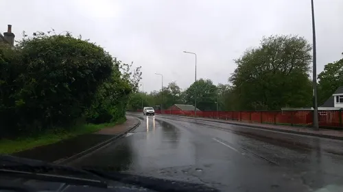

Thetford Priory
Monument and historic site
Ruins of a Cluniac priory in Thetford, Breckland, Norfolk, England, UK


Euston Hall
Museum · 3.4 mi
An ancestral home of the Dukes of Grafton and Earls of Arlington


Ancient House Museum of Thetford Life
Museum
21-23 White Hart Street, Thetford
Apr 01-Sep 30 Tu-Sa 10:00-17:00; Jan 01-Mar 31 Tu-Sa 10:00-16:00;...

Holy Sepulchre Priory, Thetford
Monument and historic site · 0.4 mi
Grade I listed building in Thetford, Breckland, Norfolk, England, UK
39 more on the map.
Parks, trails and playgrounds30




18 more on the map.
Restaurants and cafes69
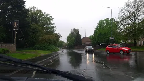
The Thomas Paine Hotel Restaurant
Restaurant
33 White Hart Street, Thetford
Fr-Sa 12:00-21:00; Su 12:00-17:00

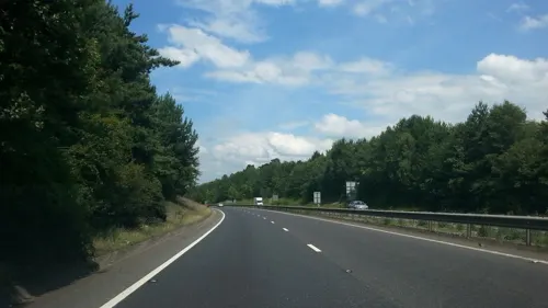



Oriental Garden Chinese Restaurant
Restaurant · Chinese
Guildhall Street, Thetford
Tu-Th 17:00-22:00; Fr,Sa 12:00-14:00, Th,Fr 17:00-22:30; Su...
57 more on the map.
History
Breckland was used as an excavation site for flint tools around 2000 BC. During the Iron Age, a fort was established on Icknield Way at the site of Thetford Castle. Thetford was an important tribal centre for the Iceni during the late Iron Age and early Roman period, with Castle Hill and Gallows Hill being sites of particular note. During the Saxon period it was the principal centre of the eastern Heptarchy and a regular battle site between locals and the Viking invaders.
A mint was built in Thetford in the 9th century. There is evidence of coins minted in Thetford from the time of King Canute to the reign of King John. A monastery was established around 1020 and a grammar school was operating since before the Norman Conquest of 1066. The town greatly prospered during the reign of Edward the Confessor (1042–1066), and at one point there were 944 free Burgesses living in Thetford. The Domesday Book of 1086 estimated the population of Thetford to have grown to between 4000 and 4500 people, which would have been the sixth largest town in Britain at the time. The Book lists William of Bello Fargo as the Bishop of Thetford then. The bishopric had moved here from North Elmham in 1071 and stayed in Thetford until moving to Norwich in 1096.
Read more of the history
In 1067–1069, Thetford Castle was built on the ruins of an Iron Age fort at Castle Hill. It is believed to have been constructed either by Ralph Guader, Earl of East Anglia, or Roger Bigod, his successor as Earl, who is known to have ordered Bungay and Framlingham castles to have been built in Suffolk. In 1104, Bigod founded the Cluniac Priory of St Mary. The priory grew rapidly, with an influx of monks from Lewes, and in 1107 it was moved to a larger site on the other side of the river where the ruins remain today. It became the largest and most important religious institution in Thetford.
The Norfolk Lent Assizes were held at Thetford from 1264 because there was only one Assize for both Norfolk and Suffolk. Thetford, being close to the border between the two, was convenient for both. However, after much pressure, an Act of Parliament was passed in 1832 to transfer them to Norwich. In 1373, John of Gaunt, the Duke of Lancaster, was responsible for altering the administrative makeup of the town, promoting the mayor to its most important official, subjecting the bailiff and the coroner to report to him. Thetford had its own coroner, courts and legal officials, without depending on those for the counties of Norfolk and Suffolk.
Henry VIII sent Anne Boleyn's father, Thomas, as part of a Commission to assess Thetford in 1527. The Commission concluded that the town had fallen into "great ruin and decay" and that the burgesses of the town had squandered rents and dues which belonged to the King. Thetford was struck hard by the Dissolution of the Monasteries in the 1530s and 1540s. A formal complaint was raised by the mayors and burgesses to Thomas Cromwell in 1539, arguing that many of the town's inhabitants would fall into extreme poverty because their livelihoods depended on pilgrims visiting Thetford. Thetford Priory was closed down in 1540 and fell into the possession of Thomas Howard, 3rd Duke of Norfolk. In 1574, Elizabeth I granted a Charter of Incorporation to the town, setting up a governing body of a mayor, ten burgesses and twenty commoners to meet in the Guildhall and redevelop the town's main streets, houses and shops. Elizabeth arrived in Thetford on 27 August 1578 to survey developments, holding a Privy Council meeting at Sir Edward Clere's Place House, now Nunnery Place. A lot of material from the decaying priory and religious buildings in the town were used to save building costs in the building of King's House and other buildings in Thetford.
James VI and I visited Thetford, and in 1609 bought a house near St Peter's churchyard from Sir William Barwick, still known as the King's House. The house was rebuilt and extended for the king with a "treble roof" of three gables. Charles I granted the house to his Master Falconer, Andrew Pitcairns.
In 1819 there was a local desire to develop Thetford into a spa town modelled on Bath, Cheltenham and Harrogate. A pump room was built over the spring at Nuns Bridges and the Thetford Mineral Spring Company was established. The mayor financed a new gravel path along the bank of the Little Ouse, which was named Spring Walk. The plan did not succeed; by 1838 the pump room was closed. In 1835 the old Corporation of Thetford was abolished, and a new one set up a mayor, four aldermen and twelve councillors. The town was represented by two MPs until 1868 when it lost a seat to Scotland.
Dr Allan Glaisyer Minns, born in Inagua, the Bahamas, became the first black man to become a mayor in Britain when he was elected as Mayor of Thetford in 1904.
In 1912, more than 30,000 troops participated in military manoeuvres on the heath land outside the town. Over 700 men from the town fought in World War I; a memorial was erected in 1921 with the names of over 100 men who died during the war. Locally in the wooded and sandy-soiled areas the trial tests of the first tank took place in total secrecy in early 1915. At the end of World War II, Thetford still only had a population of around 5000 people. In the 1950s, the borough council drew up a plan with the London County Council to relocate Londoners and several businesses to Thetford and double the population. By the late 1980s the population of Thetford had reached around 21,000 people. This meant that Thetford grew faster than any other town in Norfolk.
In July 2026 there were several nights of mob violence including attacks on police officers and on homes thought to be occupied by asylum seekers. 19 arrests had been made by 14 August 2026. On 18 August a man was charged with misconduct in a public office " in connection with the release of information relating to a number of addresses in Thetford, which were later targeted during several nights of violent disorder in the town."
From the History section of Thetford on Wikipedia, under CC BY-SA 4.0.
More about Thetford
Geography
Thetford is situated in the south of Norfolk, close to the county boundary with Suffolk. By road it is 33.8 miles (54.4 km) northeast of Cambridge and 30.7 miles (49.4 km) southwest of Norwich. It lies on the River Little Ouse. On the western side of Thetford is Thetford Forest, which is heavily forested with pine trees. Brettenham Heath National Nature Reserve is to the northeast, near the hamlet of Roudham. To the southeast of Thetford is Nunnery Lakes Nature Reserve, covering about 200 acres (80 hectares), with breckland heath, woodland, fen and open water habitats and two kilometres (1+1⁄4 mi) of paths.
Economy
The Thetford Borough Police Force was established in 1836, and in 1857 the small force joined Norfolk County Constabulary. Thetford Fire Brigade was established in 1880.
The Thetford Gas Company, founded in 1838, proved very short-lived until Thetford Gasworks opened on Bury Road in 1845. In 1848, gas street lighting was installed in Thetford. From 1877 the town was provided with a clean water supply thanks to a new reservoir and steam engine on Gallows Hill to pump fresh water into the town. In 1929 the Anglian Electricity Supply Company began supplying electricity to the town, which was completed in 1933.
Thetford was the headquarters of Tulip International, large-scale manufacturers of bacon, beef and pork. In March 2007 the factory laid off three quarters of their workforce in Thetford with the loss of 350 jobs, and the factory later closed in 2010. In January 2018 it was announced that a new retail park and restaurant had been approved on the factory site with over 7,367 square metres (79,300 sq ft) of retail floor space. The development was initiated by Stapleford Thetford Ltd. as part of the Thetford-Cambridge-Norwich Technology Corridor. The market is held outside Thetford Guildhall in the town centre on Tuesdays and Saturdays.
The British Trust for Ornithology has its headquarters at The Nunnery in Thetford.
Arts and culture
The external scenes for the BBC TV series Dad's Army were filmed in and around the town, with Thetford's flint buildings doubling for Walmington-on-Sea. The Dad's Army Museum is housed in part of Thetford Guildhall.
Local news and television programmes are provided by BBC East and ITV Anglia. Television signals are received from the Tacolneston and local relay transmitters.
The town's local radio stations are BBC Radio Norfolk on 104.4 FM, Greatest Hits Radio Norfolk & North Suffolk on 96.7 FM, Heart East on 102.4 FM, and Thetford Radio, a community radio station.
The local newspapers are the Thetford & Brandon Times and the Eastern Daily Press.
From the Wikipedia article Thetford, under CC BY-SA 4.0.
Notable people from Thetford
 Thomas PaineAmerican Founding Father, philosopher, and political activist (1737–1809)Photo: Laurent Dabos, Public domain
 Ryan VickersBritish motorcycle racerPhoto: Smudge 9000, CC BY-SA 2.0
 Terry JermyBritish politician (born 1985)Photo: ©House of Commons / Roger Harris, CC BY 3.0
- Ted BatesEnglish footballer (1918-2003)
- Tony PowellCanadian sprinter
- Ian HendersonEnglish association football player
- Dick ScottEnglish footballer (1941-2018)
- Pete McCormackCanadian film director and screenwriter
- James Graham-BrownEnglish cricketer (born 1951)
- Alfred Neobard PalmerBritish historian (1847-1915)
- Frederick Charles Victor LawsBritish RAF officer (1887-1975)
- Henry ParringtonNew Zealand cricketer
Born in Thetford, according to Wikidata (CC0). Each name links to its Wikipedia article.
Where to stay7
Churches and places of worship18
Shopping15
Gas and EV charging6
Schools, colleges and libraries15
Barnham Church of England Voluntary Controlled Primary School
School · Anglican · 2.8 mi
Mill Lane, Thetford
Healthcare6
Map of Thetford
219 places. The map loads OpenStreetMap tiles when you open it.
Getting there and nearby towns
RAF Honington (BEQ) is the nearest airport with scheduled flights listed in OpenStreetMap, 5 miles away.
- Norwich 27 mi northeast, about 44 min by car
- Ipswich 30 mi southeast, about 48 min by car
- Wisbech 30 mi northwest, about 49 min by car
- Cambridge 31 mi southwest, about 49 min by car
- Woodbridge 33 mi southeast, about 53 min by car
- Colchester 37 mi south, about 1 h by car
- Whittlesey 38 mi west, about 1 h by car
- Peterborough 43 mi west, about 1 h 15 min by car
- Witham 43 mi south, about 1 h 15 min by car
- Chelmsford 49 mi south, about 1 h 15 min by car
Drive times are estimates from straight-line distance, not routes.
Towns near Thetford


Keep exploring
Local news
Headlines from INDB.
Reviews, tips and questions
Loading what members have shared...
Sources and licences
- GeoNames (CC BY 4.0): population, coordinates, regions and time zone
- Mapillary (see each image): photos
- OpenStreetMap contributors (ODbL 1.0): places, airports, map data
- Wikidata (CC0 1.0): elevation, founding date, time zone, website, landmarks and historic places
- Wikimedia Commons (see each image): photos
- Wikipedia (CC BY-SA 4.0): overview and history text
Photo credits
- UK Thetford (Norfolk), Uksignpix, CC BY-SA 3.0
- 10 Croxton Road, Thetford 02, Dabacusbc, CC BY-SA 4.0
- 10 Croxton Road, Thetford 01, Dabacusbc, CC BY-SA 4.0
- Thetford Post Office - panoramio, Tanya Dedyukhina, CC BY 3.0
- -2021-04-18 Old Croxton Road at the junction of Norwich Road, Thetford, Norfolk, David Howard, CC BY-SA 2.0
- Charles Burrell Museum, Jack1956, CC0
- Dads Army Museum Thetford, Jack1956, CC0
- Cmglee Thetford Priory, Unknown author, CC BY-SA 4.0
- Croxton-g4, Bernd Jatzwauk Pommes104, CC BY-SA 3.0
- Black Horse, Thetford, John Law, CC BY-SA 2.0
- Holy Sepulchre Priory ruins - 2016-05-24, August Schwerdfeger, CC BY 4.0
- 2017 Volkswagen Polo GTi, Calreyn88, CC BY-SA 4.0
- 2017 Nissan Juke N-Connecta, Calreyn88, CC BY-SA 4.0
- 2016 BMW i3, Calreyn88, CC BY-SA 4.0
- 2012 Volkswagen Polo Match, Calreyn88, CC BY-SA 4.0
- 1998 Volvo V70 Torslanda 10V, Calreyn88, CC BY-SA 4.0
- 2006 Volvo V70 SE D5 AWD Auto, Calreyn88, CC BY-SA 4.0
- 2003 BMW 730d SE Auto, Calreyn88, CC BY-SA 4.0
- Euston hall, Qazwsx777, CC BY-SA 4.0
- Thetford Warren Lodge, Martin Neylon, CC BY-SA 4.0
- Street-level photo, IpswichEdits, CC BY-SA 4.0
- Street-level photo, IpswichEdits, CC BY-SA 4.0
- Street-level photo, IpswichEdits, CC BY-SA 4.0
- Street-level photo, IpswichEdits, CC BY-SA 4.0
- Street-level photo, IpswichEdits, CC BY-SA 4.0
- Street-level photo, adam2, CC BY-SA 4.0


Page built November 10, 2026. Spotted a mistake? Tell us or suggest a place.