




Burstwick, United Kingdom
Burstwick is a town of 1,924 people in England, United Kingdom.
Why visit Burstwick
Townapedia lists 2 museums and landmarks, 2 parks and trails and 7 places to eat in and around town.
Highlights include Constable Mausoleum.
Weather in Burstwick
Forecast from MET Norway (CC BY 4.0). Full forecast
About Burstwick
Burstwick is a village and civil parish in the Holderness region of the East Riding of Yorkshire, England. It is situated about 8 miles (13 km) east of Hull city centre. It lies on the B1362 road.
From the Wikipedia article Burstwick (this version), under CC BY-SA 4.0.
Museums and landmarks2

Constable Mausoleum
Monument and historic site · 2.6 mi
Architectural structure in Halsham, East Riding of Yorkshire, England, UK

Parks, trails and playgrounds2


Restaurants and cafes7



Churches and places of worship9


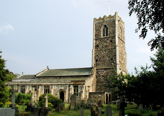
All Saints' Church, Burstwick
Church
Grade I listed church in Burstwick, East Riding of Yorkshire, England, UK

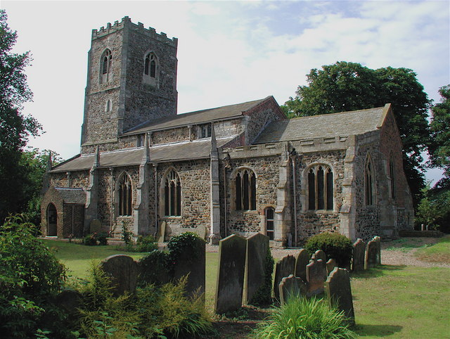
Church of Saint Peter and Saint Paul
Church · 2.5 mi
Church in Burton Pidsea, East Riding of Yorkshire, England, UK

Church of St Lawrence
Church · 2.8 mi
Church building in Elstronwick, East Riding of Yorkshire, England, UK

St Augustine's Church, Hedon
Church · 2.5 mi
Grade I listed church in Hedon, East Riding of Yorkshire, England, UK

Church of All Saints
Church · 2.5 mi
Church in Halsham, East Riding of Yorkshire, England, UK
Church of St Nicholas
Church · 1.8 mi
Grade I listed church in Keyingham, East Riding of Yorkshire, England, UK
Church of St Wilfred
Church · 3.2 mi
Church in Ottringham, East Riding of Yorkshire, England, UK
History
The name Burstwick derives from the Old English Brustiwīc meaning 'Brusti's trading settlement'.
Burstwick is described as a caput, or principal residence, in the Honour of Holderness, and is listed in the Domesday survey as one of twelve linked manors.
From the History section of Burstwick on Wikipedia, under CC BY-SA 4.0.
Shopping1
Gas and EV charging1
Schools, colleges and libraries1
Map of Burstwick
23 places. The map loads OpenStreetMap tiles when you open it.
Getting there and nearby towns
Humberside Airport (HUY) is the nearest airport with scheduled flights listed in OpenStreetMap, 14 miles away.
- Keyingham 2 mi southeast, about 3 min by car
- Hedon 2 mi west, about 4 min by car
- Kingston upon Hull 8 mi west, about 13 min by car
- Immingham 9 mi south, about 14 min by car
- Stallingborough 10 mi south, about 16 min by car
- Dunswell 11 mi northwest, about 17 min by car
- Grimsby 12 mi south, about 19 min by car
- Cleethorpes 13 mi south, about 20 min by car
- Barton upon Humber 13 mi west, about 21 min by car
- Beverley 14 mi northwest, about 23 min by car
Drive times are estimates from straight-line distance, not routes.
Towns near Burstwick


Keep exploring
Local news
Headlines from INDB.
Reviews, tips and questions
Loading what members have shared...
Sources and licences
- GeoNames (CC BY 4.0): population, coordinates, regions and time zone
- Mapillary (see each image): photos
- OpenStreetMap contributors (ODbL 1.0): places, airports, map data
- Wikidata (CC0 1.0): elevation, founding date, time zone, website, landmarks and historic places
- Wikimedia Commons (see each image): photos
- Wikipedia (CC BY-SA 4.0): overview and history text
Photo credits
- All Saints Church, Burstwick, Paul Glazzard, CC BY-SA 2.0
- Main Street Burstwick, Andy Beecroft, CC BY-SA 2.0
- Constable Mausoleum, Halsham, Paul Glazzard, CC BY-SA 2.0
- St Peter St Paul Church Burton Pidsea, Paul Glazzard, CC BY-SA 2.0
- St Lawrence's Church, Elstronwick, Paul Glazzard, CC BY-SA 2.0
- Hedon Church from Market Hill, Andy Beecroft, CC BY-SA 2.0
- Thorngumbald Church, Andy Beecroft, CC BY-SA 2.0
- The Barn Farm Thorngumbald, Paul Harrop, CC BY-SA 2.0
- Street-level photo, cuttlebug, CC BY-SA 4.0
- Street-level photo, cuttlebug, CC BY-SA 4.0
- Street-level photo, cuttlebug, CC BY-SA 4.0
Page built November 10, 2026. Spotted a mistake? Tell us or suggest a place.