


Cleethorpes, United Kingdom
Cleethorpes is a town of 38,996 people in England, United Kingdom.
Why visit Cleethorpes
Townapedia lists 7 museums and landmarks, 18 parks and trails, 224 places to eat, 29 places to stay and 7 attractions in and around town.
Highlights include Corporation Bridge, Pleasure Island Family Theme Park, Ross Castle and Weelsby Woods.
Weather in Cleethorpes
Forecast from MET Norway (CC BY 4.0). Full forecast
About Cleethorpes
Cleethorpes () is a seaside town on the estuary of the Humber in North East Lincolnshire, Lincolnshire, England with a population of 29,670 in 2021. It has been permanently occupied since the 6th century, with fishing as its original industry, and then developing into a resort in the 19th century. Before becoming a unified town, Cleethorpes was made up of the three small villages of Itterby, Oole and Thrunscoe.
From the Wikipedia article Cleethorpes (this version), under CC BY-SA 4.0.
Travel tips from other travellers: Cleethorpes on Wikivoyage (CC BY-SA 4.0).
Things to do7

Corporation Bridge
Bridge · 2.2 mi
Grade II listed bridge in Grimsby, UK

Pleasure Island Family Theme Park
Monument and historic site · 1.5 mi
1993–2016 amusement park in Lincolnshire, England



Museums and landmarks7


To Be Demollished (Unoccupied Property)
Monument and historic site · 1.8 mi
Peaks Lane, Grimsby
Parks, trails and playgrounds18

Weelsby Woods
Park · 1.4 mi
This large park features natural wooded habitats & open grassy fields for recreation.
Weelsby Road, Grimsby

People's Park
Park · 2.2 mi
Park in Grimsby, Lincolnshire, England, UK



Humber Cruising Association Ltd
Marina and boat launch · 1.9 mi

6 more on the map.
Restaurants and cafes224
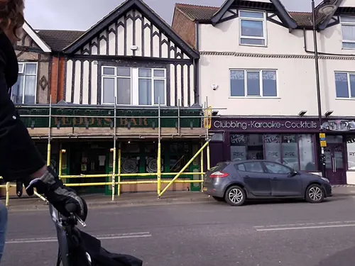
Eastern Delights
Restaurant · Indian
40 Market Street, Cleethorpes
Su-Th 17:00-23:00; Fr-Sa 17:00-23:30
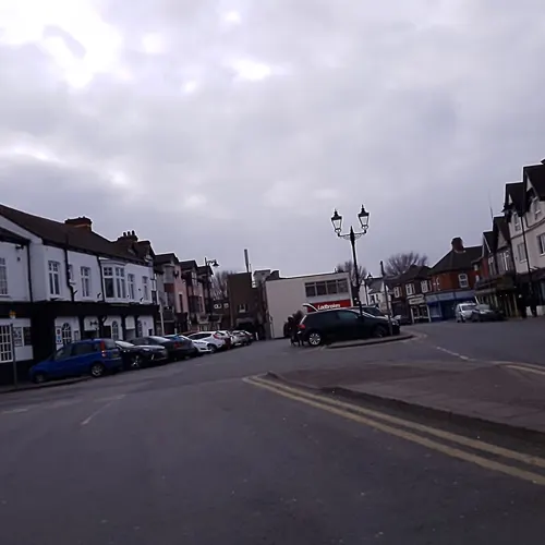
Ernie Beckett's
Restaurant · Fish And Chips
21 Market Street, Cleethorpes
Mo-Sa 12:00-20:00; Su 12:00-16:30
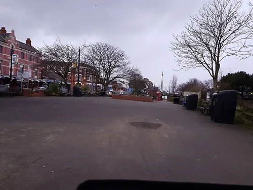
Fez Cleethorpes
Restaurant · Moroccan
40 Alexandra Road, Cleethorpes
Tu-Th 17:00-22:00; Fr-Sa 12:00-22:30; Su-Mo closed
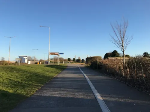


Steels Corner House Restaurant
Restaurant · Fish And Chips
10-12 Market Street, Cleethorpes
Mo-Sa 11:30-20:00; Su 11:30-19:30


Fishermans Arms
Bar and pub
25 Wardall Street, Cleethorpes
Mo-Th 09:00-23:00; Fr, Sa 09:00-00:00; Su 09:00-23:00
212 more on the map.
History
Before becoming a unified town, Cleethorpes was made up of three small villages: Itterby, Oole and Thrunscoe, which were part of a wider parish called Clee (centred on Old Clee) named from clee, an old form of the word clay. The name Cleethorpes is of comparatively recent origin, combining the parish Clee with thorp, an Old English/Old Norse word for "village". The earliest attestations are 1552 for singular Clethorpe (meaning Itterby) and 1588 for plural Clethorpes (including Oole, adjacent to Itterby; later also Thrunscoe slightly to the south).
Whilst there are Neolithic and Bronze Age remains in the area, permanent occupation appears to date from the 6th century, with substantial communities appearing only in the 9th century when the Danes arrived.
The manor of Itterby was purchased in 1616 by the trustees of Peter Blundell's charity for the benefit of scholars and fellows at Sidney Sussex College, Cambridge from Blundell's School, Tiverton.
Cleethorpes developed as a fishing village. By the time of the 1801 census the population was 284. The 1820s saw the first developments of Cleethorpes as a health holiday resort, with sea-bathing and the taking of medicinal waters becoming fashionable. By 1831 the population had increased to 497.
Read more of the history
In 1842 the Clee Inclosure Act 1842 (5 & 6 Vict. c. 1 Pr.) was enacted. 2,100 acres (8.5 km2) of land were divided among land owners and eight new roads developed. In 1848 Cleethorpes was described as:
"...much resorted to as a bathing-place, for which it is highly eligible; the air is pure, the scenery good and besides a few lodging-houses and smaller inns, there is a large hotel, built some years since, on an eminence embracing extensive views of the sea, the Humber, and the Yorkshire coast. Many of the population are employed in the oyster-fisheries."
The resort expanded following the linking of the town by railway with industrial towns in Yorkshire. Cleethorpes Pier opened in 1873 and the promenade in 1885. Cleethorpes with Thrunscoe was created as a local board of health district in 1873, and under the Local Government Act 1894 it became an urban district. Its headquarters was established at Cleethorpes Town Hall in 1905.
In 1916 the urban district was renamed Cleethorpes, and in 1922 and 1927 the town's boundaries were extended to include part of Humberston (as far as North Sea Lane) and the Beacon Hill area of Weelsby parish. In 1936 Cleethorpes was granted a charter of incorporation to become a municipal borough.
Cleethorpes successfully resisted attempts by Grimsby to absorb it and in 1974 it became the Borough of Cleethorpes within the new county of Humberside. However, when Humberside County Council was abolished in 1996, Cleethorpes Borough Council was joined with Grimsby Borough Council as the unitary authority of North East Lincolnshire. In 2009, North East Lincolnshire Council agreed to market the towns of Grimsby, Immingham and Cleethorpes, under the 'Greater Grimsby' banner.
Local residents from Lincolnshire and the Yorkshire and Humber area affectionately refer to Cleethorpes and its residents as Meggies. Cleethorpes can also be known as "down beach".
From the History section of Cleethorpes on Wikipedia, under CC BY-SA 4.0.
More about Cleethorpes
Geography
Cleethorpes is situated on the southern side of the Humber estuary in North East Lincolnshire – a unitary authority area in North of England. The Greenwich meridian passes through the town and a signpost shows some distances to world-wide locations. North Pole 2,517 miles (4,051 km), South Pole 9,919 miles (15,963 km), New York City 3,418 miles (5,501 km) and London 140 miles (230 km).
Cleethorpes is physically linked to the neighbouring town of Grimsby by built up residential estates and the villages of Old Clee and Weelsby are also contiguous with the two towns.
As with most of the British Isles, Cleethorpes experiences a maritime climate. It has mild summers and cool winters. The average annual rainfall is amongst the lowest in the British Isles.
Economy
The Winter Gardens, a venue for a variety of events, was demolished in 2007 and replaced by 47 flats. During a mass boycott of punk bands in the 1970s, the Winter Gardens was just one of five UK venues that allowed the likes of the Clash, AC/DC and the Sex Pistols to perform. The old mini steam railway running from the seafront leisure centre to St Anthony's bank has been extended. A cafe, taphouse, and gallery have been added to the boating lake, and many ducks and geese use the boating lake to breed. A large open air show ground has been built close to the eastern end of the boating lake — it often shows live bands and hosts special events, most notably hosting the London 2012 Olympic torch relay.
A new RNLI station is set to be completed on the Central Promenade by 2025.
Education
Secondary schools in Cleethorpes include Cleethorpes Academy and Beacon Academy.
From September 2011, N.E. Lincolnshire SSP was the only remaining School Sports Partnership after government funding cuts.
From the Wikipedia article Cleethorpes, under CC BY-SA 4.0.
Notable people from Cleethorpes
 Martin VickersBritish Conservative politicianPhoto: ©House of Commons / Laurie Noble, CC BY 3.0
 Siobhan LeachmanNew Zealand WikimedianPhoto: Siobhan Leachman, CC0
 Stephen BennettBritish professional golferPhoto: Pvt pauline, CC BY-SA 3.0
- Rod TempertonEnglish songwriter, producer and musician (1949–2016)
- Patricia HodgeBritish actress
- Patrick WymarkEnglish actor (1926–1970)
- Peter AppleyardCanadian vibraphonist (1928–2013)
- Gemma MernaBritish actor and model
- Michele DotriceBritish actress
- Vivean GrayEnglish TV and film actress in Australia (1924-2016)
- Jo KendallBritish actress (1940–2022)
- Terry Bartlettassociation football player (born 1948)
Born in Cleethorpes, according to Wikidata (CC0). Each name links to its Wikipedia article.
Where to stay29
Churches and places of worship21
Beaconthorpe Methodist Church (demolished)
Church · Methodist
Grimsby Road, Cleethorpes
Holy Trinity and St Mary the Virgin
Church · Anglican · 0.9 mi
Church Lane, Grimsby
St Andrew with St Luke & All Saints
Church · Anglican · 1.7 mi
Albion Street, Grimsby
St Francis of Assisi
Church · Anglican · 0.8 mi
19A Sandringham Road, Cleethorpes
Shopping28
Gas and EV charging7
Schools, colleges and libraries24
St Joseph's Catholic Primary Voluntary Academy
School · Roman Catholic · 0.9 mi
Philip Avenue, Cleethorpes
Healthcare17
Map of Cleethorpes
250 places. The map loads OpenStreetMap tiles when you open it.
Getting there and nearby towns
Humberside Airport (HUY) is the nearest airport with scheduled flights listed in OpenStreetMap, 13 miles away.
- Grimsby 2 mi west, about 3 min by car
- Immingham 8 mi northwest, about 14 min by car
- Louth 13 mi south, about 22 min by car
- Hedon 14 mi northwest, about 23 min by car
- Kingston upon Hull 18 mi northwest, about 29 min by car
- Barton upon Humber 19 mi northwest, about 31 min by car
- Mablethorpe 19 mi southeast, about 31 min by car
- Beverley 25 mi northwest, about 41 min by car
- Brough 25 mi northwest, about 40 min by car
- Scunthorpe 26 mi west, about 41 min by car
Drive times are estimates from straight-line distance, not routes.
Towns near Cleethorpes


Keep exploring
Local news
Headlines from INDB.
Reviews, tips and questions
Loading what members have shared...
Sources and licences
- GeoNames (CC BY 4.0): population, coordinates, regions and time zone
- Mapillary (see each image): photos
- OpenStreetMap contributors (ODbL 1.0): places, airports, map data
- Wikidata (CC0 1.0): elevation, founding date, time zone, website, landmarks and historic places
- Wikimedia Commons (see each image): photos
- Wikipedia (CC BY-SA 4.0): overview and history text
Photo credits
- Cleethorpes Central Promenade (June 2012), MOTORAL1987, CC BY-SA 3.0
- Cleethorpes Mark - panoramio, Graham Capstick, CC BY-SA 3.0
- Corporation Bridge, David Wright, CC BY-SA 2.0
- St. James' Church, Grimsby, David Wright, CC BY-SA 2.0
- Christ Church, Cleethorpes - DSC07275, Rept0n1x, CC BY-SA 3.0
- Weelsby1, Peter Chapman, aka Peter Chapman at en.wikipedia, CC BY-SA 3.0
- Boomerang (Pleasure Island), Calzz, CC BY-SA 3.0
- Peoples Park Grimsby 2023, Jack1956, CC BY-SA 4.0
- Ross Castle Cleethorpes July 2024, Secretlondon, CC BY-SA 4.0
- Street-level photo, cyclestreets, CC BY-SA 4.0
- Street-level photo, cyclestreets, CC BY-SA 4.0
- Street-level photo, cyclestreets, CC BY-SA 4.0
- Street-level photo, cyclestreets, CC BY-SA 4.0
- Street-level photo, cyclestreets, CC BY-SA 4.0
- Street-level photo, cyclestreets, CC BY-SA 4.0
- Street-level photo, cyclestreets, CC BY-SA 4.0
- Street-level photo, cyclestreets, CC BY-SA 4.0
- Street-level photo, cyclestreets, CC BY-SA 4.0
- Street-level photo, cyclestreets, CC BY-SA 4.0
- Street-level photo, Lapscle, CC BY-SA 4.0
- Street-level photo, Lapscle, CC BY-SA 4.0
- Street-level photo, Lapscle, CC BY-SA 4.0
- Street-level photo, Lapscle, CC BY-SA 4.0
- Street-level photo, cyclestreets, CC BY-SA 4.0
- Street-level photo, cyclestreets, CC BY-SA 4.0
- Street-level photo, lamaar639, CC BY-SA 4.0
- Street-level photo, cyclestreets, CC BY-SA 4.0
- Street-level photo, Lapscle, CC BY-SA 4.0
- Street-level photo, cyclestreets, CC BY-SA 4.0
- Street-level photo, Lapscle, CC BY-SA 4.0
- Street-level photo, cyclestreets, CC BY-SA 4.0
- Street-level photo, chuck, CC BY-SA 4.0
- Street-level photo, Lapscle, CC BY-SA 4.0
- Street-level photo, lamaar639, CC BY-SA 4.0
- Street-level photo, cyclestreets, CC BY-SA 4.0
- Street-level photo, lamaar639, CC BY-SA 4.0
- Street-level photo, Lapscle, CC BY-SA 4.0
- Street-level photo, cyclestreets, CC BY-SA 4.0
- Street-level photo, cyclestreets, CC BY-SA 4.0
Page built November 10, 2026. Spotted a mistake? Tell us or suggest a place.