


Why visit Grimsby
Townapedia lists 12 museums and landmarks, 13 parks and trails, 195 places to eat, 7 places to stay and 6 attractions in and around town.
Highlights include Corporation Bridge, Pleasure Island Family Theme Park, Fishing Heritage Centre and Ross Tiger.
Weather in Grimsby
Forecast from MET Norway (CC BY 4.0). Full forecast
About Grimsby
Grimsby or Great Grimsby is a port town in Lincolnshire, England with a population of 86,138 (as of 2021). It is located near the mouth on the south bank of the Humber that flows to the North Sea. Grimsby adjoins the town of Cleethorpes directly to the south-east, forming a conurbation. It is the administrative centre of the borough of North East Lincolnshire, which alongside North Lincolnshire is officially part of the Yorkshire and the Humber region.
From the Wikipedia article Grimsby (this version), under CC BY-SA 4.0.
Travel tips from other travellers: Grimsby on Wikivoyage (CC BY-SA 4.0).
Photos of Grimsby

Things to do6

Corporation Bridge
Bridge · 0.5 mi
Grade II listed bridge in Grimsby, UK

Pleasure Island Family Theme Park
Monument and historic site · 3.2 mi
1993–2016 amusement park in Lincolnshire, England



Museums and landmarks12




Merchant Seamen and Fishermen Who Served Their Country Memorial
Monument and historic site · 1.1 mi
To Be Demollished (Unoccupied Property)
Monument and historic site · 1.1 mi
Peaks Lane, Grimsby
Parks, trails and playgrounds13

People's Park
Park · 0.7 mi
Park in Grimsby, Lincolnshire, England, UK

Weelsby Woods
Park · 1.2 mi
This large park features natural wooded habitats & open grassy fields for recreation.
Weelsby Road, Grimsby

Bradley and Dixon Woods
Park · 3.3 mi
Park in North East Lincolnshire, England


Humber Cruising Association Ltd
Marina and boat launch · 0.9 mi
1 more on the map.
Restaurants and cafes195
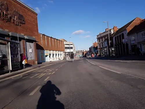
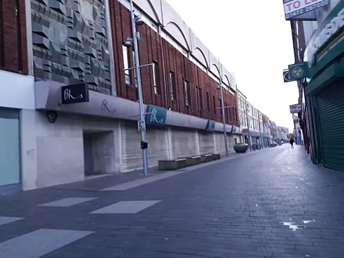
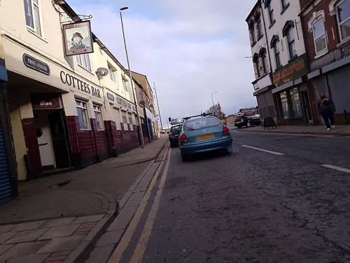
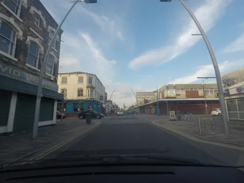
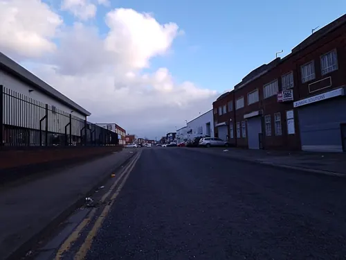
Dock Beers
Brewery and winery · 0.4 mi
King Edward Street, Grimsby
Mo-Tu closed; We-Th 12:00-21:00; Fr-Sa 12:00-23:00; Su 12:00-18:00


The Arc
Cafe · Sandwich · 0.5 mi
21 Abbey Road, Grimsby
Mo-Fr 07:30-14:30; Sa 08:00-14:30; Su 09:00-13:00

Moo Bakes
Cafe · Coffee Shop, Sandwich, Burger · 1.0 mi
98 Haycroft Avenue, Grimsby
Mo-Fr 08:30-13:30; Sa-Su closed
183 more on the map.
History
There is archaeological evidence of a small town of Roman workers in the area in the 2nd century AD during Roman occupation. Located on The Haven, which flowed into the Humber, the site long provided a location for ships to shelter from approaching storms. It was well placed to exploit the rich fishing grounds in the North Sea.
Sometime in the 9th century AD, Grimsby was settled by Danes. Local folklore claims that the name Grimsby derives from Grim, a Danish (as an old term closer to "Viking") fisherman. The common toponymic suffix -by is derived from the Old Norse word býr for village (compare with Norwegian: by, Danish: by and Swedish: by). The legendary founding of Grimsby features in a medieval romance, the Lay of Havelock the Dane, but historians see this account as a myth.
In Norse mythology, Grim (Mask) and Grimnir (Masked One) are names adopted by the deity Oðin (Anglo-Saxon Woðen) when travelling incognito amongst mortals, as in the short poem known as "Grimnir's Sayings" (Grimnismal) in the Poetic Edda. The intended audience of the Havelock tale, recorded much later as the Lay of Havelock the Dane, may have taken the fisherman Grim to be Odin in disguise.
Read more of the history
The Oðinic name "Grimr/Grim" occurs in many English place names in the historical Danelaw and elsewhere in Britain. Examples are numerous earthworks named Grimsdyke. Other British place names with the element Grim are explained as referring to Woðen/Oðin (e.g. Grimsbury, Grimspound, Grime's Graves, Grimsditch, Grimsworne), and Grimsby is likely to have the same derivation.
Grimsby is listed in the Domesday Book of 1086 as having a population of around 200, a priest, a mill, and a ferry.
In the 12th century, Grimsby grew into a fishing and trading port, at one time ranking twelfth in importance to the Crown for tax revenue. The town gained its charter from King John in 1201. The first mayor was installed in 1202.
Grimsby is noted in the Orkneyinga Saga in this Dróttkvætt stanza by Kali Kolsson:
Grimsby had no town walls. It was too small and felt to be protected by the marshland around it. However, the town dug a defensive ditch.
Grimsby in medieval times had two parish churches, St Mary's and St James. St James, now Grimsby Minster, remains. It is associated with a folk tale of an imp who played tricks in the church and was turned into stone by an angel. A similar tale is told of Lincoln Cathedral – see Lincoln Imp.
In the mid-14th century, Grimsby benefited from the generosity of Edmund de Grimsby, a local man who became a senior Crown official and judge in Ireland.
In the 15th century, The Haven began to silt up, preventing ships in the Humber from docking. As a result, Grimsby entered a long period of decline until the late 18th century. In 1801, the population of Grimsby was 1,524, around the size it had been in the Middle Ages. By 1810 Joseph Smedley was hiring a purpose built theatre for seven Guineas.
In May 1796, the Grimsby Haven Company was formed by the Great Grimsby (Lincoln) Harbour Act 1796 (36 Geo. 3. c. 98), also known as the Grimsby Haven Act 1796, for the purpose of "widening, deepening, enlarging, altering and improving the Haven of the Town and Port of Great Grimsby". After the dredging of The Haven and related improvement in the early 19th century, Grimsby grew rapidly as the port boomed, importing iron, timber, wheat, hemp, and flax. New docks were needed to cope with the expansion. The necessary works were allowed under the Grimsby Docks Act 1845 (8 & 9 Vict. c. ccii).
In 1848, the arrival of the railway eased the transport of goods to and from the port to markets and farms. Coal mined in the South Yorkshire coalfields was brought by rail and exported through Grimsby. Rail links direct to London and the Billingsgate Fish Market allowed fresh "Grimsby fish" to gain nationwide renown. The first true fish dock opened in Grimsby in 1856, and the town became central to the development of the commercial fishing industry.
The Dock Tower was completed in 1851, followed by the Royal Dock in 1852. No.1 Fish Dock was completed in 1856, followed by No.2 Fish Dock in 1877. Alexandra Dock and Union Dock were completed in 1879. During this period, the fishing fleet was much expanded. In a rare reversal of usual trends, large numbers of fishermen from the south-east and Devon travelled north to join the Grimsby fleet. Over 40 per cent of the newcomers came from Barking in East London and other Thames-side towns.
In 1857, there were 22 vessels in Grimsby. Six years later there were 112. The first two legitimate steam trawlers built in Britain were based in Grimsby. A gale in February 1889 resulted in the loss of fifteen smacks and 70 to 80 lives. At that time it was thought to be one of the most serious losses to a single port.
By 1900, a tenth of the fish consumed in the United Kingdom was landed there, although there were also many smaller coastal fishing ports and villages involved. The demand for fish in Grimsby meant that at its peak in the 1950s it claimed to be the largest fishing port in the world. The population grew from 75,000 in 1901 to 92,000 by 1931.
The Great Depression and restructured fishing caused a sharp decline in employment. After that the population was fairly stable for the rest of the 20th century.
The Royal Dock became the UK's largest base for minesweepers patrolling the North Sea. The Admiralty requisitioned numerous trawlers to serve the purpose of the Royal Naval Patrol Service. Often the crew was ex-trawlermen, alongside Royal Naval Reserve and Royal Navy volunteers. Trawlers used the winches and warps from fishing operations to tow a paravane with a cutting jaw through the water in what was known as a "sweep" to bring mines to the surface and allow for their removal.
From the History section of Grimsby on Wikipedia, under CC BY-SA 4.0.
More about Grimsby
Geography
The town was named "Great Grimsby" to distinguish it from Little Grimsby, a village about 14 mi (23 km) to the south, near Louth. It had a population of 88,243 in the 2011 census and an estimated population of 88,323 in 2019. It forms a conurbation with Cleethorpes and the villages of Humberston, Scartho, Brigsley and Waltham. The 2011 population of the conurbation was 134,160, making it the largest built-up area in Lincolnshire.
Economy
High-street shopping is grouped in central Grimsby between the railway and River Freshney, where Victoria Street acts as a central pedestrianised shopping street with an undercover Freshney Place centre to the north. Freshney Place is visited by 14 million shoppers a year and employs over 2,000 staff. The centre houses over 100 stores, including Marks and Spencer and House of Fraser. Constructed between 1967 and 1971 in a joint venture between the old Grimsby Borough Council and developers Hammerson's UK Ltd., it was known as the Riverhead Centre (so named as the development was adjacent to where the two local rivers, the Freshney and the Haven, meet). Hammerson's UK Ltd began a £100 million redevelopment of the retail centre, doubling it in size. The expanded centre was covered in a glass roof. Two multi-storey car parks were constructed at each end of the centre; with this development, the old Top Town area of Grimsby was effectively privatised and roofed over. Stores are serviced at the first floor by ramps at the western end, which can accommodate even large vehicles. The ramp also provides access to the car park on the roof of the indoor market, which is operated by the local council. Freshney Place won a design commendation in the Refurbishment Category of the 1993 BCSC awards.
Arts and culture
Before the late 1960s many public houses in the area were owned by the local brewer Hewitt Brothers and had a distinctive local touch. In 1969, it was taken over by the brewer Bass-Charrington. The pubs have been re-badged many times, closed or sold off. The Barge Inn is a former grain barge converted into a pub/restaurant. It has been moored at the Riverhead quay since 1982.
Musical entertainment is provided at the Grimsby Auditorium, built in 1995 in Cromwell Road, Yarborough, near Grimsby Leisure Centre. The smaller Caxton Theatre is in Cleethorpe Road (A180) in East Marsh, near the docks. The Caxton Theatre provides entertainment by adults and youths in theatre. Notable in the area is the Class Act Theatre Company run by the local playwright David Wrightam.
North East Lincolnshire Council has installed a Wi-Fi network covering Victoria Street in central Grimsby. The service gives access to the Internet to the general public on a yearly subscription.
Grimsby's Freeman Street cinema closed in 2004, leaving the Parkway cinema in Cleethorpes to serve the town. Periodic plans to build a new cinema in Grimsby have been made since. The Whitgift Film Theatre in John Whitgift Academy shows a programme of limited release and art-house films.
Grimsby Ice Factory – built in 1898–1901 to provide crushed ice to preserve fish stored in ships at Grimsby's seaport
Education
Secondary schools in Grimsby include Oasis Academy Wintringham and Ormiston Maritime Academy. Private schools include St James' School.
Park House mainly teaches pupils who have been suspended or excluded by other schools, and according to BBC News is "turning many of those lives around".
Franklin College is a sixth form college. The Grimsby Institute offers further and higher education courses mostly for vocational purposes. Its business courses have attracted a sizeable number of Chinese students in recent years.
From the Wikipedia article Grimsby, under CC BY-SA 4.0.
Notable people from Grimsby
 Matija SarkicMontenegrin-English association football player (1997–2024)Photo: Struway2, CC BY-SA 4.0
 Stuart CarringtonEnglish snooker playerPhoto: Benutzer:Bill da Flute, CC BY-SA 3.0
 John WhitgiftArchbishop of Canterbury from 1583 to 1604Photo: Unidentified painter, Public domain
 Patrick Cormack, Baron CormackBritish politician (1939–2024)Photo: Roger Harris, CC BY 3.0
 Thomas Benjamin KenningtonEnglish genre, social realist and portrait painter (1856-1916)Photo: Thomas Benjamin Kennington, Public domain
 Walter AmosEnglish footballer (1899-1967)Photo: Dnuttall91, CC BY-SA 4.0
 Tom WintringhamBritish politician and historian (1898–1949)Photo: Unknown author Unknown author, Public domain
- Arthur DrewryEnglish football administrator (1891-1961)
- Thomas TurgooseBritish actor
- Shirley BrasherEnglish female tennis player
- Kate HaywoodBritish swimmer, Olympic athlete, world championships silver medallist
- Mike HallettBritish snooker player
Born in Grimsby, according to Wikidata (CC0). Each name links to its Wikipedia article.
Where to stay7
Churches and places of worship27
Beaconthorpe Methodist Church (demolished)
Church · Methodist · 1.5 mi
Grimsby Road, Cleethorpes
Holy Trinity and St Mary the Virgin
Church · Anglican · 1.1 mi
Church Lane, Grimsby
St Andrew with St Luke & All Saints
Church · Anglican · 0.4 mi
Albion Street, Grimsby
St Francis of Assisi
Church · Anglican · 1.5 mi
19A Sandringham Road, Cleethorpes
Shopping37
Gas and EV charging10
Schools, colleges and libraries36
St Joseph's Catholic Primary Voluntary Academy
School · Roman Catholic · 1.5 mi
Philip Avenue, Cleethorpes
Healthcare20
Map of Grimsby
250 places. The map loads OpenStreetMap tiles when you open it.
Getting there and nearby towns
Humberside Airport (HUY) is the nearest airport with scheduled flights listed in OpenStreetMap, 11 miles away.
- Immingham 7 mi northwest, about 11 min by car
- Hedon 13 mi north, about 21 min by car
- Louth 14 mi south, about 23 min by car
- Kingston upon Hull 16 mi northwest, about 26 min by car
- Barton upon Humber 17 mi northwest, about 28 min by car
- Mablethorpe 21 mi southeast, about 33 min by car
- Brough 23 mi northwest, about 37 min by car
- Scunthorpe 24 mi west, about 38 min by car
- Beverley 24 mi northwest, about 39 min by car
- Lincoln 30 mi southwest, about 49 min by car
Drive times are estimates from straight-line distance, not routes.
Towns near Grimsby


Keep exploring
Local news
Headlines from INDB.
Reviews, tips and questions
Loading what members have shared...
Sources and licences
- GeoNames (CC BY 4.0): population, coordinates, regions and time zone
- Mapillary (see each image): photos
- OpenStreetMap contributors (ODbL 1.0): places, airports, map data
- Wikidata (CC0 1.0): elevation, founding date, time zone, website, landmarks and historic places
- Wikimedia Commons (see each image): photos
- Wikipedia (CC BY-SA 4.0): overview and history text
Photo credits
- St. James' Church, Grimsby, David Wright, CC BY-SA 2.0
- Christ Church, Cleethorpes - DSC07275, Rept0n1x, CC BY-SA 3.0
- Weelsby1, Peter Chapman, aka Peter Chapman at en.wikipedia, CC BY-SA 3.0
- Boomerang (Pleasure Island), Calzz, CC BY-SA 3.0
- GY398 Ross Tiger (53966847006), Steve Knight, CC BY 2.0
- Peoples Park Grimsby 2023, Jack1956, CC BY-SA 4.0
- Corporation Bridge, David Wright, CC BY-SA 2.0
- Former Waterproof Clothing Factory (10766041555), Reading Tom from Reading, UK, CC BY 2.0
- Fishing Heritage Centre (10766137934), Reading Tom from Reading, UK, CC BY 2.0
- Alexandra Dock (10766136544), Reading Tom from Reading, UK, CC BY 2.0
- 'Fishermen's Memorial' by Trevor Harries 2024, Jack1956, CC0
- Street-level photo, cyclestreets, CC BY-SA 4.0
- Street-level photo, lamaar639, CC BY-SA 4.0
- Street-level photo, lamaar639, CC BY-SA 4.0
- Street-level photo, Lapscle, CC BY-SA 4.0
- Street-level photo, cyclestreets, CC BY-SA 4.0
- Street-level photo, cyclestreets, CC BY-SA 4.0
- Street-level photo, lamaar639, CC BY-SA 4.0
- Street-level photo, cyclestreets, CC BY-SA 4.0
- Street-level photo, cyclestreets, CC BY-SA 4.0
- Street-level photo, cyclestreets, CC BY-SA 4.0
- Street-level photo, cyclestreets, CC BY-SA 4.0
- Street-level photo, Lapscle, CC BY-SA 4.0
- Street-level photo, Lapscle, CC BY-SA 4.0
- Street-level photo, cyclestreets, CC BY-SA 4.0
- Street-level photo, lamaar639, CC BY-SA 4.0
- Street-level photo, cyclestreets, CC BY-SA 4.0
- Street-level photo, cyclestreets, CC BY-SA 4.0
- Street-level photo, lamaar639, CC BY-SA 4.0
- Street-level photo, cyclestreets, CC BY-SA 4.0
- Street-level photo, cyclestreets, CC BY-SA 4.0
- Street-level photo, cyclestreets, CC BY-SA 4.0
- Street-level photo, lamaar639, CC BY-SA 4.0
- Street-level photo, Lapscle, CC BY-SA 4.0
- Street-level photo, Lapscle, CC BY-SA 4.0
- Street-level photo, lamaar639, CC BY-SA 4.0
- Street-level photo, cyclestreets, CC BY-SA 4.0
- Street-level photo, Lapscle, CC BY-SA 4.0
Page built November 10, 2026. Spotted a mistake? Tell us or suggest a place.