


Carnoustie, United Kingdom
Carnoustie is a town of 11,310 people in Scotland, United Kingdom.
Why visit Carnoustie
Townapedia lists 6 museums and landmarks, 12 parks and trails, 22 places to eat, 9 places to stay and 1 attraction in and around town.
Highlights include Barry Mill.
Weather in Carnoustie
Forecast from MET Norway (CC BY 4.0). Full forecast
About Carnoustie
Carnoustie (; Scottish Gaelic: Càrn Ùstaidh) is a seaside town and former police burgh in the council area of Angus, Scotland. It is at the mouth of the Barry Burn on the North Sea coast. In 2022, Carnoustie had a population of 11,359, making it the fourth-largest town in Angus. The town was founded in the late 18th century, and grew rapidly throughout the 19th century due to the growth of the local textile industry.
From the Wikipedia article Carnoustie (this version), under CC BY-SA 4.0.
Things to do1

Museums and landmarks6

Barry Mill
Museum · 2.0 mi
Category A listed watermill in Angus, Scotland, UK

Lance Corporal C Jarvis VC & Seaman G Samson VC Memorial
Monument and historic site · 0.6 mi
Parks, trails and playgrounds12

The Carnoustie Buddon Course
Golf course · 1.2 mi
Links Parade, Carnoustie
The Carnoustie Burnside Course
Golf course · 1.1 mi
Links Parade, Carnoustie
The Carnoustie Championship Course
Golf course · 1.0 mi
Links Parade, Carnoustie




Restaurants and cafes22
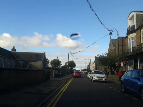
Gather Kitchen & Deli
Cafe · Coffee Shop, Brunch, Breakfast, British, Scottish · 0.4 mi
25-27 Dundee Street, Carnoustie
Tu-Sa 10:00-15:00
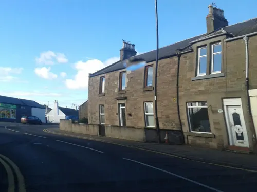
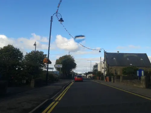
Imperial Restaurant
Restaurant · Chinese · 0.5 mi
44-46 Dundee Street, Carnoustie
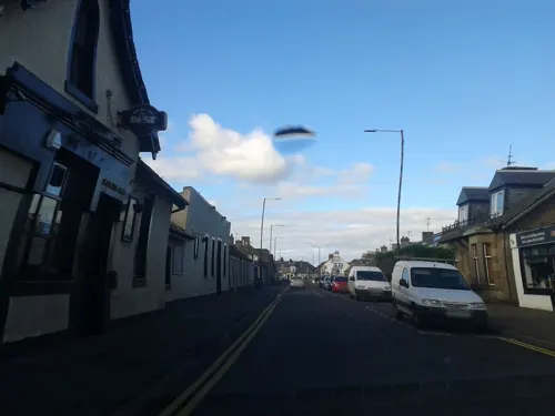




The Craw's Nest
Bar and pub · 1.4 mi
71 Ravensby Park Gardens, Carnoustie
Mo-Th 14:00-22:00 - Fr-Sa 12:00-01:00 - Su 12:30-22:00
10 more on the map.
History
Carnoustie's name is of uncertain origin. The first element has been linked to a variety of Gaelic words, including cathair (fort), càrr (stone), and carn (cairn), but the second has eluded interpretation. Càrn Ùstaidh, the name used by Ainmean-Àite na h-Alba, is merely a Gaelicized form of the English name. A popular theory interprets the name as "craws' nestie", in reference to the large number of crows and rooks which once built their nests here, and the burgh seal displays a tree surrounded by crows in allusion to this.
Read more of the history
Whatever its origin, the name predates the town itself by several hundred years. It first appears as "Carnowis" in a charter issued by James IV to the Earl of Angus in 1510. "Carnussie" farm is recorded in the Balmerino Abbey register of c. 1575, which states that it (along with part of Grange of Barry and Badiehill) was feued to the Fairny family and "Karnousty" farm can be seen on Pont's map of Lower Angus, c. 1583––1596. The town is seen as "Carnowstie" in a deed of sale from 1595, "Carnushie" appears in a tax roll from Balmerino Abbey in 1617, and the lands of "Carnouslie" are referred to in the title deeds confirming its purchase by the Earl of Panmure in 1672. Adair is perhaps the first to depict Carnoustie with the current spelling in 1703, while Roy's military survey of Scotland, 1747–55 has it as "Cornisty". In Webster's Topographical Dictionary of Scotland (1819), Carnoustie is mentioned as "Carnuistie".
The area surrounding Carnoustie has been occupied continuously since the Neolithic period, as evidenced by a Cursus monument, identified from cropmarks near Woodhill. This cursus is of a similar scale to the well characterised, mid-4th-century BC enclosure found nearby at Douglasmuir near Friockheim. Numerous stones incised with cup and ring marks have also been found in the surrounding area. An assemblage of Late Neolithic pottery fragments found at Carlogie, 1⁄2 mile (800 metres) north of Carnoustie, has been interpreted as evidence of a settlement of that age in the area.
Bronze Age archaeology is also present in the area. Numerous short cist burials have been found in the area, including one found in 1994 at West Scryne, one mile (1.5 kilometres) northeast of Carnoustie, that was radiocarbon dated to between 1730 and 1450 BC. The presence of Bronze Age round barrows at Craigmill is also indicated by cropmarks. From the Iron Age, perhaps the most prominent remains are of the Dundee Law Hill Fort, with the Iron Age fort at Craigmill Den being less well known. Near to Carnoustie can be found the souterrains at Carlungie and Ardestie, which date from around the 2nd century AD. Several brochs are also found in the area, including the ruins at Drumsturdy and at Craighill. Roman remains are also found in the area. Particularly notable are the temporary marching camps at Kirkbuddo, Marcus and Finavon, and Roman coins have periodically been found nearby.
Pictish remains are to be found in abundance in the surrounding area. Class I sculptured stones from Aberlemno and Strathmartine can be seen in the McManus Galleries in Dundee while the class I Dunnichen Stone is on loan to the Meffan Institute in Forfar. A class I stone can also be seen in situ at Aberlemno, and this stone appears to be a recycled neolithic stone, having cup and ring marks apparent on its side. Class II stones can be seen at Aberlemno and Glamis and a much-misinterpreted class III stone (known locally as the Camus Cross) can be found four miles (six kilometres) north of Carnoustie at Camuston Hill on Panmure Estate. Linked in misinterpretation with the Camus stone is the early Christian Pictish cemetery that was situated to the West of the Lochty burn, in the vicinity of the High Street. The soil in this vicinity is sandy and was prone to wind erosion, and periodically human remains became exposed to the surface prior to the founding of the town. Popular interpretation was that a great battle had taken place at the site, giving rise to the legend of the Battle of Barry.
The medieval period marks the earliest recorded history in the area. Arbroath Abbey was founded by William the Lion and dedicated in 1178 and the earldom of Dundee granted to David, Earl of Huntingdon around 1182 (Dundee later gained Royal Burgh status in 1292 on the coronation of David's heir, John Balliol). Closer to Carnoustie, a number of medieval mottes can be found, including at Old Downie, where the thanage can be traced to Duncan of Downie in 1254, and at Grange of Barry, as well as the ruins of Panmure Castle where, it is said, William the Lion signed the Panmure charter granting the lands of Panmure to Philip de Valognes in 1172. The original castle was destroyed at some point in the Second War of Independence, possibly in 1336.
The Parish of Barry was bestowed to the monks of Balmerino Abbey in Fife by Alexander II in 1230. The monks managed the lands from the Grange of Barry and latterly the land was controlled by the office of the Bailies of Barry, an early holder of this position being Sir Thomas Maule of Panmure in 1511.
A number of feus were granted in the parish around that time, including Ravensby in 1539, Gedhall to David Gardyne in 1541, half of Barry Links and Cowbyres to Walter Cant in 1545 and the other half of the links to Robert Forrester in 1552. A document from around this time details the rent charged for each of the farms in the area, and it is in this that we see the first mention of Carnoustie:
"The two part of Grange of Barrie 10s. land of ye same 9 aikers of badihill. And toun and lands of Carnussie set to ffairny for 25 li. 2s. 24 capons 20 puld."
From the History section of Carnoustie on Wikipedia, under CC BY-SA 4.0.
More about Carnoustie
Geography
Carnoustie occupies a seafront position on the North Sea coast of Scotland, on land immediately northeast of the Buddon Ness, 10 miles (16 kilometres) ENE of Dundee, 6+1⁄2 miles (10 kilometres) SW of Arbroath and 13 miles (21 kilometres) SSE of Forfar. The town lies 42 miles (68 km) NNE of Edinburgh and 360 miles (580 kilometres) NNW of London. The built-up area occupies a roughly rectangular shape measuring 2 by 1⁄2 mile (3 by 0.8 kilometres). The land is relatively flat, rising gradually to around 30 m elevation to the north of the town. The climate is typical for the east coast of Scotland, although the weather can be locally influenced by sea mist, locally known as haar.
Economy
The economy of Carnoustie relies to a large extent on its proximity to Dundee. In the 2001 census, 2,267 people reported commuting to Dundee for work, making up 41.4% of the economically active, working-age population.
Golf is a major tourist draw to the town, and it is estimated that the recent Open Championship contributed £14 million to the local economy. Television coverage during the event was estimated to be worth the equivalent of £34 million in advertising value, half of which was in North America. The 'Carnoustie Country' golf marketing campaign is funded and promoted by Angus Council to promote the area for golfing tourism in the area.
Education
At the start of the 1870s, each church in Carnoustie had its own school. Some of these can still be seen today, in the former primary schools of Barry and Panbride, which were at that point the schools of Panbride Parish Church and Barry Free Church, and the Phillip Hall on Dundee Street, which was the school connected with the Erskine Free Church. These were supplemented with a number of private subscription schools, including a school in Links Avenue, opened in 1831, that now houses the local Scout group, and a school off Maule Street that is now used as Holyrood Church's Hall. These were both victims of the success of Carnoustie Free Church school and were abandoned. More successful were the school linked to Panmure Works and a private girls school in Kinloch Street, but these too were made redundant by the 1872 act.
Carnoustie Public School was built in 1878 near the Free Church school on Dundee Street. It was extended several times before the secondary school pupils were decanted to the new Carnoustie High School building in Shanwell Road. The old school was renamed Kinloch Primary School, and continued until 2006, when it, along with Barry and Panbride Primary Schools, was closed as part of the reorganisation of schools in the area.
From the Wikipedia article Carnoustie, under CC BY-SA 4.0.
Notable people from Carnoustie
 Ian McDiarmidScottish actor and stage directorPhoto: Super Festivals from Ft. Lauderdale, USA, CC BY 2.0
 Kevin McDonaldScottish association football player (born 1988)Photo: Steindy ( talk ) 23:47, 6 September..., CC BY-SA 3.0
 Craig ForsythScottish association football player (born 1989)Photo: Timmy96, CC0
 Macdonald Smithprofessional golfer (1892-1949)Photo: Los Angeles Times, CC BY 4.0
 James Hepburnprofessional golfer from ScotlandPhoto: Unknown author Unknown author (ACME), Public domain
- Fred MartinScottish footballer (1929-2013)
- Alex SmithScottish-American professional golfer
- Thomas PeelAustralian settler
- George McKenzie SamsonScottish Victoria Cross recipient in WWI
- Alexander McLeodCanadian sheriff (1796–1871)
- George Low Sr.Scottish golfer
- George FotheringhamScottish-American professional golfer (1883-1971)
Born in Carnoustie, according to Wikidata (CC0). Each name links to its Wikipedia article.
Where to stay9
19th Hole Hotel and Restaurant
Motel and hotel · 0.4 mi
8 Ferrier Street, Carnoustie
Churches and places of worship6
Erskine United Free Church of Scotland
Church · United Free Church Of Scotland · 0.4 mi
Kinloch Street, Carnoustie
Shopping4
Schools, colleges and libraries5
Map of Carnoustie
65 places. The map loads OpenStreetMap tiles when you open it.
Getting there and nearby towns
Leuchars Station (ADX) is the nearest airport with scheduled flights listed in OpenStreetMap, 11 miles away.
- Dundee 11 mi west, about 17 min by car
- Saint Andrews 12 mi south, about 19 min by car
- Forfar 12 mi northwest, about 19 min by car
- Montrose 17 mi northeast, about 28 min by car
- Methil 25 mi southwest, about 40 min by car
- Glenrothes 28 mi southwest, about 45 min by car
- Perth 29 mi west, about 46 min by car
- Kirkcaldy 32 mi southwest, about 51 min by car
- Dunbar 35 mi south, about 57 min by car
- Edinburgh 42 mi southwest, about 1 h 15 min by car
Drive times are estimates from straight-line distance, not routes.
Towns near Carnoustie


Keep exploring
Local news
Headlines from INDB.
Reviews, tips and questions
Loading what members have shared...
Sources and licences
- GeoNames (CC BY 4.0): population, coordinates, regions and time zone
- Mapillary (see each image): photos
- OpenStreetMap contributors (ODbL 1.0): places, airports, map data
- Wikidata (CC0 1.0): elevation, founding date, time zone, website, landmarks and historic places
- Wikimedia Commons (see each image): photos
- Wikipedia (CC BY-SA 4.0): overview and history text
Photo credits
- Carnoustiehighstreet, Ollie Lloyd, CC BY-SA 3.0
- Carnoustie1900, Unknown author Unknown author, Public domain
- Barry Mill2, Scott MacDonald, CC BY-SA 3.0
- Carnoustie High School 72 08, Catfish Jim and the soapdish, CC BY-SA 3.0
- Holyroodchurchcarnoustie, D Lloyd, CC BY-SA 3.0
- Street-level photo, rudolfmayer, CC BY-SA 4.0
- Street-level photo, rudolfmayer, CC BY-SA 4.0
- Street-level photo, rudolfmayer, CC BY-SA 4.0
- Street-level photo, rudolfmayer, CC BY-SA 4.0
- Street-level photo, rudolfmayer, CC BY-SA 4.0
- Street-level photo, rudolfmayer, CC BY-SA 4.0
- Street-level photo, rudolfmayer, CC BY-SA 4.0
- Street-level photo, rudolfmayer, CC BY-SA 4.0
- Street-level photo, rudolfmayer, CC BY-SA 4.0
Page built November 10, 2026. Spotted a mistake? Tell us or suggest a place.