

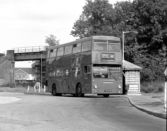


Chipstead, United Kingdom
Chipstead is a town of 3,136 people in England, United Kingdom.
Why visit Chipstead
Townapedia lists 12 museums and landmarks, 41 parks and trails, 88 places to eat, 1 place to stay and 3 attractions in and around town.
Highlights include Charles Cryer Theatre, Whitehall, Promenade de Verdun War Memorial and Oaks Park.
Weather in Chipstead
Forecast from MET Norway (CC BY 4.0). Full forecast
About Chipstead
Chipstead is a predominantly commuter village in the Reigate and Banstead district, in north-east Surrey, England, that has been a small ecclesiastical parish since the Domesday Survey of 1086. Its rolling landscape meant that Chipstead's development was late and restricted compared to parishes of comparable distance from London. Formerly and formally including Hooley and Netherne-on-the-Hill, on census day, 1831 Chipstead had 66 homes. Today, excluding those two parts, the village has 1,212 homes spread across the slopes and crests of a northern section of the North Downs.
From the Wikipedia article Chipstead, Surrey (this version), under CC BY-SA 4.0.
Things to do3

Charles Cryer Theatre
Cinema and theater · 3.5 mi
Theatre and former cinema in Carshalton, London

Back To Nature Farm Shop
Farm and orchard · 1.7 mi
We-Th 09:30-17:00; Fr-Sa 09:30-18:00; Su 09:30-16:00

Museums and landmarks12

Whitehall
Museum · 3.7 mi
House museum in Cheam, Greater London, England, UK

Promenade de Verdun War Memorial
Monument and historic site · 2.0 mi
War memorial in Croydon, London
Parks, trails and playgrounds41


Carshalton Park
Park · 3.2 mi
Public park in Carshalton, in the London Borough of Sutton


Devonshire Avenue Nature Area
Park · 2.8 mi
Public nature reserve in London, England


Grove Park
Park · 3.5 mi
Public park in Carshalton in the London Borough of Sutton



29 more on the map.
Restaurants and cafes88

The Pembroke
Bar and pub · 1.3 mi
12-16 Chipstead Valley Road, Coulsdon
Mo-Sa 10:00-00:00; Su 11:00-23:00


Mirchi Spice
Restaurant · Indian · 1.2 mi
204 Brighton Road, Coulsdon
Mo-Th 13:00-23:00; Fr 14:00-23:30; Sa 12:00-23:30; Su 12:00-23:00
Caffè Nero
Cafe · Coffee Shop · 1.3 mi
132 Brighton Road, Coulsdon
Mo-Fr 07:00-17:30; Sa 08:00-17:30; Su 08:30-17:00


T. Raj
Restaurant · Indian · 1.4 mi
133-135 Brighton Road, Coulsdon
Mo-Su 12:00-14:00, 18:00-23:00
76 more on the map.
History
Chipstead appears in Domesday Book as Tepestede. It was held by William de Wateville. Its Domesday assets were: 3 hides; 7 ploughs, 1 mill worth £1, woodland worth 5 hogs. It rendered £8.
From 1894 until 1933 Chipstead was part of Reigate Rural District. From 1933 to 1974 it was in Banstead Urban District. In 1951 the civil parish had a population of 1513. On 1 April 1974 the parish was abolished.
The Grade I listed church of St Margaret is in Hooley, the official hamlet of the village, with somewhat isolated geography and its own article. It was restored in 1827 when its patron was the Jolliffe family of Chipstead Court keeping its 12th century arch and foundations. The school in the Victorian era here was endowed by Mary Stephens in 1746 with land producing £70 per annum. Sir Edward Banks (builder) enterprising building contractor for public works, was in 1835 buried in the churchyard – his business partner and daughter's husband being the patrons of the church and owners of Chipstead Court since 1788.
From the History section of Chipstead, Surrey on Wikipedia, under CC BY-SA 4.0.
More about Chipstead
Geography
The land within and to all sides forms curved valleys of downland. Beyond Chipstead's boundaries are the villages of Woodmansterne and slightly more distant Coulsdon, Banstead, Hooley and Kingswood. Woodmansterne is in two parts, one of which is in Greater London (as is Coulsdon) – the nearest, the Surrey part is the western follow-on to the built-up valley street of Chipstead. Housing and parks span the east slopes of a narrow valley known as Chipstead Valley or Chipstead Bottom which is a dry valley. This has some subterranean flows common in the chalk hills of the North Downs, a long hill range south of Woking, Croydon and the Thames Estuary.
The residents of Chipstead have prevented installation of street lighting, particularly in the southern parts of the village. Two residents associations exist, both founded in the 20th century. One caters broadly for all parts from Chipstead Valley to Hooley, while the second concentrates on architectural beauty and views from public places in areas where these may be at risk. Identified as among Chipstead's characteristics are its mature trees, hedgerows, rural wildlife and dark skies at night:
Villagers value the mature trees and hedgerows, the open fields and farmland, the narrow, winding lanes and the absence of street lighting
From the Wikipedia article Chipstead, Surrey, under CC BY-SA 4.0.
Notable people from Chipstead
 Catherine Maria FanshaweBritish poet and etcher (1765-1834)Photo: Priya.s.d, CC BY-SA 4.0
- Tolly BurnettEnglish cricketer (1923-1993)
- Oswald NorrisEnglish cricketer and wine and spirits merchant. (1883-1973)
Born in Chipstead, according to Wikidata (CC0). Each name links to its Wikipedia article.
Where to stay1
Churches and places of worship24
St Aidan's Catholic Church
Church · Roman Catholic · 1.0 mi
1 Portnalls Road, Coulsdon
Shopping15
Gas and EV charging5
Schools, colleges and libraries17
Healthcare6
Infohealth Pharmacy
Clinic and pharmacy · 1.2 mi
28 Chipstead Valley Road, Coulsdon
Map of Chipstead
212 places. The map loads OpenStreetMap tiles when you open it.
Getting there and nearby towns
London Biggin Hill Airport (BQH) is the nearest airport with scheduled flights listed in OpenStreetMap, 9 miles away.
- Coulsdon 1 mi east, about 2 min by car
- Banstead 2 mi west, about 3 min by car
- Sutton 3 mi northwest, about 4 min by car
- Purley 3 mi northeast, about 4 min by car
- Kenley 3 mi east, about 5 min by car
- Wallington 3 mi north, about 5 min by car
- Carshalton 4 mi north, about 6 min by car
- Whyteleafe 4 mi east, about 6 min by car
- Sanderstead 4 mi east, about 7 min by car
- South Croydon 4 mi northeast, about 7 min by car
Drive times are estimates from straight-line distance, not routes.
Towns near Chipstead


Keep exploring
Local news
Headlines from INDB.
Reviews, tips and questions
Loading what members have shared...
Sources and licences
- GeoNames (CC BY 4.0): population, coordinates, regions and time zone
- Mapillary (see each image): photos
- OpenStreetMap contributors (ODbL 1.0): places, airports, map data
- Wikidata (CC0 1.0): elevation, founding date, time zone, website, landmarks and historic places
- Wikimedia Commons (see each image): photos
- Wikipedia (CC BY-SA 4.0): overview and history text
Photo credits
- London Transport bus DMS Fleetline Route 166A in Chipstead, Surrey January 1985, Dr Neil Clifton, CC BY-SA 2.0
- London Transport bus DMS1624 Daimler Fleetline MCW THM 624M Route 166A in Chipstead, Surrey 12 June 1983, Dr Neil Clifton, CC BY-SA 2.0
- Charles Cryer Theatre Carshalton, G.Rogers ( Rodge500 ), CC BY-SA 2.5
- Oaks Park, London Borough of Sutton, colourful trees, Maureen Barlin from Richmond, UK, CC BY-SA 2.0
- The Grotto Carshalton Park, G.Rogers ( Rodge500 ), CC BY-SA 2.5
- Devonshire Avenue Nature Area 3, Dudley Miles, CC BY-SA 3.0
- Foxley Wood 3, Dudley Miles, CC BY-SA 3.0
- Grove Park Carshalton, G.Rogers ( Rodge500 ), CC BY-SA 2.5
- Happy Valley Park, Dudley Miles, CC0
- Interior of Lumley Chapel, view of the rear-right wall, Bobulous, CC BY-SA 4.0
- 2016-06-04 TheSecombe, Ungry Young Man from Vienna , Austria, CC BY 2.0
- St Andrew's, Gatton - exterior, Dlg south, CC BY-SA 4.0
- Sutton, Surrey, Greater London, St Nicholas Church 6, A P Monblat, CC BY-SA 4.0
- Trinity Church , Cheam Road, SUTTON, Surrey, Greater London (2), A P Monblat, CC BY-SA 4.0
- Pembroke, Coulsdon, CR5 (4102138695), Ewan Munro from London, UK, CC BY-SA 2.0
- St Aidan's Church, Chipstead Valley Road, Coulsdon (April 2013) (1), User:Hassocks5489, CC0
- Belmont Pastures 3, Dudley Miles, CC BY-SA 3.0
- Cuddington Meadows 1, Dudley Miles, CC BY-SA 3.0
- Upstairs panelling at Whitehall, Cheam 2024-09-14, Matt Brown, CC BY 2.0
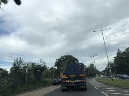
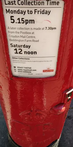
- Street-level photo, thingkcp, CC BY-SA 4.0
- Street-level photo, laye, CC BY-SA 4.0
- Street-level photo, caranteth, CC BY-SA 4.0
- Street-level photo, laye, CC BY-SA 4.0


Page built November 10, 2026. Spotted a mistake? Tell us or suggest a place.