


South Croydon, United Kingdom
South Croydon is a town of 55,198 people in England, United Kingdom.
Why visit South Croydon
Townapedia lists 20 museums and landmarks, 46 parks and trails, 319 places to eat, 17 places to stay and 9 attractions in and around town.
Highlights include Fairfield Halls, Charles Cryer Theatre, Croydon War Memorial and Museum of Croydon.
Weather in South Croydon
Forecast from MET Norway (CC BY 4.0). Full forecast
About South Croydon
South Croydon in south London is the area surrounding the valley south of central Croydon and running as far south as the former Red Deer public house on the Brighton Road. It is bounded by Waddon to the West and Selsdon and Sanderstead to the East. It is part of the South Croydon (CR2) post town and in the London Borough of Croydon.
From the Wikipedia article South Croydon (this version), under CC BY-SA 4.0.
Photos of South Croydon


Things to do9

Fairfield Halls
Cinema and theater · 0.7 mi
Arts, entertainment and conference centre in Croydon, London
Park Lane, Croydon

Charles Cryer Theatre
Cinema and theater · 2.8 mi
Theatre and former cinema in Carshalton, London


The Spread Eagle Theatre
Cinema and theater · 0.7 mi
Pub theatre above the Spread Eagle pub in Croydon, London, England

Warehouse Theatre
Cinema and theater · 0.9 mi
Former theatre in Croydon, London, England

Ashcroft Theatre
Cinema and theater · 0.7 mi
Theatre within the Fairfield Halls, Croydon, London, England
David Lean Cinema
Cinema and theater · 0.7 mi
Katharine Street, Croydon

Museums and landmarks20

Croydon War Memorial
Monument and historic site · 0.7 mi
War memorial in London



Bethlem Gallery
Museum · 3.1 mi
Art gallery in Beckenham, Bromley, England

Promenade de Verdun War Memorial
Monument and historic site · 2.5 mi
War memorial in Croydon, London
8 more on the map.
Parks, trails and playgrounds46


Coombe Wood
Park · 1.1 mi
Woodland and garden area in the London Borough of Croydon

Croham Hurst
Park · 1.1 mi
Woodland in Croydon, Greater London, England, United Kingdom


Addiscombe Railway Park
Park · 1.5 mi
Park in London Borough of Croydon, United Kingdom



34 more on the map.
Restaurants and cafes319

The Crown & Sceptre
Bar and pub
32 Junction Road, South Croydon
Mo-Th 12:00-23:00; Fr-Sa 12:00-24:00; Su 12:00-22:30
The Spreadeagle
Bar and pub · 0.7 mi
39-41 Katharine Street, Croydon
Mo-Th 11:00-23:00; Fr-Sa 11:00-00:00; Su 11:00-22:30
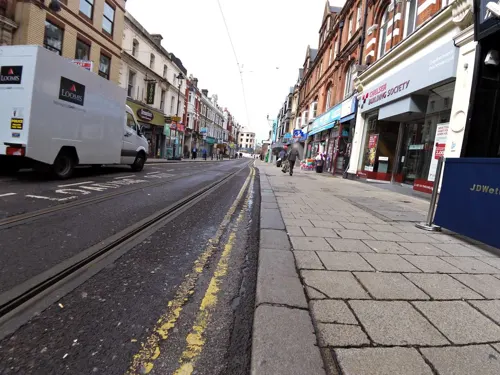
Caffè Nero
Cafe · Coffee Shop · 0.8 mi
44 George Street, Croydon
Mo-Fr 06:30-18:00; Sa 07:30-18:00; Su 08:30-17:30

Crispy Dosa
Restaurant · Indian, South Indian · 0.8 mi
38-40 High Street, Croydon
Mo-Fr 10:00-22:00; Sa-Su 09:00-22:00
Croydon Food Station
Restaurant · Indian · 1.2 mi
77A Station Road, Croydon
Mo-Sa 08:00-23:00; Su 10:00-22:00

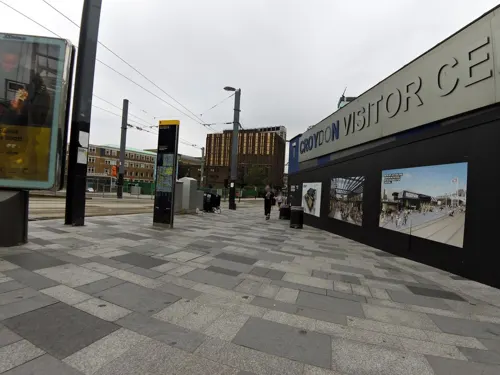
Costa
Cafe · Coffee Shop · 0.9 mi
George Street, Croydon
Mo-Sa 05:00-20:00; Su 07:00-18:00
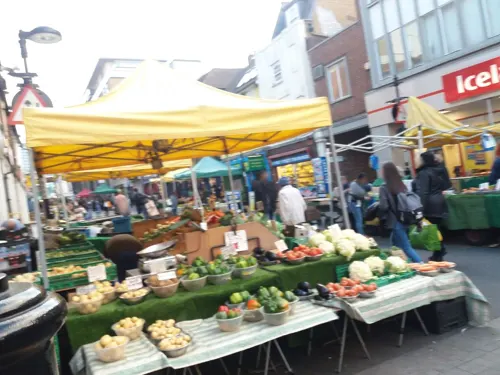

The Dutchie
Restaurant · Caribbean · 0.8 mi
32-34 High Street, Croydon
Mo-Th 11:30-23:00; Fr-Sa 11:30-00:00; Su 13:00-20:00
307 more on the map.
History
The placename Croydon is recorded as early as 809 and is listed in the 1086 Domesday Book, where it is described as the land held in Demesne by Lanfranc, the Archbishop of Canterbury in Waletone (that is Wallington) hundred. In the medieval and early modern periods the town limits, within which the inhabitants enjoyed certain privileges of self-government and tenure, were defined by boundary markers known as the "four crosses": beyond these markers, the more restrictive rules of manorial tenure applied. The southernmost marker, Hern Cross, was cut in an elm tree at the southern end of the High Street. Plaques marking the sites of the crosses (including that of Hern Cross, on the former Blacksmiths Arms, now the Corner House, at the corner of Coombe Road and South End) were erected by the Croydon Rotary Clubs in 1977.
Read more of the history
South Croydon as a distinct area south of Hern Cross is found much later, in the 19th century, when the area was developed as a residential suburb in land lying within the ancient manors of Croham and Haling. Croham Manor and the Croham area were purchased in 1601 by the Whitgift Foundation. Croham was one of four manors in the parish of Sanderstead, and included surrounding farm land and Croham Hurst. The Whitgift Foundation was and remains a charity providing care for the elderly and education for young people in Croydon. Land in South Croydon supported the foundation's work elsewhere in Croydon but in 1931 Whitgift School moved to its current South Croydon site, Haling Park. The manor of Haling lay in the parish of Croydon, and covered 400 acres. It was notable in Tudor times as the home to Lord Howard of Effingham, the Lord High Admiral of the Fleet sent against the Spanish Armada, and was host to a succession of royalty and notable visits. The estate was sold for building in 1850 and Whitgift school now occupies manor house buildings dating to the 17th century.
With the advent of stage coaches, a London to Brighton route was established, with horses being changed in Croydon. Stables were built in South Croydon at Crunden Place, near the Red Deer inn on the Brighton Road; these were used by the coaching business. These stables would later become the location of South Croydon bus garage, which now opens on to Crunden Road as well as the Brighton Road.
Croham Hurst was bought as an open space for local people from the Whitgift Foundation by Croydon Corporation in 1901, an area of 34 hectares. This was after three years of local campaigning by residents against development of the area by the Whitgift Foundation.
From the History section of South Croydon on Wikipedia, under CC BY-SA 4.0.
More about South Croydon
Geography
The area is bounded by the South Croydon electoral ward of the London Borough of Croydon. To the west and south it is bounded by the historic Croydon parish boundary, which runs from Conduit Lane to Croham Hurst, crossing Croham Road where it becomes Croham Valley Road, then across to the railway line, crossing Selsdon Road where it becomes Upper Selsdon Road and crossing Carlton Road where it becomes Mayfield Road. Thereafter the old parish boundary roughly follows the railway south as far as the Red Deer public house, beyond which lies Purley Oaks. Curiously, Purley Oaks Primary School lies on the South Croydon side of the boundary and not in Purley Oaks and Riddlesdown ward.
The much larger postal district of South Croydon includes Sanderstead, Selsdon and two remnants of Addington, Croham Valley and Monks Hill.
Green space is provided to the west by the Purley Way Playing Fields, Croham Hurst and the hidden green space with gardens that is Haling Grove sandwiched between Pampisford Road and the A23: the extensive Whitgift School playing fields frequently host international cricket and rugby matches.
From the Wikipedia article South Croydon, under CC BY-SA 4.0.
Notable people from South Croydon
 William GaoBritish actor, singer and modelPhoto: Misfit Biscuit, CC BY 4.0
- John WilliamsEnglish cricketer and solicitor (1911-1964)
- John Lewis MitchellAir Commodore & Pilot for Winston Churchill (1918–2016)
Born in South Croydon, according to Wikidata (CC0). Each name links to its Wikipedia article.
Where to stay17
London Croydon Aerodrome Hotel, BW Signature Collection
Motel and hotel · 1.0 mi
680 Purley Way, Croydon
Churches and places of worship48
St Gertrude’s Catholic Church South Croydon
Church · Roman Catholic · 0.8 mi
46 Purley Road, South Croydon
Shopping42
Gas and EV charging8
Schools, colleges and libraries61
Regina Coeli Catholic Primary School
School · Roman Catholic · 0.8 mi
173 Pampisford Road, South Croydon
The Minster Nursery and Infants Church of England Academy
School · Anglican · 0.8 mi
Warrington Road, Croydon
Healthcare17
Andrew McCoig Pharmacy
Clinic and pharmacy · 0.8 mi
367 Brighton Road, South Croydon
Map of South Croydon
250 places. The map loads OpenStreetMap tiles when you open it.
Getting there and nearby towns
London Biggin Hill Airport (BQH) is the nearest airport with scheduled flights listed in OpenStreetMap, 6 miles away.
- Croydon 1 mi north, about 2 min by car
- Purley 2 mi southwest, about 3 min by car
- Sanderstead 2 mi south, about 3 min by car
- Shirley 2 mi northeast, about 4 min by car
- Kenley 2 mi south, about 4 min by car
- Wallington 3 mi west, about 4 min by car
- Thornton Heath 3 mi north, about 4 min by car
- Carshalton 3 mi west, about 5 min by car
- West Wickham 3 mi east, about 5 min by car
- Coulsdon 4 mi southwest, about 6 min by car
Drive times are estimates from straight-line distance, not routes.
Towns near South Croydon


Keep exploring
Local news
Headlines from INDB.
Reviews, tips and questions
Loading what members have shared...
Sources and licences
- GeoNames (CC BY 4.0): population, coordinates, regions and time zone
- Mapillary (see each image): photos
- OpenStreetMap contributors (ODbL 1.0): places, airports, map data
- Wikidata (CC0 1.0): elevation, founding date, time zone, website, landmarks and historic places
- Wikimedia Commons (see each image): photos
- Wikipedia (CC BY-SA 4.0): overview and history text
Photo credits
- 46 South End, Croydon, hahnchen at Wikimedia Commons (must include link if medium allows), CC BY-SA 3.0
- 60163 Tornado steam locomotive Cathedrals Express South Croydon station 15 August 2009, Peter Trimming, CC BY-SA 2.0
- Croham Arms, South Croydon, CR2 (2770905178), Ewan Munro from London, UK, CC BY-SA 2.0
- Fairfield Halls - London, Jim Linwood, CC BY 2.0
- Charles Cryer Theatre Carshalton, G.Rogers ( Rodge500 ), CC BY-SA 2.5
- Croydon Flyover, Pafcool2, Public domain
- Croydon War Memorial - West, hahnchen at Wikimedia Commons (must include link if medium allows), CC BY-SA 3.0
- Museum of Croydon, Pafcool2, Public domain
- Addington-hills-view, Harvest1, CC BY 3.0
- Croham Hurst path, Dudley Miles, CC BY-SA 3.0
- Lloyd Park, Croydon, Eagleash, CC BY-SA 4.0
- Park Hill Entrance 2015, Eagleash, CC BY-SA 4.0
- Waddon Ponds, Croydon, UK; from viewing platform, Eagleash, CC BY-SA 4.0
- Wandle Park Croydon - Wandle River (12012995973), Anthony Spratt, CC BY 2.0
- Bramley Bank 1, Dudley Miles, CC BY-SA 3.0
- Croydon Parish Church - North East, hahnchen at Wikimedia Commons (must include link if medium allows), CC BY-SA 3.0
- Addington Church, No machine-readable author provided. Ross Burgess assumed (based on copyright claims)., CC BY-SA 3.0
- St Peter's Church, Croydon - West, hahnchen at Wikimedia Commons (must include link if medium allows), CC BY-SA 3.0
- St Andrew's, Croydon, hahnchen at Wikimedia Commons (must include link if medium allows), CC BY-SA 3.0
- Spreadeagle, Croydon, CR0 (2353133094), Ewan Munro from London, UK, CC BY-SA 2.0
- Al-Khair Secondary School, Mx. Granger, CC0
- Centrale, The original uploader was BbBear at English Wikipedia ., CC BY-SA 3.0
- Croydon clocktower, Ross Burgess, CC BY-SA 4.0
- Whitgift Centre - North End entrance, Hzh, CC BY-SA 4.0
- School From Front, Suttonner, CC BY-SA 4.0
- Parish Church of St Michael and All Angels with St James, Croydon - North, hahnchen at Wikimedia Commons (must include link if medium allows), CC BY-SA 3.0
- Control Tower & Terminal building at Croydon Airport. Croydon, UK, John Murrell, CC BY-SA 4.0
- Christ Church CofE Primary School (Purley), Frombowen, CC BY-SA 4.0
- George, Croydon, CR0 (2353126638), Ewan Munro from London, UK, CC BY-SA 2.0
- Emmanuel Church, Hurst Way, South Croydon (April 2011) (2), User:Hassocks5489, CC0
- Pump house surrey street side, Francis a b fernandes, CC BY-SA 4.0
- Crown and Sceptre, South Croydon, CR2, Ewan-M, CC BY-SA 2.0
- Royal Standard, Croydon, CR0 (3432940722), Ewan Munro from London, UK, CC BY-SA 2.0
- Round barrow memorial stone in Croham Hurst, Croydon, Eagleash, CC BY-SA 4.0
- St Peter's Church, Croydon - South East, hahnchen at Wikimedia Commons (must include link if medium allows), CC BY-SA 3.0
- Little Bay, Croydon 2025-09-16, Bex Walton, CC BY 4.0
- Warehouse Theatre Warehouse Cafe Bar, Croydon, CR0 (6109125574), Ewan Munro from London, UK, CC BY-SA 2.0
- FREDERICK GEORGE CREED 1871-1957 Electrical Engineer Inventor of the Teleprinter lived and died here, Spudgun67, CC BY-SA 4.0
- Plants and Paths at Coombe Wood Gardens, Ethan Doyle White, CC BY-SA 4.0
- Addiscombe Railway Park 4, Mx. Granger, CC0
- Ashburton Park, London Borough of Croydon, SE25 CR0 (2352153099), Ewan Munro from London, UK, CC BY-SA 2.0
- Street-level photo, smsm1, CC BY-SA 4.0
- Street-level photo, smsm1, CC BY-SA 4.0
- Street-level photo, agatefilm, CC BY-SA 4.0
- Street-level photo, ldonetc, CC BY-SA 4.0
- Street-level photo, ldonetc, CC BY-SA 4.0
- Street-level photo, tonys999, CC BY-SA 4.0
- Street-level photo, agatefilm, CC BY-SA 4.0
- Street-level photo, agatefilm, CC BY-SA 4.0
- Street-level photo, ldonetc, CC BY-SA 4.0
- Street-level photo, agatefilm, CC BY-SA 4.0
- Street-level photo, tonys999, CC BY-SA 4.0
- Street-level photo, agatefilm, CC BY-SA 4.0
- Street-level photo, smsm1, CC BY-SA 4.0
- Street-level photo, smsm1, CC BY-SA 4.0
- Street-level photo, richquansah1, CC BY-SA 4.0
- Street-level photo, tonys999, CC BY-SA 4.0
- Street-level photo, ldonetc, CC BY-SA 4.0
- Street-level photo, smsm1, CC BY-SA 4.0
- Street-level photo, jethro10, CC BY-SA 4.0
- Street-level photo, agatefilm, CC BY-SA 4.0
- Street-level photo, smsm1, CC BY-SA 4.0
- Street-level photo, tonys999, CC BY-SA 4.0
- Street-level photo, jethro10, CC BY-SA 4.0
- Street-level photo, smsm1, CC BY-SA 4.0
- Street-level photo, pbb, CC BY-SA 4.0
- Street-level photo, laye, CC BY-SA 4.0
- Street-level photo, agatefilm, CC BY-SA 4.0


Page built November 10, 2026. Spotted a mistake? Tell us or suggest a place.