
Mablethorpe, United Kingdom
Mablethorpe is a town of 12,531 people in England, United Kingdom.
Why visit Mablethorpe
Townapedia lists 2 museums and landmarks, 3 parks and trails, 69 places to eat, 30 places to stay and 2 attractions in and around town.
Highlights include Mablethorpe Seal Sanctuary and Wildlife Centre.
Weather in Mablethorpe
Forecast from MET Norway (CC BY 4.0). Full forecast
About Mablethorpe
Mablethorpe is a seaside town in the civil parish of Mablethorpe and Sutton, in the East Lindsey district of Lincolnshire, England. The population including nearby Sutton-on-Sea was 12,531 at the 2011 census and estimated at 12,633 in 2019.
From the Wikipedia article Mablethorpe (this version), under CC BY-SA 4.0.
Travel tips from other travellers: Mablethorpe on Wikivoyage (CC BY-SA 4.0).
Things to do2


Museums and landmarks2


Parks, trails and playgrounds3

Mablethorpe Seal Sanctuary and Wildlife Centre
Park · 1.2 mi
Seal sanctuary in Lincolnshire, England

Restaurants and cafes69
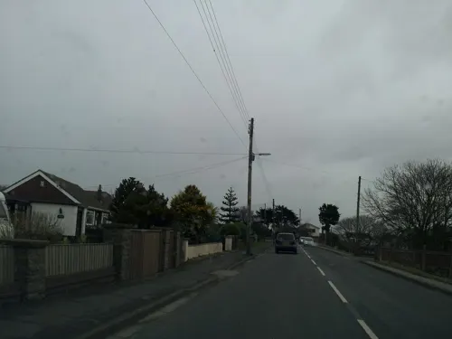
The Seacroft Club
Bar and pub · 1.1 mi
Sutton Road, Mablethorpe
Mo-Fr 12:00-22:00; Sa-Su 12:00-23:00
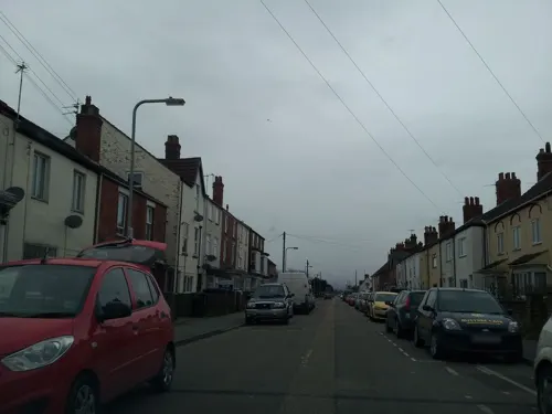
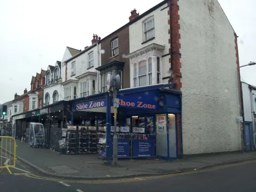

Mable's Tea Room
Cafe · Tea, Coffee, Sandwich, Pizza, Cake, Salad, Dessert, Soup, High Tea, Cocktails, Mocktails, Jacket Potato, Hot Food, Toasted Sandwich, Lincoln Tea, Baguettes, Cheese Cake, Soft Drinks
33 Victoria Road, Mablethorpe
Tu-Sa 10:30-16:00


57 more on the map.
History
In 1961 the civil parish had a population of 3,611. On 1 April 1974 the parish was abolished to form "Mablethorpe and Sutton".
A hoard of Roman treasure was found in Mablethorpe in the 1980s, as were a Roman brooch and pottery.
The name Mablethorpe derives from the Old Norse malbertþorp meaning 'Malbert's secondary settlement'.
Mablethorpe has existed as a town for many centuries, gaining its market town charter in 1253. Coastal erosion means some of it was lost to the sea in the 1540s. Records of the Fitzwilliam family of Mablethorpe Hall date back to the 14th century. In the 19th century, it was a centre for ship breaking in the winter. Mablethorpe Hall is to the west of the town along Alford Road near the Church of St Mary. The Mablethorpe church parish includes Trusthorpe.
Mablethorpe's first lifeboatstation was built in 1883. It was closed temporarily in 1917 due to crew shortages in the First World War but the closure was made permanent in 1920. It reopened as an inshore lifeboat station in 1965. It operates two lifeboats, an Atlantic 85 and a smaller D-class.
In 1953, Mablethorpe was hit by the disastrous East Coast floods. The seawall was breached on 31 January. A granite rock memorial was unveiled on the coast on 31 January 2013 on the 60th anniversary of the disaster, in memory of the town's 42 victims.
Read more of the history
Mablethorpe is the destination for the fictional Morel family's first holiday in the still popular D. H. Lawrence novel, Sons and Lovers, published in 1913: "At last they got an answer from Mablethorpe, a cottage such as they wished for thirty shillings a week. There was immense jubilation. Paul was wild with joy for his mother's sake. She would have a real holiday now. He and she sat at evening picturing what it would be like. Annie came in, and Leonard, and Alice, and Kitty. There was wild rejoicing and anticipation. Paul told Miriam. She seemed to brood with joy over it. But the Morels' house rang with excitement."
Mablethorpe is the seaside setting for the Ted Lewis crime novel GBH, published in 1980. The novel was his last and has been described as a "lost masterwork".
From the History section of Mablethorpe on Wikipedia, under CC BY-SA 4.0.
More about Mablethorpe
Geography
Mablethorpe, in the East Lindsey council district, is administered with Sutton-on-Sea and Trusthorpe as the civil parish of Mablethorpe and Sutton. The original parish of Mablethorpe covers a rectangular area inland along Alford Road towards Maltby le Marsh, as far as Grange Leisure Park, where Earl's Bridge crosses West Bank. The south of the former parish follows the Trusthorpe Drains, which are crossed at Bamber's Bridge on Mile Lane. Out towards Alford lies Strubby Airfield, with the Strubby Aviation Club and Lincs Gliding Club. To the north is the large parish of Theddlethorpe St Helen, which extends to the River Great Eau at Saltfleetby. The town is the eastern terminus of the A52. The town is also accessed by the A1104 and A16 through Alford. The A157 heads west towards Louth and is said to be the "sixth bendiest A-road in the UK".
Arts and culture
Family attractions include a small fairground and an award-winning beach with traditional seaside amusement arcades and one of the largest family entertainment centers in England named The Mirage. One of Mablethorpe's long-standing features, its sand train, takes visitors to and from the northern end of the beach. Mablethorpe Seal Sanctuary and Wildlife Centre is also north of the town.
A Time and Tide Bell installed on the beach near the Seal Sanctuary in 2019 is one of a series around the UK, rung by high tides.
A star sculpture named Star of the East was created by Michael Trainor in 2007 in North Gardens, along the foreshore. It is 14 m (46 ft) high, casting light around the seafront.
Mablethorpe's cinema, the Loewen in Quebec Road, was previously known as the Bijou. The Dunes leisure complex lies on Mablethorpe's seafront. The seafront also gained a skatepark in 2008, which includes a small funbox, a spine and two quarter pipes.
Several small caravan parks and guest houses provide tourist accommodation.
Education
The community's primary school is Mablethorpe Primary Academy School. The Mablethorpe site of Monks' Dyke Tennyson College closed in August 2016.
From the Wikipedia article Mablethorpe, under CC BY-SA 4.0.
Notable people from Mablethorpe
 James Sandby PadleyEnglish surveyor, architect and civil engineerPhoto: David Wright, CC BY-SA 2.0
- Hugh WhistlerBritish ornithologist (1889–1943)
- Chris Robertsonfootballer (1914-1995)
Born in Mablethorpe, according to Wikidata (CC0). Each name links to its Wikipedia article.
Where to stay30
Churches and places of worship11
Saint Peter's Church, Trusthorpe
Church · Anglican · 1.0 mi
Sutton Road, Mablethorpe
Shopping13
Gas and EV charging1
Schools, colleges and libraries3
Healthcare1
Map of Mablethorpe
135 places. The map loads OpenStreetMap tiles when you open it.
Getting there and nearby towns
RAF Coningsby (QCY) is the nearest airport with scheduled flights listed in OpenStreetMap, 25 miles away.
- Huttoft 5 mi south, about 8 min by car
- Skegness 14 mi south, about 23 min by car
- Lincoln 34 mi west, about 55 min by car
- Sleaford 36 mi southwest, about 59 min by car
- Kingston upon Hull 37 mi northwest, about 1 h by car
- Spalding 42 mi southwest, about 1 h by car
- Wisbech 47 mi south, about 1 h 15 min by car
- Market Deeping 52 mi southwest, about 1 h 30 min by car
- Thorne 54 mi west, about 1 h 30 min by car
- March 55 mi south, about 1 h 30 min by car
Drive times are estimates from straight-line distance, not routes.
Towns near Mablethorpe


Keep exploring
Local news
Headlines from INDB.
Reviews, tips and questions
Loading what members have shared...
Sources and licences
- GeoNames (CC BY 4.0): population, coordinates, regions and time zone
- Mapillary (see each image): photos
- OpenStreetMap contributors (ODbL 1.0): places, airports, map data
- Wikidata (CC0 1.0): elevation, founding date, time zone, website, landmarks and historic places
- Wikipedia (CC BY-SA 4.0): overview and history text
Photo credits
- Street-level photo, adam2, CC BY-SA 4.0
- Street-level photo, adam2, CC BY-SA 4.0
- Street-level photo, adam2, CC BY-SA 4.0
- Street-level photo, adam2, CC BY-SA 4.0
- Street-level photo, adam2, CC BY-SA 4.0
- Street-level photo, adam2, CC BY-SA 4.0
Page built November 10, 2026. Spotted a mistake? Tell us or suggest a place.