


Colsterworth, United Kingdom
Colsterworth is a town of 1,245 people in England, United Kingdom.
Why visit Colsterworth
Townapedia lists 6 museums and landmarks, 1 park or trail, 7 places to eat and 1 place to stay in and around town.
Highlights include Woolsthorpe Manor and Woolsthorpe Manor (Isaac Newton's Birthplace).
Weather in Colsterworth
Forecast from MET Norway (CC BY 4.0). Full forecast
About Colsterworth
Colsterworth is a village and civil parish in the South Kesteven district of Lincolnshire, England, less than half a mile (0.8 km) west of the A1, about 7 miles (11 km) south of Grantham, and 12 miles (19 km) north-west of Stamford. The village with the hamlet of Woolsthorpe-by-Colsterworth had a recorded population of 1,713 at the time of the 2011 census, in an area of 1,465 hectares (3,620 acres).
From the Wikipedia article Colsterworth (this version), under CC BY-SA 4.0.
Photos of Colsterworth

Museums and landmarks6

Woolsthorpe Manor
Museum · 0.5 mi
Country house in Woolsthorpe-by-Colsterworth, Lincolnshire, England, UK
Woolsthorpe Manor (Isaac Newton's Birthplace)
Museum · 0.5 mi
Birthplace of Isaac Newton, scientist.
Water Lane, Grantham

Parks, trails and playgrounds1

Restaurants and cafes7
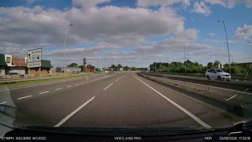
A1 Stadium Diner
Cafe · Transport Cafe · 0.6 mi
Bourne Road, Grantham



Where to stay1

More about Colsterworth
Economy
There is little employment in the village itself. During and for some time after the Second World War, work was available at the ironstone excavations, but after operations ceased in the 1970s, the site was filled and levelled. A tyre depot and a Christian Salvesen food cold-store offer local jobs. Farming, the traditional occupation that absorbed most of the workforce, still provides some employment, for instance at the Openfield grain cooperative on the former RAF station. There is work at fast-food restaurants OK Diner and Travelodge on the A1, and at the nearby Stoke Rochford Hall, a conference and function centre.
The village has a post office, a medical surgery, a Co-op store and a hairdresser, with greengrocer, butcher and fishmonger mobile shops. There is a mobile library service.
Other facilities in the village include a sports and social club, a village hall, a youth centre that doubles as a nursery, and three playgrounds. There is another village hall at North Witham.
From the Wikipedia article Colsterworth, under CC BY-SA 4.0.
Churches and places of worship5
Shopping3
Gas and EV charging4
Schools, colleges and libraries1
Map of Colsterworth
28 places. The map loads OpenStreetMap tiles when you open it.
Getting there and nearby towns
Nottingham City Airport (NQT) is the nearest airport with scheduled flights listed in OpenStreetMap, 21 miles away.
- South Witham 3 mi south, about 5 min by car
- Corby Glen 4 mi east, about 7 min by car
- Grantham 7 mi north, about 12 min by car
- Cottesmore 7 mi south, about 11 min by car
- Bourne 10 mi east, about 17 min by car
- Langham 10 mi southwest, about 16 min by car
- Ryhall 10 mi southeast, about 17 min by car
- Oakham 11 mi southwest, about 17 min by car
- Melton Mowbray 11 mi west, about 18 min by car
- Stamford 12 mi southeast, about 20 min by car
Drive times are estimates from straight-line distance, not routes.
Towns near Colsterworth


Keep exploring
Local news
Headlines from INDB.
Reviews, tips and questions
Loading what members have shared...
Sources and licences
- GeoNames (CC BY 4.0): population, coordinates, regions and time zone
- Mapillary (see each image): photos
- OpenStreetMap contributors (ODbL 1.0): places, airports, map data
- Wikidata (CC0 1.0): elevation, founding date, time zone, website, landmarks and historic places
- Wikimedia Commons (see each image): photos
- Wikipedia (CC BY-SA 4.0): overview and history text
Photo credits
- Stained glass window, St John the Baptist, Colsterworth, Lincs (16356565102), Jules & Jenny from Lincoln, UK, CC BY 2.0
- Stained glass window, St John the Baptist, Colsterworth, Lincs (16171557697), Jules & Jenny from Lincoln, UK, CC BY 2.0
- Stained glass window, St John the Baptist, Colsterworth, Lincs (16171236899), Jules & Jenny from Lincoln, UK, CC BY 2.0
- Stained glass window, St John the Baptist, Colsterworth, Lincs (16170081910), Jules & Jenny from Lincoln, UK, CC BY 2.0
- Stained glass window, St John the Baptist, Colsterworth, Lincs (15737480203), Jules & Jenny from Lincoln, UK, CC BY 2.0
- Woolsthorpe Manor, Hel-hama, CC BY-SA 3.0
- St John the Baptist, Colsterworth 8, Martinevans123, CC BY-SA 4.0
- LEO3122 2022 04 0002, Bs0u10e01, CC BY-SA 4.0
- Street-level photo, IpswichEdits, CC BY-SA 4.0
- Street-level photo, adam2, CC BY-SA 4.0
- Street-level photo, IpswichEdits, CC BY-SA 4.0
- Street-level photo, adam2, CC BY-SA 4.0
- Street-level photo, IpswichEdits, CC BY-SA 4.0
- Street-level photo, adam2, CC BY-SA 4.0
- Street-level photo, adam2, CC BY-SA 4.0
- Street-level photo, IpswichEdits, CC BY-SA 4.0
- Street-level photo, IpswichEdits, CC BY-SA 4.0
- Street-level photo, adam2, CC BY-SA 4.0

Page built November 10, 2026. Spotted a mistake? Tell us or suggest a place.