
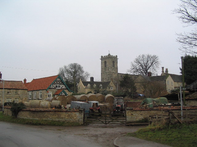


Corby Glen, United Kingdom
Corby Glen is a town of 1,017 people in England, United Kingdom.
Why visit Corby Glen
Townapedia lists 1 museum or landmark, 1 park or trail, 6 places to eat and 1 attraction in and around town.
Highlights include Grimsthorpe Castle.
Weather in Corby Glen
Forecast from MET Norway (CC BY 4.0). Full forecast
About Corby Glen
Corby Glen, formerly just Corby, is a village and civil parish in the South Kesteven district of Lincolnshire, England. It is approximately 9 miles (14 km) south-east of Grantham and 8 miles (13 km) north west of Bourne. In 2011 it had a population of 1,017.
From the Wikipedia article Corby Glen (this version), under CC BY-SA 4.0.
Things to do1

Museums and landmarks1

Grimsthorpe Castle
Museum · 3.1 mi
Country house in Lincolnshire, England, UK
Parks, trails and playgrounds1

Restaurants and cafes6



History
St John the Evangelist's Church, the Church of England parish church, dates in part from the 12th century and has a notable collection of 14th- and 15th-century murals.
Following the purchase of Irnham Hall by a Protestant family in the mid-19th century the Catholic Chapel of the hall was taken down and re-erected in Corby Glen as the Roman Catholic Church of Our Lady of Mount Carmel to the designs of architects Weightman, Hadfield & Goldie. A thousand wagonloads of material were carried between the two sites. The new church opened in 1856. The church closed in 2012. The church and the attached presbytery are Grade II Listed buildings.
The village's first Methodist chapel was built in 1846, and replaced in 1902 by the present building which is still in use. The original chapel is now a private house.
To the north of the parish church is a substantial castle mound or motte. Historian David Roffe refers to it as "an early defended manor house".
In 1238 King Henry III chartered a weekly market and an annual sheep fair. The sheep fair is still held and is claimed to be the longest-established such event in Britain.
Read more of the history
The Willoughby Memorial Library and Art Gallery is housed in a 17th-century building that was originally Reads Grammar School. The school was founded in 1669 by the bequest of Charles Read (1604–1669), who was born at Darlton in Nottinghamshire and became a wealthy shipper in Hull. Read also founded Read School at Drax in Yorkshire and a grammar school at Tuxford in Notts. Reads Grammar School in Corby closed in 1909. The building was restored and reopened for its current uses in 1965 by the Willoughby Memorial Trust which was founded by Lord Ancaster in memory of his son Timothy, Lord Willoughby de Eresby, who died in 1963. The gallery holds a series of exhibitions from Easter to November and an annual Open Art Competition.
In 1852 the Great Northern Railway opened the East Coast Main Line near Corby Glen. In 1853 the GNR opened Corby Glen railway station on the main line about 1 mile (1½ km) from the village. Corby Glen was served by local trains between Peterborough and Grantham. On 3 July 1938 the London and North Eastern Railway locomotive Mallard passed at high speed through Corby Glen shortly before achieving its world speed record for a steam locomotive seven miles further south near Carlby. British Railways closed Corby Glen station in 1959 and its yard is now occupied by a sawmill.
From the History section of Corby Glen on Wikipedia, under CC BY-SA 4.0.
More about Corby Glen
Geography
The village of Corby Glen is in the South Kesteven district of Lincolnshire. It lies mainly to the north of the A151, a former toll road, and to the east of the West Glen River, near where the Glen flows through a small graben in the Jurassic limestone.
Until the 1950s the name of the village was simply Corby. However, in the nearby county of Northamptonshire another Corby had been greatly enlarged by the addition of a steel works and housing to match. Some confusion arose between the two Corbys, so British Railways consulted the villagers to choose an additional name to distinguish the two. The villagers chose "Glen" in reference to the western branch of the River Glen which flows through the village. In 1956 the civil parish was renamed from "Corby" to "Corby Glen".
Education
A new secondary school opened in Corby Glen in 1963. The school became a comprehensive, and it was renamed the Charles Read High School in 1999. It converted to an academy in January 2011; in 2013, the David Ross Foundation took responsibility for maintaining the school.
From the Wikipedia article Corby Glen, under CC BY-SA 4.0.
Churches and places of worship5
Shopping1
Schools, colleges and libraries2
Map of Corby Glen
17 places. The map loads OpenStreetMap tiles when you open it.
Getting there and nearby towns
RAF Coningsby (QCY) is the nearest airport with scheduled flights listed in OpenStreetMap, 24 miles away.
- Bourne 6 mi southeast, about 10 min by car
- Grantham 9 mi northwest, about 14 min by car
- Cottesmore 9 mi southwest, about 15 min by car
- Stamford 11 mi south, about 18 min by car
- Market Deeping 13 mi southeast, about 20 min by car
- Easton on the Hill 13 mi south, about 21 min by car
- Sleaford 14 mi north, about 22 min by car
- Oakham 14 mi southwest, about 22 min by car
- Spalding 15 mi east, about 25 min by car
- Melton Mowbray 16 mi west, about 25 min by car
Drive times are estimates from straight-line distance, not routes.
Towns near Corby Glen


Keep exploring
Local news
Headlines from INDB.
Reviews, tips and questions
Loading what members have shared...
Sources and licences
- GeoNames (CC BY 4.0): population, coordinates, regions and time zone
- Mapillary (see each image): photos
- OpenStreetMap contributors (ODbL 1.0): places, airports, map data
- Wikidata (CC0 1.0): elevation, founding date, time zone, website, landmarks and historic places
- Wikimedia Commons (see each image): photos
- Wikipedia (CC BY-SA 4.0): overview and history text
Photo credits
- Corbyglen, Tim Heaton, CC BY-SA 2.0
- Glebe Farmhouse, Corby Glen, Dave.Dunford, CC BY-SA 4.0
- 2, Church Street, Corby Glen, Dave.Dunford, CC BY-SA 4.0
- The Old Smithy, Corby Glen, Dave.Dunford, CC BY-SA 4.0
- 7, Market Place, Corby Glen, Dave.Dunford, CC BY-SA 4.0
- Grimsthorpe Castle - North Facade, Wehha, CC BY-SA 3.0
- Corby Glen St John's - from the south-east, Acabashi, CC BY-SA 3.0
- BurtonCoggles StThomasOfC SE, Motacilla, CC BY-SA 4.0
- Fighting Cocks Inn, Corby Glen, Dave.Dunford, CC BY-SA 4.0
- Street-level photo, adam2, CC BY-SA 4.0


Page built November 10, 2026. Spotted a mistake? Tell us or suggest a place.