


Why visit Bourne
Townapedia lists 27 museums and landmarks, 11 parks and trails, 42 places to eat and 2 places to stay in and around town.
Highlights include Grimsthorpe Castle, Eastgate House and Bourne Town FC (The Wakes).
Weather in Bourne
Forecast from MET Norway (CC BY 4.0). Full forecast
About Bourne
Bourne is a market town and civil parish in the South Kesteven district of Lincolnshire, England. It lies on the eastern slopes of the limestone Kesteven Uplands and the western edge of the Fens, 11 miles (18 km) north-east of Stamford, 12 miles (19 km) west of Spalding and 17 miles (27 km) north of Peterborough. At the 2021 census, the parish had a population of 17,988.
From the Wikipedia article Bourne, Lincolnshire (this version), under CC BY-SA 4.0.
Travel tips from other travellers: Bourne on Wikivoyage (CC BY-SA 4.0).
Museums and landmarks27

Grimsthorpe Castle
Museum · 3.4 mi
Country house in Lincolnshire, England, UK
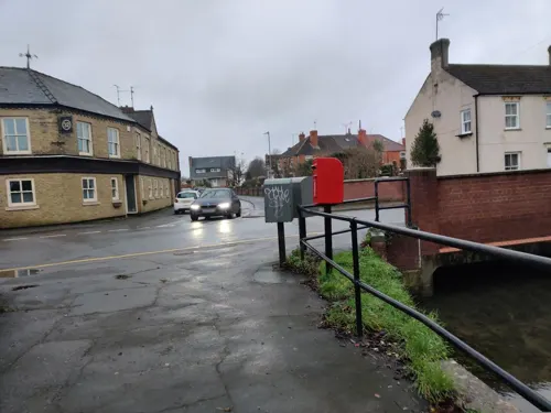

West Street Manor House
Monument and historic site
91,93,95,97,99 West Street, Bourne

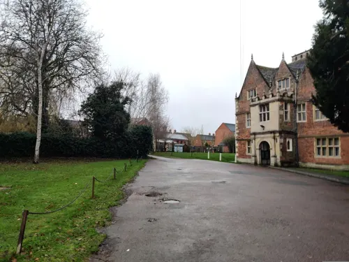


Bourne Castle
Monument and historic site
Bourne Castle was a Norman motte and double bailey castle. It was destroyed after being used by Oliver Cromwell's troops in 1645, and a...
Delaine Bus Museum
Museum · 0.7 mi
8 Spalding Road, Bourne
Mar-Oct: Sa 12:00-16:00
15 more on the map.
Parks, trails and playgrounds11

Bourne Town FC (The Wakes)
Sports field and stadium · 0.5 mi
Abbey Road, Bourne


Restaurants and cafes42


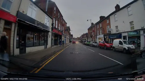
The Raymond Mays
Bar and pub
44-48 North Street, Bourne
Mo-Th 08:00-24:00; Fr-Sa 08:00-01:00; Su 08:00-24:00
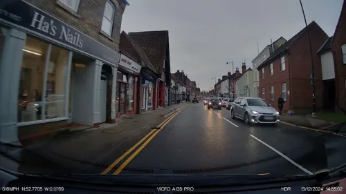



Bourne & District Royal British Legion Club
Bar and pub
7a Burghley Street, Bourne
30 more on the map.
Where to stay2

History
The ancient woodland of Bourne Woods is still extant, although much reduced. It originally formed part of the ancient Forest of Kesteven and is now managed by the Forestry Commission.
The earliest documentary reference to Brunna, meaning stream, is from a document of 960, and the town appeared in Domesday Book of 1086 as Brune.
Bourne Abbey, (charter 1138), formerly held and maintained land in Bourne and other parishes. In later times this was known as the manor of Bourne Abbots. Whether the canons knew that name is less clear. The estate was given by the founder of the Abbey, Baldwin fitz Gilbert de Clare, son of Gilbert fitz Richard, and later benefactors. The abbey was established under the Arrouaisian order. Its fundamental rule was that of St Augustine and as time went on it came to be regarded as Augustinian. The Ormulum, an important Middle English Biblical gloss, was probably written in the abbey in around 1175.
Bourne Castle was built on land that is now the Wellhead Gardens in South Street.
Much of Bourne's 19th-century affluence came from the corn-trade boom that followed the mechanisation of fen drainage. The Corn Exchange in Abbey Road dates from 1870.
Read more of the history
Bourne railway station was an important junction on the Victorian railway system, but all such connections were severed after the Second World War (see Railways section). The business stimulus it brought caused major development of the town and many of the buildings around the medieval street plan were rebuilt or at least refaced. Improved communications allowed a bottled-water industry to develop and coal to be delivered to the town's gas works.
The local authority at the time, Bourne Urban District Council, was active in the town's interests, taking over the gas works and the local watercress beds at times of financial difficulty and running them as commercial ventures. Large numbers of good-quality council houses were built in the early 20th century.
Bourne sent many men to both world wars but was otherwise not much affected. During the Second World War a German bomber shot down in May 1941 crashed into the Butcher's Arms public house in Eastgate. The landlord, his wife and eight soldiers billetted across the road were killed, as were the bomber's crew. In a separate incident several bombs were dropped on the Hereward Camp.
From the History section of Bourne, Lincolnshire on Wikipedia, under CC BY-SA 4.0.
More about Bourne
Geography
The town is located on a Roman road now known as King Street. It was built around some natural springs, hence the name "Bourne" (or "Bourn"). which derives from the Anglo-Saxon burna or burne meaning "water" or "stream". It lies on the intersection of two main roads: the A15 and the A151. The civil parish includes the main township along with the hamlets of Cawthorpe, Dyke and Twenty. In former years Austerby was regarded as a separate settlement, with its own shops and street plan, but it is now an area of Bourne.
From the Wikipedia article Bourne, Lincolnshire, under CC BY-SA 4.0.
Notable people from Bourne
 William Cecil, 1st Baron BurghleyEnglish statesman and chief adviser to Queen Elizabeth I (1520-1598)Photo: anonymous, Public domain
 Raymond MaysBritish racing driver (1899-1980)Photo: Unknown author, Public domain
 Alistair SlaterBritish bicycle racerPhoto: Cs-wolves, CC BY-SA 4.0
 Elizabeth Russell, Duchess of BedfordBritish duchess (1818–1897)Photo: Unknown author Unknown author, Public domain
- Charles Frederick WorthEnglish fashion designer (1825-1895)
- Dick GibsonEnglish racing driver (1918–2010)
- Ken RichardsonBritish racecar driver (1911-1997)
- William DoddEnglish Anglican clergyman and forger (1729-1777)
- Claire SteelsBritish cyclist
- Shaun CunningtonEnglish footballer and manager (born 1966)
- Peter GrummittFootballer (born 1942)
- David ChristmasEnglish cricketer (born 1969)
Born in Bourne, according to Wikidata (CC0). Each name links to its Wikipedia article.
Churches and places of worship12
Kingdom Hall of Jehovah's Witnesses
Church · Jehovahs Witness · 0.9 mi
Victor Way, Bourne
Shopping14
Gas and EV charging2
Schools, colleges and libraries7
Healthcare4
Map of Bourne
121 places. The map loads OpenStreetMap tiles when you open it.
Getting there and nearby towns
RAF Coningsby (QCY) is the nearest airport with scheduled flights listed in OpenStreetMap, 24 miles away.
- Market Deeping 7 mi southeast, about 11 min by car
- Stamford 9 mi southwest, about 15 min by car
- Spalding 10 mi east, about 16 min by car
- Peterborough 14 mi southeast, about 23 min by car
- Sleaford 16 mi north, about 26 min by car
- Oakham 16 mi southwest, about 26 min by car
- Whittlesey 18 mi southeast, about 29 min by car
- Melton Mowbray 21 mi west, about 34 min by car
- Wisbech 24 mi east, about 38 min by car
- March 25 mi southeast, about 40 min by car
Drive times are estimates from straight-line distance, not routes.
Towns near Bourne


Keep exploring
Local news
Headlines from INDB.
Reviews, tips and questions
Loading what members have shared...
Sources and licences
- GeoNames (CC BY 4.0): population, coordinates, regions and time zone
- Mapillary (see each image): photos
- OpenStreetMap contributors (ODbL 1.0): places, airports, map data
- Wikidata (CC0 1.0): elevation, founding date, time zone, website, landmarks and historic places
- Wikimedia Commons (see each image): photos
- Wikipedia (CC BY-SA 4.0): overview and history text
Photo credits
- Grimsthorpe Castle - North Facade, Wehha, CC BY-SA 3.0
- Burghley Arms, Bourne, Dave.Dunford, CC BY-SA 4.0
- 12, West Street, Bourne, Dave.Dunford, CC BY-SA 4.0
- 91, West Street, Bourne 03, Dave.Dunford, CC BY-SA 4.0
- Bourne was memorial, Joshie2016, CC BY-SA 4.0
- Street-level photo, adam2, CC BY-SA 4.0
- Street-level photo, IpswichEdits, CC BY-SA 4.0
- Street-level photo, IpswichEdits, CC BY-SA 4.0
- Street-level photo, IpswichEdits, CC BY-SA 4.0
- Street-level photo, jpennycook, CC BY-SA 4.0
- Street-level photo, IpswichEdits, CC BY-SA 4.0
- Street-level photo, jpennycook, CC BY-SA 4.0
- Street-level photo, adam2, CC BY-SA 4.0
- Street-level photo, jpennycook, CC BY-SA 4.0
- Street-level photo, IpswichEdits, CC BY-SA 4.0
- Street-level photo, adam2, CC BY-SA 4.0
- Street-level photo, IpswichEdits, CC BY-SA 4.0
- Street-level photo, jpennycook, CC BY-SA 4.0
- Street-level photo, IpswichEdits, CC BY-SA 4.0
- Street-level photo, adam2, CC BY-SA 4.0
Page built November 10, 2026. Spotted a mistake? Tell us or suggest a place.