


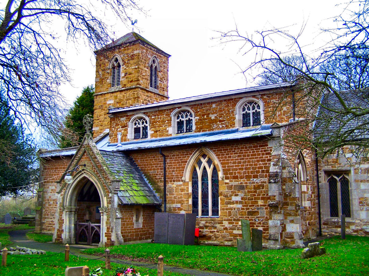
Melton Mowbray, United Kingdom
Melton Mowbray is a town of 27,737 people in England, United Kingdom.
Why visit Melton Mowbray
Townapedia lists 11 museums and landmarks, 10 parks and trails, 86 places to eat, 6 places to stay and 2 attractions in and around town.
Highlights include Regal Cinema, Melton Carnegie Museum, Melton Country Park and Egerton Park.
Weather in Melton Mowbray
Forecast from MET Norway (CC BY 4.0). Full forecast
About Melton Mowbray
Melton Mowbray () is a market town in the Melton district in Leicestershire, England, 19 miles (31 km) north-east of Leicester and 20 miles (32 km) south-east of Nottingham. It lies on the River Eye, known below Melton as the Wreake. The town had a population of 27,670 in 2019. The town is sometimes promoted as Britain's "Rural Capital of Food"; it is the home of the Melton Mowbray pork pie and is the nearest market for most licensed producers of Stilton cheese.
From the Wikipedia article Melton Mowbray (this version), under CC BY-SA 4.0.
Travel tips from other travellers: Melton Mowbray on Wikivoyage (CC BY-SA 4.0).
Photos of Melton Mowbray


Things to do2


Museums and landmarks11
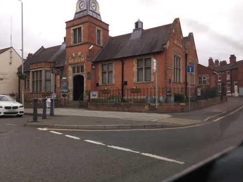
Melton Carnegie Museum
Museum
Museum in Melton Mowbray, Leicestershire, England, United Kingdom
Thorpe End, Melton Mowbray
Tu-Sa 10:00-16:30



The Mount motte at Melton Mowbray (Scheduled Monument)
Monument and historic site · 0.4 mi
Parks, trails and playgrounds10

Melton Country Park
Park · 1.0 mi
Country park in Melton Mowbray, Melton, Leicestershire, England, United Kingdom


Holwell Reserves
Park · 2.6 mi
Nature reserve in Leicestershire, England


Restaurants and cafes86

Amore
Restaurant · Mediterranean
24 Burton Street, Melton Mowbray
Mo-Th 18:00-22:00; Fr,Sa 18:00-22:30
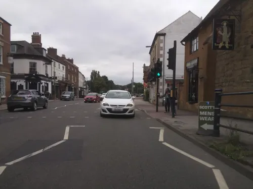
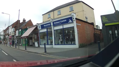
Jasmine House
Restaurant · Chinese
44 Sherrard Street, Melton Mowbray
Tu-Su 12:00-13:30 open "Telephone order only", Tu-Th 17:00-22:00,...
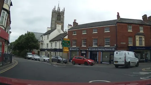
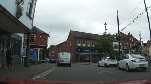
Purple Garlic
Restaurant · Indian
22 Burton Street, Melton Mowbray
Mo-Su,PH 17:00-23:30; Dec 25 off

The Welby
Bar and pub · 0.5 mi
Nottingham Road, Melton Mowbray
Mo-Th 08:00-23:00; Fr-Sa 08:00-00:00; Su 08:00-22:30
74 more on the map.
History
The name comes from the early English word Medeltone, referring to a town surrounded by small hamlets (as do Milton and Middleton). Mowbray is the Norman family name of early lords of the manor, including Robert de Mowbray.
In and around Melton, there are 28 scheduled ancient monuments, some 705 buildings of special architectural or historical interest, 16 sites of special scientific interest, and several deserted village sites. Its industrial archaeology includes the Grantham Canal and remains of the Melton Mowbray Navigation. Windmill sites and signs of ironstone working and smelting suggest that the site was densely populated in the Bronze and Iron Ages. Many small communities existed and strategic points at Burrough Hill and Belvoir were fortified.
In Roman times, Melton benefited from proximity to the Fosse Way and other major Roman roads, and to military centres at Leicester and Lincoln. Intermediate camps were established, for example, at Six Hills on the Fosse Way. Other Roman trackways passed north of Melton along the scarp of the Vale of Belvoir linking Market Harborough to Belvoir, and south to Oakham and Stamford.
Read more of the history
Evidence of settlement in the Anglo-Saxon and 8th–9th-century Danelaw periods shows in place names. Along the Wreake Valley, the Danish suffix "-by" is common, e.g. in Asfordby, Dalby, Frisby, Hoby, Rearsby and Gaddesby. A cemetery of 50–60 graves of pagan Anglo-Saxon origin has been found in Melton Mowbray. Most villages and their churches had origins before the Norman Conquest of 1066, shown by stone crosses at Asfordby and Sproxton and Anglo-Saxon cemeteries at Goadby Marwood, Sysonby and Stapleford.
Melton Mowbray had six recorded crosses from several centuries: (i) Kettleby Cross near today's filling station near the junction of Dalby Road and Leicester Road, (ii) Sheep Cross at Spital End, now Nottingham Street/Park Road junction, (iii) Corn Cross at Swine Lane/Spittle End junction, remade and re-erected at the Nottingham St/High St junction in 1996 as a memorial to the Royal Army Veterinary Corps, (iv) Butter Cross or High Cross at the west end of Beast Market, again rebuilt from remains of an original Anglo-Saxon cross in 1986–1987 in the Market Place, (v) Sage Cross at the East end of the Beast Market close to Saltgate, in Sherrard Street opposite Sage Cross Street, and (vi) Thorpe Cross at the end of Saltgate, near the junction of Thorpe Road and Saxby Road. The original crosses were removed or destroyed during the Reformation and other iconoclastic periods, or to make room for traffic or other development.
The effects of the Norman Conquest recorded in the 1086 Domesday Book show that settlements at Long Clawson and Bottesford were of noteworthy size, and that Melton Mowbray a thriving market town of some 200 inhabitants, with weekly markets, two water mills and two priests. The mills, still in use up to the 18th century, are remembered in the names of Beckmill Court and Mill Street.
Melton has thus been a market town for over 1,000 years. Recorded as Leicestershire's only market in the 1086 Domesday Survey, it is the third oldest market in England. Tuesday has been market day since royal approval was given in 1324. The market was founded with tolls before 1077.
Legacies from the Middle Ages include consolidation of village and market-town patterns – in Melton Mowbray, Bottesford, Wymondham and Waltham-on-the-Wolds. The last had a mediaeval market which survived until 1921, and an annual fair of horses and cattle. Many buildings in Melton Market Place, Nottingham Street, Church Lane, King Street and Sherrard Street have ancient foundations. Alterations to No. 16 Church Street revealed a medieval circular stone wall subjected to considerable heat. This is probably the Manor Oven mentioned in 13th-century documents. Surveys of 5 King Street show it belonged to an early medieval open-halled house. It may have been part of the 14th-century castle or fortified manor of the Mowbrays.
King Richard I and King John visited the town and may have stayed at an earlier castle. In 1549, after the dissolution of chantries, monasteries and religious guilds, church plate was sold and land bought for the town. Resulting rents were used to maintain Melton School, first recorded in 1347, making it one of the oldest in Britain. Funds were also used to maintain roads and bridges and repair the church clock.
During the English Civil War, Melton was a Roundhead garrison commanded by a Colonel Rossiter. Two battles were fought: in November 1643, Royalists caught the garrison unaware and carried away prisoners and booty; in February 1645, Sir Marmaduke Langdale, commanding a Royalist force of 1,500 men, inflicted severe losses on the Roundheads. Some 300 men were said to have been killed. Legend has it that the hillside where the battle was fought was ankle deep in blood, hence the name Ankle Hill. However, the name appears in documents from before the Civil War and the names of Dalby Road and Ankle Hill have been switched, so confusing the true site of the battle.
Local notable families seem to have had divided loyalties, though the Civil War ended with rejoicings outside the Limes in Sherrard Street, home of Sir Henry Hudson. His father, Robert Hudson, founded the Maison Dieu almshouses opposite the Church in 1640, complementing the stone Anne of Cleves House opposite. This was built in 1384 and housed chantry priests until the Dissolution. It was then included in the estates of Anne of Cleves by Henry VIII, as a divorce settlement in the 16th century, although there is debate about whether she ever stayed there. A Grade II* listed building, it is now a public house owned by Everards, a Leicester brewery.
From the History section of Melton Mowbray on Wikipedia, under CC BY-SA 4.0.
More about Melton Mowbray
Economy
Before 1960, the Production Engineering Research Association of Great Britain came to Nottingham Road and employed about 400 people in supporting research and development in industry. It is also houses the East Midlands Manufacturing Advisory Service. The former East Midlands Regional Assembly was also based in Nottingham Road.
Petfoods arrived in 1951 as Chappie Ltd, employing at its peak over 2,000. It still employs about 1,000. The firm changed its name to Petfoods in 1957, to Pedigree Petfoods in 1972, and to Masterfoods in January 2002. At Melton, it makes four million items of pet food a day, though this is less than earlier. Masterfoods now has its UK headquarters close to Melton at Waltham-on-the-Wolds.
Education
The town's secondary schools are Long Field Academy and John Ferneley College for pupils aged 11–16 and the Melton Vale Post 16 Centre (MV16) for sixth-formers. Its primary schools are Brownlow, Grove, St Francis RC, St Mary's C of E, Sherard and Swallowdale. Birchwood Special School caters for pupils of primary and secondary-school age. Melton's largest school was the King Edward VII, which at one time had some 2,000 pupils aged 11–19. It was founded as a grammar school in 1910, became comprehensive in the late 1960s, and closed after reaching its centenary. Brooksby Melton College provides vocational, further and higher education in a wide range of subjects at a campus in Asfordby Road and at its Brooksby campus 6 miles (10 km) out of town.
Several independent schools provide bus services to Melton. These include Oakham School, founded in 1584, a co-educational day and boarding school; Stamford School, established in 1532, also a co-educational day and boarding school; and the Loughborough Schools Foundation, which oversees Loughborough Grammar School, a boys’ day and boarding school, and Loughborough High School, a girls’ day school.
From the Wikipedia article Melton Mowbray, under CC BY-SA 4.0.
Notable people from Melton Mowbray
 Louise DoughtyEnglish novelist, playwright and journalistPhoto: Ubud Writers Festival, CC BY 2.0
 Tom BrakeBritish politician (born 1962)Photo: Chris McAndrew, CC BY 3.0
 Craig DalrympleEnglish footballer and coach (born 1973)Photo: Lord Bob, CC0
 Craig DolbyBritish racing driverPhoto: Officially Mr X, CC BY 3.0
 Raynor WinnBritish writer and long-distance walkerPhoto: Theroadislong, CC BY-SA 4.0
 John HenleyEnglish clergymanPhoto: Unknown author, Public domain
- Alison WilliamsonBritish archer
- Paul AndersonEnglish association football player
- Adrian ScarboroughBritish actor (born 1968)
- Tebbs Lloyd JohnsonBritish racewalker
- John BrooksEnglish football referee (born 1990)
- Amelia ColtmanBritish skeleton racer
Born in Melton Mowbray, according to Wikidata (CC0). Each name links to its Wikipedia article.
Where to stay6
Churches and places of worship15
Melton Mowbray Baptist Church
Church · Baptist · 0.9 mi
Bowling Green, Melton Mowbray
Shopping19
Gas and EV charging4
Schools, colleges and libraries12
Healthcare6
Map of Melton Mowbray
171 places. The map loads OpenStreetMap tiles when you open it.
Getting there and nearby towns
Nottingham City Airport (NQT) is the nearest airport with scheduled flights listed in OpenStreetMap, 13 miles away.
- Oakham 9 mi southeast, about 15 min by car
- Syston 9 mi southwest, about 15 min by car
- Mountsorrel 12 mi west, about 19 min by car
- Leicester 14 mi southwest, about 22 min by car
- Oadby 14 mi southwest, about 22 min by car
- Nottingham 17 mi northwest, about 27 min by car
- Shepshed 17 mi west, about 27 min by car
- Stamford 19 mi southeast, about 30 min by car
- Stapleford 19 mi northwest, about 31 min by car
- Derby 27 mi northwest, about 43 min by car
Drive times are estimates from straight-line distance, not routes.
Towns near Melton Mowbray


Keep exploring
Local news
Headlines from INDB.
Reviews, tips and questions
Loading what members have shared...
Sources and licences
- GeoNames (CC BY 4.0): population, coordinates, regions and time zone
- Mapillary (see each image): photos
- OpenStreetMap contributors (ODbL 1.0): places, airports, map data
- Wikidata (CC0 1.0): elevation, founding date, time zone, website, landmarks and historic places
- Wikimedia Commons (see each image): photos
- Wikipedia (CC BY-SA 4.0): overview and history text
Photo credits
- MeltonMowbrayTown-3, David Lally, CC BY-SA 2.0
- Melton Mowbray Nottingham Street 2011, Russ Hamer, CC BY-SA 3.0
- Melton Country Park - Flickr - It's No Game, It's No Game, CC BY 2.0
- Asfordby church, Kev747 at English Wikipedia, CC BY-SA 3.0
- St. Mary's Church, Melton Mowbray, Simon Burchell, CC BY-SA 4.0
- Thorpe Arnold, Kev747 at English Wikipedia, CC BY-SA 3.0
- The Crown Inn, Melton Mowbray, Simon Burchell, CC BY-SA 4.0
- Melton Mowbray United Reformed Church, Chapel Street, Melton Mowbray (NHLE Code 1265125) (July 2025) (2), User:Hassocks5489, CC0
- Egerton Park (5921256339), DncnH from Melton Mowbray, UK, CC BY 2.0
- MeltonManchestersRH, Russ Hamer, CC BY-SA 3.0
- DickMorrisRH, Russ Hamer, CC BY-SA 3.0
- MeltonBabtist, Russ Hamer, CC BY-SA 3.0
- Melton Mowbray Regal Cinema 2011, Russ Hamer, CC BY-SA 3.0
- Beau Brummell plaque, Jnicho02, CC0
- Melton Mowbray Butter Cross Rebuilt, Russ Hamer, CC BY-SA 3.0
- Melton Mowbray Corn Cross (reconstructed 1996), Russ Hamer, CC BY-SA 3.0
- Street-level photo, southglos, CC BY-SA 4.0
- Street-level photo, southglos, CC BY-SA 4.0
- Street-level photo, southglos, CC BY-SA 4.0
- Street-level photo, southglos, CC BY-SA 4.0
- Street-level photo, southglos, CC BY-SA 4.0
- Street-level photo, southglos, CC BY-SA 4.0
- Street-level photo, southglos, CC BY-SA 4.0
- Street-level photo, adam2, CC BY-SA 4.0
- Street-level photo, southglos, CC BY-SA 4.0
- Street-level photo, southglos, CC BY-SA 4.0
- Street-level photo, southglos, CC BY-SA 4.0
- Street-level photo, southglos, CC BY-SA 4.0
- Street-level photo, southglos, CC BY-SA 4.0
- Street-level photo, southglos, CC BY-SA 4.0
- Street-level photo, southglos, CC BY-SA 4.0
- Street-level photo, southglos, CC BY-SA 4.0
- Street-level photo, southglos, CC BY-SA 4.0
- Street-level photo, adam2, CC BY-SA 4.0
- Street-level photo, adam2, CC BY-SA 4.0
- Street-level photo, adam2, CC BY-SA 4.0
- Street-level photo, southglos, CC BY-SA 4.0
- Street-level photo, southglos, CC BY-SA 4.0
- Street-level photo, southglos, CC BY-SA 4.0

Page built November 10, 2026. Spotted a mistake? Tell us or suggest a place.