


Why visit Ryhall
Townapedia lists 6 museums and landmarks, 2 parks and trails, 9 places to eat and 2 attractions in and around town.
Highlights include Corn Exchange, Stamford, Burghley House, Discover Stamford and Stanton's Pit.
Weather in Ryhall
Forecast from MET Norway (CC BY 4.0). Full forecast
About Ryhall
Ryhall is a village and civil parish in the county of Rutland in the East Midlands of England. It is situated close to the eastern boundary of the county, about 2 miles (3 km) north of Stamford. The parish includes the hamlet of Belmesthorpe.
From the Wikipedia article Ryhall (this version), under CC BY-SA 4.0.
Things to do2

Corn Exchange, Stamford
Cinema and theater · 2.3 mi
Meeting hall, entertainment and commerce venue in Stamford, England
Museums and landmarks6

Burghley House
Museum · 3.1 mi
Grand sixteenth-century country house near Stamford, Lincolnshire, England, UK

Discover Stamford
Museum · 2.3 mi
Former local museum in Stamford, England, United Kingdom
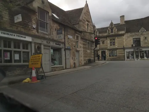
Stamford Town Hall
Museum · 2.4 mi
Building in Stamford, Lincolnshire, England, UK

Bourne and Essendine Railway
Monument and historic site · 1.1 mi
Bourne-Essendine

Parks, trails and playgrounds2


Restaurants and cafes9



History
The village's name means 'Rye nook'. The 'nook' in question has been identified as a bend in the River Gwash.
The 13th-century Church of St John the Evangelist, Ryhall, has a number of carved figures around the exterior. The southern entrance has a porch with a room over it, originally for the priest, now called the Parvis Room.
Saint Tibba, patron saint of falconers, is believed to have lived in Ryhall in the 7th century. She was buried here, but in the 11th century her relics were translated to Peterborough Abbey, now Peterborough Cathedral, by Abbot Ælfsige (1006–1042). According to legend, St Tibba was a niece of King Penda of Mercia. The remains of a small hermitage associated with the saint can be seen on the west side of the north aisle of church.
A 19th-century book refers to a holy well dedicated to Saint Tibba, though the location cannot now be identified, and there is similar doubt about the location of a well said to have been dedicated to Tibba's alleged relative, St Ebba.
The route of the Stamford and Essendine railway passed through the parish, on embankments still clearly visible today. It included a station called "Ryhall & Belmisthorpe", located in Belmesthorpe. The line opened in 1856 but closed a century later in 1959.
From the History section of Ryhall on Wikipedia, under CC BY-SA 4.0.
Notable people from Ryhall
- Henry Chaplin, 1st Viscount ChaplinBritish politician (1840-1923)
Born in Ryhall, according to Wikidata (CC0). Each name links to its Wikipedia article.
Churches and places of worship24
Shopping6
Gas and EV charging1
Schools, colleges and libraries9
St George's Church of England Aided Primary School
School · Anglican · 1.7 mi
Kesteven Road, Stamford
Healthcare2
Map of Ryhall
61 places. The map loads OpenStreetMap tiles when you open it.
Getting there and nearby towns
Sywell Aerodrome (ORM) is the nearest airport with scheduled flights listed in OpenStreetMap, 30 miles away.
- Stamford 3 mi south, about 4 min by car
- Easton on the Hill 4 mi south, about 7 min by car
- Market Deeping 6 mi east, about 10 min by car
- Bourne 7 mi northeast, about 11 min by car
- Cottesmore 8 mi west, about 13 min by car
- South Witham 9 mi northwest, about 14 min by car
- Corby Glen 9 mi north, about 14 min by car
- Oakham 11 mi west, about 18 min by car
- Peterborough 12 mi southeast, about 19 min by car
- Spalding 15 mi northeast, about 24 min by car
Drive times are estimates from straight-line distance, not routes.
Towns near Ryhall


Keep exploring
Local news
Headlines from INDB.
Reviews, tips and questions
Loading what members have shared...
Sources and licences
- GeoNames (CC BY 4.0): population, coordinates, regions and time zone
- Mapillary (see each image): photos
- OpenStreetMap contributors (ODbL 1.0): places, airports, map data
- Wikidata (CC0 1.0): elevation, founding date, time zone, website, landmarks and historic places
- Wikimedia Commons (see each image): photos
- Wikipedia (CC BY-SA 4.0): overview and history text
Photo credits
- UK Ryhall, Uksignpix, CC BY-SA 3.0
- Front of Burghley House 2009, Anthony Masi from UK, CC BY 2.0
- Stamford Museum by Bob Harvey, Bob Harvey, CC BY-SA 2.0
- Catholic church of St Mary and St Augustine, Matt Brown, CC BY 2.0
- St George's Church, Stamford, southern aspect, Paul Harrop, CC BY-SA 2.0
- 1360419 Church of St John the Baptist, St John's Street Stamford 20240519 0011 DxO, Tilman2007, CC BY-SA 4.0
- New College Stamford, Bob Harvey, CC BY-SA 2.0
- Brazenose College Gate, St Paul's Street, Stamford, Alan Murray-Rust, CC BY-SA 2.0
- Street-level photo, southglos, CC BY-SA 4.0
- Street-level photo, southglos, CC BY-SA 4.0
- Street-level photo, adam2, CC BY-SA 4.0
- Street-level photo, southglos, CC BY-SA 4.0
- Street-level photo, southglos, CC BY-SA 4.0
- Street-level photo, southglos, CC BY-SA 4.0
- Street-level photo, adam2, CC BY-SA 4.0
- Street-level photo, adam2, CC BY-SA 4.0
- Street-level photo, coljay72, CC BY-SA 4.0
- Street-level photo, southglos, CC BY-SA 4.0


Page built November 10, 2026. Spotted a mistake? Tell us or suggest a place.