


Liverpool, United Kingdom
Liverpool is a city of 496,770 people in England, United Kingdom, founded in 1207.
Why visit Liverpool
Townapedia lists 115 museums and landmarks, 74 parks and trails, 128 places to eat, 32 places to stay and 46 attractions in and around town.
Highlights include Liverpool Empire Theatre, O2 Academy Liverpool, British Music Experience and International Slavery Museum.
Weather in Liverpool
Forecast from MET Norway (CC BY 4.0). Full forecast
About Liverpool
Liverpool is a port city and metropolitan borough in Merseyside, England. It is situated on the eastern side of the Mersey Estuary, near the Irish Sea, 178 miles (286 km) north-west of London. It had an estimated population of 507,915 in 2025. The city is within the larger Liverpool City Region, a combined authority area with a population of over 1.5 million.
From the Wikipedia article Liverpool (this version), under CC BY-SA 4.0.
Travel tips from other travellers: Liverpool on Wikivoyage (CC BY-SA 4.0).
Photos of Liverpool


Things to do46

Liverpool Empire Theatre
Cinema and theater
Theatre in Liverpool, Merseyside, England, UK
11 Lime Street, Liverpool

O2 Academy Liverpool
Cinema and theater
Music venue (appropriate tagging isn't available yet)
11-13 Hotham Street, Liverpool

Epstein Theatre
Cinema and theater · 0.5 mi
Theatre in Liverpool, Merseyside, England, UK

Everyman Theatre
Cinema and theater · 0.6 mi
Theatre and building in Liverpool, Merseyside, England


Bidston Lighthouse
Lighthouse · 4.0 mi
Lighthouse in Wirral, Merseyside, England, UK

Dell Bridge, Port Sunlight
Bridge · 4.2 mi
Grade II listed bridge in Wirral

Floral Pavilion Theatre
Cinema and theater · 3.2 mi
Theatre in New Brighton, England

Leasowe Lighthouse
Lighthouse · 6.1 mi
Lighthouse in Wirral, Merseyside, England, UK


Argyle Theatre
Cinema and theater · 2.2 mi
Former theatre, music hall and cinema in Birkenhead, England
34 more on the map.
Museums and landmarks115

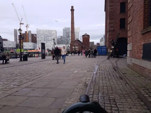
International Slavery Museum
Museum · 0.9 mi
Museum in Liverpool, England
Royal Albert Dock, Liverpool
closed


Walker Art Gallery
Museum
Art museum in Liverpool, Merseyside, England, UK
William Brown Street, Liverpool


103 more on the map.
Parks, trails and playgrounds74


Birkenhead Park
Park · 2.9 mi
Public park in Birkenhead, Wirral, Merseyside, England, UK


Vale Park
Park · 2.8 mi
Park in New Brighton, Merseyside, England, UK




62 more on the map.
Restaurants and cafes128


Ruppys
Cafe · Latin American · 2.1 mi
Ruppys is Birkenhead's go-to spot for Coffee and Smoothies and Latin-American food crafted with passion, such as Arepas, Pandebonos and...
68A Argyle Street, Birkenhead
Mo-Sa 08:00-17:00
5 Fifty Bistro
Cafe · Bistro · 4.1 mi
550 Aigburth Road, Liverpool
Mo-We Off; Th-Sa 18:00-22:00; Su 13:00-17:30

Christakis
Restaurant · Greek · 4.1 mi
544-548 Aigburth Road, Liverpool
Mo-Sa 15:00-23:00; Su 15:00-22:00
116 more on the map.
History
In the Middle Ages, Liverpool first existed as farmland within the West Derby Hundred before growing into a small town of farmers, fishermen and tradesmen and tactical army base for King John of England. A tidal creek, known as the Pool provided a natural harbour for ships. The town was planned with its own castle, although due to outbreaks of disease and its subordinance to the nearby Roman port of Chester, the town's growth and prosperity stagnated until the late 17th and early 18th centuries. There was substantial growth in the mid- to late 18th century, when the town became the European port most heavily involved in the Atlantic slave trade.
Read more of the history
King John's letters patent of 1207 announced the foundation of the borough of Liverpool (then spelt as Liuerpul). There is no evidence that the place had previously been a centre of any trade. The borough was probably created because King John decided that it would be a convenient place to embark men and supplies for his Irish campaigns: in particular his Irish campaign of 1209. The original street plan of Liverpool is said to have been designed by King John near the same time it was granted a royal charter, making it a borough. The original seven streets were laid out in the shape of a double cross: Bank Street (now Water Street), Castle Street, Chapel Street, Dale Street, Juggler Street (now High Street), Moor Street (now Tithebarn Street) and Whiteacre Street (now Old Hall Street). Liverpool Castle was built before 1235, and survived until it was demolished in the 1720s. By the middle of the 16th century, the population was still around 600, although this was likely to have fallen from an earlier peak of 1,000 people due to slow trade and the effects of the plague.
In the 17th century, there was slow progress in trade and population growth. Battles for control of the town were waged during the English Civil War, including a brief siege in 1644. In 1699, the same year as its first recorded slave ship, Liverpool Merchant, set sail for Africa, Liverpool was made a parish by Act of Parliament. But arguably, the legislation of 1695 that reformed the Liverpool council was of more significance to its subsequent development. Since Roman times nearby Chester on the River Dee had been the region's principal port on the Irish Sea. However, as the Dee began to silt up, maritime trade from Chester became increasingly difficult and shifted towards Liverpool on the neighbouring River Mersey. The first of the Liverpool docks was constructed in 1715, and the system of docks gradually grew into a large interconnected system.
As trade from the West Indies, including sugar, surpassed that of Ireland and Europe, and as the River Dee continued to silt up, Liverpool began to grow even faster. The first commercial wet dock was built in Liverpool in 1715. Substantial profits from the slave trade and tobacco helped the town to prosper and rapidly grow, although several prominent local men, including William Rathbone, William Roscoe and Edward Rushton, were at the forefront of the local abolitionist movement.
The 19th century saw Liverpool rise to global economic importance. Pioneering arose, and world-first technology and civic facilities launched in the city to serve the accelerating population, one that was fuelled by an influx of ethnic and religious communities from all around the world.
By the start of the 19th century, a large volume of trade was passing through Liverpool, and the construction of major buildings reflected this wealth. In 1830, Liverpool and Manchester became the first cities to have an intercity rail link, through the Liverpool and Manchester Railway. The population continued to rise rapidly, especially during the 1840s when Irish migrants began arriving by the hundreds of thousands as a result of the Great Famine. While many Irish people settled in the city at that time, a large percentage also emigrated to the United States or moved to the industrial centres of Lancashire, Yorkshire, and the Midlands.
In her poetical illustration "Liverpool" (1832), which celebrates the city's worldwide commerce, Letitia Elizabeth Landon refers specifically to the Macgregor Laird expedition to the Niger River, at that time in progress. This is accompanied by a painting by Samuel Austin, Liverpool, from the Mersey.
Britain was a major market for cotton imported from the Deep South of the United States, which fed the textile industry in the country. Given the crucial place cotton held in the city's economy, during the American Civil War Liverpool was, in the words of historian Sven Beckert, "the most pro-Confederate place in the world outside the Confederacy itself". Liverpool merchants helped to bring out cotton from ports blockaded by the Union Navy, built ships of war for the Confederacy, and supplied
During the war, the Confederate Navy ship, the CSS Alabama, was built at Birkenhead on the Mersey, and the CSS Shenandoah surrendered there (being the final surrender at the end of the war). The city was also the centre of Confederate purchases of war materiel, including arms and ammunition, uniforms, and naval supplies to be smuggled by British blockade runners to the South.
For periods during the 19th century, the wealth of Liverpool exceeded that of London, and Liverpool's Custom House was the single largest contributor to the British Exchequer. Liverpool was the only British city ever to have its own Whitehall office. During this century, at least 40% of the world's entire trade passed through Liverpool.
In the early 19th century, Liverpool played a major role in the Antarctic sealing industry, in recognition of which Liverpool Beach in the South Shetland Islands is named after the city.
From the History section of Liverpool on Wikipedia, under CC BY-SA 4.0.
More about Liverpool
Geography
Liverpool has been described as having "the most splendid setting of any English city". At 53°24′0″N 2°59′0″W (53.4, −2.98), 176 miles (283 kilometres) north-west of London, located on the Liverpool Bay of the Irish Sea, Liverpool is built across a ridge of sandstone hills rising up to a height of around 230 feet (70 m) above sea-level at Everton Hill, which represents the southern boundary of the West Lancashire Coastal Plain.
The Mersey Estuary separates Liverpool from the Wirral Peninsula. The boundaries of Liverpool are adjacent to Bootle, Crosby and Maghull in south Sefton to the north, and Kirkby, Huyton, Prescot and Halewood in Knowsley to the east.
Liverpool experiences a temperate maritime climate (Köppen: Cfb), like much of the British Isles, with relatively mild summers, cool winters and rainfall spread fairly evenly throughout the year. Rainfall and temperature records had been kept at Bidston Hill since 1867, but records for atmospheric pressure go back as far as at least 1846. Bidston closed down in 2002 but the Met Office also has a weather station at Crosby. Since records began in 1867, temperatures have ranged from −17.6 °C (0.3 °F) on 21 December 2010 to 34.5 °C (94.1 °F) on 2 August 1990, although Liverpool Airport recorded a temperature of 35.0 °C (95.0 °F) on 19 July 2006.
Economy
Liverpool forms an integral part of North West England's economy, the third largest regional economy in the United Kingdom. The city is also a major contributor to the economy of Liverpool City Region, worth over £40 billion per year.
The local authority area governed by Liverpool City Council accounts for 39% of the Liverpool city region's total jobs, 40% of its total GVA and 35% of its total businesses. At the local authority level, the city's GVA (balanced) at current basic prices was £14.3 billion in 2021. Its GDP at current market prices was £15.9 billion. This equates to £32,841 per head of the population.
At the 2021 United Kingdom census, 51.1% of Liverpool's population aged 16 years and over was classed as employed, 44.2% economically inactive and 4.8% unemployed. Of those employed, the most popular industries providing the employment were human health and social work activities (18.7%), wholesale and retail trade; repair of motor vehicles and motor cycles (15%), education (10.8%), public administration and defence; compulsory social security (7.3%), accommodation and food service activities (6.8%), construction (6.5%), transport and storage (5.8%), manufacturing (5.5%) and professional, scientific and technical activities (5.2%).
Arts and culture
As with other large cities, Liverpool is an important cultural centre within the United Kingdom, incorporating music, performing arts, museums and art galleries, literature and nightlife among others. In 2008, the cultural heritage of the city was celebrated with the city holding the title of European Capital of Culture, during which time a wide range of cultural celebrations took place in the city, including Go Superlambananas! and La Princesse. Liverpool has also held Europe's largest music and poetry event, the Welsh national Eisteddfod, three times, despite being in England, in 1884, 1900, and 1929.
Education
In Liverpool primary and secondary education is available in various forms supported by the state including secular, Church of England, Jewish, and Roman Catholic. Islamic education is available at primary level, but there is no secondary provision.
One of Liverpool's important early schools was The Liverpool Blue Coat School; founded in 1708 as a charitable school. It is now a state grammar school.
The Liverpool Blue Coat School is the top-performing school in the city with 100% 5 or more A*-C grades at GCSE resulting in the 30th best GCSE results in the country and an average point score per student of 1087.4 in A/AS levels. Other notable schools include Liverpool College founded in 1840 Merchant Taylors' School founded in 1620. Another of Liverpool's notable senior schools is St. Edward's College situated in the West Derby area of the city. Historic grammar schools, such as the Liverpool Institute High School and Liverpool Collegiate School—both closed in the 1980s—are still remembered as centres of academic excellence. Bellerive Catholic College is the city's top-performing non-selective school, based upon GCSE results in 2007.
From the Wikipedia article Liverpool, under CC BY-SA 4.0.
Notable people from Liverpool
 John LennonBritish musician (1940–1980)Photo: Bob Gruen; Distributed by Capitol Records, Public domain
 George HarrisonEnglish musician and member of the Beatles (1943–2001)Photo: John Kelly, Public domain
 Ringo StarrBritish musician, drummer for the Beatles (born 1940)Photo: dearMoon, CC BY 3.0
 Wayne RooneyEnglish footballer and managerPhoto: All-Pro Reels from District of Columbia, USA, CC BY-SA 2.0
 William Ewart GladstoneBritish Liberal prime minister (1809–1898)Photo: Samuel Alexander Walker, Public domain
 Jason IsaacsBritish actor (born 1963)Photo: Harald Krichel, CC BY-SA 4.0
 Clive BarkerEnglish author, film director, and visual artist (born 1952) (74 years)Photo: Steven Friederich, CC BY 2.0
 William Stanley JevonsEnglish economist and logicianPhoto: Unknown (via University of..., CC BY-SA 4.0
 John Horton ConwayEnglish mathematician (1937–2020)Photo: "Thane Plambeck", CC BY 2.0
 Julian LennonEnglish musician; son of John LennonPhoto: DavidPMaynard, CC BY-SA 4.0
 Tom BakerEnglish actor (born 1934)Photo: Legendphotography, CC BY-SA 4.0
- Andy BurnhamBritish politician
Born in Liverpool, according to Wikidata (CC0). Each name links to its Wikipedia article.
Where to stay32
62 Castle Street Hotel
Motel and hotel · 0.6 mi
62 Castle Street, Liverpool
Churches and places of worship60
St Luke's, West Derby & St Jude's, Stockbridge Village Church & Community Centre
Church · Anglican · 4.4 mi
Princess Drive, Liverpool
St. Bride's Church
Church · Anglican · 1.0 mi
Percy Street, Liverpool
Shopping65
Gas and EV charging28
Schools, colleges and libraries36
Our Lady and St Swithin's Catholic Primary School
School · Roman Catholic · 4.6 mi
Parkstile Lane, Liverpool
Healthcare31
Map of Liverpool
250 places. The map loads OpenStreetMap tiles when you open it.
Getting there and nearby towns
Liverpool John Lennon Airport (LPL) is the nearest airport with scheduled flights listed in OpenStreetMap, 7 miles away.
- St Helens 10 mi east, about 17 min by car
- Warrington 16 mi east, about 26 min by car
- Wigan 17 mi northeast, about 27 min by car
- Preston 27 mi northeast, about 43 min by car
- Salford 29 mi east, about 46 min by car
- Manchester 31 mi east, about 50 min by car
- Stockport 34 mi east, about 54 min by car
- Oldham 36 mi east, about 59 min by car
- Newcastle under Lyme 42 mi southeast, about 1 h by car
- Stoke-on-Trent 43 mi southeast, about 1 h 15 min by car
Drive times are estimates from straight-line distance, not routes.
Towns near Liverpool


Keep exploring
Local news
Headlines from INDB.
Reviews, tips and questions
Loading what members have shared...
Sources and licences
- GeoNames (CC BY 4.0): population, coordinates, regions and time zone
- Mapillary (see each image): photos
- OpenStreetMap contributors (ODbL 1.0): places, airports, map data
- Wikidata (CC0 1.0): elevation, founding date, time zone, website, landmarks and historic places
- Wikimedia Commons (see each image): photos
- Wikipedia (CC BY-SA 4.0): overview and history text
Photo credits
- Liverpool Montage, Daviessimo, CC BY-SA 3.0
- Liverpool, Francis Jesse Adair, CC BY-SA 4.0
- Liverpool svgFresco, Francis Jesse Adair, CC BY-SA 4.0
- Liverpool...Ici, le moderne cotoie l'ancien... effet stylistique particulier - panoramio, Luc Cloutier-Villene…, CC BY 3.0
- The Liner Hotel Liverpool - panoramio, Robin Pollard, CC BY 3.0
- Hunter Street, Liverpool 2019-2, Rodhullandemu, CC BY-SA 4.0
- Hunter Street, Liverpool 2019-1, Rodhullandemu, CC BY-SA 4.0
- County Sessions House Liverpool (6727601361), Tony Hisgett from Birmingham, UK, CC BY 2.0
- Liverpool, UK - panoramio - IIya Kuzhekin (30), IIya Kuzhekin, CC BY 3.0
- Liverpool (Exchange) Station - 31122548051, Hugh Llewelyn, CC BY-SA 2.0
- Liverpool (Exchange) Station, Hugh Llewelyn, CC BY-SA 2.0
- Liverpool (Exchange) Station - 30415659474, Hugh Llewelyn, CC BY-SA 2.0
- Liverpool (7795237164), Tekniska museet, CC BY 2.0
- Liverpool (25769821621), Alex Liivet from Chester, United Kingdom, CC0
- Liverpool, UK - panoramio - IIya Kuzhekin (31), IIya Kuzhekin, CC BY 3.0
- Liverpool, UK - panoramio, IIya Kuzhekin, CC BY 3.0
- Empire Theatre, Liverpool 2018, Rodhullandemu, CC BY-SA 4.0
- Neptune Theatre, Liverpool, John Bradley, CC BY-SA 3.0
- Everyman Theatre, Liverpool 2018, Rodhullandemu, CC BY-SA 4.0
- Bidston Lighthouse 102, RHaworth, CC BY 2.5
- Dell Bridge, David Squire, CC BY-SA 2.0
- Floral Pavilion Theatre, Frombowen, CC BY-SA 4.0
- Leasowe Lighthouse 2019-1, Rodhullandemu, CC BY-SA 4.0
- British Music Experience LONDON, Liz Koravos, CC BY-SA 4.0
- Merseyside Maritime Museum 2021, Rodhullandemu, CC BY-SA 4.0
- Walker Art Gallery, Liverpool 161009, Rept0n1x, CC BY-SA 3.0
- Grand Entrance, Birkenhead Park 2019, Rodhullandemu, CC BY-SA 4.0
- Clarkes Gardens, Allerton (1), Reptonix free Creative Commons licensed photos, CC BY 3.0
- Vale Park, Wallasey (33), Rept0n1x, CC BY-SA 3.0
- Arrowe Park - DSC04040, Rept0n1x, CC BY-SA 3.0
- Arrowe Park - DSC04037, Rept0n1x, CC BY-SA 3.0
- Liverpool anfield road stadium, Arne Müseler, CC BY-SA 3.0 de
- Frontage of Liverpool Lime Street railway station, Rodhullandemu, CC BY-SA 4.0
- St George's Hall, Liverpool (2007), fabiopauleri, CC BY-SA 2.0
- Liverpool Metropolitan Cathedral 02, Superchilum, CC BY-SA 4.0
- LIVERPOOL ANGLICAN CATHEDRAL SEP2012 (7916053494), calflier001, CC BY-SA 2.0
- Entrance to The Beatles Story - Liverpool, Lipinski, CC BY-SA 3.0
- 60 & 62 Castle Street 2018 - Castle Street, Rodhullandemu, CC BY-SA 4.0
- Britannia Adelphi, Liverpool 2018, Rodhullandemu, CC BY-SA 4.0
- Church of Our Lady and St Nicholas, Liverpool, Rodhullandemu, CC BY-SA 4.0
- Everton Park, Vanbasten 23, CC BY-SA 3.0
- North Western Hotel August 01 2010, John Bradley, CC BY-SA 3.0
- Gustaf Adolf Church, Liverpool 2018, Rodhullandemu, CC BY-SA 4.0
- Hard Days Night Hotel, Liverpool, John Bradley, CC BY-SA 3.0
- Hilton Liverpool City Centre 2, Frombowen, CC BY-SA 4.0
- Liscard Town Centre-by-Sue-Adair, Sue Adair, CC BY-SA 2.0
- Liverpool Philharmonic facade 2018, Rodhullandemu, CC BY-SA 4.0
- St Brides Church Liverpool, User:David Humphreys, CC BY-SA 3.0
- FACT Liverpool, Sweetie candykim, Public domain
- Liverpool Cenotaph, SomeDriftwood, CC BY-SA 3.0
- St. Bartholomew's Church, Roby (5), Rept0n1x, CC BY-SA 3.0
- Baltic Fleet 2016-2, Rodhullandemu, CC BY-SA 3.0
- Vue cinema, Birkenhead (3), Rept0n1x, CC BY-SA 3.0
- Frontage of Western Approaches Museum, Rodhullandemu, CC BY-SA 4.0
- Hampton by Hilton Liverpool City Centre 2020, Rodhullandemu, CC BY-SA 4.0
- DoubleTree by Hilton Hotel & Spa Liverpool, Frombowen, CC BY-SA 4.0
- Holy Cross Catholic Primary School, Frombowen, CC BY-SA 4.0
- St Luke's Church (99204), Frombowen, CC BY-SA 4.0
- Trinity Church, Page Moss (1), Rept0n1x, CC BY-SA 3.0
- The Shankly Hotel, Frombowen, CC BY-SA 4.0
- Port Sunlight buildings 5, Man vyi, Public domain
- News From Nowhere 2, Frombowen, CC BY-SA 4.0
- Arnot St Mary Primary School 1, Rodhullandemu, CC BY-SA 4.0
- Fort Perch Rock and Lighthouse From River Mersey-by-Stephen-Nunney, Stephen Nunney, CC BY-SA 2.0
- Day 2- Museum of Liverpool (8366287442), Takashi Hososhima from Tokyo, Japan, CC BY-SA 2.0
- Street-level photo, cyclestreets, CC BY-SA 4.0
- Street-level photo, thingomy, CC BY-SA 4.0
- Street-level photo, panieravide, CC BY-SA 4.0
- Street-level photo, thingomy, CC BY-SA 4.0
- Street-level photo, thingomy, CC BY-SA 4.0
- Street-level photo, thingomy, CC BY-SA 4.0
- Street-level photo, thingomy, CC BY-SA 4.0
- Street-level photo, thingomy, CC BY-SA 4.0
- Street-level photo, thingomy, CC BY-SA 4.0
- Street-level photo, victuallers, CC BY-SA 4.0
- Street-level photo, Junguin, CC BY-SA 4.0
- Street-level photo, victuallers, CC BY-SA 4.0
- Street-level photo, thingomy, CC BY-SA 4.0


Page built November 10, 2026. Spotted a mistake? Tell us or suggest a place.