


Why visit Moreton
Townapedia lists 2 museums and landmarks, 15 parks and trails, 56 places to eat, 3 places to stay and 3 attractions in and around town.
Highlights include Leasowe Lighthouse, Bidston Lighthouse, Hoylake and West Kirby War Memorial and Williamson Art Gallery and Museum.
Weather in Moreton
Forecast from MET Norway (CC BY 4.0). Full forecast
About Moreton
Moreton is a town in the Metropolitan Borough of Wirral in Merseyside, England. Located on the north coast of the Wirral Peninsula, it is approximately 3 mi (4.8 km) to the west of Wallasey. Historically part of Cheshire and now within the Metropolitan Borough of Wirral, the town was divided in 2004 between the local government wards of Leasowe & Moreton East and Moreton West & Saughall Massie. Moreton is also part of the parliamentary constituency of Wallasey.
From the Wikipedia article Moreton, Merseyside (this version), under CC BY-SA 4.0.
Photos of Moreton


Things to do3


Bidston Lighthouse
Lighthouse · 1.7 mi
Lighthouse in Wirral, Merseyside, England, UK

Hoylake Lighthouse
Lighthouse · 2.8 mi
Lighthouse in Wirral, Merseyside, England, UK
Museums and landmarks2

Hoylake and West Kirby War Memorial
Monument and historic site · 3.0 mi
Grade II listed WW1 & WW2 war memorial in West Kirby, Wirral, Merseyside, England, UK

Williamson Art Gallery and Museum
Museum · 3.3 mi
Art museum in Wirral, Merseyside, England, UK
Parks, trails and playgrounds15


Birkenhead Park
Park · 3.2 mi
Public park in Birkenhead, Wirral, Merseyside, England, UK


Central Park, Wallasey
Park · 3.4 mi
Public park in Liscard, Wirral, England

Meols Park
Park · 1.7 mi
Park located in Meols on the Wirral Peninsula, England




3 more on the map.
Restaurants and cafes56

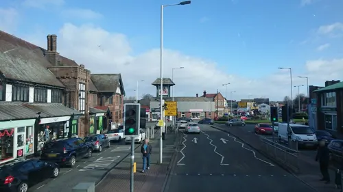



44 more on the map.
History
Prior to the Norman conquest, the Lingham area of Moreton was a possible location for Dingesmere, mentioned with regard to the Battle of Brunanburh, in Egil's Saga.
It was in the Wirral Hundred, the ancient administrative area for the Wirral Peninsula. In the twelfth century, it formed part of the estates of Hamo de Mascy.
The village joined with neighbouring Lingham to form the parish of Moreton-cum-Lingham in the late nineteenth century. Moreton was formerly a township and chapelry in the parish of Bidston; in 1866, Moreton became a separate civil parish.
On 1 April 1928, the parish was abolished and merged with Wallasey, becoming part of the County Borough of Wallasey.
From the History section of Moreton, Merseyside on Wikipedia, under CC BY-SA 4.0.
More about Moreton
Geography
The town is located between Great Meols to the west, and Bidston and Upton to the south and east. Before the sea embankment was constructed, the area included 3000 acres of tidal lagoon, at between one and two metres below sea level, with most of the remainder little more than one metre above.
The coast at Moreton is part of a stretch of sand that runs from Meols to Leasowe; it is known as Mockbeggar Wharf, named after Mockbeggar Hall, otherwise known as Leasowe Castle. Mockbeggar Hall is also the name of Moreton's former Wetherspoons pub; the name Mockbeggar being an old sailors' term for a lone house. The North Wirral Coastal Park also runs for four miles along this coast, including public open space, common land, natural foreshore and sand dunes. The park provides a wide variety of recreational activities; some of the more popular being sailing, sea angling, swimming, cycling, picnicking, walking, jogging, ball games, bird watching and horse riding.
Economy
Moreton is also known for being the home of the Burton's factory, which is now owned by Duke Street Capital. This factory was also the producer of Cadbury's biscuits. Manor Bakeries is located in the town at Reeds Lane, near to Leasowe railway station; it was formerly Cadbury's cakes department, which now owned by Premier Foods Group,
Moreton is also home to Typhoo Tea, with the factory located next to the Burton's factory.
Until the 1990s, Bristol-Myers Squibb was also a major employer to the local workforce, with a large factory located on the opposite side of Reeds Lane to Burton's, next to Leasowe station. However, in the mid-90s, manufacturing was moved out of Moreton which led to the closure of the factory.
At the same time, there was heavy investment into modern drug development and research labs on the site, which are still operated by Bristol-Myers Squibb. In 2009, the company provided further investment into the site.
The estate is mainly home to various car repair facilities and other light industry businesses.
Dantec is the UK's biggest manufacturer of composite hoses, which are used in the transfer of petrochemicals. The company was established in 1969 and the business is situated on Tarran Way.
Della Robbia Pottery used local red clay from Moreton. Barker and Briscoe Brickworks was situated on Carr Lane, 1 mile (1.6 km) west of the centre of the village.
From the Wikipedia article Moreton, Merseyside, under CC BY-SA 4.0.
Notable people from Moreton
 Jonathan WaltersIrish footballerPhoto: Timmy96, CC0
 Daniel IlabacaBritish freerunnerPhoto: Jon Lucas, CC BY-SA 3.0
- Paul RutherfordEnglish footballer (born 1987)
Born in Moreton, according to Wikidata (CC0). Each name links to its Wikipedia article.
Where to stay3
Churches and places of worship31
Church of Our Lady of the Immaculate Conception, Birkenhead
Church · 3.1 mi
Shopping10
Gas and EV charging4
Schools, colleges and libraries21
Bidston Village CofE (Controlled) Primary School
School · Anglican · 1.4 mi
Ballantyne Drive, Prenton
Healthcare10
Map of Moreton
155 places. The map loads OpenStreetMap tiles when you open it.
Getting there and nearby towns
Liverpool John Lennon Airport (LPL) is the nearest airport with scheduled flights listed in OpenStreetMap, 12 miles away.
- Birkenhead 4 mi east, about 7 min by car
- Liverpool 6 mi east, about 9 min by car
- Neston 9 mi south, about 14 min by car
- West Derby 9 mi east, about 14 min by car
- Woolton 10 mi east, about 17 min by car
- Speke 12 mi east, about 19 min by car
- Rainhill 14 mi east, about 23 min by car
- Ormskirk 15 mi northeast, about 24 min by car
- St Helens 16 mi east, about 26 min by car
- Wigan 22 mi northeast, about 36 min by car
Drive times are estimates from straight-line distance, not routes.
Towns near Moreton


Keep exploring
Local news
Headlines from INDB.
Reviews, tips and questions
Loading what members have shared...
Sources and licences
- GeoNames (CC BY 4.0): population, coordinates, regions and time zone
- Mapillary (see each image): photos
- OpenStreetMap contributors (ODbL 1.0): places, airports, map data
- Wikidata (CC0 1.0): elevation, founding date, time zone, website, landmarks and historic places
- Wikimedia Commons (see each image): photos
- Wikipedia (CC BY-SA 4.0): overview and history text
Photo credits
- Moreton Cross 2020-4, Rodhullandemu, CC BY-SA 4.0
- The Farmers Arms, Moreton-by-Sue-Adair, Sue Adair, CC BY-SA 2.0
- Moreton Presbyterian Church-by-Sue-Adair, Sue Adair, CC BY-SA 2.0
- Leasowe Lighthouse 2019-1, Rodhullandemu, CC BY-SA 4.0
- Bidston Lighthouse 102, RHaworth, CC BY 2.5
- Hoylake Lighthouse 1, Rodhullandemu, CC BY-SA 4.0
- Hoylake War Memorial, Peter Miller, CC BY-SA 2.0
- Williamson Art Gallery, Oxton, Merseyside, Rept0n1x, CC BY-SA 2.0
- Arrowe Park - DSC04040, Rept0n1x, CC BY-SA 3.0
- Arrowe Park - DSC04037, Rept0n1x, CC BY-SA 3.0
- Ashton Park, West Kirby (12), Rept0n1x, CC BY-SA 3.0
- Grand Entrance, Birkenhead Park 2019, Rodhullandemu, CC BY-SA 4.0
- Caldy Hill, Colmanian ( talk ) ( Uploads ), Public domain
- Liscard Hall, Central Park-by-Sue-Adair, Sue Adair, CC BY-SA 2.0
- Coach House, Royden Park 2019-2, Rodhullandemu, CC BY 3.0
- Christ Church, Oxton 2018-2, Rodhullandemu, CC BY-SA 4.0
- Christ the King, Birkenhead (4), Rept0n1x, CC BY-SA 3.0
- Church of Our Lady of the Immaculate Conception, Birkenhead 2019, Rodhullandemu, CC BY-SA 4.0
- St John, Frankby 2019-1, Rodhullandemu, CC BY-SA 4.0
- East end of Hoylake Chapel, Rodhullandemu, CC BY-SA 4.0
- English Martyrs church, Wallasey Village 2018, Rodhullandemu, CC BY-SA 4.0
- South side of Holy Cross, Woodchurch, Rodhullandemu, CC BY-SA 4.0
- St Alban's, Liscard 2017-1, Rodhullandemu, CC BY-SA 4.0
- St Andrew's, West Kirby 2020-1, Rodhullandemu, CC BY-SA 4.0
- St Bridget's Church, West Kirby 2019, Rodhullandemu, CC BY-SA 4.0
- St Hilary, Wallasey from the south, Rodhullandemu, CC BY-SA 4.0
- Park 1931, Cragsby, CC BY-SA 4.0
- Park 1986, Cragsby, CC BY-SA 4.0
- Ken Crofton, Cragsby, CC BY-SA 4.0
- Brian Jameson, Cragsby, CC BY-SA 4.0
- Park 1960, Cragsby, CC BY-SA 4.0
- Park 1996, Cragsby, CC BY-SA 4.0
- Holden + Barnes, Cragsby, CC BY-SA 4.0
- Unknown Historic Building-by-Sue-Adair, Sue Adair, CC BY-SA 2.0
- Supertravel Wright StreetLite, Quackdave, CC0
- The Plough Inn-by-Sue-Adair, Sue Adair, CC BY-SA 2.0
- Coach and Horses, Moreton by-Sue-Adair, Sue Adair, CC BY-SA 2.0
- The New Meols Park Play Area-by-Roy-James-Shuttleworth, Roy James Shuttleworth, CC BY-SA 2.0
- Street-level photo, skifans, CC BY-SA 4.0
- Street-level photo, skifans, CC BY-SA 4.0
- Street-level photo, skifans, CC BY-SA 4.0
- Street-level photo, skifans, CC BY-SA 4.0


Page built November 10, 2026. Spotted a mistake? Tell us or suggest a place.