


Wallasey, United Kingdom
Wallasey is a town of 58,794 people in England, United Kingdom.
Why visit Wallasey
Townapedia lists 28 museums and landmarks, 26 parks and trails, 106 places to eat, 5 places to stay and 9 attractions in and around town.
Highlights include Bidston Lighthouse, Crosby Beach, Birkenhead Priory and Birkenhead War Memorial.
Weather in Wallasey
Forecast from MET Norway (CC BY 4.0). Full forecast
About Wallasey
Wallasey () is a town in the Metropolitan Borough of Wirral, Merseyside, England. It is at the mouth of the River Mersey, on the north-eastern corner of the Wirral Peninsula. It lies within the historic county boundaries of Cheshire, and became part of Merseyside in 1974. At the 2021 Census, the built up area as defined by the Office for National Statistics had a population of 85,610.
From the Wikipedia article Wallasey (this version), under CC BY-SA 4.0.
Travel tips from other travellers: Wallasey on Wikivoyage (CC BY-SA 4.0).
Photos of Wallasey


Things to do9

Bidston Lighthouse
Lighthouse · 1.6 mi
Lighthouse in Wirral, Merseyside, England, UK


Floral Pavilion Theatre
Cinema and theater · 1.6 mi
Theatre in New Brighton, England

Leasowe Lighthouse
Lighthouse · 2.6 mi
Lighthouse in Wirral, Merseyside, England, UK

New Brighton Lighthouse
Lighthouse · 1.7 mi
Grade II* listed lighthouse in New Brighton, Wirral, Merseyside, England, UK


Argyle Theatre
Cinema and theater · 2.9 mi
Former theatre, music hall and cinema in Birkenhead, England
Winter Gardens Theatre
Cinema and theater · 1.2 mi
Former cinema in New Brighton, Wallasey, Wirral, Merseyside, England

Museums and landmarks28

Birkenhead Priory
Museum · 3.2 mi
Monastery and musem in Wirral, United Kingdom

Birkenhead War Memorial
Monument and historic site · 2.9 mi
Grade II listed war memorial in Wirral, Merseyside, England, UK
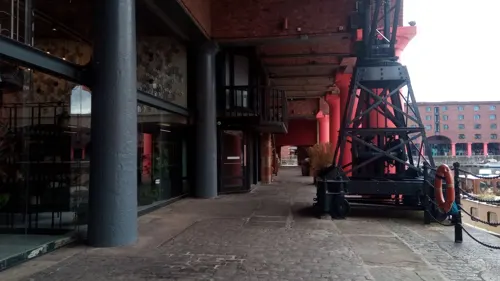
International Slavery Museum
Museum · 3.3 mi
Museum in Liverpool, England

Liverpool Beatles Museum
Museum · 3.4 mi
Museum dedicated to the Beatles

Liverpool Naval Memorial
Monument and historic site · 3.1 mi
War memorial in Liverpool, Merseyside, England, UK

Memorial to the Engine Room Heroes of the Titanic
Monument and historic site · 3.0 mi
Monument in England


Monument to Sir Alfred Lewis Jones
Monument and historic site · 3.1 mi
Memorial with a statue of the personification of Liverpool and a bust of Alfred Lewis Jones at Georges Pier Head, Liverpool, Merseyside,...

Monument to the Mersey Tunnel
Monument and historic site · 3.2 mi
Monument in Birkenhead, Merseyside, England, UK

National Museums Liverpool
Museum · 3.3 mi
Public body running museums in Liverpool, England

Eureka! Science + Discovery
Museum · 2.2 mi
Tourist attraction in Seacombe, Wallasey, Merseyside, North West England
16 more on the map.
Parks, trails and playgrounds26

Vale Park
Park · 1.4 mi
Park in New Brighton, Merseyside, England, UK

Birkenhead Park
Park · 2.3 mi
Public park in Birkenhead, Wirral, Merseyside, England, UK


Central Park, Wallasey
Park · 1.2 mi
Public park in Liscard, Wirral, England
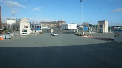
Dock Branch Park
Park · 2.9 mi
Proposed public park in Birkenhead, Merseyside, England, UK, due to open in 2023


Kings Parade Gardens Pitch & Putt
Golf course · 1.2 mi
9 hole Pitch & Putt

14 more on the map.
Restaurants and cafes106


Smuggler's Cove Cafe
Cafe · Sandwich, Breakfast, Coffee Shop · 1.4 mi
86 Victoria Road, Wallasey
Mo-Sa 08:00-14:00

The Bow-Legged Beagle
Bar and pub · 1.4 mi
88 Victoria Road, Wallasey
Mo 15:00-22:00, Tu-Th 13:00-22:00, Fr-Sa 13:00-23:00, Su 13:00-22:00

The Olive Tree
Restaurant · 1.4 mi
78 Victoria Road, Wallasey
Th 12:00-20:00, Fr-Sa 12:00-22:00, Su 12:00-18:00
Homebrew Tap
Bar and pub · 1.4 mi
84 Victoria Road, Wallasey
Tu-Fr 15:00-22:00, Sa 13:00-23:00, Su 13:00-22:00
River Coffee Lounge
Cafe · Coffee Shop, Brunch · 1.2 mi
162 Seabank Road, Wallasey
Mo-Su 08:00-18:00
Central Park Cafe
Cafe · Coffee Shop · 1.2 mi
Liscard Road, Wallasey
Mo-Su 10:00-16:00

94 more on the map.
History
The name of Wallasey originates from the Old English word Walh, meaning a Briton, a Welshman, which is also the origin of the name Wales. The suffix -ey denotes an island or area of dry land. Originally the higher ground now occupied by Wallasey was separated from the rest of Wirral by the creek known as Wallasey Pool (which later became the docks), the marshy areas of Bidston Moss and Leasowe, and sand dunes along the coast.
The area was sparsely populated before the 19th century and horse races organised for the Earls of Derby on the sands at Leasowe in the 16th and 17th centuries are regarded as forerunners of the modern Derby.
Old maps show that the main centre and parish church (St Hilary's) were located at what is now called Wallasey Village, and there were smaller hamlets at Liscard, Poulton and Seacombe, from where there were occasional ferries across the Mersey. There was also a mill (at Mill Lane), and from the mid-18th century a gunpowder store or magazine at Rock Point, located well away from the built-up areas.
Read more of the history
The main activities in the area were farming and fishing. The area also had a reputation for smuggling and “wrecking”, the act of luring ships onto rocks or sandbanks with false lights in order to raid their cargo. Underground cellars and tunnels, which were used to hide cargo pilfered from wrecked ships still exist in the town. As late as 1839, the “Pennsylvania” and two other ships were wrecked off Leasowe in a severe storm, and their cargoes and furnishings were later found distributed among local residents.
By the early 19th century, the shoreline between Seacombe and Rock Point started to become an attractive area to which affluent Liverpool merchants and sea captains could retire. Development at Egremont began around this time, and gained pace with the introduction of steam ferries across the river. The area also had a defensive role overlooking the growing Port of Liverpool. In 1829, Fort Perch Rock was built, and in 1858 Liscard Battery.
In 1835 Liscard Hall was built by another merchant, Sir John Tobin. Its grounds later became Central Park. His family also developed a “model farm” nearby.
With the expansion of trade on the Mersey, new docks were constructed between 1842 and 1847 in the Wallasey Pool, and by 1877 the dock system between Wallasey and neighbouring Birkenhead was largely complete. The area around the docks became a centre for engineering industries, many associated with shipbuilding, and other activities including sugar refining and the manufacture of cement and fertilisers. Bidston Dock, the last in the area, was opened in 1933, but was filled in during 2003.
During the latter half of the 19th century New Brighton developed as a popular seaside resort serving Liverpool and the Lancashire industrial towns, and many of the large houses were converted to inexpensive hotels. A pier was opened in the 1860s, and the promenade from Seacombe to New Brighton was built in the 1890s. This served both as a recreational amenity in its own right and to link up the developments along the estuary, and was later extended westwards towards Leasowe. The New Brighton Tower, the tallest in the country, was opened in 1900 but closed in 1919 and dismantled shortly afterwards. However, its ballroom continued as a major venue, hosting numerous concerts in the 1950s and 1960s by local Liverpool bands as well as other international stars.
After 1886, with the opening of the Mersey Railway allowing access via a tunnel to Liverpool, the pace of housing development increased, particularly in the Liscard and Wallasey Village areas. The area now called Wallasey comprises several distinct districts which gradually merged to form a single built-up area during the 19th and early-20th centuries. Further growth continued well into the 20th century and eventually spread into the Leasowe area and beyond to Moreton.
The UK's first guide dog training school, the Guide Dogs for the Blind Association, was founded in the town in 1931. A statue sits outside the Floral Pavilion Theatre to celebrate this.
The Wallasey Golf Club is where club member, Dr Frank Stableford, developed the Stableford system of points scoring. This was first used in competition in 1932.
Because of its docks and proximity to Liverpool, parts of the area suffered aerial bombing in 1940–41. After the Second World War, the popularity of New Brighton as a seaside resort declined dramatically, as did the use of the docks, and Wallasey gradually became more obviously a residential suburb for Liverpool, Birkenhead, and the other towns in the area.
The Beatles played some of their first shows outside Liverpool at the Grosvenor Ballroom in Liscard in 1960, and over the next few years also played several times at the Tower Ballroom in New Brighton. On 12 October 1962, they played there as the support act for Little Richard. Wallasey was also the home base of two other leading Merseybeat groups, the Undertakers featuring Jackie Lomax, and the Pressmen featuring Ritchie Prescott and Phil Kenzie who later became a successful saxophone soloist.
The world's first passenger hovercraft service operated from July 1962 to September 1962 between Leasowe and Rhyl in North Wales. Local MP Ernest Marples was responsible as Minister of Transport (1959–64) for introducing parking meters, yellow lines, and seat belt controls to the UK.
The "Solar Campus" on Leasowe Road was the first building in the world to be heated entirely by solar energy. It was formerly St George's Secondary School, and was completed in 1961 to the designs of Emslie Morgan. The solar panels on this establishment have since been removed due to high costs and has been renamed.
Wallasey was struck by an F1/T3 tornado on 23 November 1981, as part of the record-breaking nationwide tornado outbreak on that day.
From the History section of Wallasey on Wikipedia, under CC BY-SA 4.0.
More about Wallasey
Geography
Wallasey is situated at the north-east of the Wirral Peninsula, on the western side of the River Mersey and adjoining the Irish Sea. The area is approximately 9.5 km (5.9 mi) east-north-east of the Dee Estuary at Hoylake. Wallasey is at an elevation of between 0–50 m (0–164 ft) above sea level, with the highest point being around St Peter and St Paul's Church in New Brighton.
The area now called Wallasey comprises several distinct districts - Egremont, Liscard, New Brighton, Poulton, Seacombe and Wallasey Village. These gradually merged to form a single built-up area during the 19th and early 20th centuries.
Unlike in most other towns, there is no single Wallasey town centre, although the main shopping area is centrally located at Liscard. Both the parliamentary constituency and the former County Borough of Wallasey also include (or included) Leasowe, Moreton and Saughall Massie, which are now usually regarded as separate settlements.
The town forms part of the wider Birkenhead Urban Area, which in 2011 had a population of 325,000.
Education
When compared to the national average, the schools of Wallasey slightly underperform on GCSE results. However, they are above the national average on 'A' Level results.
From the Wikipedia article Wallasey, under CC BY-SA 4.0.
Notable people from Wallasey
 Dominic PurcellactorPhoto: Gage Skidmore from Peoria, AZ,..., CC BY-SA 2.0
 Jay SpearingEnglish association football playerPhoto: Anthony Booker, CC BY 2.0
 Miles DempseyBritish army officer (1896-1969)Photo: War Office official photographer, Public domain
 Saunders LewisWelsh writer and politician (1893-1985)Photo: Geoff Charles, CC BY-SA 4.0
 Tyler MortonEnglish association football playerPhoto: Werner100359, CC BY-SA 4.0
 Heather Couperastronomer (1949–2020)Photo: Gallina3795, CC BY-SA 4.0
 Ralph SteadmanBritish cartoonist (born 1936)Photo: Dave, CC BY-SA 2.0
 Nigel OlssonBritish drummerPhoto: Raph_PH, CC BY 2.0
 Graham StarkBritish comedian, actor, writer and director (1922-2013)Photo: TV episode screenshot (ABC), Public domain
- Olaf StapledonBritish novelist and philosopher (1886–1950)
- Charles CrichtonBritish film director, film editor, screenwriter and film producer (1910-1999)
- Geoffrey HughesBritish actor (1944–2012)
Born in Wallasey, according to Wikidata (CC0). Each name links to its Wikipedia article.
Where to stay5
Churches and places of worship49
Church of Our Lady of the Immaculate Conception, Birkenhead
Church · 1.9 mi
Shopping17
Gas and EV charging3
Schools, colleges and libraries26
Bidston Village CofE (Controlled) Primary School
School · Anglican · 1.4 mi
Ballantyne Drive, Prenton
Holy Spirit Catholic and Church of England Primary School
School · Anglican, Roman Catholic · 1.0 mi
Gardenside, Wirral
Healthcare7
Map of Wallasey
250 places. The map loads OpenStreetMap tiles when you open it.
Getting there and nearby towns
Liverpool John Lennon Airport (LPL) is the nearest airport with scheduled flights listed in OpenStreetMap, 11 miles away.
- Birkenhead 3 mi southeast, about 5 min by car
- Moreton 3 mi southwest, about 4 min by car
- Liverpool 4 mi east, about 6 min by car
- Prenton 4 mi south, about 6 min by car
- Litherland 4 mi northeast, about 7 min by car
- Dingle 5 mi southeast, about 9 min by car
- Fazakerley 6 mi northeast, about 10 min by car
- Bromborough 6 mi southeast, about 10 min by car
- Old Swan 6 mi east, about 10 min by car
- West Derby 6 mi east, about 10 min by car
Drive times are estimates from straight-line distance, not routes.
Towns near Wallasey


Keep exploring
Local news
Headlines from INDB.
Reviews, tips and questions
Loading what members have shared...
Sources and licences
- GeoNames (CC BY 4.0): population, coordinates, regions and time zone
- Mapillary (see each image): photos
- OpenStreetMap contributors (ODbL 1.0): places, airports, map data
- Wikidata (CC0 1.0): elevation, founding date, time zone, website, landmarks and historic places
- Wikimedia Commons (see each image): photos
- Wikipedia (CC BY-SA 4.0): overview and history text
Photo credits
- Wallasey Town Hall, Stephen Nunney, CC BY-SA 2.0
- English Martyrs church, Wallasey Village 2018, Rodhullandemu, CC BY-SA 4.0
- Post box, Wallasey Village roundabout, Rodhullandemu, CC BY-SA 3.0
- 28th Wallasey Scout Huts, Rodhullandemu, CC BY-SA 3.0
- Lady Chapel of English Martyrs, Wallasey, Rodhullandemu, CC BY-SA 3.0
- St George's Primary School, Wallasey-by-Sue-Adair, Sue Adair, CC BY-SA 2.0
- Wallasey Village Library, Rodhullandemu, CC BY-SA 3.0
- G H Peers Social Club, Wallasey, Rodhullandemu, CC BY-SA 3.0
- Wallasey G.H.Peers club, Rept0n1x, CC BY-SA 3.0
- St Mary's RC College, Wallasey Village, Rodhullandemu, CC BY-SA 3.0
- Post box on Village Way, Wallasey, Rodhullandemu, CC BY-SA 3.0
- Gate piers of Buxton House, Wallasey Village, Rodhullandemu, CC BY-SA 3.0
- Post box on Folly Lane, Wallasey, Rodhullandemu, CC BY-SA 3.0
- Bidston Lighthouse 102, RHaworth, CC BY 2.5
- Crosby Beach ship, Chris Howells (= Chowells ), CC BY-SA 3.0
- Floral Pavilion Theatre, Frombowen, CC BY-SA 4.0
- Leasowe Lighthouse 2019-1, Rodhullandemu, CC BY-SA 4.0
- Perch Rock Lighthouse 2021, Rodhullandemu, CC BY-SA 4.0
- Birkenhead Priory from St Mary's Tower 2019-2, Rodhullandemu, CC BY-SA 4.0
- Birkenhead War Memorial, Rodhullandemu, CC BY-SA 4.0
- 23 Mathew Street, Liverpool, Rodhullandemu, CC BY-SA 4.0
- Liverpool Naval Memorial aerial 2, Rodhullandemu, CC BY-SA 4.0
- Memorial to the Engine Room Heroes Liverpool 1, Man vyi, Public domain
- Merseyside Maritime Museum 2021, Rodhullandemu, CC BY-SA 4.0
- Sir Alfred Lewis Jones statue 2019, Rodhullandemu, CC BY-SA 4.0
- Queensway tunnel pylon in Birkenhead, Rept0n1x, CC BY-SA 3.0
- Museum of Liverpool 04-01-2010 (01), John Bradley, CC BY-SA 3.0
- Vale Park, Wallasey (33), Rept0n1x, CC BY-SA 3.0
- Grand Entrance, Birkenhead Park 2019, Rodhullandemu, CC BY-SA 4.0
- Canalside Park September 16 2010 (1), John Bradley, CC BY-SA 3.0
- St Nicholas Church, Wallasey (1), Rept0n1x, CC BY-SA 3.0
- Wallasey Memorial Unitarian Church 2018-1, Rodhullandemu, CC BY-SA 4.0
- Christ Church, Oxton 2018-2, Rodhullandemu, CC BY-SA 4.0
- Christ the King, Birkenhead (4), Rept0n1x, CC BY-SA 3.0
- Church of Our Lady of Reconciliation, Liverpool 2019, Rodhullandemu, CC BY-SA 4.0
- Church of Our Lady of the Immaculate Conception, Birkenhead 2019, Rodhullandemu, CC BY-SA 4.0
- Our Lady Star of the Sea and St Joseph, Seacombe 3a, Rodhullandemu, CC BY-SA 4.0
- Oxton Congregational church from Balls Road East, Rodhullandemu, CC BY-SA 4.0
- Liscard Hall, Central Park-by-Sue-Adair, Sue Adair, CC BY-SA 2.0
- Liscard Town Centre-by-Sue-Adair, Sue Adair, CC BY-SA 2.0
- St Peter and Paul's Church, New Brighton (1), Reptonix free Creative Commons licensed photos, CC BY 3.0
- The light cinema, New Brighton, Rept0n1x, CC BY-SA 3.0
- The Clairville, Liscard, Rept0n1x, CC BY-SA 3.0
- St Thomas the Apostle, Liscard, Rodhullandemu, CC BY-SA 4.0
- Captain's Pit, Wallasey, Rodhullandemu, CC BY-SA 3.0
- Street-level photo, cyclestreets, CC BY-SA 4.0
- Street-level photo, victuallers, CC BY-SA 4.0
- Street-level photo, skifans, CC BY-SA 4.0


Page built November 10, 2026. Spotted a mistake? Tell us or suggest a place.