


Why visit Crail
Townapedia lists 10 museums and landmarks, 4 parks and trails, 9 places to eat, 9 places to stay and 2 attractions in and around town.
Highlights include Caves of Caiplie, Fife Ness Lighthouse, Crail Museum and Heritage Centre and Scotland's Secret Bunker.
Weather in Crail
Forecast from MET Norway (CC BY 4.0). Full forecast
About Crail
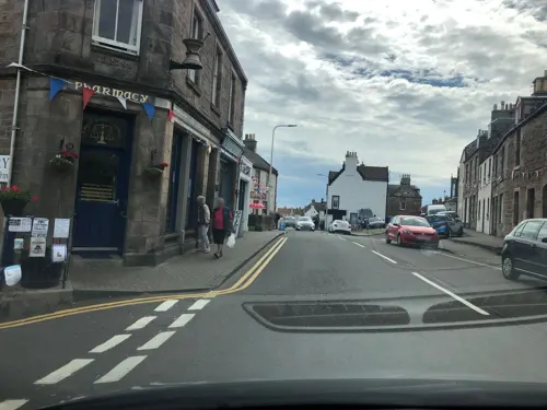
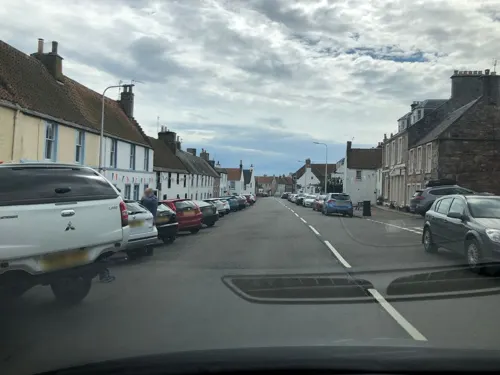
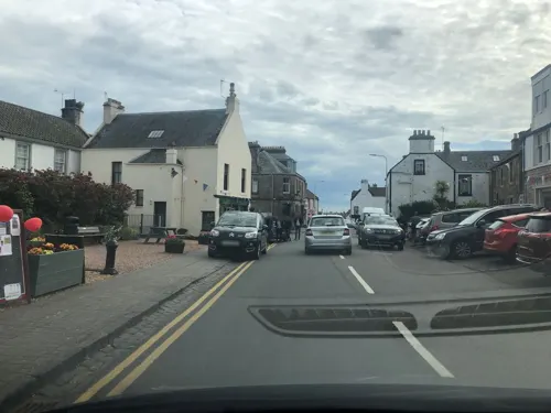
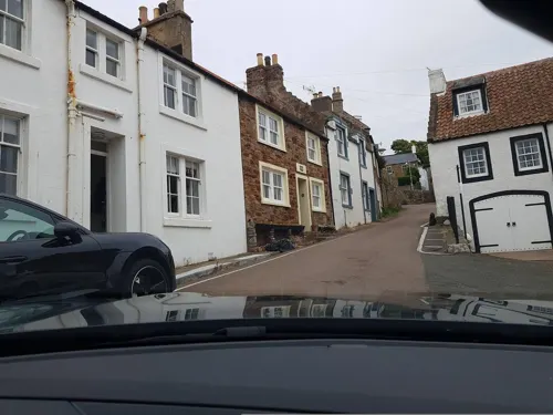
Crail (; Scottish Gaelic: Cathair Aile) is a coastal town, royal burgh and community council area (Royal Burgh of Crail and District) in the East Neuk of Fife, Scotland.
From the Wikipedia article Crail (this version), under CC BY-SA 4.0.
Things to do2

Caves of Caiplie
Monument and historic site · 1.4 mi
Cave in Fife, Scotland, UK

Fife Ness Lighthouse
Lighthouse · 2.0 mi
Lighthouse at Fife Ness, Scotland
Museums and landmarks10

Crail Museum and Heritage Centre
Museum
64 Marketgate South, Crail
Mar 28-Apr 01,May 02-06,May 23-27 Mo,Th-Sa 11:00-16:00; Mar 28-Apr...

Scotland's Secret Bunker
Museum · 2.8 mi
Underground bunker near Anstruther, Fife, Scotland, now a museum
HMS Success
Monument and historic site · 3.2 mi
1901 B-class destroyer
Parks, trails and playgrounds4


Restaurants and cafes9
Crail Fishbar and Café
Restaurant
35, 37 High Street North, Crail
We,Th 16:00-20:00; Fr,Sa 16:00-21:00; Su 16:00-20:00

History
The site on which the parish church is built appears to have religious associations that pre-date the parish church's foundation in early medieval times, as evidenced by an 8th-century cross-slab preserved in the church. The parish church was itself dedicated (in the 13th-century) to the early holy man St. Maelrubha of Applecross in Wester Ross.
Crail Castle was an occasional residence of David I of Scotland during the 12th century but subsequently fell into ruin.
Crail became a royal burgh in 1178 during the reign of King William the Lion. Robert the Bruce granted permission to hold markets on a Sunday.
Mary of Guise, afterward consort of James V, landed in Crail in June 1538 after a severe storm, and was hospitably entertained in the ancient mansion of Balcomie Castle, whence, accompanied by the king, she proceeded to St. Andrew's.
Read more of the history
John Knox, visiting Crail on his way to St Andrews in 1559, was moved to deliver a sermon in Crail Parish Church. Afterwards, protesters went through the church and destroyed idols and images. In August 1583, many of the inhabitants of Crail attacked nearby Wormiston House, which belonged to Sir John Anstruther. They filled up newly made ponds and ditches, and destroyed a plantation of ash trees. They were vexed at Anstruther because his new ditches had been built on land they claimed to belong to them as common land. The Privy Council of Scotland ordered them to rebuild the dykes.
Although the nature of the fishing in Crail was different from that in Anstruther and Pittenweem, involving more local fishing and an emphasis on shellfish, Crail continued to prosper as a fishing port in the years leading up to the First World War.
In 2017, the Community Council was granted the Letters Patent to the Crail Shield and Coat of Arms. This was lost when the Royal Burgh of Crail Council was abolished in 1976.
From the History section of Crail on Wikipedia, under CC BY-SA 4.0.
More about Crail
Arts and culture
In 1965, Crail Pottery, a family-run pottery and ceramics workshop and retailer, was founded in the locality by Stephen and Carol Grieve. The pottery has attracted attention from both local and national sources as a longstanding craft business and attraction.
From the Wikipedia article Crail, under CC BY-SA 4.0.
Notable people from Crail
 Charles CowanBritish politicianPhoto: David Octavius Hill & Robert Adamson, Public domain
- Alexander HendersonMinister of the Church of Scotland, theologian; (1583-1646)
- William DicksonScottish footballer, born 1866
- William LeggattBritish army officer and cricketer (1900-1946)
- Alexander CrombieScottish surgeon (1845-1906)
Born in Crail, according to Wikidata (CC0). Each name links to its Wikipedia article.
Where to stay9
Churches and places of worship2
Shopping2
Schools, colleges and libraries1
Healthcare1
Map of Crail
40 places. The map loads OpenStreetMap tiles when you open it.
Getting there and nearby towns
Leuchars Station (ADX) is the nearest airport with scheduled flights listed in OpenStreetMap, 12 miles away.
- Pittenweem 5 mi southwest, about 8 min by car
- Saint Monans 7 mi southwest, about 11 min by car
- Saint Andrews 9 mi northwest, about 14 min by car
- Methil 16 mi west, about 26 min by car
- Carnoustie 17 mi north, about 27 min by car
- Dunbar 18 mi south, about 30 min by car
- Dundee 20 mi northwest, about 32 min by car
- Glenrothes 21 mi west, about 35 min by car
- Arbroath 21 mi north, about 34 min by car
- Kirkcaldy 23 mi southwest, about 37 min by car
Drive times are estimates from straight-line distance, not routes.
Towns near Crail


Keep exploring
Local news
Headlines from INDB.
Reviews, tips and questions
Loading what members have shared...
Sources and licences
- GeoNames (CC BY 4.0): population, coordinates, regions and time zone
- Mapillary (see each image): photos
- OpenStreetMap contributors (ODbL 1.0): places, airports, map data
- Wikidata (CC0 1.0): elevation, founding date, time zone, website, landmarks and historic places
- Wikimedia Commons (see each image): photos
- Wikipedia (CC BY-SA 4.0): overview and history text
Photo credits
- Crail, Fife, Scotland, Kim Traynor, CC BY-SA 3.0
- The Golf Hotel Crail, Margaret Hyland, CC BY-SA 3.0
- Crail, 16 High Street, Drkirstyross, CC BY-SA 4.0
- Scotland's Secret Bunker (30133329717), Mike McBey, CC BY 2.0
- Fife - Crail, 64 Marketgate - 20210829121257, Dbrooke1829, CC BY-SA 4.0
- Street-level photo, drnoble, CC BY-SA 4.0
- Street-level photo, drnoble, CC BY-SA 4.0
- Street-level photo, toho, CC BY-SA 4.0
- Street-level photo, toho, CC BY-SA 4.0
- Street-level photo, drnoble, CC BY-SA 4.0
- Street-level photo, toho, CC BY-SA 4.0
- Street-level photo, drnoble, CC BY-SA 4.0
- Street-level photo, ccbb7766, CC BY-SA 4.0
- Street-level photo, drnoble, CC BY-SA 4.0
- Street-level photo, toho, CC BY-SA 4.0
- Street-level photo, drnoble, CC BY-SA 4.0
- Street-level photo, drnoble, CC BY-SA 4.0
- Street-level photo, drnoble, CC BY-SA 4.0
- Street-level photo, drnoble, CC BY-SA 4.0
- Street-level photo, toho, CC BY-SA 4.0
- Street-level photo, drnoble, CC BY-SA 4.0
- Street-level photo, drnoble, CC BY-SA 4.0
- Street-level photo, drnoble, CC BY-SA 4.0
- Street-level photo, ccbb7766, CC BY-SA 4.0
- Street-level photo, toho, CC BY-SA 4.0
Page built November 10, 2026. Spotted a mistake? Tell us or suggest a place.