


Cringleford, United Kingdom
Cringleford is a town of 2,105 people in England, United Kingdom.
Why visit Cringleford
Townapedia lists 9 museums and landmarks, 28 parks and trails, 42 places to eat, 4 places to stay and 14 attractions in and around town.
Highlights include Blackfriar's Bridge, Carrow Bridge, The Sainsbury Centre and Norwich Castle.
Weather in Cringleford
Forecast from MET Norway (CC BY 4.0). Full forecast
About Cringleford
Cringleford is a civil parish and village in the English county of Norfolk.
From the Wikipedia article Cringleford (this version), under CC BY-SA 4.0.
Things to do14

Blackfriar's Bridge
Bridge · 2.9 mi
Bridge in Norwich, Norfolk, England, UK


Foundry Bridge
Bridge · 3.1 mi
Bridge in Norwich, Norfolk, England, UK


Maddermarket Theatre
Cinema and theater · 2.7 mi
Theatre in Norwich, England

Norwich Playhouse
Cinema and theater · 2.8 mi
Theatre in Norwich, Norfolk, England

St Crispin's Bridge
Bridge · 2.8 mi
Bridge in Norwich, Norfolk, England, UK

Theatre Royal, Norwich
Cinema and theater · 2.5 mi
Theatre in Norwich, England



Bishop Bridge
Bridge · 3.3 mi
Bridge in Norwich, Norfolk, England, UK
St Miles Bridge
Bridge · 2.7 mi
Bridge in Norwich, Norfolk, England, UK
2 more on the map.
Museums and landmarks9

The Sainsbury Centre
Museum · 1.1 mi
Norfolk Road, Norwich
Mo off; Tu-Fr 09:00-18:00; Sa-Su 10:00-17:00

Norwich Castle
Monument and historic site · 2.8 mi
Historic castle and museum in Norwich, England
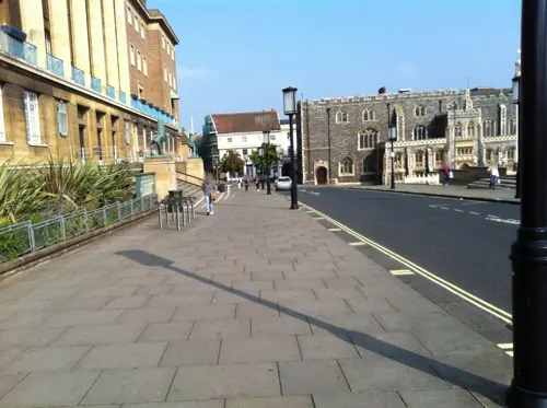
Norwich War Memorial
Monument and historic site · 2.6 mi
War memorial in Norwich, England
Sainsbury Centre
Museum · 1.1 mi
Art gallery and museum at the University of East Anglia, Norwich, England, United Kingdom

Strangers' Hall
Museum · 2.7 mi
Grade I listed building in Norwich, England

Bridewell Museum
Museum · 2.8 mi
Grade I listed building in Norwich, Norfolk, England, UK

Parks, trails and playgrounds28


Earlham Park Woods
Park · 1.4 mi
Nature reserve in Norwich, Norfolk, England, UK




16 more on the map.
Restaurants and cafes42
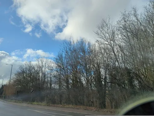
The Marsh Harrier
Bar and pub · 1.5 mi
158 Ipswich Road, Norwich
Mo-We 12:00-22:00; Th-Sa 12:00-23:00; Su 12:00-22:30

The Cellar House
Bar and pub · 0.5 mi
2 Eaton Street, Norwich
Mo-Th 11:00-23:00; Fr 11:00-00:00; Sa 12:00-21:00; Su 09:30-22:00+
The Beehive
Bar and pub · 1.3 mi
30 Leopold Road, Norwich
Mo-We 15:00-22:00; Th 15:00-23:00; Fr-Sa 12:00-23:00; Su 12:00-22:00


Zest
Restaurant · 1.2 mi
The Square, Norwich
Jun 5-Apr 13: Mo-Fr 07:30-20:00; Sa-Su 09:30-16:30; Jun 6-Sep 20:...
Ziggy’s
Cafe · 1.1 mi
The Street, Norwich
Apr 13-Jun 05: Mo-Fr 08:00-19:00; Sa-Su 09:30-16:30; Jun 06-Sep...
30 more on the map.
History
Cringleford's name is of mixed Viking and Anglo-Saxon origin and derives from an amalgamation of the Old English and Old Norse for a circular ford over the River Yare.
In the Domesday Book of 1086, Cringleford is listed as a settlement of 25 households located in the hundred of Humbleyard. In 1086, the village was divided between the estates of Odo of Bayeux, Alan of Brittany and Roger Bigod.
From the History section of Cringleford on Wikipedia, under CC BY-SA 4.0.
More about Cringleford
Geography
According to the 2021 census, Cringleford has a population of 4,685 people which shows a dramatic increase from the 2,963 people recorded in the 2011 census.
Cringleford is located along the course of the River Yare and the A11, between London and Norwich. The A47, between Birmingham and Lowestoft, also passes through the parish.
From the Wikipedia article Cringleford, under CC BY-SA 4.0.
Where to stay4
Churches and places of worship49
Shopping4
Gas and EV charging7
Schools, colleges and libraries14
Healthcare9
Map of Cringleford
180 places. The map loads OpenStreetMap tiles when you open it.
Getting there and nearby towns
Norwich Airport (NWI) is the nearest airport with scheduled flights listed in OpenStreetMap, 5 miles away.
- Norwich 3 mi northeast, about 5 min by car
- Bowthorpe 3 mi northwest, about 4 min by car
- Rackheath 7 mi northeast, about 11 min by car
- Brooke 7 mi southeast, about 11 min by car
- Mattishall 10 mi northwest, about 15 min by car
- Buxton 10 mi north, about 17 min by car
- Attleborough 11 mi southwest, about 18 min by car
- Hingham 11 mi west, about 18 min by car
- Horning 11 mi northeast, about 19 min by car
- Cawston 12 mi north, about 19 min by car
Drive times are estimates from straight-line distance, not routes.
Towns near Cringleford


Keep exploring
Local news
Headlines from INDB.
Reviews, tips and questions
Loading what members have shared...
Sources and licences
- GeoNames (CC BY 4.0): population, coordinates, regions and time zone
- Mapillary (see each image): photos
- OpenStreetMap contributors (ODbL 1.0): places, airports, map data
- Wikidata (CC0 1.0): elevation, founding date, time zone, website, landmarks and historic places
- Wikimedia Commons (see each image): photos
- Wikipedia (CC BY-SA 4.0): overview and history text
Photo credits
- Blackfriars Bridge Norwich, Northmetpit, CC BY-SA 3.0
- Norwich - Fye Bridge - 20220911135036, Barrymyles, CC BY-SA 4.0
- Maddermarket, Cameron Self, aka C1self at en.wikipedia, CC BY 2.5
- NorwichPlayhouse, Cameron Self, CC BY 2.5
- -2018-07-14 City Station (St Crispin's) Bridge, Norwich, Norfolk (1), Evelyn Simak, CC BY-SA 2.0
- Norwich Theatre Royal, Northmetpit, Public domain
- Trowse Bridge, Pierre Terre, CC BY-SA 2.0
- Norwich castle, The original uploader was Bluemoose at English Wikipedia ., CC BY-SA 3.0
- Strangers' Hall - Charing Cross, Norwich - museum windows, Elliott Brown, CC BY 2.0
- Danby Wood 4, Dudley Miles, CC BY-SA 4.0
- Brundall Church Fen 3, Dudley Miles, CC BY-SA 4.0
- Earlham Park Woods 1, Dudley Miles, CC BY-SA 4.0
- Eaton Common 1, Dudley Miles, CC BY-SA 4.0
- Heigham Park Norwich 2, Northmetpit, CC BY-SA 4.0
- Marston Marshes 2, Dudley Miles, CC BY-SA 4.0
- St Helen's, Bishopgate, Norwich, Mn~commonswiki, CC BY-SA 3.0
- Church of St John the Baptist , Timberhill, Elliott Brown, CC BY 2.0
- St Julian's, Norwich, Unknown author, CC BY-SA 3.0
- Sainsbury Centre for Visual Arts, Oxyman, CC BY 2.5
- School of World Art Studies, IWAM2009, CC0
- NHS NNUH entrance, Unknown author, CC BY-SA 3.0
- Intwood-g1, Bernd Jatzwauk Pommes104, CC BY-SA 3.0
- All Saints Keswick Norfolk (4785306740), David from Colorado Springs, United States, CC BY 2.0
- -2017-02-25 Looking across Carrow Bridge, Norwich, Norfolk, Stephen McKay, CC BY-SA 2.0
- -2021-04-24 Foundry Bridge, River Wensum, Norwich, Adrian S Pye, CC BY-SA 2.0
- Frozen Eaton Park Boat Pond, Sebastiandoe5, CC BY-SA 4.0
- -2011-03-24 Bandstand, Chapelfield gardens, Norwich, Norfolk, Tanya Dedyukhina, CC BY 3.0
- Street-level photo, IpswichEdits, CC BY-SA 4.0
- Street-level photo, markdatoo, CC BY-SA 4.0
- Street-level photo, adam2, CC BY-SA 4.0
- Street-level photo, IpswichEdits, CC BY-SA 4.0
- Street-level photo, IpswichEdits, CC BY-SA 4.0
- Street-level photo, IpswichEdits, CC BY-SA 4.0
- Street-level photo, adam2, CC BY-SA 4.0
- Street-level photo, miguel_andrade, CC BY-SA 4.0
- Street-level photo, adam2, CC BY-SA 4.0
- Street-level photo, 4004, CC BY-SA 4.0
- Street-level photo, miguel_andrade, CC BY-SA 4.0


Page built November 10, 2026. Spotted a mistake? Tell us or suggest a place.