


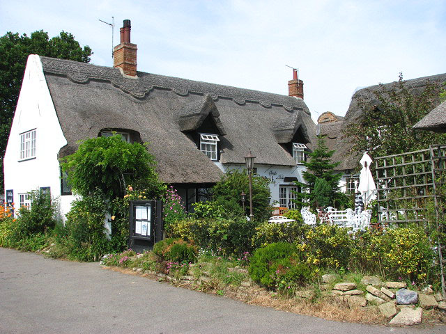

Why visit Horning
Townapedia lists 6 museums and landmarks, 6 parks and trails, 10 places to eat and 3 places to stay in and around town.
Highlights include RAF Air Defence Radar Museum, Trafford Mausoleum, St Mary's Churchyard, The Broads and BeWILDerwood.
Weather in Horning
Forecast from MET Norway (CC BY 4.0). Full forecast
About Horning
Horning is an ancient village and parish in the English county of Norfolk.
From the Wikipedia article Horning (this version), under CC BY-SA 4.0.
Museums and landmarks6


Trafford Mausoleum, St Mary's Churchyard
Monument and historic site · 2.7 mi
Mausoleum in Wroxham, Broadland, Norfolk, England, UK
Parks, trails and playgrounds6

The Broads
Park · 3.0 mi
Network of rivers and lakes in the English counties of Norfolk and Suffolk

BeWILDerwood
Sports field and stadium · 0.7 mi
Family adventure park in Norfolk, UK
Horning Road, Norwich

Catfield Fen Reserve
Park · 2.9 mi
Nature reserve in Norfolk, England, UK
Restaurants and cafes10



The Swan Inn
Bar and pub
10 Lower Street, Norwich
Mo-Th 12:00-22:00; Fr-Sa 12:00-23:00; Su 12:00-22:00



Where to stay3

History
The name Horning means the "folk who live on the high ground between the rivers". Its history dates back to 1020, when the manor was given by King Canute to the newly founded Abbey of St. Benet at Hulme. The Bishop of Norwich, as Abbot of St. Benets, is still Lord of the Manor.
Horning Parish extends along the south bank of the River Bure to Thurne Mouth, and includes the ruins of St Benet's Abbey & St. James Hospital. St. Benet's Abbey is a Grade I listed building, and dates back to the 9th century. The importance of the Abbey as a medieval place of pilgrimage is reflected in the medieval finds of two papal seals, that would have secured documents from the Pope. It was also the site of the composition of the c. 1290 Chronicle of John of Oxnead.
The Church of St. Benedict lies half a mile east of the village, and dates back to the 13th century.
Horning is situated on the River Bure (pronounced locally "Burr") between Wroxham and Ludham. A ferry plied across the river for more than 1,000 years.
Horning has an entry in the Domesday Book of 1086, noted under the name 'Horningam'. In 1086, Horning had 18 villagers, 11 'smallholders', 4 cattle, 10 pigs, 360 sheep and the taxable value was £4.
Read more of the history
Archaeologists have found ancient earthworks in Horning, which run alongside the River Bure, possibly dating to the early Saxon period. The earliest ancient monument is a Bronze Age ring ditch and possible burial pit. Neolithic and Bronze Age artefacts have also been found.
From the History section of Horning on Wikipedia, under CC BY-SA 4.0.
More about Horning
Education
Horning Community Primary School has primary education for 5–11 year olds, and pre-school for 2–4 year olds.
The 2022 Ofsted report rated Horning Community Primary School overall as 'Good'.
The nearest secondary school to Horning is Broadland High School in Hoveton.
From the Wikipedia article Horning, under CC BY-SA 4.0.
Notable people from Horning
 Thomas StuttafordBritish politician (1931-2018)Photo: Nigel Cake, CC BY 4.0
- Mordecai Cubitt CookeEnglish botanist and mycologist (1825–1914)
- Stefen TchamcheDanish football player
- Joseph CubittEnglish civil engineer
Born in Horning, according to Wikidata (CC0). Each name links to its Wikipedia article.
Churches and places of worship10
Shopping1
Gas and EV charging1
Schools, colleges and libraries3
Map of Horning
40 places. The map loads OpenStreetMap tiles when you open it.
Getting there and nearby towns
Norwich Airport (NWI) is the nearest airport with scheduled flights listed in OpenStreetMap, 8 miles away.
- Rackheath 5 mi southwest, about 7 min by car
- Norwich 9 mi southwest, about 14 min by car
- North Walsham 9 mi north, about 14 min by car
- Bowthorpe 11 mi southwest, about 18 min by car
- Reedham 11 mi southeast, about 18 min by car
- Great Yarmouth 13 mi southeast, about 21 min by car
- Bradwell 13 mi southeast, about 22 min by car
- Thurlton 13 mi south, about 21 min by car
- Beccles 17 mi south, about 28 min by car
- Lowestoft 20 mi southeast, about 32 min by car
Drive times are estimates from straight-line distance, not routes.
Towns near Horning


Keep exploring
Local news
Headlines from INDB.
Reviews, tips and questions
Loading what members have shared...
Sources and licences
- GeoNames (CC BY 4.0): population, coordinates, regions and time zone
- OpenStreetMap contributors (ODbL 1.0): places, airports, map data
- Wikidata (CC0 1.0): elevation, founding date, time zone, website, landmarks and historic places
- Wikimedia Commons (see each image): photos
- Wikipedia (CC BY-SA 4.0): overview and history text
Photo credits
- Ricking the reed, Peter Henry Emerson, Public domain
- St Peter's church Neatishead Norfolk (2929296576), David from Colorado Springs, United States, CC BY 2.0
- The Swan Inn house, ZakDL, CC BY-SA 4.0
- Staithe n Willow, Evelyn Simak, CC BY-SA 2.0
- The Ferry Inn Horning, ZakDL, CC BY-SA 4.0
Page built November 10, 2026. Spotted a mistake? Tell us or suggest a place.