


Why visit Cults
Townapedia lists 25 museums and landmarks, 15 parks and trails, 22 places to eat, 6 places to stay and 11 attractions in and around town.
Highlights include Bridge of Dee, His Majesty's Theatre, Aberdeen Art Gallery and Aberdeen Maritime Museum.
Weather in Cults
Forecast from MET Norway (CC BY 4.0). Full forecast
About Cults
Cults is a suburb on the western edge of Aberdeen, Scotland. It lies on the banks of the River Dee and marks the eastern boundary of Royal Deeside.
From the Wikipedia article Cults, Aberdeen (this version), under CC BY-SA 4.0.
Photos of Cults


Things to do11


His Majesty's Theatre
Cinema and theater · 3.2 mi
Theatre in Aberdeen, Scotland, UK

King George VI Bridge
Bridge · 2.3 mi
Arch bridge in Aberdeen, Scotland, UK, carries the B9077 road across River Dee

Music Hall Aberdeen
Cinema and theater · 3.0 mi
Arts venue in Aberdeen, Scotland, UK

Queen Elizabeth Bridge
Bridge · 3.0 mi
Bridge in Aberdeen, Scotland, UK, carries the A956 road across River Dee

Queen Victoria Bridge
Bridge · 3.3 mi
Bridge in Aberdeen City, Scotland, UK, carries a minor road across River Dee

Shakkin' Briggie
Bridge
Suspension footbridge, now disused, in Aberdeen City, Scotland, UK, crosses the River Dee

Tivoli Theatre, Aberdeen
Cinema and theater · 3.2 mi
Theatre in Aberdeen, Scotland, UK

Union Bridge, Aberdeen
Bridge · 3.2 mi
Road bridge in Aberdeen, Scotland, UK, carries Union Street across Denburn Road and the Aberdeen-Inverness railway line
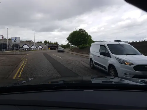
Wellington Suspension Bridge
Bridge · 3.0 mi
Suspension bridge in Aberdeen, Scotland

Museums and landmarks25

Aberdeen Art Gallery
Museum · 3.2 mi
Local Authority Museum in Scotland, United Kingdom

Aberdeen Maritime Museum
Museum · 3.4 mi
Local Authority Museum in Scotland, United Kingdom

Gordon Highlanders Museum
Museum · 1.6 mi
Military museum in Aberdeen, Scotland, United Kingdom

Lang Stane, Aberdeen
Monument and historic site · 3.0 mi
Menhir in Aberdeen, Scotland, UK

Provost Skene's House
Museum · 3.4 mi
House museum in Aberdeen, Scotland, United Kingdom

Blairs College
Museum · 1.6 mi
Seminary, now museum, in Aberdeenshire, Scotland, UK

13 more on the map.
Parks, trails and playgrounds15


Hazlehead Park
Park · 1.6 mi
Public park in the Hazlehead area of Aberdeen, Scotland, UK

Rubislaw and Queens Terrace Gardens
Park · 2.6 mi
Park in Aberdeen City, Scotland, UK

The Den and the Glen
Park · 3.2 mi
Park in Aberdeenshire, Scotland, UK

Union Terrace Gardens
Park · 3.2 mi
Park in Aberdeen City, Scotland, UK


Westburn Park
Park · 3.0 mi
Urban park in Aberdeen City, Scotland, UK


Bonnymuir Green Community Trust
Park · 2.7 mi
Green space in Aberdeen, Scotland, UK

3 more on the map.
Restaurants and cafes22

Figment
Cafe · 1.4 mi
70 Countesswells Road, Aberdeen
Mo-Th 07:30-17:00; Fr 07:30-22:00; Sa 08:30-22:00; Su 08:30-17:00


Oor Wullie's Braw Fish & Chips
Restaurant · Fish And Chips · 1.5 mi
529 Great Western Road, Aberdeen
10 more on the map.
History
Originally, Cults had two railway stations on the Royal Deeside Railway Line, West Cults and Cults before the line was closed in the middle of the 20th century. The route has since been converted into a cycle path and walkway which leads to Duthie Park in Aberdeen in one direction and further into Deeside in the other, running alongside Cults' public park, Allan Park. Cults was also on a tram route between Aberdeen and Bieldside, operated by the Aberdeen Suburban Tramways Company until 1927. Today, public transport to Aberdeen takes the form of buses.
From the History section of Cults, Aberdeen on Wikipedia, under CC BY-SA 4.0.
More about Cults
Education
There are three main schools in the village: the state-run Cults Primary School and Cults Academy (one of Scotland's top-performing secondary schools). The village is also only a short drive from the International School of Aberdeen (ISA) in Pitfodels and
From the Wikipedia article Cults, Aberdeen, under CC BY-SA 4.0.
Notable people from Cults
 Archibald Bisset Smithrecipient of the Victoria CrossPhoto: Auckland Weekly News, Public domain
- Piers MackesyBritish military historian (1924-2014)
- James ThompsonBritish civil servant and administrator (1848–1929)
- Majel DavidsonBritish artist
Born in Cults, according to Wikidata (CC0). Each name links to its Wikipedia article.
Where to stay6
Churches and places of worship17
Saint Francis of Assisi Catholic Church
Church · Roman Catholic · 1.1 mi
231 Deeside Gardens, Aberdeen
Shopping5
Gas and EV charging1
Schools, colleges and libraries11
Healthcare3
Map of Cults
116 places. The map loads OpenStreetMap tiles when you open it.
Getting there and nearby towns
Aberdeen International Airport (ABZ) is the nearest airport with scheduled flights listed in OpenStreetMap, 6 miles away.
- Aberdeen 3 mi northeast, about 5 min by car
- Milltimber 3 mi west, about 5 min by car
- Portlethen 4 mi south, about 6 min by car
- Peterculter 4 mi west, about 6 min by car
- Westhill 5 mi northwest, about 8 min by car
- Newtonhill 6 mi south, about 9 min by car
- Dubford 7 mi north, about 11 min by car
- Newmacher 10 mi north, about 17 min by car
- Stonehaven 11 mi south, about 17 min by car
- Kintore 11 mi northwest, about 17 min by car
Drive times are estimates from straight-line distance, not routes.
Towns near Cults


Keep exploring
Local news
Headlines from INDB.
Reviews, tips and questions
Loading what members have shared...
Sources and licences
- GeoNames (CC BY 4.0): population, coordinates, regions and time zone
- Mapillary (see each image): photos
- OpenStreetMap contributors (ODbL 1.0): places, airports, map data
- Wikidata (CC0 1.0): elevation, founding date, time zone, website, landmarks and historic places
- Wikimedia Commons (see each image): photos
- Wikipedia (CC BY-SA 4.0): overview and history text
Photo credits
- Cults Burn, Watty62, CC BY-SA 4.0
- Cults Mill, Cults, Aberdeen, OEJUTILA, CC BY-SA 4.0
- Bridge of Dee Aberdeen, Peter Ward, CC BY-SA 2.0
- His Majesty's Theatre, Aberdeen 2025, Lucas Kendall, CC BY-SA 2.0
- King George VI Bridge, User:Peartree85, CC BY-SA 3.0
- Victoria Bridge, Chadlongstaff at English Wikipedia, Public domain
- Aberdeen, Cults, St Devenick Suspension Bridge, Watty62, CC BY-SA 4.0
- The Tivoil, Guild St, Aberdeen, Scotland, Ragazzi99, CC BY-SA 3.0
- Union Bridge, Aberdeen, Lucas Kendall, CC BY-SA 2.0
- Aberdeen Art Gallery (53533915342), Tom Parnell from Scottish Borders, Scotland, CC BY-SA 2.0
- Gordon Highlander Museum, LindaAnn08, CC BY-SA 4.0
- Provost Skene's House, Ryan Mitchell, CC BY-SA 4.0
- Duthie Park - Winter Gardens, The original uploader was PMJ at English Wikipedia ., CC BY-SA 3.0
- HazleheadWoods, Richard Slessor, CC BY-SA 2.0
- Rubislaw Terrace Gardens, UltrasonicMadness, CC BY-SA 4.0
- Storybook-13723-Colin Walker, Colin Walker, CC BY-SA 2.0
- Union Terrace Gardens, June 2026, Lucas Kendall, CC BY-SA 4.0
- Victoria Park, crocuses, Richard Slessor, CC BY-SA 2.0
- Westburn Park - May 2025, UltrasonicMadness, CC BY-SA 4.0
- Bon-Accord Church, Rosemount Viaduct, Aberdeen, Watty62, CC BY-SA 4.0
- Gilcomston Church, Aberdeen, Lucas Kendall, CC BY-SA 2.0
- Holburn West Church, CCMCB, CC BY-SA 4.0
- Queen's Cross, Colin Smith, CC BY-SA 2.0
- Rubislaw Kirk, Val Vannet, CC BY-SA 2.0
- St John's Episcopal Church - panoramio, T. Thielemans, CC BY 3.0
- St Mary's Cathedral, Aberdeen 2025, Lucas Kendall, CC BY-SA 2.0
- Aberdeen St Nicholas Kirk, Ikiwaner, CC BY-SA 3.0
- Triple Kirk's Public House, 69 Schoolhill, Aberdeen, Watty62, CC BY-SA 4.0
- Plaza at The Robert Gordon University 2, Jackofhearts101, CC BY-SA 3.0
- Johnston Gardens - bridge, Lizzie, CC BY-SA 2.0
- Model Mk IX Spitfire RAF Polish Squadron 306 I, Scotch Mist, CC BY-SA 4.0
- Model Mk IX Spitfire RAF Polish Squadron 306 II, Scotch Mist, CC BY-SA 4.0
- Sluice gates - panoramio, Jim Dewar, CC BY 3.0
- Auld Bridge - panoramio, Jim Dewar, CC BY 3.0
- Shakkin' Briggie, Watty62, CC BY-SA 4.0
- Interior of The Music Hall, Aberdeen, Ian Watt, CC BY-SA 4.0
- Queen Elizabeth Bridge, watty62, CC BY-SA 4.0
- Outside Aberdeen Maritime Museum (172014), Tore Sætre, CC BY-SA 4.0
- Lang stane Aberdeen, Bobbacon, Public domain
- Street-level photo, hobgoblin, CC BY-SA 4.0
- Street-level photo, hobgoblin, CC BY-SA 4.0
- Street-level photo, toho, CC BY-SA 4.0
- Street-level photo, hobgoblin, CC BY-SA 4.0
- Street-level photo, hobgoblin, CC BY-SA 4.0
- Street-level photo, hobgoblin, CC BY-SA 4.0
- Street-level photo, hobgoblin, CC BY-SA 4.0
- Street-level photo, hobgoblin, CC BY-SA 4.0


Page built November 10, 2026. Spotted a mistake? Tell us or suggest a place.