
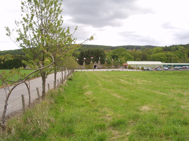

Peterculter, United Kingdom
Peterculter is a town of 4,560 people in Scotland, United Kingdom.
Why visit Peterculter
Townapedia lists 9 museums and landmarks, 3 parks and trails, 11 places to eat, 4 places to stay and 1 attraction in and around town.
Highlights include Park Bridge, Belskavie Tower, Blairs College and The Den and the Glen.
Weather in Peterculter
Forecast from MET Norway (CC BY 4.0). Full forecast
About Peterculter
Peterculter , also known as Culter, is an outer suburb of Aberdeen, Scotland, about eight miles (13 km) from the city centre. It lies on the north bank of the River Dee, at its confluence with the Culter Burn. Following the 1996 Scottish council boundary changes, it became part of the Lower Deeside ward in the Aberdeen City council area. As of the 2022 census, it had a population of 4,359.
From the Wikipedia article Peterculter (this version), under CC BY-SA 4.0.
Things to do1

Museums and landmarks9


Blairs College
Museum · 2.7 mi
Seminary, now museum, in Aberdeenshire, Scotland, UK
Parks, trails and playgrounds3

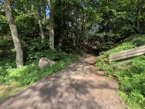
The Den and the Glen
Park · 1.6 mi
Park in Aberdeenshire, Scotland, UK

Restaurants and cafes11
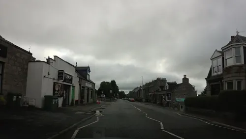
Jumbo's Fish and Chips
Fast food · Fish And Chips
319 North Deeside Road, Peterculter

History
About one mile (2 km) south west of Peterculter is the site of the Roman marching camp at Normandykes.
King William the Lion bestowed the church of Kulter, "iuxta Abirdene", upon the Abbey and monks of St Mary of Kelso, about 1165–1199. The gift was afterwards confirmed by Mathew, Bishop of Aberdeen, within whose diocese the church sat.
Alan of Soltre, chaplain, who had probably been an ecclesiastic of the hospital, or monastery of Soutra, in Lothian, was presented by the Abbot of Kelso, to the vicarage of the church of Culter, 1239–1240.
In 1287–1288, an agreement was made between the Abbot and Convent of Kelso and the brotherhood of the Knights of Jerusalem, regarding the Templars' lands of Blairs and Kincolsi (Kincousie, now Kincaussie), on the south side of the Dee, by which a chapel, built by the Templars at their house of Culter, was recognised as a church, with parochial rights, for the inhabitants of the said lands. It was this agreement that changed the existing parish of Culter into two separate parishes with two separate names, the other being Maryculter.
From the History section of Peterculter on Wikipedia, under CC BY-SA 4.0.
More about Peterculter
Arts and culture
High on the steep bank of the Culter Burn, near the western edge of the settlement, stands a kilted figure holding a broadsword and targe, representing Rob Roy MacGregor. According to local tradition, Rob Roy is said to have leapt across the burn at this point while fleeing Hanoverian troops, although the story is unlikely to have a firm historical basis and may instead relate to the outlaw Gilderoy. The original statue is thought to have been adapted from a ship’s figurehead, and was replaced in 2017 by a resin effigy wearing ancient MacGregor tartan.
Due to its nearness to Aberdeen City and being only about thirty miles (50 km) from the Cairngorm National Park
, Culter is a base for tourists. In the town itself there are choices of many local walks, including its connection to the Deeside Way at the site of the former Culter railway station, as well as the forest area known locally as "Sandy Hilly", or "The Muggie Widds" (St. Margaret Woods), the entrance to which sits beside the Bucklerburn region.
For sport, there is Peterculter Golf Club and Culter Sports Centre. Each year, on the last Saturday in May, is the Culter Gala, in the main playing field of the town; this event draws hundreds of local townsfolk.
From the Wikipedia article Peterculter, under CC BY-SA 4.0.
Notable people from Peterculter
 John SmithNew South Wales politician (1821-1885)Photo: Freeman and Co., Public domain
- Nan Shepherd(1893 - 1981), Scottish novelist, poet, educator
- Roy ErskineScottish footballer and optician (born 1931)
- John Burnettcivil servant
Born in Peterculter, according to Wikidata (CC0). Each name links to its Wikipedia article.
Where to stay4
Churches and places of worship2
Deeside Christian Fellowship Church
Church · Evangelical · 1.3 mi
Binghill Drive, Aberdeen
Shopping1
Gas and EV charging1
Schools, colleges and libraries4
Healthcare1
Map of Peterculter
37 places. The map loads OpenStreetMap tiles when you open it.
Getting there and nearby towns
Aberdeen International Airport (ABZ) is the nearest airport with scheduled flights listed in OpenStreetMap, 7 miles away.
- Westhill 4 mi north, about 6 min by car
- Portlethen 5 mi east, about 9 min by car
- Aberdeen 7 mi northeast, about 11 min by car
- Stonehaven 10 mi south, about 15 min by car
- Dubford 10 mi northeast, about 15 min by car
- Inverurie 13 mi north, about 22 min by car
- Pitmedden 17 mi north, about 27 min by car
- Ellon 20 mi north, about 32 min by car
- Saint Cyrus 23 mi south, about 37 min by car
- Montrose 27 mi south, about 44 min by car
Drive times are estimates from straight-line distance, not routes.
Towns near Peterculter


Keep exploring
Local news
Headlines from INDB.
Reviews, tips and questions
Loading what members have shared...
Sources and licences
- GeoNames (CC BY 4.0): population, coordinates, regions and time zone
- Mapillary (see each image): photos
- OpenStreetMap contributors (ODbL 1.0): places, airports, map data
- Wikidata (CC0 1.0): elevation, founding date, time zone, website, landmarks and historic places
- Wikimedia Commons (see each image): photos
- Wikipedia (CC BY-SA 4.0): overview and history text
Photo credits
- Storybook-13723-Colin Walker, Colin Walker, CC BY-SA 2.0
- Rob Roy's Leap - panoramio, tormentor4555, CC BY-SA 3.0
- Street-level photo, hobgoblin, CC BY-SA 4.0
- Street-level photo, hobgoblin, CC BY-SA 4.0
- Street-level photo, hobgoblin, CC BY-SA 4.0
- Street-level photo, hobgoblin, CC BY-SA 4.0
- Street-level photo, hobgoblin, CC BY-SA 4.0
- Street-level photo, hobgoblin, CC BY-SA 4.0
- Street-level photo, hobgoblin, CC BY-SA 4.0
- Street-level photo, hobgoblin, CC BY-SA 4.0
- Street-level photo, hobgoblin, CC BY-SA 4.0
- Street-level photo, hobgoblin, CC BY-SA 4.0
- Street-level photo, hobgoblin, CC BY-SA 4.0
- Street-level photo, hobgoblin, CC BY-SA 4.0
- Street-level photo, hobgoblin, CC BY-SA 4.0
- Street-level photo, coetserw, CC BY-SA 4.0
Page built November 10, 2026. Spotted a mistake? Tell us or suggest a place.