
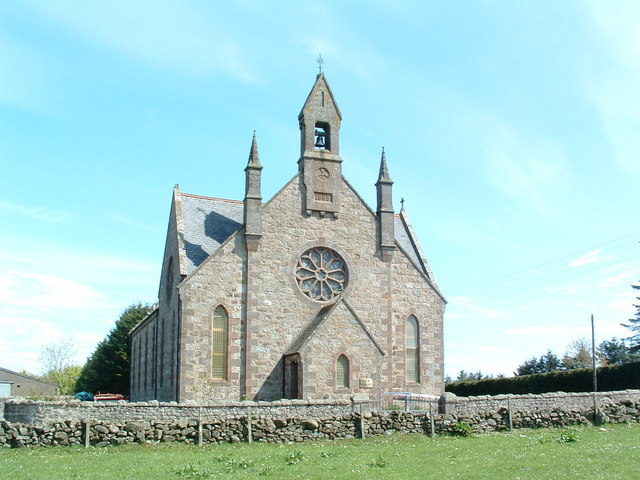


Newtonhill, United Kingdom
Newtonhill is a town of 3,040 people in Scotland, United Kingdom.
Why visit Newtonhill
Townapedia lists 6 museums and landmarks, 5 parks and trails, 7 places to eat and 1 attraction in and around town.
Highlights include Aquhorthies stone circle, Old Bourtreebush and Portlethen Moss.
Weather in Newtonhill
Forecast from MET Norway (CC BY 4.0). Full forecast
About Newtonhill
Newtonhill is a village in Aberdeenshire (historically Kincardineshire), Scotland. It is popular due to its location just nine miles south of Aberdeen, within easy reach of Stonehaven and with views over the North Sea.
From the Wikipedia article Newtonhill (this version), under CC BY-SA 4.0.
Things to do1

Museums and landmarks6

Aquhorthies stone circle
Monument and historic site · 1.8 mi
Architectural structure in Aberdeenshire, Scotland, UK

Old Bourtreebush
Monument and historic site · 1.6 mi
Stone circle in Aberdeenshire, Scotland, UK
Birth place of Richard Henry Brunton, Engineer
Monument and historic site · 1.0 mi
11 Marine Terrace, Muchalls
Parks, trails and playgrounds5

Portlethen Moss
Park · 1.7 mi
Nature reserve in Aberdeenshire, Scotland, UK
Restaurants and cafes7




Newtonhill Tandoori
Fast food · Indian
10 Old Mill Road, Newtonhill
History
The town was originally called Skateraw in the 17th century. Skateraw was a fishing village, and the older part of the village (still called Skateraw) between the railway line and the sea reflects that heritage, though nearly all of the old houses have been modernised and extended. An old smoke house is still visible on Skateraw Road, though it has been many years since it was in use.
The village had a railway station which led to the change of name from Skateraw to Newtonhill but it was closed in 1956; the signal box was still in use until May 2019 and remnants of a platform can still be seen. A feasibility study received funding in May 2018 to study the possible reopening of the station.
In 1846, the first school in Skateraw (Newtonhill) was established by the Scottish Episcopal Church. The school was housed in a rented cottage No.18 Skateraw Village (Now 15 Skateraw Road). In 1855, due to the ruinous state of the school room, the church then established the school in St Michaels on Elsick Place, the current site of Newtonhill Church.
Newtonhill is in Kincardineshire, though local government re-organisation means that the local authority is Aberdeenshire Council.
In the 1880s, Skateraw pier was built on Skateraw Shore to accommodate larger fishing boats in the waters around Skateraw. In the early 1980s, the pier was demolished by the British army due to its deterioration.
From the History section of Newtonhill on Wikipedia, under CC BY-SA 4.0.
More about Newtonhill
Geography
Newtonhill is located on the North-East coast of Scotland, approximately 9 miles south of Aberdeen and 6 miles north of Stonehaven.
The Burn of Elsick, which drains agricultural lands from the west, flows into the North Sea at Newtonhill.
The White Wife is a rock formation which allows sea angling. Newtonhill also has a great scenic view of the cliffs looking on to the pebble shore, where fishing is still a custom to many.
From the Wikipedia article Newtonhill, under CC BY-SA 4.0.
Notable people from Newtonhill
 Ryan SharpBritish racing driverPhoto: Petr Gabriel Photo, CC BY-SA 4.0
Born in Newtonhill, according to Wikidata (CC0). Each name links to its Wikipedia article.
Churches and places of worship3
Shopping1
Schools, colleges and libraries2
Healthcare1
Map of Newtonhill
26 places. The map loads OpenStreetMap tiles when you open it.
Getting there and nearby towns
Aberdeen International Airport (ABZ) is the nearest airport with scheduled flights listed in OpenStreetMap, 12 miles away.
- Portlethen 3 mi north, about 4 min by car
- Stonehaven 5 mi southwest, about 9 min by car
- Peterculter 6 mi northwest, about 10 min by car
- Aberdeen 8 mi north, about 13 min by car
- Westhill 10 mi northwest, about 15 min by car
- Dubford 12 mi north, about 19 min by car
- Inverurie 19 mi northwest, about 31 min by car
- Saint Cyrus 20 mi southwest, about 33 min by car
- Oldmeldrum 22 mi north, about 35 min by car
- Ellon 23 mi north, about 37 min by car
Drive times are estimates from straight-line distance, not routes.
Towns near Newtonhill


Keep exploring
Local news
Headlines from INDB.
Reviews, tips and questions
Loading what members have shared...
Sources and licences
- GeoNames (CC BY 4.0): population, coordinates, regions and time zone
- Mapillary (see each image): photos
- OpenStreetMap contributors (ODbL 1.0): places, airports, map data
- Wikidata (CC0 1.0): elevation, founding date, time zone, website, landmarks and historic places
- Wikimedia Commons (see each image): photos
- Wikipedia (CC BY-SA 4.0): overview and history text
Photo credits
- Cookney Church, Alan Thomson, CC BY-SA 2.0
- Fahrt von Aberdeen zu Dunnotar Castle (38584800162), Herbert Frank from Wien (Vienna), AT, CC BY 2.0
- Easter Aquhorthies stone circle, NorthCol, CC BY-SA 4.0
- Street-level photo, smsm1, CC BY-SA 4.0
Page built November 10, 2026. Spotted a mistake? Tell us or suggest a place.